Whitley Head, Banwell
- Land size
- 6 acres
- Bedrooms
- 8
- Bathrooms
- 4
Key Features
- Elegant period home constructed as a summer residence in the 1830's for the then Bishop of Bath and Wells
- Set in approximately six acres of gardens and historical woodland
- Eight bedrooms with four bathrooms (plus ground floor shower room)
- Five superb reception rooms including an impressive 31' drawing room
- The site of the archaeologically important Banwell Caves (not open to the public)
- Several enchanting outbuildings included a Grade II listed Pebble Summer House
- Plethora of period features including stained glass windows, fireplaces and oak flooring
- Large triple garage/workshop with plenty of off street parking
- In need of moderate updating
- Over 6,000 sq ft of accommodation
Description
The Caves is an elegant and romantically positioned residence set against the picturesque backdrop of Banwell Hill, which affords exceptional views over the Somerset countryside towards the Bristol Channel and Welsh coastline beyond.
Offering substantial accommodation arranged over two principal floors the property was constructed during the mid 1830s of local stone under a slate tile roof and features beautiful stained glass windows, handsome fireplaces to many rooms, and many period features throughout.
Approached via a sweeping driveway, there is a large triple garage/workshop with potential, and ample parking for a good number of vehicles. The original entrance to the house is to the front northerly elevation where an enclosed staircase rises to a fine entrance porch with beautiful stained glass windows, which in turn leads into an enchanting reception hallway with a fine oak floor and pillared oak surround.
To the ground floor of the property there are a number of impressive reception rooms including a bay fronted L-shaped family room, with oak flooring, leading out to a side terrace garden.
Off the entrance hallway is an impressive bay-fronted dining room with French doors and stunning views looking down across the valley.
There is a lovely study/library with a cast iron woodburning stove that leads onto a spacious conservatory. The main drawing room measures an impressive 31' x 19' and has been enhanced in recent times by the addition of painted panelled walls and a woodburning stove. This dual aspect room has four magnificent shuttered windows, one of which looks directly into a now sealed entrance of the Stalactite Cave.
The kitchen is another well proportioned room and is fitted with traditional wooden units, with a tiled floor and an oil fired range. The kitchen provides access into 'The Caves' house which is the most frequently used by the family and visitors. Beyond the kitchen, French doors lead to a far more recent addition, a beautiful garden room which is blessed with superb natural light from its large lantern window, with a further pair of French doors leading to a discrete courtyard. There is a handy ground floor shower room and WC within the garden room and a good sized utility room with plumbing for white goods and additional kitchen units.
To the first floor are the property's eight bedrooms and four bathrooms which are accessed by an elegant stone staircase with cast iron balustrades and a walnut handrail. The bedrooms are arranged off two separate wings, with the dual aspect principal bedroom situated off the main hallway and enjoying an incredible outlook of the property's land towards the North Somerset coastline, with a generous en-suite bathroom and fitted wardrobes. The seven further bedrooms are all captivating in their own way, with most also benefiting from period fireplaces and features, along with lovely rural outlooks.
Outside, 'The Caves' sits within approximately 6 acres of grounds and woodlands which have been beautifully tendered and maintained by the current owners, with a former lawn tennis court, impressive stone terrace that sits to the front elevation of the house, and mixed native woodland with meandering footpaths which were established for visitors to enjoy the scenic location and caves. Within the grounds of the property are several significant outbuildings which include 'The Osteoicon', a picturesque former folly which was fully restored between 2010 and 2016. The Osteoicon was built as a small museum to display a selection of bones discovered within the Caves which included the skull of a Brown Bear that lived on the site some 80,000 years ago, a species that became extinct in the UK some 10,000 years ago. Several of the property's outbuildings are Grade II listed, owing to their historically and archaeological significance; these being 'The Pebble Summerhouse' which is set in the most captivating position to enjoy the setting sun, along with the entrance to the 'Stalactite Cave' and the 'Bone Cave'. The Druids Altar or Temple was constructed in 1834 as a reminder to visitors of the Biblical flood, believed to have destroyed the Pagan world, better known to most as the Story of Noah and his Ark, and the bones which were discovered in the caves are mythically linked to the event. The bones discovered also included those of ox, deer, bison and reindeer, along with the revered brown bear, and there are also unsubstantiated tales of the bones of early man also being unearthed on the site.
Viewing strictly by appointments only.
What We Love About The Caves ... This is a quite remarkable house in an amazing position. 'The Caves' is a substantial non listed house that offers impressive accommodation for a large family. The unique inclusion of two historical caves and several outbuildings further enhances the attraction for those who are seeking a truly unique place to call home.
Situation: The North Somerset village of Banwell is within easy driving distance of Bristol, Weston-super-Mare, Bath, Wells and the national motorway network, making it an ideal choice for the commuter. The village itself has local facilities including shops, pubs, restaurants, churches, primary school and pre-school, with more comprehensive shopping, social and recreational facilities at the above-mentioned cities and the coastal town of Weston-super-Mare. Secondary schooling is at nearby Churchill with its associated sports complex and nearby dry-ski slope. The Mendip Hills are close by with an excellent range of country pursuits readily available, including riding, walking, and caving, whilst the Chew and Yeo Valley’s with the Chew and Blagdon lakes offering excellent sailing and fishing. The long-distance traveller has plenty of choice - there are excellent motorway and rail links, whilst Bristol International Airport is just a short drive away. For further information see the Banwell website -
Directions: Approaching Banwell from the direction of Weston-super-Mare on the A371 Knightcott Road proceed over the motorway bridge passing the turning for Old Banwell Road on your right, take the next right hand turn onto Well Lane and continue around to the left and up the hill, at the junction of the High Street proceed right continuing on Well Lane, as you reach the brow of the hill you will see a sign saying 'The Caves' and 'The Coach House' take this left hand turn and continue to the top of the drive where you will find 'The Caves' on your left hand side. ///amended.headed.sized
Material Information: The property operates on oil central heating. Council Tax band: G EPC Rating: E
Map Location
Property details
- Tenure
- Freehold
- Council Tax Band
- G
- Date Posted
- 2026-01-29
Market Value Analysis
Compared with 459 Homes with Land listings in South West England (5+ acres).
Energy Performance Certificate
Energy Efficiency Rating
Based on UK Energy Performance Certificate standards (EU Directive 2002/91/EC)
Running costs are one side. Planning activity, flood history and ground risks for this location are in the full report.
Utilities & Restrictions
Utilities
- Electricity
- Ask Agent
- Water
- Mains
- Heating
- Oil Heating
- Broadband
- Ask Agent
- Sewerage
- Septic Tank / Private
Rights & Restrictions
- Public Rights of Way
- Ask Agent
- Private Rights of Way
- Ask Agent
- Listed Property
- Ask Agent
- Restrictions
- Ask Agent
Listed status, conservation areas and planning constraints for this location are in the full report.
Property Features
- Accessibility
- Ask Agent
- Parking
- Garage, Driveway, Off-Street Parking
- Garden
- Private Garden
Beyond the particulars: planning activity, flood history, heritage and ground risks, checked for this exact spot.
Connectivity
Broadband
Fastest speed available at this postcode
1 Gbps
Gigabit full fibre · available to 75% of premises
Suitable for
- 4K streaming on every screen
- Full-time home working
- Online gaming & big downloads
Mobile signal
Predicted 4G and 5G signal; indoor signal depends on building materials.
Ofcom Connected Nations postcode-level predictions. Speeds and signal are modelled, not measured, and vary between addresses and providers.
Signal is the easy part. Planning activity, flood history and protected designations here are in the full report.
Nearest Schools
Primary
- Banwell Primary School0.9 milesOfsted report card · Mar 2026
- Ages
- 4 to 11
- Pupils
- 137
- Type
- Academy converter
- Parklands Educate Together Primary1.2 milesOfsted: Good
- Ages
- 3 to 11
- Pupils
- 424
- Type
- Free schools
- Locking Primary School1.2 milesOfsted report card · Jun 2026
- Ages
- 2 to 11
- Pupils
- 386
- Type
- Academy converter
- Hutton Church of England Primary School1.9 milesNo Ofsted rating
- Ages
- 4 to 11
- Pupils
- 200
- Type
- Academy converter
- Faith
- Church of England
- Herons' Moor Academy2.2 milesOfsted: Good *
- Ages
- 3 to 11
- Pupils
- 447
- Type
- Academy converter
Secondary
- Winterstoke Hundred Academy2.3 milesOfsted: Good
- Ages
- 11 to 19
- Pupils
- 870
- Type
- Free schools
- Worle Community School2.7 milesOfsted report card · Jun 2026
- Ages
- 11 to 16
- Pupils
- 1,244
- Type
- Academy sponsor led
- Priory Community School2.9 milesOfsted: Good
- Ages
- 11 to 16
- Pupils
- 1,486
- Type
- Academy converter
- Churchill Academy & Sixth Form3.4 milesOfsted: Good *
- Ages
- 11 to 18
- Pupils
- 1,488
- Type
- Academy converter
- Hans Price Academy3.4 milesNo Ofsted rating
- Ages
- 11 to 16
- Pupils
- 1,046
- Type
- Academy sponsor led
* Latest graded judgement covers quality of education only; no overall grade was issued under the 2024-25 inspection framework.
Distances are straight-line from the advertised location. Source: the national school registers (DfE, Welsh Government, Scottish Government) and Ofsted.
Schools are just the start: sold prices nearby, planning activity and any flood history are in the full report.
Amenities
Supermarket
GP surgery
Pharmacy
Hospital
Straight-line distances from the advertised location. Sources: NHS records, Geolytix supermarket locations, OS Open Greenspace and the national trails registers.
The area stacks up? Now check the location itself: planning nearby, protected designations and past flooding.
Getting Around
Nearest station
Nearest bus stop
Typical drive times
Straight-line distances from the advertised location; drive times are typical free-flow times over OpenStreetMap road data, so allow more at peak. Public transport locations from DfT NaPTAN.
Easy to reach matters. So do planning activity, flood history and ground risks: all in the full report.
Flood Risk
Environment Agency open data, checked around the advertised map pin for the listed acreage. Long-term risk counts flood defences; the planning map's flood zones do not. Provided by LandSale, not the listing agent, and not part of the agent's particulars. Risk varies across a holding, so verify before committing.
Rivers and the sea
Planning map: Flood Zone 1.
Surface water
These bandings are the summary. Where this location sits on the flood maps, plus planning activity, heritage and ground risks, is in the full report.
Important notice: Information, maps and tags on this page are drawn from the advertising agent's marketing materials or generated automatically. LandSale has not verified them. Relying on these details is at your own risk, always carry out independent checks before committing to a purchase.
LandSale full disclaimer
Marketing information only - not formal particulars. The details on this website are provided for general guidance and do not constitute an offer or contract. Neither LandSale nor the advertising estate/land agent accepts responsibility for any inaccuracy.
1. Source of information
- Listing content: Core description, asking price, tenure, measurements, photographs and planning history originate from the marketing materials of the advertising estate or land agent. LandSale does not author this content and cannot guarantee its accuracy.
- Automated tags & categorisation: Property type, land-use class, acreage bands and similar labels may be applied by machine-learning models. They are intended as a helpful guide only and may not reflect the property's legal status or permitted use.
- Third-party & enriched data layers: Maps, boundary outlines, planning designations, soil reports, broadband coverage and other environmental or location-based insights are licensed from external suppliers. Such data are supplied “as is", may be incomplete or out of date and are subject to change without notice.
2. Verification required
Prospective purchasers must verify critical matters, including but not limited to planning permission, title boundaries, public rights of way, environmental constraints, acreage, services, access and VAT status, through their own inspections, specialist surveys, legal advisers and the selling agent before relying on the information or entering into any contract.
3. No warranty or liability
LandSale gives no warranty, express or implied, as to the accuracy, completeness or fitness for any particular purpose of the information displayed. LandSale shall not be liable for any loss, damage, cost or expense arising directly or indirectly from any use of or reliance on such information, save where liability may not be excluded by law.
4. Updates & feedback
If you believe any detail on this listing is inaccurate, please let us know. We will investigate and, where appropriate, update the listing or notify the agent.
© LandSale | Version 1.3 - August 2026
Listing agent
Debbie Fortune Estate Agents, Congresbury
High Street Congresbury Bristol BS49 5JA
Contact Debbie Fortune Estate Agents, Congresbury
High Street Congresbury Bristol BS49 5JA
View agent profileSimilar properties for sale
- Price
- £875,000
- Size
- 4.8 acres
Christon Road, Loxton, Axbridge, BS26, Axbridge, North Somerset BS26 England
Added on 29/01/2026Smallholding
- Price
- Guide Price£995,000
- Size
- 10.04 acres
Weston Road, Loxton, Axbridge, BS26, Axbridge, North Somerset BS26 England
Added on 24/06/2026House with Land
- Price
- £950,000
- Size
- 4.5 acres
Added on 01/08/2026House with Land
- Price
- Guide Price£1,195,000
- Size
- 7.7 acres
Hewish, Weston-super-Mare, North Somerset, BS24, Puxton, North Somerset BS24 England
Added on 20/05/2026House with Land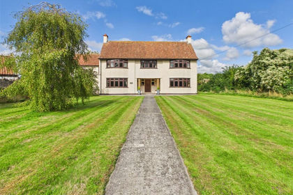
- Price
- £1,250,000
- Size
- 5 acres
Bristol Road, Rooksbridge, Axbridge, Somerset, BS26, East Brent, Somerset BS26 England
Added on 30/09/2026House with Land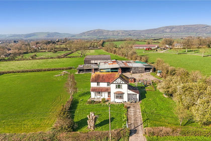
- Price
- Guide Price£795,000
- Size
- 6.43 acres
Badgworth Lane, Badgworth, Axbridge, BS26, Axbridge, Somerset BS26 England
Added on 21/03/2026Farmhouse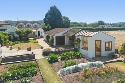
- Price
- £860,000
- Size
- 3.25 acres
Jubilee Lane, Langford, BS40, Churchill, North Somerset BS40 England
Added on 04/08/2026House with Land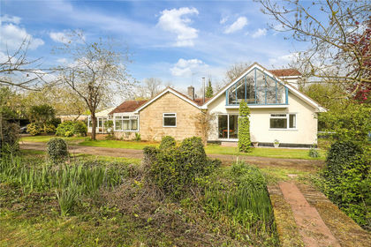
- Price
- Guide Price£1,100,000
- Size
- 10.24 acres
Ham Lane, Kingston Seymour, Clevedon, BS21, Clevedon, North Somerset BS21 England
Added on 10/05/2026House with Land
- Price
- Guide Price£1,100,000
- Size
- 4.31 acres
Kewstoke, Weston-Super-Mare, North Somerset, BS22, Kewstoke, North Somerset BS22 England
Added on 14/08/2026Smallholding
- Price
- £1,200,000
- Size
- 3 acres
Added on 25/07/2026Equestrian property