Christon Road, Loxton, Axbridge, BS26
- Land size
- 4.8 acres
- Bedrooms
- 5
- Bathrooms
- 3
Key Features
- Detached five bedroom charming period home
- Three reception rooms
- Utility
- Two ensuites
- Family bathroom
- Conservatory
- Double garage
- 4.8 acres of land
Description
Charming 5-bedroom detached house nestled in a serene rural setting. This property boasts a private parking area, double garage, and ample outdoor space. Perfect for those seeking a peaceful countryside retreat with 4.8 acres of land.
Nestled in the picturesque countryside of the quaint village of Loxton, this charming 5-bedroom detached property is a true gem. Boasting 4 acres of beautiful farmland, this smallholding offers a peaceful and scenic retreat for those seeking a rural lifestyle. The property exudes a homely and inviting atmosphere, with spacious rooms and stylish decor throughout. Well-maintained gardens surround the house, providing a tranquil outdoor space perfect for relaxing or entertaining. In addition to private parking and a garage, there are also outbuildings that offer potential for further development or use as an office, music room or a variety of other uses. This property is ideal for those looking to escape the hustle and bustle of city life and embrace the tranquillity of the countryside. Don't miss out on the opportunity to make this idyllic retreat your new home.
Located in this highly sought after village within a Conservation Area and the Mendip Area of Outstanding Natural Beauty. Loxton is well situated between Junction 21 (Weston super Mare) to the North and Junction 22 (Edithmead) to the South of the M5. It is also well placed for access to Weston super Mare, Axbridge and the A38 leading to Bristol and the International Airport to the North.
A sympathetically restored Detached Farmhouse with a 4 Acre field, offering spacious accommodation with many original features. This includes a superb open plan bespoke fitted Kitchen/Breakfast Room, Conservatory, Lounge with Inglenook Fireplace and bi-fold doors onto the rear garden,, Dining Room and Study. Upstairs there is a large Master Bedroom incorporating an En Suite and Walk In Wardrobe; there are 4 further Double Bedrooms and 2 Family Bathrooms. The property also benefits from hardwood framed double glazing and oil fired central heating. Externally the property boasts a detached outbuilding which offers excellant space for a home office, music room or a host of other functions. 2 former Stables and generous parking as well as a 4 Acre (1.62 Ha) naturally draining field with superb views towards Crook Peak and the Mendip Hills, ideal for those with equestrian interests.
Entrance:
Door to Entrance Vestibule with further door to Hall and door to:-
Utility Room: Base units with worksurfaces over. Single drainer stainless steel sink unit. Plumbing for an automatic washing machine. Vent for tumble dryer. Oil fired boiler providing central heating and hot water.
Hall:
Oak floor, Cloaks cupboard. Staircase rising to First Floor.
Cloakroom: Low level WC. Wash hand basin. Extractor.
Snug:
Inglenook fireplace with wood burner. Two double glazed doors to Garden. Beamed ceiling.
Study: Radiator. Arched recesses. Beamed ceiling.
Dining Room: Two double glazed windows.
Kitchen/Breakfast Room:
A superb open plan room with a bespoke fitted Kitchen area with a range of base units with granite worksurfaces over and a central island with cupboards under and wash basin. Oil fired aga supplemented by a fitted electric oven and ceramic 4 ring hob and space for microwave. Enamel double sink with mixer taps over. Integrated refrigerator and dishwasher. Space for American-style fridge/freezer. Window seat. Beamed ceiling. Fitted dresser. Tiled floor. Double glazed door to Garden and further door to:-
Conservatory:
Upvc double glazed, French doors to Patio and Garden.
First Floor Landing:
Airing cupboard with hot water tank and immersion heater. Store cupboard. Access to loft space.
Master Bedroom:
Walk-in wardrobe. Access to loft space.
En Suite:
With white suite comprising panelled bath with mixer shower over. Low level WC. Vanity unit with inset wash hand basin. Double cubicle with 'Triton Unichrome' shower unit. Tiled splashback and floor.
Bedroom 2:
Fitted wardrobes.
Bedroom 3:
Fitted wardrobes.
Bedroom 4:
Fitted wardrobes.
Bedroom 5:
Bathroom:
White suite with panelled bath with mixer shower over. Low level WC. Pedestal wash hand basin. Corner cubicle with 'New Team' shower unit. Tiled splashback and floor.
Outside: The property is approached from Christon Road over a cattle grid and driveway over which two other properties have right of access. There is a large gravelled parking area in front of a Garage and two former Stables: Area of lawn and rockery on two levels. Fruit trees and mature shrubs. Archway with gates leading to a cobbled Courtyard with ornamental well. Discrete wood store and oil storage tank. Mature trees. Gate to secluded Patio Garden with mature shrubs and high hedges. Access to landscaped Garden laid mainly to lawn with mature shrub and hedge borders. Access from the road and driveway to a naturally draining Paddock of approximately 4 Acres (1.62 Ha) part fenced and part walled with superb views over the valley towards Crook Peak and the Mendip Hills.
Map Location
Property details
- Tenure
- Freehold
- Council Tax Band
- G
- Date Posted
- 2026-01-29
Market Value Analysis
Compared with 150 Farms & Smallholdings listings in South West England (1+ acres).
Energy Performance Certificate
Energy Efficiency Rating
Based on UK Energy Performance Certificate standards (EU Directive 2002/91/EC)
Running costs are one side. Planning activity, flood history and ground risks for this location are in the full report.
Property Brochure
Seen the details? The full report adds the independent checks: planning activity, flood history, heritage and ground.
Utilities & Restrictions
Utilities
- Electricity
- Mains
- Water
- Mains
- Heating
- Oil Heating
- Broadband
- Ask Agent
- Sewerage
- Mains
Rights & Restrictions
- Public Rights of Way
- Ask Agent
- Private Rights of Way
- Ask Agent
- Listed Property
- Ask Agent
- Restrictions
- Ask Agent
Listed status, conservation areas and planning constraints for this location are in the full report.
Property Features
- Accessibility
- Ask Agent
- Parking
- Garage, Driveway, Off-Street Parking
- Garden
- Garden
Beyond the particulars: planning activity, flood history, heritage and ground risks, checked for this exact spot.
Connectivity
Broadband
Fastest speed available at this postcode
1 Gbps
Gigabit full fibre
Suitable for
- 4K streaming on every screen
- Full-time home working
- Online gaming & big downloads
Mobile signal
Predicted 4G and 5G signal; indoor signal depends on building materials.
Ofcom Connected Nations postcode-level predictions. Speeds and signal are modelled, not measured, and vary between addresses and providers.
Signal is the easy part. Planning activity, flood history and protected designations here are in the full report.
Nearest Schools
Primary
- Hutton Church of England Primary School2.2 milesNo Ofsted rating
- Ages
- 4 to 11
- Pupils
- 200
- Type
- Academy converter
- Faith
- Church of England
- Banwell Primary School2.3 milesOfsted report card · Mar 2026
- Ages
- 4 to 11
- Pupils
- 137
- Type
- Academy converter
- Locking Primary School2.4 milesOfsted report card · Jun 2026
- Ages
- 2 to 11
- Pupils
- 386
- Type
- Academy converter
- Parklands Educate Together Primary2.5 milesOfsted: Good
- Ages
- 3 to 11
- Pupils
- 424
- Type
- Free schools
- Lympsham Church of England Academy2.7 milesNo Ofsted rating
- Ages
- 2 to 9
- Pupils
- 139
- Type
- Academy converter
- Faith
- Church of England
Secondary
- Winterstoke Hundred Academy3.2 milesOfsted: Good
- Ages
- 11 to 19
- Pupils
- 870
- Type
- Free schools
- Hans Price Academy3.9 milesNo Ofsted rating
- Ages
- 11 to 16
- Pupils
- 1,046
- Type
- Academy sponsor led
- Broadoak Academy3.9 milesOfsted: Good
- Ages
- 11 to 16
- Pupils
- 792
- Type
- Academy converter
- Worle Community School4 milesOfsted report card · Jun 2026
- Ages
- 11 to 16
- Pupils
- 1,244
- Type
- Academy sponsor led
- Priory Community School4.4 milesOfsted: Good
- Ages
- 11 to 16
- Pupils
- 1,486
- Type
- Academy converter
Distances are straight-line from the advertised location. Source: the national school registers (DfE, Welsh Government, Scottish Government) and Ofsted.
Schools are just the start: sold prices nearby, planning activity and any flood history are in the full report.
Amenities
Supermarket
GP surgery
Pharmacy
Hospital
Straight-line distances from the advertised location. Sources: NHS records, Geolytix supermarket locations, OS Open Greenspace and the national trails registers.
The area stacks up? Now check the location itself: planning nearby, protected designations and past flooding.
Getting Around
Nearest station
Nearest bus stop
Typical drive times
Straight-line distances from the advertised location; drive times are typical free-flow times over OpenStreetMap road data, so allow more at peak. Public transport locations from DfT NaPTAN.
Easy to reach matters. So do planning activity, flood history and ground risks: all in the full report.
Flood Risk
Environment Agency open data, checked around the advertised map pin for the listed acreage. Long-term risk counts flood defences; the planning map's flood zones do not. Provided by LandSale, not the listing agent, and not part of the agent's particulars. Risk varies across a holding, so verify before committing.
Rivers and the sea
Not at the pin: mapped about 40 metres away.
Planning map: Flood Zone 2, about 40 metres away.
Surface water
These bandings are the summary. Where this location sits on the flood maps, plus planning activity, heritage and ground risks, is in the full report.
Important notice: Information, maps and tags on this page are drawn from the advertising agent's marketing materials or generated automatically. LandSale has not verified them. Relying on these details is at your own risk, always carry out independent checks before committing to a purchase.
LandSale full disclaimer
Marketing information only - not formal particulars. The details on this website are provided for general guidance and do not constitute an offer or contract. Neither LandSale nor the advertising estate/land agent accepts responsibility for any inaccuracy.
1. Source of information
- Listing content: Core description, asking price, tenure, measurements, photographs and planning history originate from the marketing materials of the advertising estate or land agent. LandSale does not author this content and cannot guarantee its accuracy.
- Automated tags & categorisation: Property type, land-use class, acreage bands and similar labels may be applied by machine-learning models. They are intended as a helpful guide only and may not reflect the property's legal status or permitted use.
- Third-party & enriched data layers: Maps, boundary outlines, planning designations, soil reports, broadband coverage and other environmental or location-based insights are licensed from external suppliers. Such data are supplied “as is", may be incomplete or out of date and are subject to change without notice.
2. Verification required
Prospective purchasers must verify critical matters, including but not limited to planning permission, title boundaries, public rights of way, environmental constraints, acreage, services, access and VAT status, through their own inspections, specialist surveys, legal advisers and the selling agent before relying on the information or entering into any contract.
3. No warranty or liability
LandSale gives no warranty, express or implied, as to the accuracy, completeness or fitness for any particular purpose of the information displayed. LandSale shall not be liable for any loss, damage, cost or expense arising directly or indirectly from any use of or reliance on such information, save where liability may not be excluded by law.
4. Updates & feedback
If you believe any detail on this listing is inaccurate, please let us know. We will investigate and, where appropriate, update the listing or notify the agent.
© LandSale | Version 1.3 - August 2026

Listing agent
Greenslade Taylor Hunt, Burnham-On-Sea
44 High Street, Burnham-On-Sea, TA8 1AZ
Contact Greenslade Taylor Hunt, Burnham-On-Sea
44 High Street, Burnham-On-Sea, TA8 1AZ
View agent profileSimilar properties for sale
- Price
- Guide Price£925,000
- Size
- 9.93 acres
Small holding - 9.93 acres, Chilcompton, Radstock, BA3, Chilcompton, Somerset BA3 England
Added on 21/05/2026Smallholding
- Price
- Guide Price£795,000
- Size
- 16 acres
Sedgemoor Road, North Curry, Taunton, TA3, Taunton, Somerset TA3 England
Added on 09/07/2026Smallholding
- Price
- Offers in Region of£750,000
- Size
- 20.54 acres
Llanvair Discoed, Chepstow, Monmouthshire, NP16, Caerwent, Monmouthshire NP16 Wales
Added on 06/10/2026Smallholding
- Price
- £1,000,000
- Size
- 29 acres
Llantrisant, Usk, NP15, Llantrisant Fawr, Monmouthshire NP15 Wales
Added on 29/01/2026Small Farm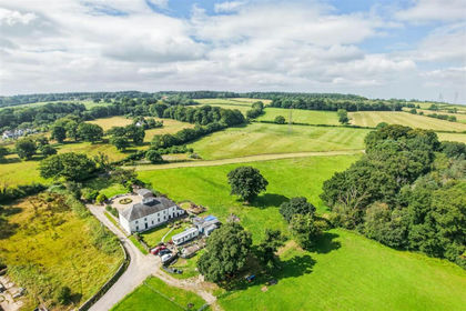
- Price
- £695,000
- Size
- 3.33 acres
Llwynrhyddid Farmhouse, Hensol, Pontyclun, CF72, Pendoylan, Vale of Glamorgan CF72 Wales
Added on 29/01/2026Farmhouse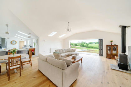
- Price
- Guide Price£775,000
- Size
- 2 acres
North Cheriton SOMERSET, North Cheriton, Somerset BA8 England
Added on 08/10/2026Barn Conversion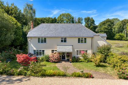
- Price
- Guide Price£1,000,000
- Size
- 11 acres
Timberscombe, Minehead, TA24, Minehead, Somerset TA24 England
Added on 05/09/2026Smallholding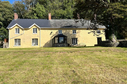
- Price
- Guide Price£865,000
- Size
- 11.47 acres
Added on 09/10/2026Smallholding
- Price
- Guide Price£675,000
- Size
- 15.81 acres
Whitestaunton, Chard, Somerset, Whitestaunton, Somerset TA20 England
Added on 18/06/2026Farm
- Price
- Guide Price£950,000
- Size
- 41.35 acres
Ashbrittle, Wellington, TA21, Wellington, Somerset TA21 England
Added on 18/09/2026Small Farm