Cwm Cewydd, Machynlleth, Gwynedd, SY20
- Land size
- 14 acres
- Bedrooms
- 4
- Bathrooms
- 2
Key Features
- 14 acre Nature Reserve in unspoilt open upland countryside
- Panoramic, far reaching views across surrounding valley
- 4 Bedroom property has recently undergone a scheme of major improvements
- Additional land comprising of meadow land, woodland and 3 nature ponds, one with central island
- Freehold
- EPC - D62. Expiry 14/08/2035
Description
Bwlchgoediog Isaf is an idyllic setting in the small valley of Cwm Cewydd leading off the protected Upper Dyfi Valley Biosphere, just below Dinas Mawddwy.
The property is quietly located and only 1.5 miles from the main Machynlleth to Welshpool road and was previously a private Nature Reserve with 3 ponds, the larger of which has a small island. Surrounded by Snowdonia National Park's spectacular mountains, Bwlchgoediog Isaf is a haven for wildlife, with various species of garden birds nesting in numerous bird boxes within native broadleaf woodland and regular sightings of foxes and badgers as well as otters, pine martens and the occasional deer.
The property itself has undergone a major scheme of improvements including installation of replacement UPVC double glazed windows throughout, all improved and updated fixtures and fittings and restoration of some original features, taking full advantage of the incredible scenery on offer from the valley below. A true slice of paradise, viewing is essential, don't miss out!
The accommodation comprises:
Breakfast Kitchen (8'10 x 32'1); a bright, open space of contemporary design with vaulted ceilings and Velux sky lights. The kitchen comprises blue high gloss base cupboards to 3 walls with wall cupboards to one wall. Contrasting white Quartz and wooden worktops with 1.5 bowl composite sink unit inset. A range of integrated appliances to include 4 ring induction hob with extractor hood over, double oven and dishwasher. Ceramic tiled floor throughout with sliding doors from the dining area to garden. Door to Dining Room and wide opening to
Day Room (15' x 16'5) with engineered oak flooring. Dual aspect corner glazing with sliding patio doors to paved patio area boasting panoramic far reaching views across the valley to the Cambrian Mountains. Wide opening to
Dining Room (12' x 14'7) with engineered oak flooring. Glazed double doors to Hall and wide opening to
Snug (12' x 10'9) with original parquet mahogany flooring and feature red brick wall. Wood burner inset to fireplace with slate hearth and oak lintel above.
Hall with engineered oak flooring and stairs to first floor with under stairs cupboard housing central heating boiler. Separate Cloakroom comprising low flush WC and vanity wash hand basin. Door to
Utility Room (6'4 x 18') with wooden laminate flooring and external door to garden. Base cupboards to one wall with stainless steel sink unit inset and under counter space for appliances including plumbing for washing machine.
First Floor:
Spacious Landing with airing cupboard housing hot water tank and under stairs storage cupboard. Stairs to second floor and doors to
Principle Bedroom (16'1 x 15'2 max) with 2 built-in double wardrobes and vaulted exposed ceiling beam. Dual aspect, wide picture windows enjoying panoramic views across the surrounding mountains and valley, far reaching towards the Cambrian Mountains. Door to
En-suite Shower Room with statement vinyl flooring and matching sink splashback. Double shower cubicle with tiled surround and electric power shower over, WC, vanity wash hand basin and heated towel rail.
Bedroom 2 (10'5 x 10'11) a good sized double bedroom with views across the surrounding mountains.
Bedroom 3 (8'4 x 12') with window overlooking the garden.
Bedroom 4 (7'1 x 8'10) with window overlooking the garden.
Family Bathroom (6'5 x 7') with panel bath, electric power shower over, WC, vanity wash hand basin, heated towel rail and vinyl flooring.
Second Floor:
Hobby Room/Home Office (9'2 x 12'6 max) with 2 Velux sky lights offering views over surrounding mountains. Panelled walls and ceiling with concealed door to
Loft Space (10'3 x 9'2 max) fully boarded with Velux sky light and lights.
Please note that a charge of £36 per person will be applied to cover mandatory anti-money laundering checks.
To the North of the property, parking for multiple vehicles with gated access and steps down. Mature trees and bushes line the steps down to gravel and paved patio which surrounds the house. There are floral borders to one end with a timber built Log Store and glazed Grow House extending to the rear of the property. To the rear, several raised beds, suitable as floral or vegetable beds. To the South side of the property, further paved patio boasting far reaching views down the valley below with steps to the vegetable garden. The Barn (29'2 x 12'5) boasts a covered Verandah enjoying the stunning scenery in all weathers and offers a large Workshop area with power and lights and crawl space storage. The former Stable Block comprises 2 Loose Boxes which are currently used as garden storage. Double gated access from the road side, allowing vehicular access to the outbuildings and additional land with additional parking. The vegetable garden sits on a terrace below the property and is complete with raised beds and fruit trees. 150 sq m Chicken Enclosure with both indoor and outdoor roaming.
The additional land extends to approximately 14 acres, down into the valley below and is a real slice of paradise, complete with 3 large nature ponds, a wildlife meadow, broadleaf woodland and a Summer House with a terrace. There is also an additional small barn here, currently used for storage. The land has been lovingly restored by the current owners who have created and maintained a blissful wildlife habitat.
Map Location
Property details
- Tenure
- Freehold
- Council Tax Band
- G
- Date Posted
- 2026-01-29
Market Value Analysis
Compared with 168 Homes with Land listings in Wales (10+ acres).
Energy Performance Certificate
Energy Efficiency Rating
Based on UK Energy Performance Certificate standards (EU Directive 2002/91/EC)
View official EPC certificate ↗
Running costs are one side. Planning activity, flood history and ground risks for this location are in the full report.
Utilities & Restrictions
Utilities
- Electricity
- Ask Agent
- Water
- Ask Agent
- Heating
- Ask Agent
- Broadband
- Ask Agent
- Sewerage
- Ask Agent
Rights & Restrictions
- Public Rights of Way
- Ask Agent
- Private Rights of Way
- Ask Agent
- Listed Property
- Ask Agent
- Restrictions
- Ask Agent
Listed status, conservation areas and planning constraints for this location are in the full report.
Property Features
- Accessibility
- Ask Agent
- Parking
- Parking Available
- Garden
- Garden
Beyond the particulars: planning activity, flood history, heritage and ground risks, checked for this exact spot.
Connectivity
Broadband
Fastest speed available at this postcode
1 Gbps
Gigabit full fibre · available to 78% of premises
Suitable for
- 4K streaming on every screen
- Full-time home working
- Online gaming & big downloads
Mobile signal
Predicted 4G and 5G signal; indoor signal depends on building materials.
Ofcom Connected Nations postcode-level predictions. Speeds and signal are modelled, not measured, and vary between addresses and providers.
Signal is the easy part. Planning activity, flood history and protected designations here are in the full report.
Nearest Schools
Primary
- Ysgol Gynradd Glantwymyn7.4 miles
- Pupils
- 78
- Type
- Nursery, Infants & Juniors
- Language
- Welsh medium school / provision (including transitional)
- Ysgol Llanbrynmair7.8 miles
- Pupils
- 35
- Type
- Nursery, Infants & Juniors
- Language
- Welsh medium school / provision (including transitional)
- Ysgol Cwm Banwy8.3 miles
- Pupils
- 46
- Type
- Nursery, Infants & Juniors
- Language
- Welsh medium school / provision (including transitional)
- Ysgol Gynradd Dyffryn Dulas8.8 miles
- Pupils
- 33
- Type
- Nursery, Infants & Juniors
- Language
- Welsh medium school / provision (including transitional)
- Bro Idris9.2 miles
- Pupils
- 541
- Type
- Middle (ages 3-16)
- Language
- Welsh medium school / provision (including transitional)
Secondary
- Bro Idris9.2 miles
- Pupils
- 541
- Type
- Middle (ages 3-16)
- Language
- Welsh medium school / provision (including transitional)
- Ysgol Bro Hyddgen12 miles
- Pupils
- 441
- Type
- Middle (ages 4-19)
- Language
- Welsh medium school / provision (including transitional)
- YSGOL Godre'r Berwyn14 miles
- Pupils
- 571
- Type
- Middle (ages 3-19)
- Language
- Welsh medium school / provision (including transitional)
- Ysgol Bro Caereinion15 miles
- Pupils
- 494
- Type
- Middle (ages 4-19)
- Language
- Welsh medium school / provision (including transitional)
- Ysgol Llanfyllin17 miles
- Pupils
- 775
- Type
- Middle (ages 4-19)
- Language
- Dual language school / provision (Welsh and English) (including transitional)
Distances are straight-line from the advertised location. Source: the national school registers (DfE, Welsh Government, Scottish Government) and Ofsted.
Schools are just the start: sold prices nearby, planning activity and any flood history are in the full report.
Amenities
Supermarket
GP surgery
Pharmacy
Straight-line distances from the advertised location. Sources: NHS records, Geolytix supermarket locations, OS Open Greenspace and the national trails registers.
The area stacks up? Now check the location itself: planning nearby, protected designations and past flooding.
Getting Around
Nearest station
Nearest bus stop
Typical drive times
Straight-line distances from the advertised location; drive times are typical free-flow times over OpenStreetMap road data, so allow more at peak. Public transport locations from DfT NaPTAN.
Easy to reach matters. So do planning activity, flood history and ground risks: all in the full report.
Flood Risk
Natural Resources Wales open data, checked around the advertised map pin for the listed acreage. Long-term risk counts flood defences; the planning map's flood zones do not. Provided by LandSale, not the listing agent, and not part of the agent's particulars. Risk varies across a holding, so verify before committing.
Rivers and the sea
Planning map: Flood Zone 1.
Surface water
Not at the pin: mapped about 70 metres away.
These bandings are the summary. Where this location sits on the flood maps, plus planning activity, heritage and ground risks, is in the full report.
Important notice: Information, maps and tags on this page are drawn from the advertising agent's marketing materials or generated automatically. LandSale has not verified them. Relying on these details is at your own risk, always carry out independent checks before committing to a purchase.
LandSale full disclaimer
Marketing information only - not formal particulars. The details on this website are provided for general guidance and do not constitute an offer or contract. Neither LandSale nor the advertising estate/land agent accepts responsibility for any inaccuracy.
1. Source of information
- Listing content: Core description, asking price, tenure, measurements, photographs and planning history originate from the marketing materials of the advertising estate or land agent. LandSale does not author this content and cannot guarantee its accuracy.
- Automated tags & categorisation: Property type, land-use class, acreage bands and similar labels may be applied by machine-learning models. They are intended as a helpful guide only and may not reflect the property's legal status or permitted use.
- Third-party & enriched data layers: Maps, boundary outlines, planning designations, soil reports, broadband coverage and other environmental or location-based insights are licensed from external suppliers. Such data are supplied “as is", may be incomplete or out of date and are subject to change without notice.
2. Verification required
Prospective purchasers must verify critical matters, including but not limited to planning permission, title boundaries, public rights of way, environmental constraints, acreage, services, access and VAT status, through their own inspections, specialist surveys, legal advisers and the selling agent before relying on the information or entering into any contract.
3. No warranty or liability
LandSale gives no warranty, express or implied, as to the accuracy, completeness or fitness for any particular purpose of the information displayed. LandSale shall not be liable for any loss, damage, cost or expense arising directly or indirectly from any use of or reliance on such information, save where liability may not be excluded by law.
4. Updates & feedback
If you believe any detail on this listing is inaccurate, please let us know. We will investigate and, where appropriate, update the listing or notify the agent.
© LandSale | Version 1.3 - August 2026
Listing agent
Morris Marshall & Poole, Machynlleth
18 Heol Maengwyn, Machynlleth, SY20 8DT
View agent profileSimilar properties for sale
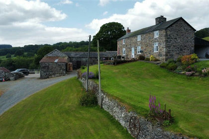
- Price
- £750,000
- Size
- 31.8 acres
Llanwddyn, Oswestry, Powys, SY10, Llanwddyn, Powys SY10 Wales
Added on 29/01/2026Small Farm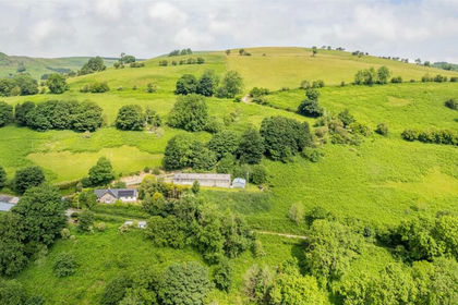
- Price
- Offers in Region of£695,000
- Size
- 53.32 acres
Hirnant, Penybontfawr, Oswestry, Pen-y-Bont-Fawr, Powys SY10 Wales
Added on 09/07/2026Farm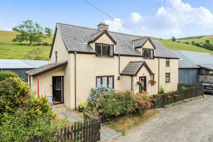
- Price
- Guide Price£625,000
- Size
- 9.4 acres
Pennant, Llanbrynmair, Powys, SY19, Llanbrynmair, Powys SY19 Wales
Added on 25/07/2026House with Land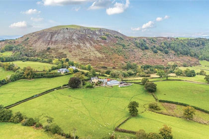
- Price
- Guide Price£750,000
- Size
- 14.83 acres
Gelli (Lot 1), Llanfair Caereinion, Welshpool, Powys, SY21, Llanfair Caereinion, Powys SY21 Wales
Added on 29/07/2026Small Farm
- Price
- Offers in Excess of£700,000
- Size
- 42.52 acres
Added on 29/04/2026Smallholding
- Price
- Offers in Region of£675,000
- Size
- 8 acres
Added on 19/05/2026House with Land
- Price
- Offers in Region of£649,500
- Size
- 8.88 acres
Added on 28/07/2026House with Land
- Price
- £680,000
- Size
- 22.5 acres
Added on 20/07/2026House with Land
- Price
- Guide Price£850,000
- Size
- 8.43 acres
Van, Llanidloes, Powys, SY18, Llanidloes Without, Powys SY18 Wales
Added on 28/08/2026Country Home
- Price
- £775,000
- Size
- 27 acres
Castle Caereinion, Welshpool, Powys, Castle Caereinion, Powys SY21 Wales
Added on 08/07/2026Smallholding