Bodowen Lodge, Barmouth
- Land size
- 8 acres
- Bedrooms
- 3
- Bathrooms
- 3
Key Features
- Unique detached historical property boasting 3 bedrooms and 3 en-suite
- Unrivalled in its location with private access onto the beautiful Mawddach Estuary yet 5 minutes from the hustle and bustle of the seaside town of Barmouth
- Nestled in approximately 8 acres of private garden and woodland
- Fully renovated to the highest standards - internally and externally
- Newly built triple garage - perfect for the storage of a classic vehicle, boat etc
- Perfect blend of modern luxury and natural beauty
- Large outbuildings
- Underfloor heating throughout
- Being sold with the benefit of no onward chain
- Bodowen Lodge is an opportunity which will not be available for long!
Description
A beautifully restored and extended three-bedroom lodge of historic character, set within approximately eight acres of private grounds and offering rare, direct access to the breathtaking Mawddach Estuary. Formerly a gate house, this unique residence has been thoughtfully and comprehensively renovated, blending period charm with refined modern living in an exceptional rural setting.
The property sits gracefully within its expansive landholding, surrounded by mature woodland, open clearings, and sweeping natural scenery. To the front are unbeatable sea and mountain views.
The property has recently undergone a comprehensive renovation programme which has elevated every aspect of this home, with a calm, contemporary interior palette, quality finishes, and an effortless flow between rooms.
The single storey property features inviting living spaces with generous natural light, while the bespoke kitchen/diner provides a stylish heart to the home — ideal for both everyday comfort and entertaining. In addition there are three beautifully appointed bedrooms, all with stylish and contemporary en-suite facilities.
The land itself is a standout feature: circa eight acres of private, unspoilt countryside, offering exceptional privacy, wildlife, and endless possibilities for leisure, small-scale hobby farming, or simply enjoying the tranquillity. A private pathway leads directly to the Mawddach Estuary, granting exclusive access to one of Wales’ most celebrated natural landscapes — perfect for paddleboarding, kayaking, or peaceful shoreline walks.
Externally, the lodge is framed by charming stonework, landscaped areas, and natural woodland, creating a sense of seclusion and timeless rural beauty. This is a property that offers not just a home, but a lifestyle — one defined by space, nature, and the rare privilege of private estuary access.
A truly exceptional opportunity to acquire a fully renovated historic property in the perfect setting.
Accommodation comprises:
Rear Entrance Hall - 4.86 x 1.17 (15'11" x 3'10") - Open space leading directly into kitchen/dining with doors into
Cloakroom - 2.07 x 1.20 (6'9" x 3'11") - Contemporary fittings including low level W.C. with concealed cistern, wash hand basin, obscured window to rear
Walk In Storage/Utility Space - 2.02 x 1.31 (6'7" x 4'3") - Useful storage area containing "Glow Worm" boiler
Kitchen/Diner - 5.61 x 3.54 (18'4" x 11'7") - Luxurious kitchen beautifully fitted with wall and base units including integrated fridge/freezer, oven, microwave, induction hob with extractor hood above, laminate worktops, sink and drainer unit, open to dining area with original alcove cupboards and feature "fireplace", two windows to front with far reaching sea and mountain views
Lounge - 3.76 x 3.40 (12'4" x 11'1") - Nestled in the original part of the property with feature log burning stove on slate hearth, window to front with far reaching views, door to outside
Bedroom 1 - 5.18 x 3.65 (16'11" x 11'11") - Bay window to front with stunning sea and mountain views, two windows to side, door leading to
En-Suite - 1.36 x 2.97 (4'5" x 9'8") - Shower enclosure, low level W.C., with concealed cistern, wash hand basin with vanity unit below, obscured window to rear
Bedroom 2 - 3.59 x 3.19 (11'9" x 10'5") - Window to side, door leading to
En-Suite - 1.94 x 2.39 (6'4" x 7'10") - Fully tiled shower cubicle with rainfall head shower, wash hand basin, low level W.C., tiled floor, shaving socket, two skylight windows
Bedroom 3 - 3.61 x 3.59 (11'10" x 11'9") - Window to side, door leading to
En-Suite Bathroom - 3.29 x 2.20 (10'9" x 7'2") - Panelled bath, fully tiled shower enclosure, wash hand basin with vanity drawers below, low level W.C., skylight window, glass bricks to rear
External - The property is set back from the road and entry into ground is via a newly laid tarmacadam driveway.
There is approximately 8 acres of land belonging to the lodge - a mixture of woodland, natural clearings, rock face and gardens - ample spaces to sit and soak up the spectacular views.
External Utility - 4.42 x 2.36 (14'6" x 7'8") - Base units with worktops above, space and plumbing for washing machine, private water supply treatment system, concrete floor
Garage - 8.61 x 6.63 (28'2" x 21'9") - Newly built with electric doors - perfect for storage of larger vehicles
Storage Shed - 5.86 x 9.09 (19'2" x 29'9") - Steel structure for additional storage - currently being used as a workshop, complete with separate room housing shower and wash hand basin.
Location - The property is located approximately a 5 minute drive to the classic seaside resort of Barmouth “where the mountains meet the sea” Residents can lose themselves in the rugged landscapes of Snowdonia National Park or stroll along the quaint streets lined with colourful shops, restaurants and cafes. There are good local bus services and the nearby stations along the Cambrian Coastline railway provide excellent links to nearby towns, including Porthmadog and Harlech, with regular services to the Midlands and beyond. Whether it's hiking, beachcombing, or simply soaking in the tranquil atmosphere, Barmouth is timeless and captivating place to live
Services - Private water supply - borehole
Private drainage - treatment plant newly installed
Mains electricity
LPG central heating system
Material Information - Freehold property of standard construction.
Gwynedd Council tax band C
Map Location
Property details
- Tenure
- Freehold
- Council Tax Band
- C
- Date Posted
- 2026-05-19
Market Value Analysis
Compared with 365 Homes with Land listings in Wales (5+ acres).
Utilities & Restrictions
Utilities
- Electricity
- Mains
- Water
- Private Supply
- Heating
- Gas Heating
- Broadband
- Ask Agent
- Sewerage
- Septic Tank / Private
Rights & Restrictions
- Public Rights of Way
- Ask Agent
- Private Rights of Way
- Ask Agent
- Listed Property
- Ask Agent
- Restrictions
- Ask Agent
Listed status, conservation areas and planning constraints for this location are in the full report.
Property Features
- Accessibility
- Ask Agent
- Parking
- Parking Available
- Garden
- Garden
Beyond the particulars: planning activity, flood history, heritage and ground risks, checked for this exact spot.
Connectivity
Broadband
Fastest speed available at this postcode
1.8 Gbps
Gigabit full fibre
Suitable for
- 4K streaming on every screen
- Full-time home working
- Online gaming & big downloads
Mobile signal
Predicted 4G and 5G signal; indoor signal depends on building materials.
Ofcom Connected Nations postcode-level predictions. Speeds and signal are modelled, not measured, and vary between addresses and providers.
Signal is the easy part. Planning activity, flood history and protected designations here are in the full report.
Nearest Schools
Primary
- Ysgol y Traeth1.4 miles
- Pupils
- 185
- Type
- Nursery, Infants & Juniors
- Language
- Welsh medium school / provision (including transitional)
- Ysgol Gynradd Dyffryn Ardudwy4.6 miles
- Pupils
- 68
- Type
- Infants & Juniors
- Language
- Welsh medium school / provision (including transitional)
- Bro Idris6.4 miles
- Pupils
- 541
- Type
- Middle (ages 3-16)
- Language
- Welsh medium school / provision (including transitional)
- Ysgol Gynradd Llanbedr6.9 miles
- Pupils
- 43
- Type
- Infants & Juniors
- Language
- Welsh medium school / provision (including transitional)
- Ysgol Craig y Deryn7.4 miles
- Pupils
- 95
- Type
- Nursery, Infants & Juniors
- Language
- Welsh medium school / provision (including transitional)
Secondary
- Bro Idris6.4 miles
- Pupils
- 541
- Type
- Middle (ages 3-16)
- Language
- Welsh medium school / provision (including transitional)
- Ysgol Ardudwy9.7 miles
- Pupils
- 331
- Type
- Secondary (ages 11-16)
- Language
- Welsh medium school / provision (including transitional)
- Ysgol Uwchradd Tywyn10 miles
- Pupils
- 376
- Type
- Secondary (ages 11-16)
- Language
- Dual language school / provision (Welsh and English) (including transitional)
- Ysgol Bro Hyddgen12 miles
- Pupils
- 441
- Type
- Middle (ages 4-19)
- Language
- Welsh medium school / provision (including transitional)
- Ysgol Eifionydd15 miles
- Pupils
- 373
- Type
- Secondary (ages 11-16)
- Language
- Welsh medium school / provision (including transitional)
Distances are straight-line from the advertised location. Source: the national school registers (DfE, Welsh Government, Scottish Government) and Ofsted.
Schools are just the start: sold prices nearby, planning activity and any flood history are in the full report.
Amenities
Supermarket
GP surgery
Pharmacy
Straight-line distances from the advertised location. Sources: NHS records, Geolytix supermarket locations, OS Open Greenspace and the national trails registers.
The area stacks up? Now check the location itself: planning nearby, protected designations and past flooding.
Getting Around
Nearest station
Nearest bus stop
Typical drive times
Straight-line distances from the advertised location; drive times are typical free-flow times over OpenStreetMap road data, so allow more at peak. Public transport locations from DfT NaPTAN.
Easy to reach matters. So do planning activity, flood history and ground risks: all in the full report.
Flood Risk
Natural Resources Wales open data, checked around the advertised map pin for the listed acreage. Long-term risk counts flood defences; the planning map's flood zones do not. The map pin for this listing marks the postcode area rather than the exact location, so these readings describe the surrounding area. Provided by LandSale, not the listing agent, and not part of the agent's particulars. Risk varies across a holding, so verify before committing.
Rivers and the sea
Not at the pin: mapped about 90 metres away.
Planning map: Flood Zone 3, about 90 metres away.
Surface water
These bandings are the summary. Where this location sits on the flood maps, plus planning activity, heritage and ground risks, is in the full report.
Important notice: Information, maps and tags on this page are drawn from the advertising agent's marketing materials or generated automatically. LandSale has not verified them. Relying on these details is at your own risk, always carry out independent checks before committing to a purchase.
LandSale full disclaimer
Marketing information only - not formal particulars. The details on this website are provided for general guidance and do not constitute an offer or contract. Neither LandSale nor the advertising estate/land agent accepts responsibility for any inaccuracy.
1. Source of information
- Listing content: Core description, asking price, tenure, measurements, photographs and planning history originate from the marketing materials of the advertising estate or land agent. LandSale does not author this content and cannot guarantee its accuracy.
- Automated tags & categorisation: Property type, land-use class, acreage bands and similar labels may be applied by machine-learning models. They are intended as a helpful guide only and may not reflect the property's legal status or permitted use.
- Third-party & enriched data layers: Maps, boundary outlines, planning designations, soil reports, broadband coverage and other environmental or location-based insights are licensed from external suppliers. Such data are supplied “as is", may be incomplete or out of date and are subject to change without notice.
2. Verification required
Prospective purchasers must verify critical matters, including but not limited to planning permission, title boundaries, public rights of way, environmental constraints, acreage, services, access and VAT status, through their own inspections, specialist surveys, legal advisers and the selling agent before relying on the information or entering into any contract.
3. No warranty or liability
LandSale gives no warranty, express or implied, as to the accuracy, completeness or fitness for any particular purpose of the information displayed. LandSale shall not be liable for any loss, damage, cost or expense arising directly or indirectly from any use of or reliance on such information, save where liability may not be excluded by law.
4. Updates & feedback
If you believe any detail on this listing is inaccurate, please let us know. We will investigate and, where appropriate, update the listing or notify the agent.
© LandSale | Version 1.3 - August 2026
Listing agent
Tom Parry & Co, Harlech
6 High Street, Harlech, LL46 2YA
Similar properties for sale
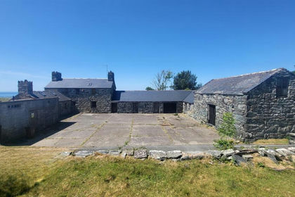
- Price
- Offers in Region of£649,500
- Size
- 6.2 acres
LLwyneinion Fechan, Dyffryn Ardudwy, Dyffryn Ardudwy, Gwynedd LL44 Wales
Added on 29/01/2026Farmhouse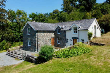
- Price
- £535,000
- Size
- 8.56 acres
Added on 28/07/2026House with Land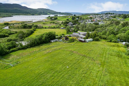
- Price
- Guide Price£600,000
- Size
- 5 acres
Old Mill Farmhouse, Trawsfynydd, Trawsfynydd, Gwynedd LL41 Wales
Added on 29/01/2026Holiday Let Property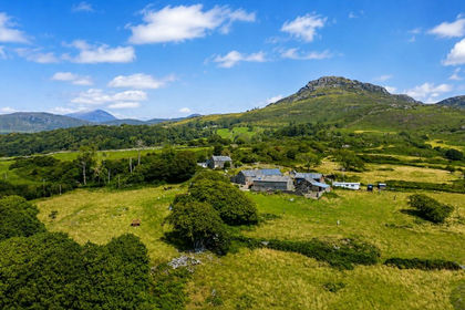
- Price
- £695,000
- Size
- 73.12 acres
Added on 29/01/2026House with Land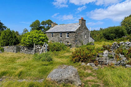
- Price
- £595,000
- Size
- 13.34 acres
Added on 27/08/2026Multiple Dwelling Property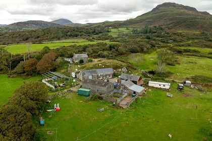
- Price
- £725,000
- Size
- 73.12 acres
Morfa Bychan, Porthmadog, Gwynedd, LL49, Porthmadog, Gwynedd LL49 Wales
Added on 21/05/2026House with Land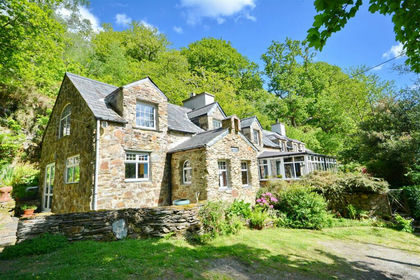
- Price
- £690,000
- Size
- 4 acres
Tan-Y-Bwlch, Blaenau Ffestiniog, Gwynedc, Maentwrog, Gwynedd LL41 Wales
Added on 17/03/2026House with Land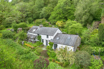
- Price
- £550,000
- Size
- 8.7 acres
Blaenau Ffestiniog, Gwynedd, LL41, Ffestiniog, Gwynedd LL41 Wales
Added on 26/06/2026House with Land
- Price
- £775,000
- Size
- 12 acres
Dolbenmaen, Garndolbenmaen, Gwynedd, Dolbenmaen, Gwynedd LL51 Wales
Added on 08/08/2026House with Land
- Price
- £765,000
- Size
- 10 acres
Llanfrothen, Penrhyndeudraeth, Gwynedd, Beddgelert, Gwynedd LL48 Wales
Added on 01/07/2026House with Land