Impressive Barn Conversion in Sedgeford
- Bedrooms
- 4
- Bathrooms
- 3
Key Features
- Converted Barn with Generous Family Accommodation
- Four Double Bedrooms Including Principal Suite with En-Suite
- Large Open Plan Kitchen, Dining and Family Room
- Lakeland Slate Island and Aga at the Heart of the Home
- Drawing Room with Real Flame Gas Fire and South Facing Roof Terrace
- Full Width Glazing to Sheltered South Facing Terrace
- Discrete Internal Lift Serving Both Floors
- Two Bedroom Self Contained Annexe
- Double Garage and Ample Parking
- South Facing Gardens with Versatile Summer House
Description
The Haybarn is a beautifully conceived and carefully crafted converted barn that offers exceptional family living in the heart of a peaceful Norfolk village. Its understated frontage gives little hint of the scale and quality that unfolds beyond the threshold, yet once inside, the thoughtful layout, generous proportions and harmonious flow of the accommodation become immediately evident. Designed and created by the current owner, this is a home shaped with both practicality and long term comfort in mind, making it as functional as it is inviting.
Set across two levels due to the gentle gradient of the site, the main entrance is most conveniently approached from the parking and double garage level. Stepping into the hall, the drawing room sits to one side, a wonderfully welcoming space with a real flame gas fire forming an attractive winter focal point. Almost full width glazing allows the room to open completely during the warmer months, creating a seamless extension onto the substantial south facing roof terrace. Elevated, private and bathed in sunlight, this terrace provides an idyllic setting for quiet relaxation or summer entertaining.
The lower level forms the true heart of the home. Here, the large open plan kitchen, dining and living room brings the family together in a light filled and supremely comfortable environment. The striking Lakeland slate island invites informal gatherings, while the Aga offers warmth and familiarity that enhances the character of this sociable space. Full width glass doors lead directly onto a sheltered south facing terrace that feels reminiscent of a Tuscan courtyard, complete with a gentle water feature and tiered planting that rises towards the garden. A generous walk in utility room further complements the practical design of this level.
The principal bedroom suite occupies a private position on the upper floor and benefits from both staircase and discrete lift access. This suite is notably spacious, comprising a large bedroom, elegant en-suite bathroom and a substantial dressing room fitted with plentiful wardrobe space. Two additional double bedrooms can be arranged to form a fully self contained annex with its own reception room, offering excellent flexibility for multi generational living, guest accommodation or an income producing arrangement.
Outside, the south facing garden is well proportioned and beautifully arranged, offering a series of inviting spaces to enjoy throughout the seasons. A charming summer house stands to one side, currently used as an artist’s studio but equally suited to those seeking a home office, creative retreat or peaceful garden room. A two bay cart barn and ample off street parking further enhance the practicality of the property.
The Haybarn has been a cherished family home, loved across generations and frequently enjoyed by returning holiday guests. The combination of character, comfort, craftsmanship and versatility makes it a rare and special opportunity. This is a home that continues to reveal its qualities with every step, offering a way of living that is both relaxed and beautifully refined.
SEDGEFORD
A popular conservation village, Sedgeford is just 2.5 miles inland from the thriving village of Heacham with its wide range of shops and facilities.
Sedgeford is home to the SHARP (the Sedgeford Historical Archaeological Research Project), a long term, independently run archaeological project, one of the largest projects in Britain and is firmly rooted in the local community. Peddars Way, a 46 mile trail full of history and tradition, which begins in Thetford, runs through Sedgeford and as far as Holme, where it connects with the Norfolk Coastal Path. Addtionally, on the cusp of Sedgeford and between Snettisham and Heacham is the Wild Ken Hill project, a project to restore nature, fight climate change and grow healthy food across a coastal farm in West Norfolk. There’s also the King William IV Country Inn and Restaurant, which serves traditional ales and good pub food.
King’s Lynn is 15 miles away with its many amenities including schools, shopping and leisure facilities. At King’s Lynn there is a mainline train service via Cambridge to London Kings Cross - approx. 1hr 40mins. The Sandringham Estate is close, with the House, gardens and attractive walks through the woods.
The North West Norfolk coastline is within a short drive, with beautiful, long sandy beaches, and for golfing enthusiasts there is the King’s Lynn Golf Club and the challenging links courses of Hunstanton and The Royal West Norfolk Golf Club at Brancaster.
SERVICES CONNECTED
Mains electricity and water. Drainage via septic tank. Oil fired central heating.
COUNCIL TAX
Band G.
ENERGY EFFICIENCY RATING
D. Ref:-2900-0369-0922-8495-3453
To retrieve the Energy Performance Certificate for this property please visit and enter in the reference number above. Alternatively, the full certificate can be obtained through Sowerbys.
TENURE
Freehold.
LOCATION
What3words: ///spicy.paramedic.inches
WEBSITE TAGS
sea-breeze
village-spirit
bloom-blossom
family-life
EPC Rating: D
Parking - Double garage
Parking - Off street
Disclaimer
These particulars are provided as a guide only and do not form part of any offer or contract. Sowerbys and its representatives have no authority to make or give representations or warranties. All descriptions, measurements, photographs and plans are for guidance only and should not be relied upon as statements of fact. Buyers should satisfy themselves as to the accuracy of the information through inspection or professional advice. Services, appliances and equipment have not been tested and no warranty can be given as to their condition. Planning permissions, building regulations and other consents should be verified by the buyer’s legal adviser. In accordance with Anti-Money Laundering regulations, proceeding buyers must complete a digital ID check through our compliance partner. A charge of £48 including VAT per sale or purchase applies. Leasehold buyers should confirm ground rent, service charges and lease details with their legal adviser.
Map Location
Property details
- Tenure
- Freehold
- Council Tax Band
- G
- Date Posted
- 2026-01-29
Energy Performance Certificate
Energy Efficiency Rating
Based on UK Energy Performance Certificate standards (EU Directive 2002/91/EC)
Running costs are one side. Planning activity, flood history and ground risks for this location are in the full report.
Utilities & Restrictions
Utilities
- Electricity
- Mains
- Water
- Mains
- Heating
- Air Source Heat Pump
- Broadband
- Ask Agent
- Sewerage
- Septic Tank / Private
Rights & Restrictions
- Public Rights of Way
- Ask Agent
- Private Rights of Way
- Ask Agent
- Listed Property
- Ask Agent
- Restrictions
- Ask Agent
Listed status, conservation areas and planning constraints for this location are in the full report.
Property Features
- Accessibility
- Ask Agent
- Parking
- Garage, Off-Street Parking
- Garden
- Private Garden
Beyond the particulars: planning activity, flood history, heritage and ground risks, checked for this exact spot.
Connectivity
Broadband
Fastest speed available at this postcode
80 Mbps
Superfast
Suitable for
- HD streaming
- Video calls
- Web & social
Mobile signal
Outdoor predictions; indoor signal depends on building materials.
Ofcom Connected Nations postcode-level predictions. Speeds and signal are modelled, not measured, and vary between addresses and providers.
Signal is the easy part. Planning activity, flood history and protected designations here are in the full report.
Nearest Schools
Primary
- Heacham Infant and Nursery School1.8 milesOfsted: Good
- Ages
- 3 to 7
- Pupils
- 102
- Type
- Academy converter
- Snettisham Primary School2 milesNo Ofsted rating
- Ages
- 5 to 11
- Pupils
- 80
- Type
- Academy sponsor led
- Heacham Junior School2.1 milesNo Ofsted rating
- Ages
- 7 to 11
- Pupils
- 94
- Type
- Academy converter
- Ingoldisthorpe Church of England Voluntary Aided Primary School2.6 milesOfsted: Good *
- Ages
- 3 to 11
- Pupils
- 152
- Type
- Voluntary aided school
- Faith
- Church of England
- Hunstanton Primary School3 milesNo Ofsted rating
- Ages
- 4 to 11
- Pupils
- 161
- Type
- Foundation school
Secondary
- Smithdon High School3.1 milesOfsted: Good
- Ages
- 11 to 16
- Pupils
- 579
- Type
- Academy sponsor led
- Springwood High School11 milesNo Ofsted rating
- Ages
- 11 to 18
- Pupils
- 1,988
- Type
- Academy converter
- King Edward VII Academy11 milesOfsted: Good *
- Ages
- 11 to 18
- Pupils
- 1,172
- Type
- Academy sponsor led
- King's Lynn Academy11 milesOfsted report card · Jun 2026
- Ages
- 11 to 16
- Pupils
- 972
- Type
- Academy sponsor led
- Fakenham Academy13 milesNo Ofsted rating
- Ages
- 11 to 18
- Pupils
- 723
- Type
- Academy sponsor led
* Latest graded judgement covers quality of education only; no overall grade was issued under the 2024-25 inspection framework.
Distances are straight-line from the advertised location. Source: the national school registers (DfE, Welsh Government, Scottish Government) and Ofsted.
Schools are just the start: sold prices nearby, planning activity and any flood history are in the full report.
Amenities
Supermarket
GP surgery
Pharmacy
Hospital
Green space
Walking trail
Straight-line distances from the advertised location. Sources: NHS records, Geolytix supermarket locations, OS Open Greenspace and the national trails registers.
The area stacks up? Now check the location itself: planning nearby, protected designations and past flooding.
Getting Around
Nearest station
Nearest bus stop
Typical drive times
Straight-line distances from the advertised location; drive times are typical free-flow times over OpenStreetMap road data, so allow more at peak. Public transport locations from DfT NaPTAN.
Easy to reach matters. So do planning activity, flood history and ground risks: all in the full report.
Flood Risk
From Environment Agency flood map open data, checked around the advertised map pin and allowing for the listed acreage where known. This summary comes from LandSale, the advertising platform, not from the listing agent, and is not part of the agent's particulars. Risk can vary across a single holding, so verify anything critical through your own searches before committing.
Rivers and the sea
Surface water
The detail behind these bandings
The full report pinpoints where this location sits on the flood maps, and runs the deeper checks that usually only surface after an offer.
- Exact flood zones & annual chances (included in the full report)
- Any recorded past flooding (included in the full report)
- Planning activity nearby (included in the full report)
- Heritage & conservation (included in the full report)
- Protected nature designations (included in the full report)
- Ground risks (included in the full report)
- Sold prices nearby (included in the full report)
£14.99 · one-off purchase
By LandSale, the platform. Not provided by the listing agent. Ready in about a minute.
Important notice: Information, maps and tags on this page are drawn from the advertising agent's marketing materials or generated automatically. LandSale has not verified them. Relying on these details is at your own risk, always carry out independent checks before committing to a purchase.
LandSale full disclaimer
Marketing information only - not formal particulars. The details on this website are provided for general guidance and do not constitute an offer or contract. Neither LandSale nor the advertising estate/land agent accepts responsibility for any inaccuracy.
1. Source of information
- Listing content: Core description, asking price, tenure, measurements, photographs and planning history originate from the marketing materials of the advertising estate or land agent. LandSale does not author this content and cannot guarantee its accuracy.
- Automated tags & categorisation: Property type, land-use class, acreage bands and similar labels may be applied by machine-learning models. They are intended as a helpful guide only and may not reflect the property's legal status or permitted use.
- Third-party & enriched data layers: Maps, boundary outlines, planning designations, soil reports, broadband coverage and other environmental or location-based insights are licensed from external suppliers. Such data are supplied “as is", may be incomplete or out of date and are subject to change without notice.
2. Verification required
Prospective purchasers must verify critical matters, including but not limited to planning permission, title boundaries, public rights of way, environmental constraints, acreage, services, access and VAT status, through their own inspections, specialist surveys, legal advisers and the selling agent before relying on the information or entering into any contract.
3. No warranty or liability
LandSale gives no warranty, express or implied, as to the accuracy, completeness or fitness for any particular purpose of the information displayed. LandSale shall not be liable for any loss, damage, cost or expense arising directly or indirectly from any use of or reliance on such information, save where liability may not be excluded by law.
4. Updates & feedback
If you believe any detail on this listing is inaccurate, please let us know. We will investigate and, where appropriate, update the listing or notify the agent.
© LandSale | Version 1.3 - August 2026
Similar properties for sale
- Price
- £795,995
- Size
- 1.5 acres
Added on 13/06/2026House with Land
- Price
- Guide Price£900,000
Added on 29/01/2026Barn Conversion
- Price
- Guide Price£899,950
Town Farm Barns, Lynn Road, Great Bircham, Bircham, Norfolk PE31 England
Added on 02/04/2026Barn Conversion
- Price
- Guide Price£995,000
Main Road, Titchwell, Norfolk, PE31, Titchwell, Norfolk PE31 England
Added on 16/07/2026Barn Conversion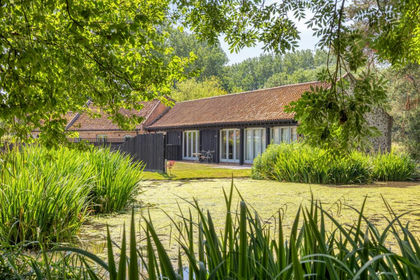
- Price
- Guide Price£825,000
Beautiful Single Story Barn Conversion in South Creake, South Creake, Norfolk NR21 England
Added on 25/02/2026Barn Conversion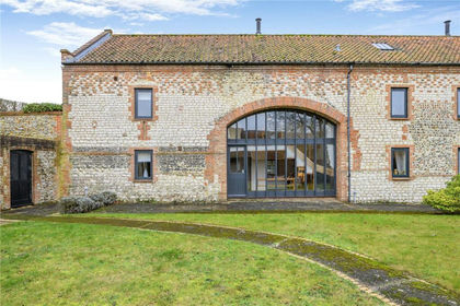
- Price
- Guide Price£750,000
Burnham Overy Town, Norfolk, Burnham Overy, Norfolk PE31 England
Added on 21/02/2026Barn Conversion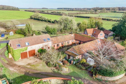
- Price
- Guide Price£850,000
Weasenham Road, Great Massingham, King's Lynn, Norfolk, PE32, Great Massingham, Norfolk PE32 England
Added on 05/02/2026Barn Conversion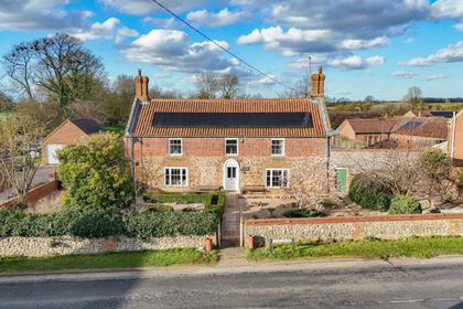
- Price
- Guide Price£895,000
- Size
- 1.75 acres
Added on 22/03/2026Farmhouse
- Price
- Guide Price£1,200,000
Exceptional Five Bedroom Barn Conversion in Gayton Thorpe, Gayton, Norfolk PE32 England
Added on 20/07/2026Barn Conversion
- Price
- From£775,000
- Size
- 0.4 acres
Wells-next-the-Sea, Wells-next-the-Sea, Norfolk NR23 England
Added on 18/08/2026Development Land