Newton St. Petrock, Torrington, Devon
- Land size
- 0.35 acres
- Bedrooms
- 3
- Bathrooms
- 2
Key Features
- Countryside views
- Barn Conversion
- Rural Setting
- Three Bedrooms
- 0.35 Acre Plot
- Workshop and Studio
- Character Features
- Parking for Multiple Cars
Description
Tucked away in the heart of the peaceful hamlet of Newton St Petrock, Higher Ford Barn is an exceptional, beautifully converted barn that delivers the perfect fusion of charm, craftsmanship and contemporary living all set within exquisitely landscaped gardens and surrounded by the rolling Devon countryside.
From the moment you step inside, the home opens with a real sense of occasion. The stunning gallery hallway sets the tone it’s a striking, light-filled space with vaulted ceilings, character beams and a statement log burner that immediately makes you feel at home. This is a house that knows how to make an entrance.
Into the living room, where a full-length window perfectly frames panoramic views across the gardens of Higher Ford Barn, flooding the space with natural light. French doors, recently upgraded, lead directly out onto the garden, creating a wonderful sense of indoor-outdoor flow and offering a perfect spot to sit and take in the peace and beauty of your surroundings.
The kitchen is nothing short of a showstopper. Recently renovated to a high standard, it’s designed with both entertaining and everyday family life in mind. A large central island offers the ideal space for bakers, hosts, or casual breakfasts with the children. There’s ample room for a generous dining table and chairs, creating a true heart of the home atmosphere. A useful boot room with WC leads directly off the kitchen practical and perfect for muddy boots after a countryside walk.
Upstairs, the gallery landing continues the feeling of spaciousness and connects the bedrooms with a sense of ease and elegance. The master bedroom is a standout: incredibly generous in size with large windows to the side aspect that look out over nothing but unspoilt countryside the kind of view you never tire of waking up to. There's an abundance of space here, perfect for a reading area or dressing space.
Bedroom Two is a comfortable double with views to the side and recently fitted bespoke wardrobes while Bedroom Three, which also benefits from newly added fitted storage, overlooks the front aspect and is ideal as a guest room, nursery or home office.
The family bathroom has been stylishly updated with a new suite including a stunning roll-top bath and a separate walk in shower just for them long, relaxing soaks.
Outside, the grounds are simply enchanting. The current vendors have poured care and creativity into crafting a private, versatile and welcoming garden that truly enhances the lifestyle on offer here. Bordered with a mix of mature trees, hedging and hedge-laying, the plot is beautifully private and securely enclosed – perfect for children, pets or peaceful evenings outdoors.
At the foot of the garden, a bespoke timber studio has been created a magical space with its own kitchen units, sink and hob, offering huge potential as guest accommodation, an artists’ retreat, home office or even a granny annexe (subject to relevant planning consents). It’s one of those rare and wonderful spaces that opens the door to a multitude of possibilities.
There is a dedicated workshop with additional storage, a large gated driveway providing ample parking, and a real sense of privacy throughout the entire setting.
The garden also boasts a thoughtfully designed wild flower meadow, encouraging local wildlife and pollinators, and providing a peaceful haven for nature lovers. It’s a true sanctuary that changes beautifully with the seasons.
While Higher Ford Barn feels like a peaceful escape from the world, you're only a short drive from some of North Devon’s most loved amenities and attractions.
Just a few miles away you'll find the Plough Arts Centre, Dartington Crystal, and the world-renowned Royal Horticultural Society gardens at Rosemoor all offering rich cultural and lifestyle experiences right on your doorstep.
For the active and outdoorsy, the Tarka Trail is within a five-minute drive a scenic, largely flat footpath and cycleway that winds through ancient woodland and along the River Torridge, famously the setting for Tarka the Otter. The trail stretches all the way to Barnstaple and beyond, with views and experiences at every turn.
For beach lovers, Westward HO! Beach is just 13 miles away, with its golden beaches, surfing hotspots and dramatic cliff walks. And if you're craving the moors, both Dartmoor and Exmoor National Parks are within an hour’s drive, making weekend adventures effortlessly accessible.
Higher Ford Barn is more than just a property it’s a lifestyle. Whether you're looking for a peaceful family home, a countryside retreat, or a property with income potential, this unique and characterful home offers it all. Lovingly cared for and sympathetically improved by its current owners, every corner of this home reflects the time, energy and affection that’s gone into making it such a special place.
The vendor informs us that the property is of stone construction under a slate roof. Your surveyor or conveyancer may be able to clarify further following their investigations. The property is serviced by Oil central heating. Other forms of heating include a log burner. Mains electric and water are connected. The property is connected to a septic tank.
The current vendor has installed solar panels to the property including a battery back up system
Broadband: Airband speeds available up to 40 mbps. (Information taken from Ofcom checker)
Mobile phone: Coverage available onsite (see Ofcom checker for further information)
Directions
From Torrington take the B3227 signposted Langtree/Holswrothy and stay on this road passing through the village of Langtree and upon reaching Stibb Cross after passing the Union Inn public house on your right hand side, continue towards Holsworthy, after approximately 1 mile take the left hand turning towards Newton St Petrock, follow this road past Bridgmans Agricultural Merchants on your left where approximately 1 mile further the property will be found to your left hand side with name plate and for sale sign clearly displayed.
Map Location
Property details
- Tenure
- Freehold
- Council Tax Band
- E
- Date Posted
- 2026-01-29
Price history
| Date | Change | Price |
|---|---|---|
| 20 Aug 2026 | Reduced 8% (−£50,000) | £575,000 |
| Until 20 Aug 2026 | Asking price | £625,000 |
Energy Performance Certificate
Energy Efficiency Rating
Based on UK Energy Performance Certificate standards (EU Directive 2002/91/EC)
Running costs are one side. Planning activity, flood history and ground risks for this location are in the full report.
Utilities & Restrictions
Utilities
- Electricity
- Ask Agent
- Water
- Ask Agent
- Heating
- Ask Agent
- Broadband
- Ask Agent
- Sewerage
- Ask Agent
Rights & Restrictions
- Public Rights of Way
- Ask Agent
- Private Rights of Way
- Ask Agent
- Listed Property
- Ask Agent
- Restrictions
- Ask Agent
Listed status, conservation areas and planning constraints for this location are in the full report.
Property Features
- Accessibility
- Ask Agent
- Parking
- Parking Available
- Garden
- Garden
Beyond the particulars: planning activity, flood history, heritage and ground risks, checked for this exact spot.
Connectivity
Broadband
Fastest speed available at this postcode
7 Mbps
Under 10 Mbps here
Suitable for
- Basic browsing & email
Fixed wireless access may also be an option here.
Mobile signal
Predicted 4G and 5G signal; indoor signal depends on building materials.
Ofcom Connected Nations postcode-level predictions. Speeds and signal are modelled, not measured, and vary between addresses and providers.
Signal is the easy part. Planning activity, flood history and protected designations here are in the full report.
Nearest Schools
Primary
- Langtree Community School and Nursery Unit2.6 milesNo Ofsted rating
- Ages
- 2 to 11
- Pupils
- 65
- Type
- Community school
- Shebbear Community School2.7 milesNo Ofsted rating
- Ages
- 4 to 11
- Pupils
- 54
- Type
- Community school
- Bradford Primary School4.5 milesOfsted: Good
- Ages
- 2 to 11
- Pupils
- 24
- Type
- Academy converter
- Buckland Brewer Primary School4.7 milesOfsted: Requires improvement
- Ages
- 2 to 11
- Pupils
- 49
- Type
- Foundation school
- Parkham Primary School5.4 milesOfsted report card · Jan 2026
- Ages
- 2 to 11
- Pupils
- 55
- Type
- Foundation school
Secondary
- Great Torrington School6.6 milesNo Ofsted rating
- Ages
- 11 to 16
- Pupils
- 863
- Type
- Academy converter
- Atlantic Academy7.2 milesOfsted: Good
- Ages
- 11 to 16
- Pupils
- 242
- Type
- Free schools
- Holsworthy Community College7.4 milesNo Ofsted rating
- Ages
- 11 to 16
- Pupils
- 551
- Type
- Academy converter
- Bideford College8.4 milesOfsted report card · May 2026
- Ages
- 11 to 18
- Pupils
- 1,455
- Type
- Academy sponsor led
- Budehaven Community School13 milesOfsted: Good
- Ages
- 11 to 18
- Pupils
- 1,145
- Type
- Foundation school
Distances are straight-line from the advertised location. Source: the national school registers (DfE, Welsh Government, Scottish Government) and Ofsted.
Schools are just the start: sold prices nearby, planning activity and any flood history are in the full report.
Amenities
Supermarket
GP surgery
Pharmacy
Hospital
Straight-line distances from the advertised location. Sources: NHS records, Geolytix supermarket locations, OS Open Greenspace and the national trails registers.
The area stacks up? Now check the location itself: planning nearby, protected designations and past flooding.
Getting Around
Nearest station
Nearest bus stop
Typical drive times
Straight-line distances from the advertised location; drive times are typical free-flow times over OpenStreetMap road data, so allow more at peak. Public transport locations from DfT NaPTAN.
Easy to reach matters. So do planning activity, flood history and ground risks: all in the full report.
Flood Risk
Environment Agency open data, checked around the advertised map pin for the listed acreage. Long-term risk counts flood defences; the planning map's flood zones do not. Provided by LandSale, not the listing agent, and not part of the agent's particulars. Risk varies across a holding, so verify before committing.
Rivers and the sea
Planning map: Flood Zone 1.
Surface water
Not at the pin: mapped about 10 metres away.
These bandings are the summary. Where this location sits on the flood maps, plus planning activity, heritage and ground risks, is in the full report.
Important notice: Information, maps and tags on this page are drawn from the advertising agent's marketing materials or generated automatically. LandSale has not verified them. Relying on these details is at your own risk, always carry out independent checks before committing to a purchase.
LandSale full disclaimer
Marketing information only - not formal particulars. The details on this website are provided for general guidance and do not constitute an offer or contract. Neither LandSale nor the advertising estate/land agent accepts responsibility for any inaccuracy.
1. Source of information
- Listing content: Core description, asking price, tenure, measurements, photographs and planning history originate from the marketing materials of the advertising estate or land agent. LandSale does not author this content and cannot guarantee its accuracy.
- Automated tags & categorisation: Property type, land-use class, acreage bands and similar labels may be applied by machine-learning models. They are intended as a helpful guide only and may not reflect the property's legal status or permitted use.
- Third-party & enriched data layers: Maps, boundary outlines, planning designations, soil reports, broadband coverage and other environmental or location-based insights are licensed from external suppliers. Such data are supplied “as is", may be incomplete or out of date and are subject to change without notice.
2. Verification required
Prospective purchasers must verify critical matters, including but not limited to planning permission, title boundaries, public rights of way, environmental constraints, acreage, services, access and VAT status, through their own inspections, specialist surveys, legal advisers and the selling agent before relying on the information or entering into any contract.
3. No warranty or liability
LandSale gives no warranty, express or implied, as to the accuracy, completeness or fitness for any particular purpose of the information displayed. LandSale shall not be liable for any loss, damage, cost or expense arising directly or indirectly from any use of or reliance on such information, save where liability may not be excluded by law.
4. Updates & feedback
If you believe any detail on this listing is inaccurate, please let us know. We will investigate and, where appropriate, update the listing or notify the agent.
© LandSale | Version 1.3 - August 2026
Similar properties for sale
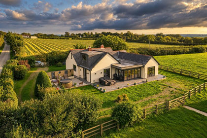
- Price
- £699,950
- Size
- 2 acres
Added on 20/08/2026House with Land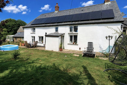
- Price
- Guide Price£677,000
- Size
- 9 acres
Shebbear, Beaworthy, Devon, EX21, Shebbear, Devon EX21 England
Added on 24/04/2026Farmhouse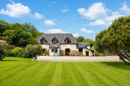
- Price
- £650,000
- Size
- 3 acres
Buckland Brewer, Bideford, Devon, Buckland Brewer, Devon EX39 England
Added on 27/06/2026Barn Conversion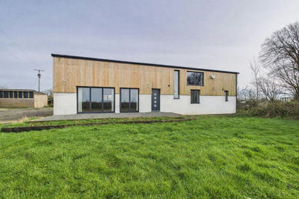
- Price
- £650,000
- Size
- 2.2 acres
Sutcombe, Youldon, EX22, Abbots Bickington, Devon EX22 England
Added on 28/04/2026Barn Conversion
- Price
- Offers in Excess of£700,000
- Size
- 8.77 acres
Buckland Brewer, Bideford, Devon, EX39, Buckland Brewer, Devon EX39 England
Added on 21/07/2026Holiday Let Property
- Price
- Offers Over£500,000
- Size
- 3 acres
Cookbury, Holsworthy, Devon, EX22, Cookbury, Devon EX22 England
Added on 19/08/2026House with Land Added on 06/06/2026Barn Conversion
- Price
- £650,000
- Size
- 3.45 acres
Added on 09/07/2026Country Home
- Price
- Guide Price£500,000
- Size
- 1.89 acres
Petrockstow, Okehampton, Devon, EX20, Buckland Filleigh, Devon EX20 England
Added on 17/06/2026Cottage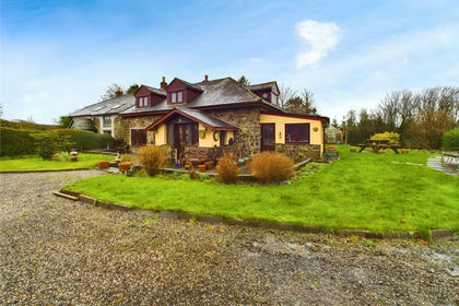
- Price
- £525,000
- Size
- 0.5 acres
Blagdon, Holsworthy, Devon, Holsworthy Hamlets, Devon EX22 England
Added on 29/01/2026Barn Conversion