Shebbear, Beaworthy, Devon, EX21
- Land size
- 9 acres
- Bedrooms
- 4
- Bathrooms
- 2
Key Features
- Country Views
- 9 Acres approx. of pasture
- Two barns that may provide further opportunity (stp)
- Multi generational living opportunity
- Character accommodation
- 3 reception rooms
- Inglenook fireplaces
- Annexe
- Gardens
- PV panels
Description
With white rendered elevations this stone built farmhouse presents very well under a slate roof whilst the adjacent stone built converted barn annexe with its slate roof compliments it wonderfully. Under the present vendors ownership there has been a sense of commitment to be energy and thermally efficient with the addition of PV panels, air source heat pump and insulation within the attic and the internal walls. A spur off the main drive into the small development leads around behind the agricultural buildings and provides ample parking, access to the single garage and on one side sits a park home also included in the sale but we are advised does need some attention. A footpath leads to the front porch and on entering the house you get a sense of what owning this home is all about with stairs rising ahead up to the first floor. To the left is a homely sitting room having a flag stone floor with large feature inglenook fireplace with a log burner sat upon the raised hearth along one wall. A step leads into the kitchen which comprises a range of wall, floor and drawer units and extensive work surfacing with built in electric hob with extractor over and oven under, microwave and under counter space for two further appliances. The dining room is a fine room with an equally impressive inglenook fireplace with bread oven and it makes quite a statement as you walk in. Off to one side is a study/office and the other end of the room a small inner hall leads to the updated bathroom with a modern suite and shower over bath.
Completing the accommodation on the ground floor is a rear hall and boot room that leads out to the gardens and towards the annexe.
At the head of the stairs is a split level landing leading to the three bedrooms. Two are doubles and one is of a particularly good size with high ceiling, plank flooring and built in cupboards, one housing the hot water tank.
Annexe
This being detached, and set away from the main house, does open the opportunity for someone to derive an income from it if so inclined or to use it as the vendors do, for multigenerational living. There is a well appointed kitchen with units on 3 sides, with under counter appliance space and space for a slot in cooker with extractor above. The conservatory/living area is a wonderful space being an absolute sun trap and has views over and doors into the gardens outside. At the far end of the barn is a lovely vaulted double bedroom with fitted wardrobes and off the corridor beforehand is a modern contemporary style bathroom with Aqua style panels.
Outside
There are two agricultural buildings one being 44’9 x 31’5 and the other 59’7 x 44’8 with the former having electricity laid on and may have been used as a workshop in previous times.
Land and Gardens
The paddock with its gate off the drive sits opposite the barns. A track runs down beside some of the neighbouring barn conversions and provides vehicle access into the pasture at the bottom of the gardens and poultry runs. The pasture has been used for livestock as well as being used in former years for grass crops. It is divided into 3 fields overall being about 8.3 acres. With the lack of light pollution at night this must be a great area to take in some star gazing and the milky way during the right parts of the year. Coming back towards the house and annexe is a poultry run, orchards, productive fruit cages, workshop/garden store 19’7 x 9’10, vegetable gardens with polytunnel and formal gardens laid to lawn and thus a blank canvas for someone to create their own piece of pleasure. Sitting beside on one of the agricultural buildings is gravel sensory garden, with slate stepping stone path, that provides a lot of privacy away from the house and must be a wonderful place to sit, enjoy nature around whilst listening to the tumbling water from the water fountain as it returns back to the ornamental pond.
This is a home that just keeps on giving in so many ways and as such presents a wonderful opportunity for any new purchaser to take on what has been started, to further the opportunity of owning and improving a home like this in such a rural environment, but not without neighbours to reach out to as required.
Agents Note
There are a few former barns behind that have been converted in previous years to provide residential accommodation and they have access over the drive owned by the Vendors of the farm, to their own parking area. A track, owned by the vendors, runs down the side of the barns and gives gated access into the pasture as well as a neighbour having access over it to their stables and paddocks and others to their parking. The Vendor advises during the summer months there is a small colony of long eared bats in loft but they hibernate elsewhere.
From Torrington Town Square, take the South Street exit to the New Street junction. Turn left, heading towards Bideford and on the outskirts of the town, bear left on the B3227 Langtree Road. Proceed through the village of Langtree, on to Stibb Cross. At the crossroads, take the left hand turning, signposted Shebbear. Continue along this road for approximately 3 miles and turn right signposted Berry. The drive to the Farm and barns development will be found on the right hand side after about 1/2 mile. The drive into the farm is a few yards on your left.
Services
Mains water and electricity with the addition of PV panels. Heating via air source heat pump. Private drainage via home treatment plant.
Agents Note
There are a few former barns behind that have been converted in previous years to provide residential accommodation and they have access over the drive owned by the Vendors of the farm, to their own parking area. A track, owned by the vendors, runs down the side of the barns and gives gated access into the pasture as well as a neighbour having access over it to their stables and paddocks and others to their parking
Council Tax
E
EPC
D
Tenure
Freehold
Kitchen
Sitting Room
Dining Room
Study
Bathroom
Garage
Bedroom
Bedroom
Bedroom
Annexe
Kitchen
Conservatory
Bedroom
Bathroom
Map Location
Property details
- Tenure
- Freehold
- Council Tax Band
- E
- Date Posted
- 2026-04-24
Market Value Analysis
Compared with 512 Homes with Land listings in South West England (5+ acres).
Utilities & Restrictions
Utilities
- Electricity
- Mains
- Water
- Mains
- Heating
- Solar PVT (Hybrid), Air Source Heat Pump
- Broadband
- Ask Agent
- Sewerage
- Septic Tank / Private
Rights & Restrictions
- Public Rights of Way
- Ask Agent
- Private Rights of Way
- Ask Agent
- Listed Property
- Ask Agent
- Restrictions
- Ask Agent
Listed status, conservation areas and planning constraints for this location are in the full report.
Property Features
- Accessibility
- Ask Agent
- Parking
- Garage, Driveway
- Garden
- Garden
Beyond the particulars: planning activity, flood history, heritage and ground risks, checked for this exact spot.
Connectivity
Broadband
Fastest speed available at this postcode
29 Mbps
Standard (10-30 Mbps)
Suitable for
- Web & social
- Music streaming
- Standard video calls
Fixed wireless access may also be an option here.
Mobile signal
Outdoor predictions; indoor signal depends on building materials.
Ofcom Connected Nations postcode-level predictions. Speeds and signal are modelled, not measured, and vary between addresses and providers.
Signal is the easy part. Planning activity, flood history and protected designations here are in the full report.
Nearest Schools
Primary
- Shebbear Community School0.9 milesNo Ofsted rating
- Ages
- 4 to 11
- Pupils
- 54
- Type
- Community school
- Langtree Community School and Nursery Unit3.1 milesNo Ofsted rating
- Ages
- 2 to 11
- Pupils
- 65
- Type
- Community school
- Black Torrington Church of England Primary School3.3 milesOfsted: Requires improvement
- Ages
- 4 to 11
- Pupils
- 3
- Type
- Academy converter
- Faith
- Church of England
- Bradford Primary School3.5 milesOfsted: Good
- Ages
- 2 to 11
- Pupils
- 24
- Type
- Academy converter
- Highampton Community Primary School4.6 milesOfsted: Good
- Ages
- 4 to 11
- Pupils
- 33
- Type
- Academy converter
Secondary
- Great Torrington School6.5 milesNo Ofsted rating
- Ages
- 11 to 16
- Pupils
- 863
- Type
- Academy converter
- Holsworthy Community College7.7 milesNo Ofsted rating
- Ages
- 11 to 16
- Pupils
- 551
- Type
- Academy converter
- Atlantic Academy9.3 milesOfsted: Good
- Ages
- 11 to 16
- Pupils
- 242
- Type
- Free schools
- Bideford College9.8 milesOfsted report card · May 2026
- Ages
- 11 to 18
- Pupils
- 1,455
- Type
- Academy sponsor led
- Okehampton College13 milesOfsted report card · Jan 2026
- Ages
- 11 to 18
- Pupils
- 1,066
- Type
- Academy converter
Distances are straight-line from the advertised location. Source: the national school registers (DfE, Welsh Government, Scottish Government) and Ofsted.
Schools are just the start: sold prices nearby, planning activity and any flood history are in the full report.
Amenities
Supermarket
GP surgery
Pharmacy
Hospital
Straight-line distances from the advertised location. Sources: NHS records, Geolytix supermarket locations, OS Open Greenspace and the national trails registers.
The area stacks up? Now check the location itself: planning nearby, protected designations and past flooding.
Getting Around
Nearest station
Nearest bus stop
Typical drive times
Straight-line distances from the advertised location; drive times are typical free-flow times over OpenStreetMap road data, so allow more at peak. Public transport locations from DfT NaPTAN.
Easy to reach matters. So do planning activity, flood history and ground risks: all in the full report.
Flood Risk
From Environment Agency flood map open data, checked around the advertised map pin and allowing for the listed acreage where known. This summary comes from LandSale, the advertising platform, not from the listing agent, and is not part of the agent's particulars. Risk can vary across a single holding, so verify anything critical through your own searches before committing.
Rivers and the sea
Surface water
Mapped within the area searched, not at the advertised map pin itself.
The detail behind these bandings
The full report pinpoints where this location sits on the flood maps, and runs the deeper checks that usually only surface after an offer.
- Exact flood zones & annual chances (included in the full report)
- Any recorded past flooding (included in the full report)
- Planning activity nearby (included in the full report)
- Heritage & conservation (included in the full report)
- Protected nature designations (included in the full report)
- Ground risks (included in the full report)
- Sold prices nearby (included in the full report)
£14.99 · one-off purchase
By LandSale, the platform. Not provided by the listing agent. Ready in about a minute.
Important notice: Information, maps and tags on this page are drawn from the advertising agent's marketing materials or generated automatically. LandSale has not verified them. Relying on these details is at your own risk, always carry out independent checks before committing to a purchase.
LandSale full disclaimer
Marketing information only - not formal particulars. The details on this website are provided for general guidance and do not constitute an offer or contract. Neither LandSale nor the advertising estate/land agent accepts responsibility for any inaccuracy.
1. Source of information
- Listing content: Core description, asking price, tenure, measurements, photographs and planning history originate from the marketing materials of the advertising estate or land agent. LandSale does not author this content and cannot guarantee its accuracy.
- Automated tags & categorisation: Property type, land-use class, acreage bands and similar labels may be applied by machine-learning models. They are intended as a helpful guide only and may not reflect the property's legal status or permitted use.
- Third-party & enriched data layers: Maps, boundary outlines, planning designations, soil reports, broadband coverage and other environmental or location-based insights are licensed from external suppliers. Such data are supplied “as is", may be incomplete or out of date and are subject to change without notice.
2. Verification required
Prospective purchasers must verify critical matters, including but not limited to planning permission, title boundaries, public rights of way, environmental constraints, acreage, services, access and VAT status, through their own inspections, specialist surveys, legal advisers and the selling agent before relying on the information or entering into any contract.
3. No warranty or liability
LandSale gives no warranty, express or implied, as to the accuracy, completeness or fitness for any particular purpose of the information displayed. LandSale shall not be liable for any loss, damage, cost or expense arising directly or indirectly from any use of or reliance on such information, save where liability may not be excluded by law.
4. Updates & feedback
If you believe any detail on this listing is inaccurate, please let us know. We will investigate and, where appropriate, update the listing or notify the agent.
© LandSale | Version 1.3 - August 2026
Listing agent
Webbers Property Services, Torrington
17 High Street, Torrington, Devon, EX38 8HN
Contact Webbers Property Services, Torrington
17 High Street, Torrington, Devon, EX38 8HN
View agent profileSimilar properties for sale
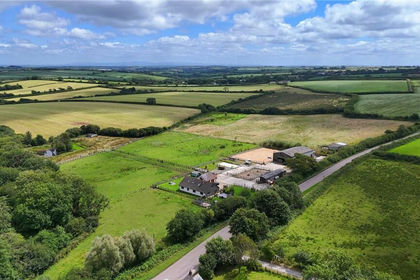
- Price
- £800,000
- Size
- 12 acres
Bradworthy, Holsworthy, EX22, Bradworthy, Devon EX22 England
Added on 01/05/2026Equestrian property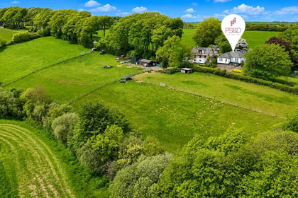
- Price
- Guide Price£725,000
- Size
- 5.26 acres
Added on 06/06/2026House with Land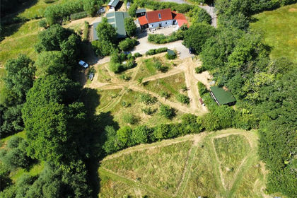
- Price
- Guide Price£600,000
- Size
- 5.19 acres
Added on 25/07/2026Barn Conversion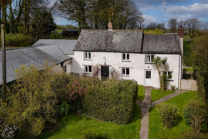
- Price
- Guide Price£795,000
- Size
- 5 acres
Added on 09/04/2026Farmhouse
- Price
- Offers in Excess of£700,000
- Size
- 4.75 acres
Higher Killatree Farm, Killatree, Holsworthy, Pyworthy, Devon EX22 England
Added on 11/08/2026House with Land
- Price
- Guide Price£695,000
- Size
- 7.2 acres
Roborough, Winkleigh, Devon, EX19, Roborough, Devon EX19 England
Added on 13/08/2026Smallholding
- Price
- £625,000
- Size
- 4.7 acres
Thorndon Cross Nr Okehampton, Okehampton Hamlets, Devon EX20 England
Added on 01/08/2026House with Land
- Price
- Guide Price£775,000
- Size
- 27.67 acres
Bratton Clovelly, Okehampton, EX20, Bratton Clovelly, Devon EX20 England
Added on 15/07/2026Smallholding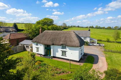
- Price
- Guide Price£700,000
- Size
- 10 acres
Sampford Courtenay, Okehampton, EX20, Sampford Courtenay, Devon EX20 England
Added on 10/05/2026Barn Conversion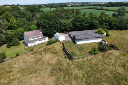
- Price
- £725,000
- Size
- 7.65 acres
Wellsprings Lane, Sampford Courtenay, Okehampton, Sampford Courtenay, Devon EX20 England
Added on 22/07/2026House with Land