Broxwood with 8.71 acre plot
- Land size
- 8.71 acres
- Bedrooms
- 6
- Bathrooms
- 4
Key Features
- Grade II listed 15th-century farmhouse
- 8.71 acres of gardens, pasture and woodland
- Ideal for equestrian, smallholding, business or multi-generational use
- Exceptional range of traditional barns and outbuildings
- Three reception rooms and six bedrooms
- No onward chain
Description
The home is a Grade II listed 15th-century farmhouse, Including an extensive range of adjoining traditional barns and outbuildings, established gardens and land extending to approximately nine acres. The scale and versatility of the buildings are a significant part of the property’s appeal, offering excellent storage and workspace together with potential to convert STPP, or for equestrian, business, leisure or ancillary uses, subject to any necessary consents.
Property Description - A gated entrance opens onto a long sweeping cherry tree-lined driveway, which leads to a generous gravelled parking and turning area between the house and the buildings. This arrangement gives the property a strong sense of arrival while also providing practical access for larger vehicles, trailers or equestrian use.
An oak-framed porch leads you into the entrance hall, with access through to the main living accommodation. The sitting room is a well-proportioned reception room with exposed beams, oak flooring and a fireplace, fitted with a wood-burning stove. A charming snug offers secondary space to enjoy and includes fitted bookshelves, a further wood-burning stove and an outlook across the garden. There is also an additional study with fitted shelving and oak flooring, together with an adjoining shower room lending itself to a downstairs bedroom if required.
The kitchen and breakfast room is a generous and practical space with fitted units, a central island, integrated dishwasher, hob and four-oven Aga. Exposed beams, flagstone flooring and a former bread oven reflect the history of the house, while a glazed door opens directly onto the terrace and gardens. A utility / boot room provides useful additional storage and a place for muddy boots, children or dogs. The formal dining room offers space for a substantial table and has direct access outside, making it suitable for both everyday family use and entertaining. From the sitting room, the staircase rises to the first floor.
Four bedrooms are served by the family bathroom, while the principal bedroom is a spacious and light room with a vaulted ceiling, exposed beams and windows on both elevations offering exceptional views. It connects to a dressing room and an en-suite bathroom with a bath and separate shower. There is another guest bedroom with a vaulted ceiling and its own shower room. This area can be reached internally or by an external stone staircase, giving it a useful degree of independence for guests or family members or even if there was a need to rent the room out.
The extensive range of traditional barns and outbuildings adjoins the farmhouse and creates a highly adaptable courtyard of buildings. They provide substantial covered storage and workshop space and could suit a wide range of requirements, including stabling, vehicle or machinery storage, studios, home-working space or possible ancillary accommodation, subject to planning permission and listed building consent. One section has already been adapted to provide a laundry room with fitted cupboards, a deep sink and plumbing for a washing machine. A separate gated entrance from the lane serves the barns directly and provides further parking and independent access, which considerably increases their practicality. This is an exceptional range of outbuildings with great potential.
The gardens extend around the house and include broad lawns, established borders, mature trees and a paved terrace. A more formal garden incorporates box hedging, raised beds, pathways and rose planting, while the wider grounds include grazing pasture, mixed woodland and a pond.
The grounds extend to approximately nine acres. The combination of the historic farmhouse, the scale of the outbuildings and the surrounding land makes Upper Broxwood Farm particularly well suited to buyers looking for a home with space for horses, a smallholding, farming hobbies, business use or multi-generational living. One of the most versatile homes we have on the market.
Services - Main water, electricity and private drainage. Gas central heating
Herefordshire council tax band F
Tenure Freehold
Location - Located just outside the rural hamlet of Broxwood just 4 miles from the popular black and white village of Pembridge, which is very well catered for offering a number of public houses and restaurants, primary school, village hall, lovely village shop/tea room and church to name just a few. The property is within the catchment area for Weobley primary and high school. The popular market towns of Leominster (7 miles), Kington (6 miles) and Weobley (3.5) Offer a further range of amenities to include supermarkets, schooling, leisure facilities and good road and rail links to surrounding areas and nationwide.
Agents Note - Buyers Compliance Administration Fee: In accordance with Money Laundering Regulations, Agents are required to carry out due diligence on all Clients to confirm their identity, including eventual buyers of a property. The Agents use electronic verification system to verify Clients' identity. This is not a credit check so will have no effect on credit history though may check details you supply against any particulars on any database to which they have access. By placing an offer on a property you agree that if your offer is accepted, subject to contract, we as Agents for the seller can complete this check for a fee of £75 inc VAT (£62.50 + VAT) per property transaction, non-refundable under any circumstance. A record of the search will be retained by the Agents.
What3words - What3words //audible.pairing.escalates
Map Location
Property details
- Tenure
- Freehold
- Council Tax Band
- F
- Date Posted
- 2026-11-13
Market Value Analysis
Compared with 73 Farms & Smallholdings listings in West Midlands (5+ acres).
Utilities & Restrictions
Utilities
- Electricity
- Ask Agent
- Water
- Ask Agent
- Heating
- Ask Agent
- Broadband
- Ask Agent
- Sewerage
- Ask Agent
Rights & Restrictions
- Public Rights of Way
- Ask Agent
- Private Rights of Way
- Ask Agent
- Listed Property
- Ask Agent
- Restrictions
- Ask Agent
Listed status, conservation areas and planning constraints for this location are in the full report.
Property Features
- Accessibility
- Ask Agent
- Parking
- Parking Available
- Garden
- Garden
Beyond the particulars: planning activity, flood history, heritage and ground risks, checked for this exact spot.
Connectivity
Broadband
Fastest speed available at this postcode
1 Gbps
Gigabit full fibre
Suitable for
- 4K streaming on every screen
- Full-time home working
- Online gaming & big downloads
Fixed wireless access may also be an option here.
Mobile signal
Predicted 4G and 5G signal; indoor signal depends on building materials.
Ofcom Connected Nations postcode-level predictions. Speeds and signal are modelled, not measured, and vary between addresses and providers.
Signal is the easy part. Planning activity, flood history and protected designations here are in the full report.
Nearest Schools
Primary
- Almeley Primary School2.2 milesOfsted report card · Jun 2026
- Ages
- 2 to 11
- Pupils
- 55
- Type
- Community school
- Weobley Primary School2.9 milesNo Ofsted rating
- Ages
- 2 to 11
- Pupils
- 215
- Type
- Community school
- St Mary's Primary School, Dilwyn3.2 milesNo Ofsted rating
- Ages
- 4 to 11
- Pupils
- 76
- Type
- Free schools
- Faith
- Church of England
- Pembridge CofE Primary School3.3 milesOfsted: Good *
- Ages
- 3 to 11
- Pupils
- 80
- Type
- Academy converter
- Faith
- Church of England
- Eardisley CofE Primary School4.2 milesNo Ofsted rating
- Ages
- 4 to 11
- Pupils
- 102
- Type
- Voluntary controlled school
- Faith
- Church of England
Secondary
- Weobley High School2.9 milesNo Ofsted rating
- Ages
- 11 to 16
- Pupils
- 533
- Type
- Community school
- Lady Hawkins' School5 milesOfsted: Good *
- Ages
- 11 to 16
- Pupils
- 281
- Type
- Academy converter
- Earl Mortimer College8.8 milesOfsted: Good
- Ages
- 11 to 16
- Pupils
- 502
- Type
- Community school
- Fairfield High School9.6 milesOfsted: Outstanding
- Ages
- 11 to 16
- Pupils
- 607
- Type
- Academy converter
- Wigmore School10 milesNo Ofsted rating
- Ages
- 11 to 19
- Pupils
- 467
- Type
- Academy converter
* Latest graded judgement covers quality of education only; no overall grade was issued under the 2024-25 inspection framework.
Distances are straight-line from the advertised location. Source: the national school registers (DfE, Welsh Government, Scottish Government) and Ofsted.
Schools are just the start: sold prices nearby, planning activity and any flood history are in the full report.
Amenities
Supermarket
GP surgery
Pharmacy
Hospital
Straight-line distances from the advertised location. Sources: NHS records, Geolytix supermarket locations, OS Open Greenspace and the national trails registers.
The area stacks up? Now check the location itself: planning nearby, protected designations and past flooding.
Getting Around
Nearest station
Nearest bus stop
Typical drive times
Straight-line distances from the advertised location; drive times are typical free-flow times over OpenStreetMap road data, so allow more at peak. Public transport locations from DfT NaPTAN.
Easy to reach matters. So do planning activity, flood history and ground risks: all in the full report.
Flood Risk
Environment Agency open data, checked around the advertised map pin for the listed acreage. Long-term risk counts flood defences; the planning map's flood zones do not. Provided by LandSale, not the listing agent, and not part of the agent's particulars. Risk varies across a holding, so verify before committing.
Rivers and the sea
Planning map: Flood Zone 1.
Surface water
Not at the pin: mapped about 20 metres away.
These bandings are the summary. Where this location sits on the flood maps, plus planning activity, heritage and ground risks, is in the full report.
Important notice: Information, maps and tags on this page are drawn from the advertising agent's marketing materials or generated automatically. LandSale has not verified them. Relying on these details is at your own risk, always carry out independent checks before committing to a purchase.
LandSale full disclaimer
Marketing information only - not formal particulars. The details on this website are provided for general guidance and do not constitute an offer or contract. Neither LandSale nor the advertising estate/land agent accepts responsibility for any inaccuracy.
1. Source of information
- Listing content: Core description, asking price, tenure, measurements, photographs and planning history originate from the marketing materials of the advertising estate or land agent. LandSale does not author this content and cannot guarantee its accuracy.
- Automated tags & categorisation: Property type, land-use class, acreage bands and similar labels may be applied by machine-learning models. They are intended as a helpful guide only and may not reflect the property's legal status or permitted use.
- Third-party & enriched data layers: Maps, boundary outlines, planning designations, soil reports, broadband coverage and other environmental or location-based insights are licensed from external suppliers. Such data are supplied “as is", may be incomplete or out of date and are subject to change without notice.
2. Verification required
Prospective purchasers must verify critical matters, including but not limited to planning permission, title boundaries, public rights of way, environmental constraints, acreage, services, access and VAT status, through their own inspections, specialist surveys, legal advisers and the selling agent before relying on the information or entering into any contract.
3. No warranty or liability
LandSale gives no warranty, express or implied, as to the accuracy, completeness or fitness for any particular purpose of the information displayed. LandSale shall not be liable for any loss, damage, cost or expense arising directly or indirectly from any use of or reliance on such information, save where liability may not be excluded by law.
4. Updates & feedback
If you believe any detail on this listing is inaccurate, please let us know. We will investigate and, where appropriate, update the listing or notify the agent.
© LandSale | Version 1.3 - August 2026
Similar properties for sale
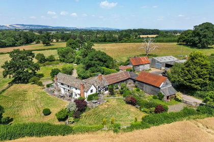
- Price
- Guide Price£885,000
- Size
- 9 acres
Broxwood, Leominster, HR6, Pembridge, Herefordshire, County of HR6 England
Added on 16/07/2026Smallholding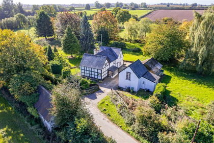
- Price
- Offers in Region of£750,000
- Size
- 6.09 acres
Marston, Pembridge, Leominster, Pembridge, Herefordshire, County of HR6 England
Added on 11/08/2026House with Land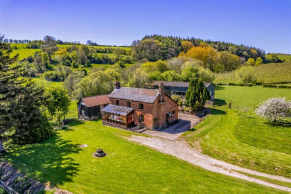
- Price
- Offers in Region of£850,000
- Size
- 8.93 acres
Bredwardine, Hereford, Bredwardine, Herefordshire, County of HR3 England
Added on 23/05/2026Smallholding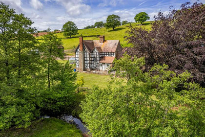
- Price
- £800,000
- Size
- 6.8 acres
Bodenham, Hereford, Bodenham, Herefordshire, County of HR1 England
Added on 16/10/2026Smallholding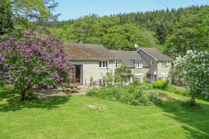
- Price
- Offers in Region of£749,950
- Size
- 5 acres
Added on 22/09/2026Smallholding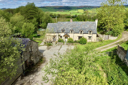
- Price
- Guide Price£950,000
- Size
- 24 acres
Llanddewi Fach, Erwood, Builth Wells, Glasbury, Powys LD2 Wales
Added on 14/05/2026Smallholding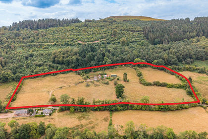
- Price
- Guide Price£675,000
- Size
- 14.67 acres
The Coed Lot 1, Cwmyoy, Abergavenny, Monmouthshire, NP7, Abergavenny, Monmouthshire NP7 Wales
Added on 11/09/2026Smallholding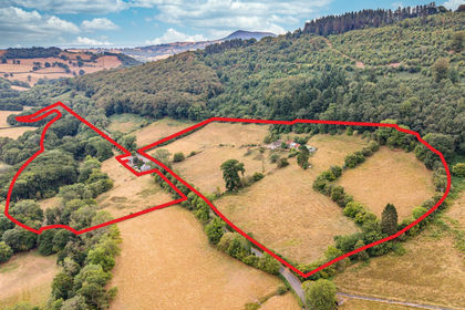
- Price
- Guide Price£875,000
- Size
- 30.97 acres
The Coed, Cwmyoy, Abergavenny, Monmouthshire, NP7, Abergavenny, Monmouthshire NP7 Wales
Added on 23/10/2026Smallholding
- Price
- Offers Over£1,000,000
- Size
- 12 acres
Added on 22/10/2026Smallholding
- Price
- Offers in Region of£800,000
- Size
- 26 acres
Added on 13/05/2026Small Farm