Highfield Hall, Wallington Lane, Worthenbury LL13
- Land size
- 27.6 acres
- Bedrooms
- 5
- Bathrooms
- 2
Key Features
- Planning Permission to create 6,888 sq ft (640 sq m) - 5 bedroom family house
- or Oppourtunity to refurbish/extend a 2,745 sq ft (259 sq m) - 5 bedroom family house
- Extensive agricultural outbuildings 8,911 sq ft (827 sq m)
- Elevated position with outstanding far reaching views
- Total acreage 49.67 acres
- Available as a whole or in two separate lots
- Lot 1 - 27.60 acres
- Lot 2 - adjoining paddock land 22.07 acres
Description
A WONDERFUL OPPORTUNITY TO REFURBISH/EXTEND A 2,745 SQ FT FIVE BEDROOM HOUSE
OR
PLANNING PERMISSION TO CREATE A 6,888 SQ FTVE BEDROOM FAMILY HOUSE,
WITH EXTENSIVE OUTBUILDINGS SITTING IN THE MOST MAGICAL ELEVATED POSITION WITH OUTSTANDING FAR-REACHING VIEWS, NESTLED IN JUST UNDER 27.60 ACRES
AVAILABLE AS A WHOLE OR IN TWO SEPARATE LOTS
LOT 1 - 27.60 ACRES
LOT 2 - 22.07 ACRES
IN TOTAL 49.67 ACRES
*NO CHAIN*
Lot 1 - PLANNING PERMISSION TO CREATE
ACCOMMODATION IN BRIEF:
· 6,888 sq ft (640 sq m) of accommodation
· Galleried entrance hall
· Side hall/boot room
· Separate WC & Cloak room
· Kitchen/breakfast room open plan to living room
· UtilIty room
· 3 reception rooms
· Principal suite with dressing room, bathroom & balcony
· Four further double beds, all en suite, 2 with dressing rooms, 1 with balcony
· Outbuilding housing car port, garage, log store & storage shed
EXISTING HOUSE FOR REFURBISHMENT/REMODELLING:
· 2,795 sq ft (259 sq m) of accommodation
· Porch
· Kitchen/breakfast room
· Utility room
· 4 reception rooms
· 6 bedrooms
· 2 family bathrooms
· An extensive range of brick and steel portal framed buildings, 8,911 sq ft (827 sq m) with a myriad of possible uses
GARDENS & PADDOCK LAND
· Garden – in need of landscaping
· Paddock land laid to grass
· Lot 1 in all about 27.60 acres
Lot 2 - LOT 2 adjoining paddock land with road frontage 22.07 acres
· In all totalling 49.67 acres
Description - Highfield Hall has so many possibilities whether you envisage an impressive five bedroom family home, an equestrian-inspired country residence or a bespoke architectural project. Highfield Hall presents an opportunity to create a property of individual character in a highly attractive rural setting, sat in an elevated position with outstanding far reaching views across the Dee Valley.
The property comprises a former farmhouse requiring comprehensive renovation/ redevelopment, together with a range of existing farm buildings with a myriad of different uses, all set within good quality farmland.
Planning permission was granted in December 2023, application number WOR P/2022/0441 for the demolition of the existing dwelling and the construction of a replacement architect-designed home with garage/carport and stores and a new entrance drive, thus offering an exciting opportunity to create a bespoke residence tailored to individual requirements. Detailed plans have been drawn up (see architects’ drawings) for a contemporary five bedroom home.
Alternatively, if you did not wish to create a new build there is an existing five bedroom house that is in need of a full scheme of refurbishment as not habitable in its current state. See existing plans for house. Further extensions and remodeling are possible subject to the necessary consents being obtained.
Outbuildings - There is an extensive range of useful agricultural buildings in need of refurbishment. They lie to the gable end of the house and range from brick construction to steel portal framed. They have scope for many different uses such as agricultural and equestrian with a full range of other uses subject to the necessary consents being obtained.
Situation - Highfield Hall sits down a long drive on the Welsh/Cheshire borders benefitting from the most incredible views, with the Welsh hills serving as a majestic backdrop. Yet despite this rural idyll, many amenities are close by. Bangor on Dee village is only a short drive away and is particularly well known for its historic character and attractive setting beside the River Dee and celebrated National Hunt racecourse. The village provides a selection of everyday amenities, including traditional public houses and local services, while the surrounding countryside offers pleasant opportunities for walking and riding.
The other close by village of note is Malpas, a popular village destination, characterised by its historic streets, traditional buildings and independent shops. Local amenities include cafés, public houses, Dr Surgery, convenience shopping and everyday services. Malpas is particularly well regarded by families for its village atmosphere and access to local schooling, including Bishop Heber High School. The village offers a quieter alternative to larger urban centres while remaining within convenient driving distance of Chester, Wrexham and Whitchurch. The popular and easy to drive to towns of Chester, Wrexham and Whitchurch all provide more comprehensive facilities.
The closeness to railway connections makes for an easy commute to major conurbations with Wrexham General and Central stations, Whitchurch, Chester and Crewe all having national and local connections. For travel to London, you would either take a train from Wrexham General or Chester and take a direct train to Euston.
The schooling opportunities are excellent with Chester having The King's School and The Queen's School, Moreton Hall, near Oswestry, Shrewsbury School and Ellesmere College, near Ellesmere.
For road commuters, the surrounding network provides access to Wrexham, Chester and the wider Northwest, with connections to the A483 and onward routes towards the A55, M53 and M56.
Distances In Approx Miles: - Bangor on Dee 1.6 miles | Malpas 6 miles | Wrexham 6.4 miles | Whitchurch 10 miles | Chester 19 miles | Liverpool Airport 44 miles | Manchester Airport 53 miles
Postcode - POSTCODE: LL13 0AL
What3words: automate.pads.formless
Directions - From the centre of Bangor-on-Dee, proceed along Station Road (B5069) towards Worthenbury and Malpas. The entrance to Highfield Hall will be seen on your left-hand side after approximately a quarter of a mile.
Property Information - TENURE: Freehold
EPC: G
SERVICES: Mains water, electricity, septic tank drainage.
LOCAL AUTHORITY: Wrexham
COUNCIL TAX BAND: H amount payable £4,618 2026/27
Agents Notes - •The plans and drone shots are for identification only and not to be relied upon
•The acreage stated for both lots is a guide only as he exact boundaries are yet to be erected
•No offer will be accepted subject to planning
•Lot 2 will not be sold before Lot 1.
•If the lots are sold separately Lot 2 will have a right of access over the first part of Lot 1 drive, this will be subject to a maintenance agreement.
•If the lots are sold separately, any gaps in fence line/gates or newly erected fences to be at the expense of Lot 2. All fences to be stock proof with the exact specification to be agreed by both parties. These are to be erected within 3 months from completion.
•Some of the trees are subject to Tree Preservation Orders.
Map Location
Property details
- Tenure
- Freehold
- Council Tax Band
- H
- Date Posted
- 2026-10-29
Market Value Analysis
Compared with 124 Farmland & Pasture listings in Wales (25+ acres).
Energy Performance Certificate
Energy Efficiency Rating
Based on UK Energy Performance Certificate standards (EU Directive 2002/91/EC)
Running costs are one side. Planning activity, flood history and ground risks for this location are in the full report.
Utilities & Restrictions
Utilities
- Electricity
- Mains
- Water
- Mains
- Heating
- Ask Agent
- Broadband
- Ask Agent
- Sewerage
- Septic Tank / Private
Rights & Restrictions
- Public Rights of Way
- Ask Agent
- Private Rights of Way
- Ask Agent
- Listed Property
- Ask Agent
- Restrictions
- Ask Agent
Listed status, conservation areas and planning constraints for this location are in the full report.
Property Features
- Accessibility
- Ask Agent
- Parking
- Driveway
- Garden
- Garden
Beyond the particulars: planning activity, flood history, heritage and ground risks, checked for this exact spot.
Connectivity
Broadband
Fastest speed available at this postcode
17 Mbps
Standard (10-30 Mbps)
Suitable for
- Web & social
- Music streaming
- Standard video calls
Fixed wireless access may also be an option here.
Mobile signal
Predicted 4G and 5G signal; indoor signal depends on building materials.
Ofcom Connected Nations postcode-level predictions. Speeds and signal are modelled, not measured, and vary between addresses and providers.
Signal is the easy part. Planning activity, flood history and protected designations here are in the full report.
Nearest Schools
Primary
- Ysgol Sant Dunawd0.9 miles
- Pupils
- 93
- Type
- Nursery, Infants & Juniors
- Language
- English medium school / provision
- Borderbrook School2.6 miles
- Pupils
- 12
- Type
- Nursery, Infants & Juniors
- Language
- English medium school / provision
- St Paul's Voluntary Aided2.7 miles
- Pupils
- 32
- Type
- Nursery, Infants & Juniors
- Language
- English medium school / provision
- St Mary's Overton3 miles
- Pupils
- 147
- Type
- Nursery, Infants & Juniors
- Language
- English medium school / provision
- Ysgol Deiniol C P3.3 miles
- Pupils
- 158
- Type
- Nursery, Infants & Juniors
- Language
- English medium school / provision
Secondary
- The Maelor School3.7 miles
- Pupils
- 787
- Type
- Secondary (ages 11-19)
- Language
- English medium school / provision
- Ysgol Morgan Llwyd4.8 miles
- Pupils
- 930
- Type
- Secondary (ages 11-19)
- Language
- Welsh medium school / provision (including transitional)
- Rhosnesni High School5.1 miles
- Pupils
- 1,091
- Type
- Secondary (ages 11-16)
- Language
- English medium school / provision
- St Joseph's Catholic and Anglican High5.2 miles
- Pupils
- 748
- Type
- Secondary (ages 11-16)
- Language
- English medium school / provision
- Ysgol Clywedog5.9 miles
- Pupils
- 801
- Type
- Secondary (ages 11-16)
- Language
- English medium school / provision
Distances are straight-line from the advertised location. Source: the national school registers (DfE, Welsh Government, Scottish Government) and Ofsted.
Schools are just the start: sold prices nearby, planning activity and any flood history are in the full report.
Amenities
Supermarket
GP surgery
Pharmacy
Green space
Straight-line distances from the advertised location. Sources: NHS records, Geolytix supermarket locations, OS Open Greenspace and the national trails registers.
The area stacks up? Now check the location itself: planning nearby, protected designations and past flooding.
Getting Around
Nearest station
Nearest bus stop
Typical drive times
Straight-line distances from the advertised location; drive times are typical free-flow times over OpenStreetMap road data, so allow more at peak. Public transport locations from DfT NaPTAN.
Easy to reach matters. So do planning activity, flood history and ground risks: all in the full report.
Flood Risk
Natural Resources Wales open data, checked around the advertised map pin for the listed acreage. Long-term risk counts flood defences; the planning map's flood zones do not. Provided by LandSale, not the listing agent, and not part of the agent's particulars. Risk varies across a holding, so verify before committing.
Rivers and the sea
Planning map: Flood Zone 1.
Surface water
These bandings are the summary. Where this location sits on the flood maps, plus planning activity, heritage and ground risks, is in the full report.
Important notice: Information, maps and tags on this page are drawn from the advertising agent's marketing materials or generated automatically. LandSale has not verified them. Relying on these details is at your own risk, always carry out independent checks before committing to a purchase.
LandSale full disclaimer
Marketing information only - not formal particulars. The details on this website are provided for general guidance and do not constitute an offer or contract. Neither LandSale nor the advertising estate/land agent accepts responsibility for any inaccuracy.
1. Source of information
- Listing content: Core description, asking price, tenure, measurements, photographs and planning history originate from the marketing materials of the advertising estate or land agent. LandSale does not author this content and cannot guarantee its accuracy.
- Automated tags & categorisation: Property type, land-use class, acreage bands and similar labels may be applied by machine-learning models. They are intended as a helpful guide only and may not reflect the property's legal status or permitted use.
- Third-party & enriched data layers: Maps, boundary outlines, planning designations, soil reports, broadband coverage and other environmental or location-based insights are licensed from external suppliers. Such data are supplied “as is", may be incomplete or out of date and are subject to change without notice.
2. Verification required
Prospective purchasers must verify critical matters, including but not limited to planning permission, title boundaries, public rights of way, environmental constraints, acreage, services, access and VAT status, through their own inspections, specialist surveys, legal advisers and the selling agent before relying on the information or entering into any contract.
3. No warranty or liability
LandSale gives no warranty, express or implied, as to the accuracy, completeness or fitness for any particular purpose of the information displayed. LandSale shall not be liable for any loss, damage, cost or expense arising directly or indirectly from any use of or reliance on such information, save where liability may not be excluded by law.
4. Updates & feedback
If you believe any detail on this listing is inaccurate, please let us know. We will investigate and, where appropriate, update the listing or notify the agent.
© LandSale | Version 1.3 - August 2026
Contact Larch Property, Preston On Severn
Franks Barn, Preston On Severn, Uffington, SY4 4TB
View agent profileSimilar properties for sale
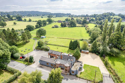
- Price
- Offers Over£795,000
- Size
- 2.5 acres
Added on 29/01/2026Camping Land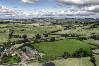
- Price
- £1,100,000
- Size
- 3.19 acres
Added on 10/09/2026Development Land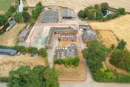
- Price
- £650,000
Onston Farm Barns, Tetchill, Ellesmere, Shropshire, SY12, Ellesmere Rural, Shropshire SY12 England
Added on 01/10/2026Development Land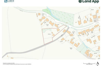
- Price
- Guide Price£650,000
- Size
- 0.98 acres
Rosedale, Hollins Green Lane, Tilstock, Whitchurch, Whitchurch Rural, Shropshire SY13 England
Added on 01/05/2026Development Land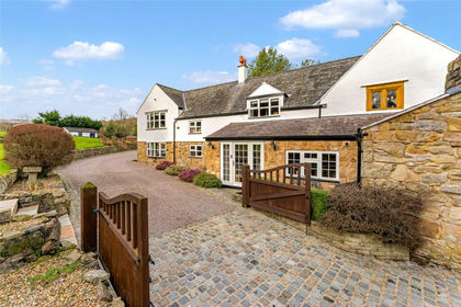
- Price
- Guide Price£850,000
- Size
- 1.16 acres
Added on 25/02/2026Historic House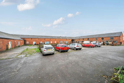
- Price
- Guide Price£700,000
Added on 17/07/2026Development Land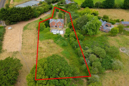
- Price
- Offers in Region of£975,000
- Size
- 0.76 acres
Hatton Lane, Waverton, Chester, Hargrave and Huxley, Cheshire West and Chester CH3 England
Added on 08/08/2026Development Land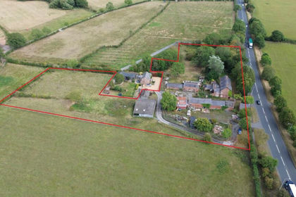
- Price
- Offers Over£850,000
- Size
- 4 acres
The Limes, Holme Street, Tarvin, Chester, Barrow, Cheshire West and Chester CH3 England
Added on 08/08/2026Development Land
- Price
- £950,000
- Size
- 1.25 acres
Added on 25/09/2026Building Plot
- Price
- Guide Price£850,000
- Size
- 4.2 acres
Stapeley Farm, London Road, Nantwich, CW5, Stapeley and District, Cheshire East CW5 England
Added on 22/06/2026Development Land