Painshawfield Road, Stocksfield, Northumberland, NE43
- Land size
- 1.1 acres
- Bedrooms
- 5
- Bathrooms
- 3
Key Features
- Substantial Detached Bungalow
- Four/Five Bedrooms
- Highly Desirable Location
- Attached Garaging & Driveway
- Gardens & Two Paddocks Totalling 1.1 Acres
- Current EPC Rating: E
- Council Tax Band: G
- Tenure: Freehold
- No Ongoing Chain
- Viewing Recommended
Description
Situated in the heart of this highly desirable estate, this is a rare gem of a property. Comprising a very substantial bungalow surrounded by gardens and two paddocks which total just over an acre or thereabouts. The bungalow offers well-proportioned accommodation with versatility, but can comprise five bedrooms and three reception rooms, if required. It would therefore suit not just active retirement purposes, but family use as well. The property is in need of some modernisation, but offers huge potential to either update the existing property, or subject to any necessary planning consents being obtained, be redeveloped, as so many of the neighbours have done so. Properties of this nature and calibre and more over space, rarely come onto the market in this location, and we would strongly urge an early inspection, in order to avoid disappointment.
BRIEFLY COMPRISING;
LARGE ENTRANCE PORCH 10'9" x 5'10" (3.28m x 1.78m)
With uPVC front door with glazed insets and side panels. Polished timber flooring.
HALLWAY 14'3" x 6' (4.34m x 1.83m)
LIVING ROOM 23'9" x 19'6" (7.24m x 5.94m)
A generous sized room with ample glazing to allow natural light in and provide a very pleasant outlook. Feature brick fireplace and hearth incorporating a wood-burning stove.
KITCHEN 19' x 17'2" (5.8m x 5.23m)
(measurement overall) Fitted wall and floor units with matching island unit, worktops over incorporating a one and a half stainless steel sink with single drainer and mixer tap over. Four ring ceramic hob with extractor canopy over and built-in single oven, tiled splash back and laminate flooring. Breakfasting area with stove.
UTILITY ROOM 10'1" x 5'1" (3.07m x 1.55m)
Fitted cupboards and worktop incorporating a ceramic sink with mixer tap over, tiled splash back, plumbing for washing machine and uPVC rear door.
BATHROOM
Corner bath with shower over, vanity unit with cupboards below and low level WC.
DINING ROOM 16' x 9'7" (4.88m x 2.92m)
Display fireplace with electric fire. Glazed double doors to outside.
STUDY 12' x 10' (3.66m x 3.05m)
To the side. Possible bedroom if required.
REAR HALLWAY
Door to outside. Separate door to garaging.
WASHROOM 7'4" x 5'4" (2.24m x 1.63m)
Belfast sink with tiled splash back and plumbing for washing machine.
CLOAKROOM
Low level WC.
GARDEN ROOM 12'2" x 9'3" (3.7m x 2.82m)
(average measurement) Laminate flooring. Pleasant outlook over gardens/paddock. uPVC door to outside.
INNER CORRIDOR
Staircase to first floor. Leading to:
DOUBLE BEDROOM ONE 14'5" x 9'7" (4.4m x 2.92m)
To the rear. Laminate flooring and built-in wardrobe.
EN-SUITE BATHROOM
Panelled bath with shower attachment, pedestal wash hand basin, low level WC, tiled splash back and heated towel rail.
DOUBLE BEDROOM TWO 16'10" x 14'1" (5.13m x 4.3m)
(measurement overall) Range of fitted wardrobes with hanging and shelving space. Windows to two aspects.
EN-SUITE SHOWER ROOM
Shower cubicle, wash hand basin, low level WC, splash boarding to walls and chrome heated towel rail.
DOUBLE BEDROOM THREE 11' x 10'9" (3.35m x 3.28m)
With vanity unit and cupboard.
FIRST FLOOR
FAMILY ROOM 31'5" x 10'7" (9.58m x 3.23m)
Eaves storage cupboard. Wall-mounted central heating boiler.
SINGLE BEDROOM FOUR 14'4" x 7'4" (4.37m x 2.24m)
DOUBLE BEDROOM FIVE 16'2" x 14'8" (4.93m x 4.47m)
(maximum measurement overall) Glazed double doors out.
EXTERNALLY
ATTACHED GARAGING 18'1" x 16'8" (5.5m x 5.08m)
Power and water both connected.
GARDENS
The property has mature garden areas with lawned areas, mature trees, bushes and shrubs, raised flower beds, substantial flagged patio areas to the front offering a very pleasant and sunny outdoor entertaining space.
PADDOCKS
There is a paddock to the front, all fences, with an additional paddock to the rear with mature trees and hedges, together with an old field shelter/stable. The total site area including the paddocks and gardens are circa 1.1 acres or thereabouts.
SERVICES
Mains electricity, mains water, mains drainage and mains gas are connected. Gas central heating to radiators also supplying the domestic hot water.
TENURE:
We understand that the property is freehold.
NOTES
The property is sold as seen.
COUNCIL TAX BAND:
The local authority is Northumberland County Council. The property is Council Tax Band G.
REFERRAL FEES:
In accordance with the Estate Agents’ (Provision of Information) Regulations 1991 and the Consumer Protection from Unfair Trading Regulations 2008, we are obliged to inform you that this Company may offer the following services to sellers and purchasers from which we may earn a related referral fee from on completion, in particular the referral of: Conveyancing where typically we can receive an average fee of £100.00 incl of VAT. Surveying services we can typically receive an average fee of £90.00 incl VAT. Mortgages and related products our average share of a commission from a broker is typically an average fee of £120.00 incl VAT, however this amount can be proportionally clawed back by the lender should the mortgage and/or related product(s) be cancelled early. Removal Services we can typically receive an average fee of £60 incl of VAT.
Map Location
Property details
- Tenure
- Freehold
- Council Tax Band
- G
- Date Posted
- 2026-10-28
Market Value Analysis
Compared with 182 Homes with Land listings in North East England (1+ acres).
Energy Performance Certificate
Energy Efficiency Rating
Based on UK Energy Performance Certificate standards (EU Directive 2002/91/EC)
Running costs are one side. Planning activity, flood history and ground risks for this location are in the full report.
Utilities & Restrictions
Utilities
- Electricity
- Mains
- Water
- Mains
- Heating
- Gas Central Heating
- Broadband
- Ask Agent
- Sewerage
- Mains
Rights & Restrictions
- Public Rights of Way
- Ask Agent
- Private Rights of Way
- Ask Agent
- Listed Property
- Ask Agent
- Restrictions
- Ask Agent
Listed status, conservation areas and planning constraints for this location are in the full report.
Property Features
- Accessibility
- Ask Agent
- Parking
- Garage, Driveway
- Garden
- Garden
Beyond the particulars: planning activity, flood history, heritage and ground risks, checked for this exact spot.
Connectivity
Broadband
Fastest speed available at this postcode
1 Gbps
Gigabit full fibre
Suitable for
- 4K streaming on every screen
- Full-time home working
- Online gaming & big downloads
Mobile signal
Predicted 4G and 5G signal; indoor signal depends on building materials.
Ofcom Connected Nations postcode-level predictions. Speeds and signal are modelled, not measured, and vary between addresses and providers.
Signal is the easy part. Planning activity, flood history and protected designations here are in the full report.
Nearest Schools
Primary
- Broomley First School0.6 milesOfsted: Good
- Ages
- 5 to 9
- Pupils
- 99
- Type
- Academy converter
- Mickley First School1.2 milesOfsted: Good
- Ages
- 2 to 9
- Pupils
- 61
- Type
- Academy converter
- Prudhoe Castle First School2.2 milesOfsted: Good *
- Ages
- 2 to 9
- Pupils
- 74
- Type
- Academy converter
- Ovingham Church of England First School2.3 milesOfsted: Good
- Ages
- 5 to 9
- Pupils
- 107
- Type
- Academy converter
- Faith
- Church of England
- Whittonstall First School2.3 milesOfsted: Good
- Ages
- 3 to 9
- Pupils
- 67
- Type
- Academy converter
Secondary
- Ovingham Middle School2.2 milesNo Ofsted rating
- Ages
- 9 to 13
- Pupils
- 344
- Type
- Academy converter
- Highfield Middle School2.4 milesNo Ofsted rating
- Ages
- 9 to 13
- Pupils
- 365
- Type
- Academy converter
- Prudhoe Community High School2.5 milesNo Ofsted rating
- Ages
- 13 to 19
- Pupils
- 680
- Type
- Academy converter
- Corbridge Middle School5.3 milesOfsted report card · Feb 2026
- Ages
- 9 to 13
- Pupils
- 367
- Type
- Community school
- Thorp Academy5.7 milesNo Ofsted rating
- Ages
- 11 to 18
- Pupils
- 1,442
- Type
- Academy sponsor led
* Latest graded judgement covers quality of education only; no overall grade was issued under the 2024-25 inspection framework.
Distances are straight-line from the advertised location. Source: the national school registers (DfE, Welsh Government, Scottish Government) and Ofsted.
Schools are just the start: sold prices nearby, planning activity and any flood history are in the full report.
Amenities
Supermarket
GP surgery
Pharmacy
Hospital
Green space
Straight-line distances from the advertised location. Sources: NHS records, Geolytix supermarket locations, OS Open Greenspace and the national trails registers.
The area stacks up? Now check the location itself: planning nearby, protected designations and past flooding.
Getting Around
Nearest station
Nearest bus stop
Typical drive times
Straight-line distances from the advertised location; drive times are typical free-flow times over OpenStreetMap road data, so allow more at peak. Public transport locations from DfT NaPTAN.
Easy to reach matters. So do planning activity, flood history and ground risks: all in the full report.
Flood Risk
Environment Agency open data, checked around the advertised map pin for the listed acreage. Long-term risk counts flood defences; the planning map's flood zones do not. The map pin for this listing marks the postcode area rather than the exact location, so these readings describe the surrounding area. Provided by LandSale, not the listing agent, and not part of the agent's particulars. Risk varies across a holding, so verify before committing.
Rivers and the sea
Planning map: Flood Zone 1.
Surface water
Not at the pin: mapped about 30 metres away.
These bandings are the summary. Where this location sits on the flood maps, plus planning activity, heritage and ground risks, is in the full report.
Important notice: Information, maps and tags on this page are drawn from the advertising agent's marketing materials or generated automatically. LandSale has not verified them. Relying on these details is at your own risk, always carry out independent checks before committing to a purchase.
LandSale full disclaimer
Marketing information only - not formal particulars. The details on this website are provided for general guidance and do not constitute an offer or contract. Neither LandSale nor the advertising estate/land agent accepts responsibility for any inaccuracy.
1. Source of information
- Listing content: Core description, asking price, tenure, measurements, photographs and planning history originate from the marketing materials of the advertising estate or land agent. LandSale does not author this content and cannot guarantee its accuracy.
- Automated tags & categorisation: Property type, land-use class, acreage bands and similar labels may be applied by machine-learning models. They are intended as a helpful guide only and may not reflect the property's legal status or permitted use.
- Third-party & enriched data layers: Maps, boundary outlines, planning designations, soil reports, broadband coverage and other environmental or location-based insights are licensed from external suppliers. Such data are supplied “as is", may be incomplete or out of date and are subject to change without notice.
2. Verification required
Prospective purchasers must verify critical matters, including but not limited to planning permission, title boundaries, public rights of way, environmental constraints, acreage, services, access and VAT status, through their own inspections, specialist surveys, legal advisers and the selling agent before relying on the information or entering into any contract.
3. No warranty or liability
LandSale gives no warranty, express or implied, as to the accuracy, completeness or fitness for any particular purpose of the information displayed. LandSale shall not be liable for any loss, damage, cost or expense arising directly or indirectly from any use of or reliance on such information, save where liability may not be excluded by law.
4. Updates & feedback
If you believe any detail on this listing is inaccurate, please let us know. We will investigate and, where appropriate, update the listing or notify the agent.
© LandSale | Version 1.3 - August 2026
Listing agent
Andrew Coulson Property Sales & Lettings, Hexham39 Fore Street, Hexham, NE46 1LN
View agent profileSimilar properties for sale
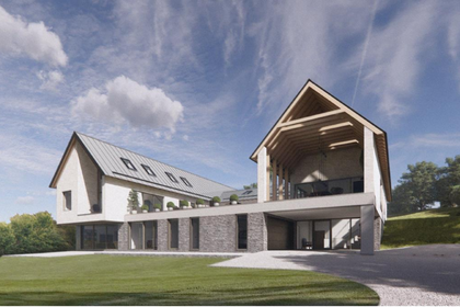
- Price
- Guide Price£650,000
- Size
- 1 acres
Apperley Road, Stocksfield, Stocksfield, Northumberland NE43 England
Added on 12/03/2026Building Plot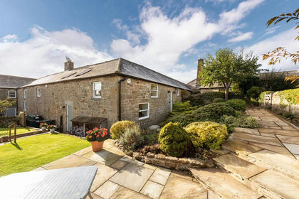
- Price
- Guide Price£625,000
The Stables, Town Farm, Newton, Northumberland, Bywell, Northumberland NE43 England
Added on 02/09/2026Barn Conversion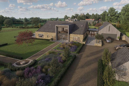
- Price
- Offers Over£795,000
- Size
- 11 acres
East Barns, Newton, Stocksfield, Northumberland, Bywell, Northumberland NE43 England
Added on 03/06/2026Development Land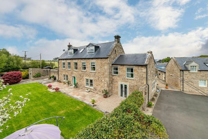
- Price
- Guide Price£750,000
- Size
- 1.25 acres
Kyo Lane, Coalburns, Ryton, NE40, Blaydon and Consett, Gateshead NE40 England
Added on 20/05/2026House with Land
- Price
- £750,000
- Size
- 4.5 acres
High Waskley Farm, Shotley Bridge, Consett, Shotley Low Quarter, Northumberland DH8 England
Added on 01/10/2026House with Land
- Price
- Offers Over£695,000
Aydon, Corbridge, Northumberland, NE45, Corbridge, Northumberland NE45 England
Added on 17/10/2026Barn Conversion
- Price
- Guide Price£675,000
Hustledowne, Colpitts Grange, Slaley, Hexham, Northumberland, Slaley, Northumberland NE47 England
Added on 22/06/2026Barn Conversion
- Price
- Guide Price£525,000
- Size
- 7.55 acres
Trygill Farm Cottage, Slaley, Hexham, Northumberland, Slaley, Northumberland NE47 England
Added on 12/11/2026Equestrian property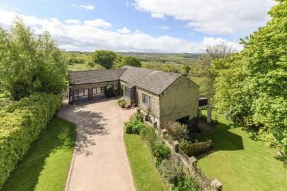
- Price
- Guide Price£625,000
Added on 29/05/2026Barn Conversion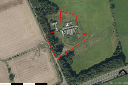
- Price
- Offers in Region of£800,000
- Size
- 4.17 acres
Added on 17/07/2026Development Land