
Moore's Cottage Farm and Land, Upper Mayfield, Ashbourne, DE6
- Land size
- 5.2 acres
- Bedrooms
- 4
- Bathrooms
- 1
Key Features
- Four Bedroom Grade II Listed Stone Farmhouse
- Ancillary Buildings including Stables
- Summer House/Office
- Private and Peaceful Location
- Stunning Views
- Set in approximately 5 Acres
- Additional land available at separate negotiation
- Enquiries to Ashbourne Office
Description
A wonderful opportunity to purchase a Grade II Listed stone farmhouse together with ancillary buildings including stables, an office, all set in 5.20 acres of land.
Description
This presents a most wonderful opportunity to purchase a Grade II Listed stone farmhouse together with ancillary buildings including stables , an office and further accommodation set in approximately 5 .20 acres of land.
Moore’s Cottage Farm is delightfully situated in a very private and peaceful location at the bottom of a bridlepath. Its seclusion and outstanding views across rolling countryside are a special feature of the property yet it is only about 2 miles from the sought after market town of Ashbourne.
Moore’s Cottage Farm takes its name from the Georgian Irish lyric poet Thomas Moore, a friend of Byron, who published his most famous Irish Melodies during the 1810s when he lived in the Farmhouse.
Moore's Cottage Farm
The principal dwelling is an attractive well proportioned stone farm house Grade II Listed with very attractive gardens and prominently situated with outstanding views across rolling countryside.
The rooms are well proportioned and in particular the Sitting Room/Library is an outstanding room for entertaining. Additionally the Conservatory is another space for entertaining or simply enjoying the garden and views.
The front aspect of the property faces south where the main access door leads into the Formal Dining Room having delightful feature stone fire place with brick inset and cast iron woodburning stove. Internal door off the Dining Room leads to the Sitting Room also south facing with open fire and charming built-in cupboards which flank either side of the chimney breast.
The Sitting Room is open plan through to the Library having built-in book shelving and window to side. Accessed from the dining room is central hallway with the staircase winding to the first floor galleried landing and down to the Cellar with barrel vaulted ceiling
The Breakfast Kitchen has a range of wall drawer and base units with granite work surface over to three walls, integrated electric hob, inset sink and drainer, access to larder having fridge freezer space and built-in shelving. Glazed door leading through to the Conservatory, a stunning room with delightful stone floor and bi fold doors opening out onto the patio seating area within the garden.
To the north side of the property is a further access door leading into the Side Hall which provides hanging space and access to the Ground Floor WC and the Utility Room with a further range of wall and base units with inset sink and plumbing for washing machine. And leading through to the boiler room having further shelving and the base mounted central heating boiler.
First Floor
The central galleried landing provides access to all four bedrooms and the family bathroom.
Bedroom One is the largest of the bedrooms and is south facing with three double built-in wardrobes and enjoying stunning views across the land to the rolling countryside beyond. Bedroom Two also a generous double room is south facing enjoying the same open views.
Bedroom Three has been fitted with an ensuite WC and basin, and separate built-in shower cubicle and built-in storage cupboard. Bedroom four is the smallest of the rooms currently used as a home office but large enough to accommodate a double bed and has a built-in double wardrobe.
The Family Bathroom has been fitted with a four piece bathroom suite including panelled bath, vanity wash hand basin low flush WC and bidet, having part tiled walls.
Buildings
Within the grounds of the principal residence are two stone built stables with a functional office above, a further multifunctional building which could be used as office space or residential accommodation, including kitchen, shower room, basin and WC, sitting room and large first floor room used as offices/bedrooms . There is an adjoining greenhouse.
Garden and Grounds
The property is accessed off Slack Lane which is a no through road with no passing traffic. It benefits from a right of way along the private access driveway and leads to the hardstanding providing off-road parking for a number of vehicles..
The delightfully sculpted gardens surround the house and are predominantly lawns with a lovely paved seating area to the west of the property directly outside the conservatory. There is a most useful caged vegetable garden within and a number of fruit trees.
Land
The land is all laid to pasture and comprises of three fields with access both from the driveway and from Slack Lane. The field nearest to the house has an attractive pond and wildlife area which complements the setting of the property. The land in all extends to approximate 5.20 .acres with additional land at separate negotiation.
Please note that part of the land has not been fenced however the vendor has committed to erecting this by completion,
Services
Mains water supply, mains electricity, oil fired central heating. private drainage (a separate tank for the main house and for the cottages).
Tenure and Possession
The property is sold Freehold with vacant possession.
Sporting, Timber and Mineral Rights
It is understood that these are included in the sale as far as they exist.
Rights of Way, Wayleaves and Easements
The property is sold subject to and with the benefit of all rights of way, easements and wayleaves whether or not defined in these particulars.
Please note that the neighbouring house to the west owns the driveway to access their property and affords a right of way., there will be a shared contribution to the driveway upkeep.
There is a Public Footpath across part of the field.
A limited right of way to cross the field to access the retained land is to be provided to the vendor.
Fixtures and Fittings
Only those fixtures and fittings referred to in the sale particulars are included in the purchase price. Bagshaws have not tested any equipment, fixtures, fittings or services and no guarantee is given that they are in good working order.
Local Authority and Council Tax Band
East Staffordshire Borough Council
House - F
Directions
What3words/// mooring.leave.bookings
Viewings
Strictly by appointment through the Ashbourne Office of Bagshaw's as sole agents on 01335 342201 or e-mail: ashbourne@bagshaws.com.
EPC
House - E
Broadband Connectivity
It is understood that there is full fibre connection via Openreach.
Mobile Network Coverage
The property is well-situated for mobile signal coverage and is expected to be served by a broad range of providers. Prospective purchasers are encouraged to consult the Ofcom website (https://www.ofcom.org.uk) to obtain an estimate of the signal strength for this specific location.
Agents Notes
Bagshaws LLP have made every reasonable effort to ensure these details offer an accurate and fair description of the property. The particulars are produced in good faith, for guidance only and do not constitute or form an offer or part of the contract for sale. Bagshaws LLP and their employees are not authorised to give any warranties or representations in relation to the sale and give notice that all plans, measurements, distances, areas and any other details referred to are approximate and based on information available at the time of printing.
Map Location
Property details
- Tenure
- Freehold
- Council Tax Band
- F
- Date Posted
- 2026-10-27
Market Value Analysis
Compared with 247 Homes with Land listings in West Midlands (5+ acres).
Energy Performance Certificate
Energy Efficiency Rating
Based on UK Energy Performance Certificate standards (EU Directive 2002/91/EC)
Running costs are one side. Planning activity, flood history and ground risks for this location are in the full report.
Property Brochure
Seen the details? The full report adds the independent checks: planning activity, flood history, heritage and ground.
Utilities & Restrictions
Utilities
- Electricity
- Ask Agent
- Water
- Ask Agent
- Heating
- Ask Agent
- Broadband
- Ask Agent
- Sewerage
- Ask Agent
Rights & Restrictions
- Public Rights of Way
- Ask Agent
- Private Rights of Way
- Ask Agent
- Listed Property
- Ask Agent
- Restrictions
- Ask Agent
Listed status, conservation areas and planning constraints for this location are in the full report.
Property Features
- Accessibility
- Ask Agent
- Parking
- Ask Agent
- Garden
- Ask Agent
Beyond the particulars: planning activity, flood history, heritage and ground risks, checked for this exact spot.
Connectivity
Broadband
Fastest speed available at this postcode
1.8 Gbps
Gigabit full fibre · available to 38% of premises
Suitable for
- 4K streaming on every screen
- Full-time home working
- Online gaming & big downloads
Mobile signal
Predicted 4G and 5G signal; indoor signal depends on building materials.
Ofcom Connected Nations postcode-level predictions. Speeds and signal are modelled, not measured, and vary between addresses and providers.
Signal is the easy part. Planning activity, flood history and protected designations here are in the full report.
Nearest Schools
Primary
- Clifton CofE Primary School1.1 milesOfsted: Good *
- Ages
- 5 to 11
- Pupils
- 107
- Type
- Voluntary controlled school
- Faith
- Church of England
- St Oswald's CofE Primary School1.7 milesNo Ofsted rating
- Ages
- 5 to 11
- Pupils
- 204
- Type
- Voluntary controlled school
- Faith
- Church of England
- Hilltop Primary Academy2 milesOfsted: Requires improvement
- Ages
- 3 to 11
- Pupils
- 126
- Type
- Academy sponsor led
- Ashbourne Primary School2.3 milesOfsted: Good
- Ages
- 3 to 11
- Pupils
- 202
- Type
- Academy converter
- Norbury CofE Primary School2.8 milesNo Ofsted rating
- Ages
- 4 to 11
- Pupils
- 75
- Type
- Academy converter
- Faith
- Church of England
Secondary
- Queen Elizabeth's Grammar School2.2 milesNo Ofsted rating
- Ages
- 11 to 18
- Pupils
- 1,276
- Type
- Academy converter
- Faith
- Christian
- Ryecroft CofE Middle School4.4 milesNo Ofsted rating
- Ages
- 9 to 13
- Pupils
- 201
- Type
- Academy converter
- Faith
- Church of England
- The JCB Academy4.7 milesOfsted: Good
- Ages
- 13 to 19
- Pupils
- 781
- Type
- University technical college
- Thomas Alleyne's High School8.2 milesNo Ofsted rating
- Ages
- 13 to 18
- Pupils
- 941
- Type
- Academy converter
- Windsor Park CE Middle School8.4 milesOfsted report card · Jun 2026
- Ages
- 9 to 13
- Pupils
- 345
- Type
- Academy converter
- Faith
- Church of England
* Latest graded judgement covers quality of education only; no overall grade was issued under the 2024-25 inspection framework.
Distances are straight-line from the advertised location. Source: the national school registers (DfE, Welsh Government, Scottish Government) and Ofsted.
Schools are just the start: sold prices nearby, planning activity and any flood history are in the full report.
Amenities
Supermarket
GP surgery
Pharmacy
Hospital
Green space
Straight-line distances from the advertised location. Sources: NHS records, Geolytix supermarket locations, OS Open Greenspace and the national trails registers.
The area stacks up? Now check the location itself: planning nearby, protected designations and past flooding.
Getting Around
Nearest station
Nearest bus stop
Typical drive times
Straight-line distances from the advertised location; drive times are typical free-flow times over OpenStreetMap road data, so allow more at peak. Public transport locations from DfT NaPTAN.
Easy to reach matters. So do planning activity, flood history and ground risks: all in the full report.
Flood Risk
Environment Agency open data, checked around the advertised map pin for the listed acreage. Long-term risk counts flood defences; the planning map's flood zones do not. Provided by LandSale, not the listing agent, and not part of the agent's particulars. Risk varies across a holding, so verify before committing.
Rivers and the sea
Planning map: Flood Zone 3.
Surface water
Not at the pin: mapped about 30 metres away.
These bandings are the summary. Where this location sits on the flood maps, plus planning activity, heritage and ground risks, is in the full report.
Important notice: Information, maps and tags on this page are drawn from the advertising agent's marketing materials or generated automatically. LandSale has not verified them. Relying on these details is at your own risk, always carry out independent checks before committing to a purchase.
LandSale full disclaimer
Marketing information only - not formal particulars. The details on this website are provided for general guidance and do not constitute an offer or contract. Neither LandSale nor the advertising estate/land agent accepts responsibility for any inaccuracy.
1. Source of information
- Listing content: Core description, asking price, tenure, measurements, photographs and planning history originate from the marketing materials of the advertising estate or land agent. LandSale does not author this content and cannot guarantee its accuracy.
- Automated tags & categorisation: Property type, land-use class, acreage bands and similar labels may be applied by machine-learning models. They are intended as a helpful guide only and may not reflect the property's legal status or permitted use.
- Third-party & enriched data layers: Maps, boundary outlines, planning designations, soil reports, broadband coverage and other environmental or location-based insights are licensed from external suppliers. Such data are supplied “as is", may be incomplete or out of date and are subject to change without notice.
2. Verification required
Prospective purchasers must verify critical matters, including but not limited to planning permission, title boundaries, public rights of way, environmental constraints, acreage, services, access and VAT status, through their own inspections, specialist surveys, legal advisers and the selling agent before relying on the information or entering into any contract.
3. No warranty or liability
LandSale gives no warranty, express or implied, as to the accuracy, completeness or fitness for any particular purpose of the information displayed. LandSale shall not be liable for any loss, damage, cost or expense arising directly or indirectly from any use of or reliance on such information, save where liability may not be excluded by law.
4. Updates & feedback
If you believe any detail on this listing is inaccurate, please let us know. We will investigate and, where appropriate, update the listing or notify the agent.
© LandSale | Version 1.3 - August 2026
Similar properties for sale
- Price
- £750,000
- Size
- 6.59 acres
Added on 26/06/2026House with Land
- Price
- Offers in Region of£795,000
- Size
- 2 acres
Cliff Bank Cottage, Calwich, Ashbourne, Derbyshire, Mayfield, Staffordshire DE6 England
Added on 17/06/2026House with Land
- Price
- Guide Price£600,000
- Size
- 2.34 acres
Chaff Lane, Stanton, DE6, Stanton, Staffordshire DE6 England
Added on 13/09/2026Barn Conversion
- Price
- Offers in Region of£950,000
- Size
- 2.24 acres
Windmill Lane, Ashbourne, Derbyshire, DE6, Offcote and Underwood, Derbyshire DE6 England
Added on 08/09/2026Multiple Dwelling Property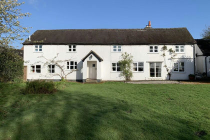
- Price
- £895,000
- Size
- 5 acres
Wyaston, Ashbourne, Edlaston and Wyaston, Derbyshire DE6 England
Added on 18/04/2026Cottage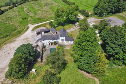
- Price
- £875,000
- Size
- 23.89 acres
Riddings Park Farm, Kniveton, Ashbourne, DE6, Ashbourne, Derbyshire DE6 England
Added on 12/08/2026Farmhouse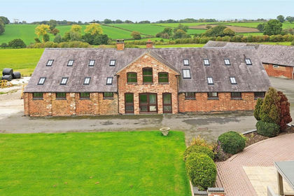
- Price
- £795,000
- Size
- 12.09 acres
War Farm Barn, Bradley, Ashbourne, DE6, Ashbourne, Derbyshire DE6 England
Added on 25/09/2026Barn Conversion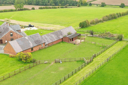
- Price
- £650,000
- Size
- 11.7 acres
Lot 3, War Farm, Undeveloped Barn, Bradley, Ashbourne, DE6, Ashbourne, Derbyshire DE6 England
Added on 25/09/2026Development Land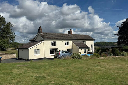
- Price
- £795,000
- Size
- 3.5 acres
Taylors Lane, Denstone, Denstone, Staffordshire ST14 England
Added on 17/04/2026House with Land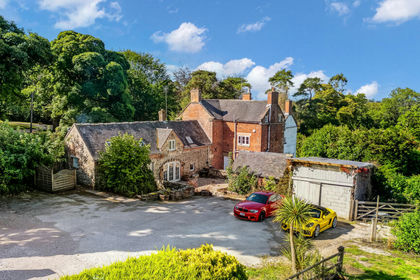
- Price
- Offers Over£900,000
- Size
- 6.8 acres
Hulland Village, Ashbourne, DE6, Hulland, Derbyshire DE6 England
Added on 18/09/2026House with Land