Capel Dewi, Aberystwyth
- Bedrooms
- 3
- Bathrooms
- 2
Description
Part of the barn conversion of the mews at Lovesgrove Farm a traditional 3 Bedroomed double glazed and centrally heated bungalow in convenient edge of town location.
For Sale By Private Treaty -
Part of the barn conversion of the mews at Lovesgrove Farm a traditional 3 Bedroomed double glazed and centrally heated bungalow in convenient edge of town location.
7 Lovesgrove Farm Stables
Capel Dewi
Aberystwyth
SY23 3HR
The single storey 3 Bedroomed property enjoys commodious accommodation in a sought-after edge of town location. 7 Lovesgrove is some 4 miles inland and forms part of a small cluster of similar properties on the former Lovesgrove Farm homestead. Aberystwyth is one of largest towns in Mid Wales and has a good range of both local and National retailers in addition to both social, leisure and educational facilities.
Capel Dewi in a South semi-rural village with attractive walks nearby. There is a Railway Station, General Stores and Primary School close at hand at Bow Street.
The electric central heating system is new which will be evident on inspection. Externally there is an enclosed decked area and a parking space.
Tenure - Freehold
Council Tax - Band
Services - Mains water and electricity. Shared private drainage system. Please refer to Ofcom for Internet speed and Mobile Signal by using the following link;
Viewing - Strictly by appointment with the sole selling agents; Aled Ellis & Co, 16 Terrace Rd, Aberystwyth. or
Money Laundering Regulations - Successful parties will be required to provide sufficient up to date identification to verify your identity in compliance with the Money Laundering Regulations. For example: - Passport/ Photographic Driving licence and a current utility bill.
Land Transaction Tax - The purchase of this property may be subject to Land Transaction Tax (LTT), with the amount payable depending on the purchase price and the buyer’s circumstances. For an estimate, please use the Welsh Revenue Authority Land Transaction Tax calculator at and/or seek advice from your solicitor or financial adviser.
7 Lovesgrove Farm Stables provides for the following accommodation. All room dimensions are approximate. All images have been taken with a digital camera.
Front Entrance Door To -
Reception Hallway - Laminated floor, access to roofspace, radiator. Doors to
Living Room - 4.78m x 5.51m (15'8 x 18'1) - Spacious room with exposed high ceiling with A Frame and exposed beams. Exposed stone wall feature, radiators. Two Velux windows together with windows to fore and rear. Laminated floor.
Kitchen - 4.32m x 4.57m (14'2 x 15') - Single drainer sink unit with mixer tap. Base and eye level units with appliance spaces, worktops over together with fitted electric cooker and hob. Eye level units, extractor hood, cooker point and tiled splashbacks. Plumbing for dishwasher, cupboard housing the new electric central heating system with hot water tank and immersion switch. Radiator, window to rear.
Bedroom 1 - 2.95m x 2.77m (9'8 x 9'1) - Part sloping headroom, radiator and window to side.
Bedroom 2 - 3.12m x 3.78m (10'3 x 12'5) - Window to fore, laminated floor and radiator. Door to
Ensuite Wc - 1.14m x 2.92m max (3'9 x 9'7 max) - with wash hand basin, radiator and shelving. Velux window.
Bedroom 3 - 4.32m x 4.39m max (14'2 x 14'5 max) - Feature exposed stone wall. Laminated floor, window to rear and radiator.
Bathroom - 2.16m x 2.46m (7'1 x 8'1) - Bath with shower over and screen, WC and wash handbasin, WC. Velux window, radiator.
Externally - Enclosed front garden with decking and garden shed.
Directions - (What3Words///performs.unhappy.awestruck)
From Aberystwyth proceed inland towards Capel Bangor on the A44 trunk road. After about 4 miles take the first exit left on to the A4159 Bow Street and proceed towards Capel Dewi. Turn right after the brow of the hill and proceed to the property taking the left fork to the rear of the development.
Map Location
Property details
- Tenure
- Freehold
- Council Tax Band
- Ask Agent
- Date Posted
- 2026-10-08
Utilities & Restrictions
Utilities
- Electricity
- Ask Agent
- Water
- Ask Agent
- Heating
- Ask Agent
- Broadband
- Ask Agent
- Sewerage
- Ask Agent
Rights & Restrictions
- Public Rights of Way
- Ask Agent
- Private Rights of Way
- Ask Agent
- Listed Property
- Ask Agent
- Restrictions
- Ask Agent
Listed status, conservation areas and planning constraints for this location are in the full report.
Property Features
- Accessibility
- Ask Agent
- Parking
- Parking Available
- Garden
- Garden
Beyond the particulars: planning activity, flood history, heritage and ground risks, checked for this exact spot.
Connectivity
Broadband
Fastest speed available at this postcode
80 Mbps
Superfast · available to 83% of premises
Suitable for
- HD streaming
- Video calls
- Web & social
Mobile signal
Predicted 4G and 5G signal; indoor signal depends on building materials.
Ofcom Connected Nations postcode-level predictions. Speeds and signal are modelled, not measured, and vary between addresses and providers.
Signal is the easy part. Planning activity, flood history and protected designations here are in the full report.
Nearest Schools
Primary
- Ysgol Gymunedol Comins Coch1 mile
- Pupils
- 133
- Type
- Infants & Juniors
- Language
- Dual language school / provision (Welsh and English) (including transitional)
- Ysgol Penrhyncoch1.5 miles
- Pupils
- 115
- Type
- Infants & Juniors
- Language
- Welsh medium school / provision (including transitional)
- Ysgol Penllwyn1.7 miles
- Pupils
- 42
- Type
- Infants & Juniors
- Language
- Welsh medium school / provision (including transitional)
- Ysgol Gymunedol Rhydypennau2.2 miles
- Pupils
- 194
- Type
- Nursery, Infants & Juniors
- Language
- Welsh medium school / provision (including transitional)
- Ysgol Gymraeg Aberystwyth2.4 miles
- Pupils
- 368
- Type
- Nursery, Infants & Juniors
- Language
- Welsh medium school / provision (including transitional)
Secondary
- Penglais School1.9 miles
- Pupils
- 1,120
- Type
- Secondary (ages 11-19)
- Language
- English medium school / provision
- Ysgol Gyfun Penweddig2.3 miles
- Pupils
- 587
- Type
- Secondary (ages 11-19)
- Language
- Welsh medium school / provision (including transitional)
- Ysgol Uwchradd Tywyn12 miles
- Pupils
- 376
- Type
- Secondary (ages 11-16)
- Language
- Dual language school / provision (Welsh and English) (including transitional)
- Ysgol Bro Hyddgen14 miles
- Pupils
- 441
- Type
- Middle (ages 4-19)
- Language
- Welsh medium school / provision (including transitional)
- Ysgol Henry Richard14 miles
- Pupils
- 387
- Type
- Middle (ages 3-16)
- Language
- Welsh medium school / provision (including transitional)
Distances are straight-line from the advertised location. Source: the national school registers (DfE, Welsh Government, Scottish Government) and Ofsted.
Schools are just the start: sold prices nearby, planning activity and any flood history are in the full report.
Amenities
Supermarket
GP surgery
Pharmacy
Straight-line distances from the advertised location. Sources: NHS records, Geolytix supermarket locations, OS Open Greenspace and the national trails registers.
The area stacks up? Now check the location itself: planning nearby, protected designations and past flooding.
Getting Around
Nearest station
Nearest bus stop
Typical drive times
Straight-line distances from the advertised location; drive times are typical free-flow times over OpenStreetMap road data, so allow more at peak. Public transport locations from DfT NaPTAN.
Easy to reach matters. So do planning activity, flood history and ground risks: all in the full report.
Flood Risk
Natural Resources Wales open data, checked around the advertised map pin for the listed acreage. Long-term risk counts flood defences; the planning map's flood zones do not. Provided by LandSale, not the listing agent, and not part of the agent's particulars. Risk varies across a holding, so verify before committing.
Rivers and the sea
Planning map: Flood Zone 1.
Surface water
Not at the pin: mapped about 10 metres away.
These bandings are the summary. Where this location sits on the flood maps, plus planning activity, heritage and ground risks, is in the full report.
Important notice: Information, maps and tags on this page are drawn from the advertising agent's marketing materials or generated automatically. LandSale has not verified them. Relying on these details is at your own risk, always carry out independent checks before committing to a purchase.
LandSale full disclaimer
Marketing information only - not formal particulars. The details on this website are provided for general guidance and do not constitute an offer or contract. Neither LandSale nor the advertising estate/land agent accepts responsibility for any inaccuracy.
1. Source of information
- Listing content: Core description, asking price, tenure, measurements, photographs and planning history originate from the marketing materials of the advertising estate or land agent. LandSale does not author this content and cannot guarantee its accuracy.
- Automated tags & categorisation: Property type, land-use class, acreage bands and similar labels may be applied by machine-learning models. They are intended as a helpful guide only and may not reflect the property's legal status or permitted use.
- Third-party & enriched data layers: Maps, boundary outlines, planning designations, soil reports, broadband coverage and other environmental or location-based insights are licensed from external suppliers. Such data are supplied “as is", may be incomplete or out of date and are subject to change without notice.
2. Verification required
Prospective purchasers must verify critical matters, including but not limited to planning permission, title boundaries, public rights of way, environmental constraints, acreage, services, access and VAT status, through their own inspections, specialist surveys, legal advisers and the selling agent before relying on the information or entering into any contract.
3. No warranty or liability
LandSale gives no warranty, express or implied, as to the accuracy, completeness or fitness for any particular purpose of the information displayed. LandSale shall not be liable for any loss, damage, cost or expense arising directly or indirectly from any use of or reliance on such information, save where liability may not be excluded by law.
4. Updates & feedback
If you believe any detail on this listing is inaccurate, please let us know. We will investigate and, where appropriate, update the listing or notify the agent.
© LandSale | Version 1.3 - August 2026
Listing agent
Aled Ellis & Co Ltd, Aberystwyth
16 Terrace Road, Aberystwyth, SY23 1NP
Similar properties for sale
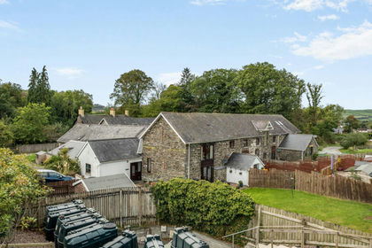 Added on 06/10/2026Barn Conversion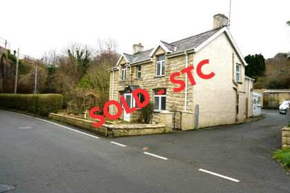
- Price
- Offers in Region of£238,500
- Size
- 3 acres
Borth, Cardiganshire, Ceredigion, Mid Wales, SY24, Borth, Ceredigion SY24 Wales
Added on 29/01/2026Cottage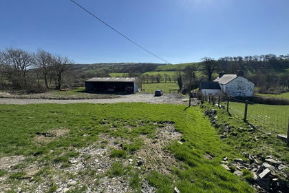
- Price
- £290,000
- Size
- 1.6 acres
Llangwyryfon, Aberystwyth, SY23, Llangwyryfon, Ceredigion SY23 Wales
Added on 31/03/2026House with Land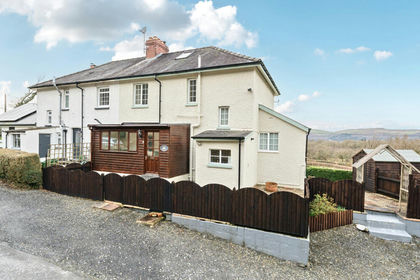
- Price
- £329,500
- Size
- 2 acres
Furnace, Machynlleth, Ceredigion, SY20, Ysgubor-y-coed, Ceredigion SY20 Wales
Added on 24/02/2026House with Land
- Price
- £319,950
- Size
- 5.37 acres
Added on 14/08/2026House with Land
- Price
- Offers in Region of£250,000
- Size
- 1.5 acres
Plas Panteidal, Aberdovey/Aberdyfi, Gwynedd, LL35, Aberdovey, Gwynedd LL35 Wales
Added on 03/07/2026House with Land
- Price
- Offers in Region of£345,000
- Size
- 3 acres
Pennal, Machynlleth, Gwynedd, SY20, Pennal, Gwynedd SY20 Wales
Added on 13/06/2026House with Land
- Price
- Guide Price£350,000
- Size
- 77 acres
Llanio Road, Tregaron, Llanddewi Brefi, Ceredigion SY25 Wales
Added on 30/05/2026Farm
- Price
- Offers Over£325,000
Storws Fawr, Drury Lane, Aberaeron, SA46, Aberaeron, Ceredigion SA46 Wales
Added on 20/08/2026Development Land Added on 02/09/2026Cottage