Gladestry, Kington, HR5
- Land size
- 6 acres
- Bedrooms
- 6
- Bathrooms
- 2
Description
There are properties that tick boxes, and then there are those that quietly change your idea of what home could be. The Foyce belongs firmly in the latter! Believed to date back to the early-18th Century and Grade II Listed, this wonderfully attractive former farmhouse occupies a rural position just outside the village of Gladestry, enjoying beautiful views across the surrounding countryside and hills.
Having been lovingly cared for by the current owners since 2001, it remains a home of immense warmth and authenticity, where centuries of history are evident in almost every room. Original fireplaces, exposed stonework, timber beams, flagstone flooring, wide wooden floorboards, beautifully crafted leaded windows and an impressive staircase all serve as reminders of the property's rich heritage, while the expansive accommodation spans across three floors, offering six bedrooms, spacious reception rooms and a wealth of versatile living space. Whether you are searching for a sizeable family home, somewhere to welcome visiting family and friends or simply a property that provides room to grow, The Foyce offers the flexibility to suit a variety of lifestyles.
Adjoining the house is a substantial traditional barn, providing excellent storage, workshop or hobby space and lending itself to a variety of alternative uses, while a detached three-bay garage/carport and a further storage shed provide all the practicality one would hope for from a country home. Yet, as special as the farmhouse undoubtedly is, it is what lies beyond the front door that truly captures the imagination... Extending to approximately 6 acres, the beautifully landscaped gardens have clearly evolved over many years and include sweeping lawns, mature trees, colourful planting and a unique dovecot, creating a setting every bit as attractive as the house itself. Beyond, the formal gardens transition naturally into an orchard, mature woodland with winding paths, a charming babbling brook and the top field with its own gated access onto the adjoining lane. It is a landscape that invites exploration throughout the seasons, whether that's enjoying a walk through your own woodland, watching wildlife by the brook, keeping a few animals or simply appreciating the ever-changing beauty of the surrounding countryside.
In addition and accessed off the gated driveway, behind the garaging/carport, is a sizeable hardstanding area, which provides parking for numerous vehicles. It is this combination of house, gardens, outbuildings and land that makes The Foyce so special. Rather than simply being a farmhouse with acreage, it feels like a wonderfully complete country home, where every element has evolved naturally over generations. From relaxing in the beautifully established gardens and entertaining family throughout the summer months, to tending the orchard, pottering in the barn, exploring the woodland or simply sitting back to admire the far-reaching views across the surrounding hills, this is a property that offers far more than just somewhere to live.
Whether your dream is to enjoy a more self-sufficient way of life, keep a few animals, immerse yourself in nature or simply enjoy the luxury of owning a wonderfully complete country home, The Foyce offers the opportunity to make that dream a reality. Available with no upward chain, opportunities to acquire a property of this nature are becoming increasingly difficult to find. Beautifully preserved, full of character and combining a wealth of original features with approximately 6 acres of gardens, woodland, orchard and pasture, together with a traditional barn and useful outbuildings, The Foyce is the sort of property that rarely comes to the market. For those searching for a home where history, space and lifestyle come together in equal measure, The Foyce could be exactly what you have been waiting for.
Key Features
- Detached, Grade II Listed, Former Farmhouse - Set Within Approx. 6 Acres - 6 Bedroom Country Home - Wonderful Lifestyle Purchase - Beautiful Gardens, Woodland, Orchard & Field - Traditional Barn & Outbuildings - Far-Reaching Views Across Surrounding Countryside - Wealth of Original Character - Available with No Upward Chain - Just Outside the Popular Village of Gladestry
Services
We are informed the property is connected to mains electricity and has private drainage and a private water supply.
Heating
Oil fired central heating and stoves.
Tenure
We are informed the property is of freehold tenure.
Council Tax
Powys County Council - Band G.
Broadband
Enquiries indicate the property has an estimated fibre broadband speed of 67MB. Interested parties are advised to make their own enquiries.
What3Words
///villager.legwork.darts
Nearest Towns/Cities
Kington - Approximately 6 miles Hay-on-Wye - Approximately 10 miles Presteigne - Approximately 11 miles Knighton - Approximately 18 miles Leominster - Approximately 20 miles Builth Wells - Approximately 20 miles Llandrindod Wells - Approximately 22 miles Hereford - Approximately 25 miles Ludlow - Approximately 28 miles
Disclaimer
Referral Fees: Holters routinely refers vendors and purchasers to providers of conveyancing and financial services. See our website for more information.
Money Laundering Regulations: In order to comply with current legislation, we are required to carry out Anti-Money Laundering (AML) checks on all prospective purchasers verifying the customer’s identity using biometric identification checks, which includes facial recognition. A company called Creditsafe Business Solutions Ltd provide Anti Money Laundering compliance reports for us, the cost of which is to be covered by prospective purchasers. At the point of your offer being verbally accepted, you agree to paying a non-refundable fee of £35 + VAT (£42 inc. VAT) per purchaser in order for us to carry out our due diligence.
Wayleaves, Easements and Rights of Way: The property will be sold subject to and with the benefits of all wayleaves, easements and rights of way, whether mentioned in these sales particulars or not.
Consumer Pro...
Map Location
Property details
- Tenure
- Freehold
- Council Tax Band
- Ask Agent
- Date Posted
- 2026-08-28
Market Value Analysis
Compared with 365 Homes with Land listings in Wales (5+ acres).
Utilities & Restrictions
Utilities
- Electricity
- Ask Agent
- Water
- Ask Agent
- Heating
- Ask Agent
- Broadband
- Ask Agent
- Sewerage
- Ask Agent
Rights & Restrictions
- Public Rights of Way
- Ask Agent
- Private Rights of Way
- Ask Agent
- Listed Property
- Ask Agent
- Restrictions
- Ask Agent
Listed status, conservation areas and planning constraints for this location are in the full report.
Property Features
- Accessibility
- Ask Agent
- Parking
- Parking Available
- Garden
- Garden
Beyond the particulars: planning activity, flood history, heritage and ground risks, checked for this exact spot.
Connectivity
Broadband
Fastest speed available at this postcode
80 Mbps
Superfast · available to 89% of premises
Suitable for
- HD streaming
- Video calls
- Web & social
Mobile signal
Predicted 4G and 5G signal; indoor signal depends on building materials.
Ofcom Connected Nations postcode-level predictions. Speeds and signal are modelled, not measured, and vary between addresses and providers.
Signal is the easy part. Planning activity, flood history and protected designations here are in the full report.
Nearest Schools
Primary
- Gladestry C.I.W. School822 metres
- Pupils
- 34
- Type
- Nursery, Infants & Juniors
- Language
- English medium school / provision
- Radnor Valley C.P. School3.2 miles
- Pupils
- 48
- Type
- Nursery, Infants & Juniors
- Language
- English medium school / provision
- Franksbridge C.P. School6.7 miles
- Pupils
- 37
- Type
- Nursery, Infants & Juniors
- Language
- English medium school / provision
- Presteigne C.P. School7.4 miles
- Pupils
- 173
- Type
- Nursery, Infants & Juniors
- Language
- English medium school / provision
- Clyro C.I.W. School7.8 miles
- Pupils
- 71
- Type
- Nursery, Infants & Juniors
- Language
- English medium school / provision
Secondary
- Gwernyfed High School12 miles
- Pupils
- 505
- Type
- Secondary (ages 11-19)
- Language
- English medium school / provision
- Ysgol Calon Cymru12 miles
- Pupils
- 948
- Type
- Secondary (ages 11-19)
- Language
- Dual language school / provision (Welsh and English) (including transitional)
- Brecon High School20 miles
- Pupils
- 557
- Type
- Secondary (ages 11-19)
- Language
- English medium school / provision
- Newtown High School23 miles
- Pupils
- 896
- Type
- Secondary (ages 11-19)
- Language
- English medium school / provision
- Crickhowell High School23 miles
- Pupils
- 942
- Type
- Secondary (ages 11-19)
- Language
- English medium school / provision
Distances are straight-line from the advertised location. Source: the national school registers (DfE, Welsh Government, Scottish Government) and Ofsted.
Schools are just the start: sold prices nearby, planning activity and any flood history are in the full report.
Amenities
Supermarket
GP surgery
Pharmacy
Green space
Walking trail
Straight-line distances from the advertised location. Sources: NHS records, Geolytix supermarket locations, OS Open Greenspace and the national trails registers.
The area stacks up? Now check the location itself: planning nearby, protected designations and past flooding.
Getting Around
Nearest station
Nearest bus stop
Typical drive times
Straight-line distances from the advertised location; drive times are typical free-flow times over OpenStreetMap road data, so allow more at peak. Public transport locations from DfT NaPTAN.
Easy to reach matters. So do planning activity, flood history and ground risks: all in the full report.
Flood Risk
Natural Resources Wales open data, checked around the advertised map pin for the listed acreage. Long-term risk counts flood defences; the planning map's flood zones do not. Provided by LandSale, not the listing agent, and not part of the agent's particulars. Risk varies across a holding, so verify before committing.
Rivers and the sea
Planning map: Flood Zone 1.
Surface water
Not at the pin: mapped about 50 metres away.
These bandings are the summary. Where this location sits on the flood maps, plus planning activity, heritage and ground risks, is in the full report.
Important notice: Information, maps and tags on this page are drawn from the advertising agent's marketing materials or generated automatically. LandSale has not verified them. Relying on these details is at your own risk, always carry out independent checks before committing to a purchase.
LandSale full disclaimer
Marketing information only - not formal particulars. The details on this website are provided for general guidance and do not constitute an offer or contract. Neither LandSale nor the advertising estate/land agent accepts responsibility for any inaccuracy.
1. Source of information
- Listing content: Core description, asking price, tenure, measurements, photographs and planning history originate from the marketing materials of the advertising estate or land agent. LandSale does not author this content and cannot guarantee its accuracy.
- Automated tags & categorisation: Property type, land-use class, acreage bands and similar labels may be applied by machine-learning models. They are intended as a helpful guide only and may not reflect the property's legal status or permitted use.
- Third-party & enriched data layers: Maps, boundary outlines, planning designations, soil reports, broadband coverage and other environmental or location-based insights are licensed from external suppliers. Such data are supplied “as is", may be incomplete or out of date and are subject to change without notice.
2. Verification required
Prospective purchasers must verify critical matters, including but not limited to planning permission, title boundaries, public rights of way, environmental constraints, acreage, services, access and VAT status, through their own inspections, specialist surveys, legal advisers and the selling agent before relying on the information or entering into any contract.
3. No warranty or liability
LandSale gives no warranty, express or implied, as to the accuracy, completeness or fitness for any particular purpose of the information displayed. LandSale shall not be liable for any loss, damage, cost or expense arising directly or indirectly from any use of or reliance on such information, save where liability may not be excluded by law.
4. Updates & feedback
If you believe any detail on this listing is inaccurate, please let us know. We will investigate and, where appropriate, update the listing or notify the agent.
© LandSale | Version 1.3 - August 2026
Similar properties for sale
- Price
- £900,000
- Size
- 5.5 acres
Added on 16/10/2026Country Home
- Price
- Offers in Region of£750,000
- Size
- 6.09 acres
Martson, Pembridge, Leominster, Pembridge, Herefordshire, County of HR6 England
Added on 11/08/2026House with Land
- Price
- Offers in Region of£895,000
- Size
- 9.7 acres
Treburvaugh House, Knighton, LD7, Llangunllo, Powys LD7 Wales
Added on 28/08/2026Country Home
- Price
- Guide Price£595,000
- Size
- 4.6 acres
Dorstone, Hereford, Dorstone, Herefordshire, County of HR3 England
Added on 12/10/2026Mill Conversion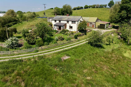
- Price
- Guide Price£575,000
- Size
- 7.3 acres
Added on 09/09/2026House with Land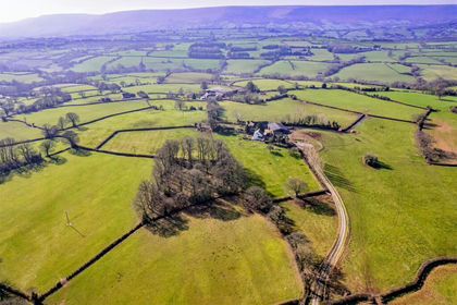
- Price
- Guide Price£750,000
- Size
- 4.82 acres
Added on 17/09/2026House with Land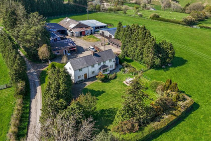
- Price
- Offers in Region of£800,000
- Size
- 26 acres
Added on 13/05/2026Farm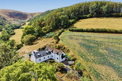
- Price
- Guide Price£700,000
- Size
- 41.8 acres
Added on 04/09/2026Woodland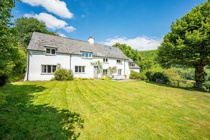
- Price
- £925,000
- Size
- 15 acres
Added on 03/04/2026Farmhouse
- Price
- £775,000
- Size
- 3.5 acres
Leysters with circa 3 acres and annex, Middleton on the Hill, Herefordshire, County of HR6 England
Added on 31/07/2026Barn Conversion