
Lot 3 - Gallowberry Bank, West Mains Farm, Blyth Bridge, Peeblesshire, EH46
- Land size
- 3.24 acres
- Bedrooms
- 4
- Bathrooms
- 2
Key Features
- Modern farmhouse with 4 bedrooms; living/dining room; kitchen/breakfast room; utility room and bathroom
- Approximately 140sqm
- Detached garage. Large and enclosed garden
- High amenity surroundings with outlook onto open woodland and equestrian grazing
- Excellent small holding or equestrian property
- Approximately 1.3 Ha (3.24 acres) of land
Description
CLOSING DATE SET FOR: TUESDAY 6TH OCTOBER 2026 AT 12.00 NOON
ALL offers to be submitted by post or hand delivered in sealed envelopes to our office at 82 High Street, Peebles, EH45 8SW
GENERAL DESCRIPTION
Lot 3 - Gallowberry Bank, West Mains Farm is a modern farmhouse with Hall; 4 bedrooms (one with ensuite shower room); living / dining room; kitchen/breakfast room; utility room; and bathroom. It has a good sized and enclosed garden. There is a detached garage and ample parking. Open woods and grassland suitable for grazing of approximately 1.3 Ha (3.24 acres) surround and give the opportunity for horse/pony grazing or to develop as a stand-alone small holding.
LOCATION
West Mains Farm lies adjacent to and on the north-east and south-west sides of the A72, leading from Blyth Bridge to Peebles, within the north-western edge of Peeblesshire and the Scottish Borders area.
The farm lies approximately ten miles north-west of the town of Peebles and eight miles north-east of the town of Biggar, with Edinburgh City Centre being approximately twenty-five miles to the north-east and accessed by the A701 at Blyth Bridge. Glasgow lies approximately forty-three miles to the north-west.
Biggar offers a good range of local town services, with Peebles providing a larger range of services along with secondary schooling. Nearest primary schooling is at Romano Bridge, approximately two miles to the north.
The nearest livestock market is at Lanark, which is approximately nineteen miles to the west.
The surrounding area is characterised by a mixture of open farmland, commercial forestry, farm woodland and upland areas.
DIRECTIONS
From Edinburgh, take the A703 south from the Hillend junction and joining the A701. Continue through Penicuik on the A701. Approximately three miles south of Penicuik, turn right at the “Leadburn” junction, staying on the A701. Continue on the A701 for approximately nine miles and continue through Blyth Bridge. Immediately after Blyth Bridge, turn left onto the A72 (Signposted “Peebles”). The entrance to West Mains Farm is approximately 200m from the junction.
Post Code: EH46 7AH. It is strongly recommended that you do not rely on Satnav in this rural location and check on a route map prior to any scheduled viewing.
What3Words: ///polar.expand.compiled
LOT 3 – “GALLOWBERRY BANK” AND LAND
DESCRIPTION
“Gallowberry Bank” is an attractive and well-designed modern bungalow, set in a good sized and enclosed garden, with ample parking. It is a timber frame “kit” construction with block/rendered outer walls, under a pitched slate roof.
ACCOMMODATION
Accommodation comprises:
Ground floor – Front door porch; main hall; living/dining room with open fire; kitchen/breakfast room with wall and base units; utility room with boiler; master bedroom with ensuite shower room; two further double bedrooms; one single bedroom; and bathroom
OUTBUILDINGS
Garage – block/rendered walls under slate roof with single up and over door.
COUNCIL TAX
The property is assessed for Council Tax as Band F.
SERVICES
Mains electricity. Mains water. Private drainage. Oil boiler central heating and hot water.
ITEMS INCLUDED
All carpets. Other items may be available by separate negotiation.
HOME REPORT
A copy of the Home Report is available to interested parties from the selling agents.
ENERGY PERFORMANCE CERTIFICATE (EPC)
The property is assessed for EPC purposes as Band C (70).
ACCESS
Access is over a short section of farm road leading from the A72. This private road is also shared with the adjoining farm and in the event of a separate sale of this lot, appropriate access rights will be granted.
AREAS
Mixed open woods and grazings – approximately 1.31 Ha (3.24 acres)
GENERAL INFORMATION
PLANNING AND PLANNING HISTORY
The farm has previously been subject to a Section 75 agreement relating to the farmhouse (“Gallowberry Bank”). A Notice of Discharge in relation to the Section 75 agreement was issued by Scottish Borders Council (Ref 26/00677/MOD75) on 23rd June 2026, for the “Discharge of planning obligation pursuant to planning permission 98/00465/OUT AND 03/01996/FUL”, and the formal Discharge has been signed by Scottish Borders Council.
Further details are available as part of the information pack.
THIRD PARTY RIGHTS AND SERVITUDES
The property is sold together with and subject to all existing rights of way, servitudes, wayleaves, and others, whether contained in the Title Deeds or otherwise and purchasers will be deemed to have satisfied themselves in all such respects.
THIRD PARTY OCCUPANCIES
“Gallowberry Bank” (Lot 3) is currently occupied under a Private Residential Tenancy.
Further details are available as part of the information pack.
MINERAL RIGHTS AND SPORTING RIGHTS
Insofar as these rights form part of the seller’s title, they are included within the sale.
ENTRY
By mutual agreement.
VIEWINGS AND FURTHER INFORMATION
For further information or to arrange an appointment to view please contact Walker Scott Ireland Ltd. Viewing is strictly by appointment. Please note that the fields may be grazed by stock (cattle and sheep) at the time of viewing and viewers must take all steps not to unduly disturb stock or put themselves in danger by approaching stock in a manner that might cause them disturbance.
Interested parties are advised to note interest with Walker Scott Ireland Ltd in order to be kept informed of any closing date that is set. Please note, our client need not accept the highest offer, nor indeed any offer.
INFORMATION PACK
An information pack, including copies of key documents, will be available on request from the selling agents to all those who note interest through their solicitor and can provide acceptable proof of funding.
ANTI-MONEY LAUNDERING REGULATIONS
To comply with current Anti-Money Laundering Regulations, before an offer can be accepted and the property put “Under Offer”, the offer must be accompanied with Notarised/certified photographic evidence of the purchaser’s identity and separate evidence of the purchaser’s residential address, or the offering parties must attend our offices with the original documents. In addition, all offers must be accompanied by clear confirmation of the sources of funding.
SELLER’S SOLICITORS
Turcan Connell, Princes Exchange, 1 Earl Grey St, Edinburgh, EH3 9EE
Tel: 0131 228 8111
W: www.turcanconnell.com
LOCAL AUTHORITY
Scottish Borders Council, Newtown St Boswells, Melrose, TD6 0SA
Tel: 01835 824000
W: www.scotborders.gov.uk
GENERAL NOTICE
Walker Scott Ireland Ltd give notice that: They are not authorised to make or give any representations or warranties in relation to the business or property for sale, either here or elsewhere, either on their own behalf or on behalf of their client or otherwise. These details do not form part of any offer or contract and must not be relied upon as statements or representations of fact. Any areas, measurements or distances are approximate. The text, photographs and plans are for guidance only and are not necessarily comprehensive. Photographs may show parts of neighbouring properties. It should not be assumed that the property has all necessary planning, building regulation or any other consents. No tests to any services, equipment or facilities have been carried out. Purchasers must satisfy themselves in all aspects of the property by inspection and their own due diligence, or otherwise. Photos July/August 2026 and text July/August 2026.
Map Location
Property details
- Tenure
- Freehold
- Council Tax Band
- F
- Date Posted
- 2026-08-26
Market Value Analysis
Compared with 457 Homes with Land listings in Scotland (1+ acres).
Energy Performance Certificate
Energy Efficiency Rating
Based on UK Energy Performance Certificate standards (EU Directive 2002/91/EC)
Running costs are one side. Planning activity, flood history and ground risks for this location are in the full report.
Utilities & Restrictions
Utilities
- Electricity
- Mains
- Water
- Mains
- Heating
- Oil Heating
- Broadband
- Ask Agent
- Sewerage
- Septic Tank / Private
Rights & Restrictions
- Public Rights of Way
- Ask Agent
- Private Rights of Way
- Ask Agent
- Listed Property
- Ask Agent
- Restrictions
- Ask Agent
Listed status, conservation areas and planning constraints for this location are in the full report.
Property Features
- Accessibility
- Ask Agent
- Parking
- Garage, Off-Street Parking
- Garden
- Enclosed Garden
Beyond the particulars: planning activity, flood history, heritage and ground risks, checked for this exact spot.
Connectivity
Broadband
Fastest speed available at this postcode
1.8 Gbps
Gigabit full fibre · available to 78% of premises
Suitable for
- 4K streaming on every screen
- Full-time home working
- Online gaming & big downloads
Mobile signal
Predicted 4G and 5G signal; indoor signal depends on building materials.
Ofcom Connected Nations postcode-level predictions. Speeds and signal are modelled, not measured, and vary between addresses and providers.
Signal is the easy part. Planning activity, flood history and protected designations here are in the full report.
Nearest Schools
Primary
- Newlands Primary School2.6 miles
- Pupils
- 67
- Type
- Non-denominational
- West Linton Primary School4.7 miles
- Pupils
- 215
- Type
- Non-denominational
- Black Mount Primary School5.1 miles
- Pupils
- 46
- Type
- Non-denominational
- Broughton Central P School5.4 miles
- Pupils
- 40
- Type
- Non-denominational
- Biggar Primary School7.1 miles
- Pupils
- 208
- Type
- Non-denominational
Secondary
- Biggar High School7.2 miles
- Pupils
- 637
- Type
- Non-denominational
- Peebles High School8 miles
- Pupils
- 1,342
- Type
- Non-denominational
- Penicuik High School12 miles
- Pupils
- 640
- Type
- Non-denominational
- Beeslack Community High School12 miles
- Pupils
- 751
- Type
- Non-denominational
- West Calder High School13 miles
- Pupils
- 1,132
- Type
- Non-denominational
Distances are straight-line from the advertised location. Source: the national school registers (DfE, Welsh Government, Scottish Government) and Ofsted.
Schools are just the start: planning activity, heritage and any flood history here are in the full report.
Amenities
Supermarket
GP surgery
Pharmacy
Green space
Straight-line distances from the advertised location. Sources: NHS records, Geolytix supermarket locations, OS Open Greenspace and the national trails registers.
The area stacks up? Now check the location itself: planning nearby, protected designations and past flooding.
Getting Around
Nearest station
Nearest bus stop
Typical drive times
Straight-line distances from the advertised location; drive times are typical free-flow times over OpenStreetMap road data, so allow more at peak. Public transport locations from DfT NaPTAN.
Easy to reach matters. So do planning activity, flood history and ground risks: all in the full report.
Flood Risk
SEPA open data, checked around the advertised map pin for the listed acreage. Provided by LandSale, not the listing agent, and not part of the agent's particulars. Risk varies across a holding, so verify before committing.
Rivers and the sea
Surface water
Not at the pin: mapped about 10 metres away.
These bandings are the summary. Where this location sits on the flood maps, plus planning activity, heritage and ground risks, is in the full report.
Important notice: Information, maps and tags on this page are drawn from the advertising agent's marketing materials or generated automatically. LandSale has not verified them. Relying on these details is at your own risk, always carry out independent checks before committing to a purchase.
LandSale full disclaimer
Marketing information only - not formal particulars. The details on this website are provided for general guidance and do not constitute an offer or contract. Neither LandSale nor the advertising estate/land agent accepts responsibility for any inaccuracy.
1. Source of information
- Listing content: Core description, asking price, tenure, measurements, photographs and planning history originate from the marketing materials of the advertising estate or land agent. LandSale does not author this content and cannot guarantee its accuracy.
- Automated tags & categorisation: Property type, land-use class, acreage bands and similar labels may be applied by machine-learning models. They are intended as a helpful guide only and may not reflect the property's legal status or permitted use.
- Third-party & enriched data layers: Maps, boundary outlines, planning designations, soil reports, broadband coverage and other environmental or location-based insights are licensed from external suppliers. Such data are supplied “as is", may be incomplete or out of date and are subject to change without notice.
2. Verification required
Prospective purchasers must verify critical matters, including but not limited to planning permission, title boundaries, public rights of way, environmental constraints, acreage, services, access and VAT status, through their own inspections, specialist surveys, legal advisers and the selling agent before relying on the information or entering into any contract.
3. No warranty or liability
LandSale gives no warranty, express or implied, as to the accuracy, completeness or fitness for any particular purpose of the information displayed. LandSale shall not be liable for any loss, damage, cost or expense arising directly or indirectly from any use of or reliance on such information, save where liability may not be excluded by law.
4. Updates & feedback
If you believe any detail on this listing is inaccurate, please let us know. We will investigate and, where appropriate, update the listing or notify the agent.
© LandSale | Version 1.3 - August 2026
Similar properties for sale
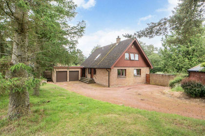
- Price
- Offers Over£650,000
- Size
- 8 acres
Added on 22/07/2026House with Land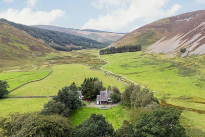
- Price
- Offers Over£450,000
- Size
- 2.9 acres
Added on 17/09/2026House with Land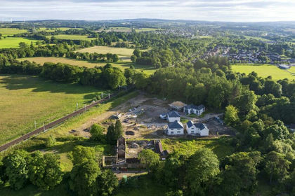
- Price
- Offers Over£600,000
- Size
- 2.78 acres
Added on 29/01/2026Development Land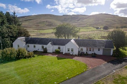
- Price
- Offers Over£595,000
- Size
- 25 acres
Added on 08/10/2026Smallholding
- Price
- Offers Over£425,000
- Size
- 2.9 acres
Added on 24/08/2026House with Land
- Price
- Offers Over£599,000
- Size
- 7.5 acres
Ettrickbridge, Selkirkshire, Berwickshire, Roxburgh and Selkirk, Scottish Borders TD7 Scotland
Added on 02/07/2026House with Land
- Price
- Offers in Excess of£600,000
- Size
- 5.16 acres
Added on 14/09/2026Development Land
- Price
- Offers Over£460,000
- Size
- 18.74 acres
Standrigg Farm, Wallacetown, Falkirk, FK1, Falkirk, Falkirk FK1 Scotland
Added on 18/09/2026Smallholding
- Price
- Offers Over£650,000
- Size
- 6.91 acres
Westwinds, Moffat, DG10, Moffat, Dumfries and Galloway DG10 Scotland
Added on 29/01/2026Development Land
- Price
- Offers Over£590,000
- Size
- 1 acres
Added on 10/08/2026House with Land