Deptford Farm, Wylye, Wiltshire
- Land size
- 499.52 acres
- Bedrooms
- 3
- Bathrooms
- 2
Key Features
- Set within the Wylye Valley
- Profitable commercial building portfolio totalling 3170.8m2
- Two semi-detached farm cottages
- High yielding, Grade 3 commercial farmland
- Direct access onto the A303 with excellent transport links
- Excellent sporting appeal
- In total 499.52 acres (202.15 hectares)
Description
A commercial farm that boasts a profitable income stream, including a range of commercial buildings and two farm cottages. Encompassing 499.52 acres (202.15 hectares) of productive arable land, pasture, and woodland with sporting opportunities, all set in the Wylye Valley.
Introduction - Deptford Farm presents a unique chance to purchase a collection of lucrative commercial buildings totalling 3170.8m2, along with two semi-detached cottages and a ring-fenced block of productive arable land, pastureland and woodland in total 499.52 acres (202.15 hectares)
This is an exceptional opportunity to enhance commercial revenue, making it a rare find for those looking to invest in a sustainable farming enterprise with excellent transport connections directly to the A303.
The land is high yielding, Grade 3 commercial farmland, with lime-rich loamy soils over chalk or limestone. The land is predominantly arable, with areas of pastureland and woodland interspersed throughout. Furthermore, the land is complemented by an established shoot, which is managed in conjunction with a larger enterprise, and it currently includes nine separate drives.
Situation - Deptford Farm is located to the north of the A36/A303 interchange. It comprises range of commercial buildings, two semi-detached cottages all set within 499.52 acres (202.15 hectares) in a ring fence. The topography is characterised by gentle undulations, rising in elevation towards the north in the direction of Salisbury Plain. It is positioned 8.75 miles southeast of Warminster and 12 miles northwest of Salisbury.
The farm enjoys outstanding transport links, with direct access available on the eastern boundary from the A303.
Buildings - A collection of commercial buildings encompassing a total area of 3170.8m2. All buildings are presently leased under three distinct commercial agreements, as detailed in the building schedule.
Originally designed for agricultural purposes to support dairy and arable farming, these buildings now hold B1 and B8 classifications. They produce a significant yearly revenue from reliable, long-term tenants and have the potential to enhance the existing arrangement.
Cottages - A pair of semi-detached cottages, each with a total area of 1098 square feet, located to the east of the commercial buildings.
Each cottage features three bedrooms, a sitting room, a dining room, a kitchen, a utility room, and two bathrooms, along with their own garage and a spacious rear garden.
Both cottages are currently let on Assured Shorthold Tenancy Agreements.
The Land - The land features stunning topography, comprising mainly arable land, alongside areas of Downland grazing and some woodland. The land has been farmed in an arable rotation system, complemented by mixed livestock grazing on pasture. The woodlands consist of both mature and young plantations, with excellent access provided by tracks and rides. All arable land can be accessed through hardcore tracks and is classified as Grade 3, with certain regions classified as Grade 2.
The arable land is currently managed in a contract farming agreement with the neighbouring landowner, resulting in clean and high-yield crops that have been skilfully cultivated. The cropping rotations are strategically planned to preserve soil health, generally incorporating wheat, barley, oilseed , and oats, all of which achieve and produce premium quality. For many years, variable rate fertiliser applications have been employed, leading to soils that demonstrate elevated levels of organic matter and a balanced pH throughout all parcels.
The grassland has been preserved with an emphasis on environmental sustainability, serving as a significant resource for local wildlife. The downland sustains a species-rich grassland abundant with flowering herb varieties. The ungrazed pasture areas exhibit a remarkable diversity of flowering plants that contribute to a robust and biodiverse ecosystem.
The woodland is divided into three distinct blocks, designed to facilitate shooting and sporting activities across the land. The northern block features mature coniferous trees interspersed with younger broadleaf plantations. The central block comprises four belts of mixed trees, predominantly broadleaf, of different ages. The southern block consists of two distinct areas: one is a mature coniferous plantation, while the other is a younger mixed plantation.
Sporting - The farm’s rolling landscape, combined with thoughtfully placed woodlands, facilitates an exceptional game shoot across nine designated drives. Three of these drives are integrated within the woodland, and the shoot operates as a component of a broader collaboration with a nearby landowner.
The sporting rights are included within the sale, but the owners will retain the 2026/2027 season to satisfy the current lease.
Designations - The land is in the Salisbury Plain and West Wiltshire Downs National Character Area.
The southern half of the land is located within the Cranborne Chase & West Wiltshire Downs Areas of Outstanding Natural Beauty.
The land is in a Nitrate Vulnerable Zone.
Access, Easements, Wayleaves And Rights Of Way - A personal right of way will be retained for the current owner and their immediate family to traverse the land on foot.
There are no registered public rights of way on the property.
Access to the land is provided from the Public Highway in Deptford Village, traversing land retained by the local highway authority and the vendors. Additionally, there is direct gated access from the A303 along the eastern boundary.
The land is sold subject to a right of way for access to the Telecommunication Masts.
Services - Private water supply, mains electricity.
Cottages 1 and 2 feature oil central heating and are connected to a septic tank for drainage.
Borehole situated at Grid Reference: SU . Registration number SU04SW10.
Reservoir positioned at Field Reference SU01390694, leading to the Pump house at Grid reference: SU .
The current water supply services the cottages situated in Deptford, as well as the adjacent land on the western boundary, which incurs an annual surcharge. The buyer will be obligated to maintain this supply.
Mineral Rights - Mineral rights are included in the sale.
Sporting - The sporting rights will be retained for the 2026/2027 season.
Overage - A part of the property indicated with hatching will be sold with an overage provision applicable to future development. This provision will not cover agricultural, horticultural, or equestrian developments. The overage will remain in effect for 30 years from the completion date, applying to 30% of any value increase resulting from the granting of planning permission.
Telecommunications Masts - There are two operational telecommunication masts and one redundant mast that are currently under existing leases.
Vat - In addition to the purchase price, should any sale of the property, or any right attached to it, become a chargeable supply for the purposes of Value Added Tax, such tax shall be payable by the purchasers in addition to any monies to be paid during the course of the sale and the purchaser shall indemnify the vendors in respect thereof, including interest, or penalty.
Local Authority - Wiltshire Council –
Tenure And Possession - Freehold with vacant possession subject to the existing contract farming agreement, current commercial leases of all the buildings and yard area and current Assured Shorthold Tenancies on both cottages.
The land will be sold subject to holdover for harvest 2026 and subject to existing telecommunication lease agreements.
Directions - What3words ///comedians.stopped.magical
Viewing - All viewings strictly by appointment with the vendor’s agent Gabriella Placidi on .
Map Location
Property details
- Tenure
- Freehold
- Council Tax Band
- Ask Agent
- Date Posted
- 2026-08-08
Market Value Analysis
Compared with 20 Farms & Smallholdings listings in South West England (100+ acres).
Energy Performance Certificate
Energy Efficiency Rating
Based on UK Energy Performance Certificate standards (EU Directive 2002/91/EC)
Running costs are one side. Planning activity, flood history and ground risks for this location are in the full report.
Utilities & Restrictions
Utilities
- Electricity
- Mains
- Water
- Private Supply
- Heating
- Oil Heating
- Broadband
- Ask Agent
- Sewerage
- Septic Tank / Private
Rights & Restrictions
- Public Rights of Way
- Ask Agent
- Private Rights of Way
- Yes
- Listed Property
- Ask Agent
- Restrictions
- Yes
Listed status, conservation areas and planning constraints for this location are in the full report.
Property Features
- Accessibility
- Ask Agent
- Parking
- Parking Available
- Garden
- Garden
Beyond the particulars: planning activity, flood history, heritage and ground risks, checked for this exact spot.
Connectivity
Broadband
Fastest speed available at this postcode
1 Gbps
Gigabit full fibre
Suitable for
- 4K streaming on every screen
- Full-time home working
- Online gaming & big downloads
Mobile signal
Predicted 4G and 5G signal; indoor signal depends on building materials.
Ofcom Connected Nations postcode-level predictions. Speeds and signal are modelled, not measured, and vary between addresses and providers.
Signal is the easy part. Planning activity, flood history and protected designations here are in the full report.
Nearest Schools
Primary
- Wylye Valley Church of England Voluntary Aided Primary School2.9 milesNo Ofsted rating
- Ages
- 5 to 11
- Pupils
- 129
- Type
- Voluntary aided school
- Faith
- Church of England
- Dinton CofE Primary School4.2 milesNo Ofsted rating
- Ages
- 4 to 11
- Pupils
- 66
- Type
- Academy converter
- Faith
- Church of England
- Chilmark and Fonthill Bishop Church of England Aided Primary School4.4 milesOfsted: Good
- Ages
- 4 to 11
- Pupils
- 48
- Type
- Voluntary aided school
- Faith
- Church of England
- Great Wishford CofE (VA) Primary School4.6 milesOfsted: Good *
- Ages
- 4 to 11
- Pupils
- 55
- Type
- Academy sponsor led
- Faith
- Church of England
- Shrewton CofE Primary School5 milesOfsted: Good
- Ages
- 4 to 11
- Pupils
- 141
- Type
- Academy sponsor led
- Faith
- Church of England
Secondary
- Sarum Academy7.6 milesNo Ofsted rating
- Ages
- 11 to 18
- Pupils
- 747
- Type
- Academy sponsor led
- Faith
- Church of England
- Kingdown School8.8 milesNo Ofsted rating
- Ages
- 11 to 18
- Pupils
- 1,347
- Type
- Academy converter
- South Wilts Grammar School9.2 milesOfsted: Good
- Ages
- 11 to 18
- Pupils
- 1,200
- Type
- Academy converter
- Gender
- Girls
- The Stonehenge School9.5 milesNo Ofsted rating
- Ages
- 11 to 16
- Pupils
- 1,072
- Type
- Community school
- Bishop Wordsworth's Church of England Grammar School9.9 milesOfsted: Outstanding
- Ages
- 11 to 18
- Pupils
- 1,193
- Type
- Academy converter
- Faith
- Church of England
- Gender
- Boys
* Latest graded judgement covers quality of education only; no overall grade was issued under the 2024-25 inspection framework.
Distances are straight-line from the advertised location. Source: the national school registers (DfE, Welsh Government, Scottish Government) and Ofsted.
Schools are just the start: sold prices nearby, planning activity and any flood history are in the full report.
Amenities
Supermarket
GP surgery
Pharmacy
Hospital
Green space
Straight-line distances from the advertised location. Sources: NHS records, Geolytix supermarket locations, OS Open Greenspace and the national trails registers.
The area stacks up? Now check the location itself: planning nearby, protected designations and past flooding.
Getting Around
Nearest station
Nearest bus stop
Typical drive times
Straight-line distances from the advertised location; drive times are typical free-flow times over OpenStreetMap road data, so allow more at peak. Public transport locations from DfT NaPTAN.
Easy to reach matters. So do planning activity, flood history and ground risks: all in the full report.
Flood Risk
Environment Agency open data, checked around the advertised map pin for the listed acreage. Long-term risk counts flood defences; the planning map's flood zones do not. Provided by LandSale, not the listing agent, and not part of the agent's particulars. Risk varies across a holding, so verify before committing.
Rivers and the sea
Not at the pin: mapped about 330 metres away.
Planning map: Flood Zone 3, about 210 metres away.
Surface water
Not at the pin: mapped about 40 metres away.
These bandings are the summary. Where this location sits on the flood maps, plus planning activity, heritage and ground risks, is in the full report.
Important notice: Information, maps and tags on this page are drawn from the advertising agent's marketing materials or generated automatically. LandSale has not verified them. Relying on these details is at your own risk, always carry out independent checks before committing to a purchase.
LandSale full disclaimer
Marketing information only - not formal particulars. The details on this website are provided for general guidance and do not constitute an offer or contract. Neither LandSale nor the advertising estate/land agent accepts responsibility for any inaccuracy.
1. Source of information
- Listing content: Core description, asking price, tenure, measurements, photographs and planning history originate from the marketing materials of the advertising estate or land agent. LandSale does not author this content and cannot guarantee its accuracy.
- Automated tags & categorisation: Property type, land-use class, acreage bands and similar labels may be applied by machine-learning models. They are intended as a helpful guide only and may not reflect the property's legal status or permitted use.
- Third-party & enriched data layers: Maps, boundary outlines, planning designations, soil reports, broadband coverage and other environmental or location-based insights are licensed from external suppliers. Such data are supplied “as is", may be incomplete or out of date and are subject to change without notice.
2. Verification required
Prospective purchasers must verify critical matters, including but not limited to planning permission, title boundaries, public rights of way, environmental constraints, acreage, services, access and VAT status, through their own inspections, specialist surveys, legal advisers and the selling agent before relying on the information or entering into any contract.
3. No warranty or liability
LandSale gives no warranty, express or implied, as to the accuracy, completeness or fitness for any particular purpose of the information displayed. LandSale shall not be liable for any loss, damage, cost or expense arising directly or indirectly from any use of or reliance on such information, save where liability may not be excluded by law.
4. Updates & feedback
If you believe any detail on this listing is inaccurate, please let us know. We will investigate and, where appropriate, update the listing or notify the agent.
© LandSale | Version 1.3 - August 2026
Listing agent
Symonds & Sampson, Salisbury
Units 6 & 7 Chapel Barnyard, Deptford Farm, Deptford, Wylye, Warminster, Wiltshire, BA12 0QQ
View agent profileSimilar properties for sale
- Price
- Guide Price£4,500,000
- Size
- 52 acres
Added on 07/07/2026Country Estate
- Price
- Guide Price£6,250,000
- Size
- 36 acres
Upper Vobster Farm, Upper Vobster, Radstock, Mells, Somerset BA3 England
Added on 11/06/2026Country Estate
- Price
- £4,000,000
- Size
- 25 acres
Danes Road, Awbridge, Romsey, SO51, Awbridge, Hampshire SO51 England
Added on 08/08/2026House with Land
- Price
- £3,850,000
- Size
- 2 acres
Horsebridge, Stockbridge, Hampshire, SO20, Kings Somborne, Hampshire SO20 England
Added on 17/06/2026Mill Conversion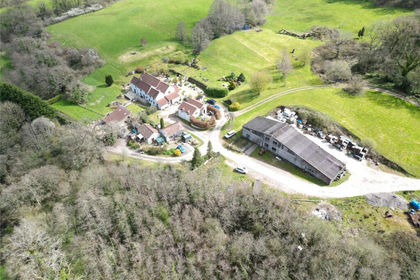
- Price
- £3,750,000
- Size
- 105 acres
Whitehole Farm, Leigh Upon Mendip, Leigh-on-Mendip, Somerset BA3 England
Added on 25/04/2026Country Estate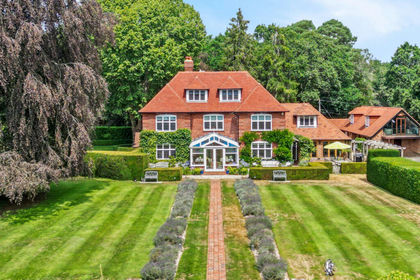
- Price
- Guide Price£3,750,000
- Size
- 6.5 acres
St. Aubyns Lane, Hangersley, Ringwood, Hampshire, BH24, Ringwood, Hampshire BH24 England
Added on 09/09/2026House with Land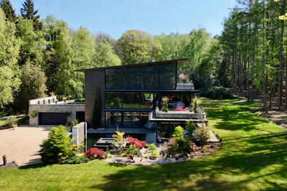
- Price
- Guide Price£4,750,000
- Size
- 22 acres
Gardeners Lane, East Wellow, Romsey, Hampshire, SO51, Wellow, Hampshire SO51 England
Added on 25/04/2026House with Land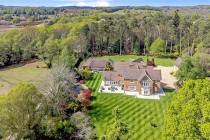
- Price
- £3,950,000
- Size
- 5 acres
Emery Down, Lyndhurst, Hampshire, SO43, Minstead, Hampshire SO43 England
Added on 26/03/2026Country Home
- Price
- £3,950,000
- Size
- 5 acres
Emery Down, Lyndhurst, SO43, Minstead, Hampshire SO43 England
Added on 10/09/2026Country Home
- Price
- £4,950,000
- Size
- 3.48 acres
Broadlands Road, Brockenhurst, SO42, Brockenhurst, Hampshire SO42 England
Added on 07/09/2026Country Home