Branscombe, Nr Sidmouth, Devon, EX12
- Land size
- 58 acres
- Bedrooms
- 8
- Bathrooms
- 5
Description
An ancient and historic Grade II* listed manor house and associated estate for modernisation at the head of a wooded combe running down to the coast.
Manor House
• 3 main reception rooms
• 8 bedrooms
• 5 bathrooms
• Spiral staircase
• Potential top floor flat
Outside
• Courtyard of stone outbuildings with garaging and workshop
• First floor studio
• Attached 3 bedroom converted barn
• Fig Tree Cottage used as pool house
• Gardens around the house
• About 13 acres of grazing in front of the house
• About 41 acres of broad-leaved woodlands
• About 58 acres in all
Situation
Edge Barton Manor Estate is situated on the edge of the parish of Branscombe, which is about midway between the coastal towns of Sidmouth and Lyme Regis on the beautiful East Devon Coast. It is withing the East Devon Area of Outstanding Natural Beauty and about 1 mile in land from the “Jurrasic coast”.
It lies on a favoured south sloping bank surrounded by farm and woodland at the end of a no through lane in a settlement of about 7 other properties. From the property a public path leads down the combe to the lower village and beach at Branscombe.
Historic Note
Edge Barton is one of Devon’s oldest surviving manor houses, with a documented history spanning around 800 years. Originally the seat of the Branscombe (Bronescombe) family, including Walter Bronescombe, Bishop of Exeter, it passed in 1377 to the Wadham family, whose most notable member was Nicholas Wadham, founder of Wadham College, Oxford. Through inheritance it later belonged to the Wyndhams and Strangeways before becoming a tenanted farmhouse for over three centuries. In the 19th and 20th centuries it underwent
significant alterations under successive owners. Since 1996 it has been owned by the vendor.
Although extensively altered, its plan still reflects a medieval courtyard house centred on a late 15th-century great hall, with evidence of an earlier chapel and several phases of rebuilding. Architectural changes, including relocated doorways, staircases and fireplaces, reveal the building’s gradual adaptation rather than a single coherent design.
The interior retains many features of interest despite the loss of some original fittings. These include restored medieval roof trusses, carved Beer stone fireplaces, decorative plasterwork and scratched graffiti dating from the early 17th century.
Description
The Edge Barton Manor Estate is a small country estate comprising the main listed manor house supported by outbuildings, an annexe and a barn conversion all standing in grounds of around 58 acres.
Edge Barton Manor House is a fine Grade II* listed country house dating in parts from the 13th and 14th Centuries, with later additions and alterations, most recently with modernisations in the 19th Century. It forms the principal structure in the group of buildings that include a courtyard of former service buildings, the Thatched Barn, Fig Tree Cottage and a former granary, all of which are separately listed Grade II.
Inside the house, there is much evidence of its long history with use of stonework, woodwork, spiral staircase, open fireplaces, and stone mullioned leaded light windows. The house adjoins the courtyard of stone outbuildings which have been converted into domestic use. Part of the courtyard has been developed into a workshop/studio/ annexe, (The Thatched Barn) which has been used as a separate 3-bedroom house with its own access, garden area and services. The remainder of the courtyard accommodates garaging, storage and a garden room/conservatory on the ground floor with another studio on the first floor. In addition to the courtyard within the curtilage of the house there are other outbuildings which have separate Grade II listing and include Fig Tree Cottage, another converted barn that is now used as a pool house, The single storey former granary, which is detached from the other buildings and is used for general domestic storage.
The house and buildings stand in simple gardens that surround the house and are separated into different areas by stone retaining walls. There is parking within the courtyard and a separate area outside and behind The Thatched Barn.
The land includes the park fields in the combe immediately in front of the house. They have been grazed with sheep under an informal annual licence. The pasture extends to about 13 acres and within it there are two areas fenced off for ponds.
The woodlands form the higher ground either side of the combe and the setting for the house and buildings. They are served by some informal paths and are predominantly mature native hardwood species.
Map Location
Property details
- Tenure
- Freehold
- Council Tax Band
- H
- Date Posted
- 2026-07-24
Market Value Analysis
Compared with 24 Homes with Land listings in South West England (50+ acres).
Utilities & Restrictions
Utilities
- Electricity
- Mains
- Water
- Private Supply
- Heating
- Oil Heating
- Broadband
- Ask Agent
- Sewerage
- Septic Tank / Private
Rights & Restrictions
- Public Rights of Way
- Yes
- Private Rights of Way
- Ask Agent
- Listed Property
- Yes
- Restrictions
- Ask Agent
Listed status, conservation areas and planning constraints for this location are in the full report.
Property Features
- Accessibility
- Ask Agent
- Parking
- Parking Available
- Garden
- Garden
Beyond the particulars: planning activity, flood history, heritage and ground risks, checked for this exact spot.
Connectivity
Broadband
Fastest speed available at this postcode
13 Mbps
Standard (10-30 Mbps)
Suitable for
- Web & social
- Music streaming
- Standard video calls
Mobile signal
Outdoor predictions; indoor signal depends on building materials.
Ofcom Connected Nations postcode-level predictions. Speeds and signal are modelled, not measured, and vary between addresses and providers.
Signal is the easy part. Planning activity, flood history and protected designations here are in the full report.
Nearest Schools
Primary
- Branscombe Church of England Primary School1.1 milesNo Ofsted rating
- Ages
- 2 to 11
- Pupils
- 6
- Type
- Academy converter
- Faith
- Church of England
- Beer Church of England Primary School2.5 milesOfsted: Good
- Ages
- 4 to 11
- Pupils
- 94
- Type
- Academy converter
- Faith
- Church of England
- Sidbury Church of England Primary School3 milesOfsted: Good
- Ages
- 4 to 11
- Pupils
- 127
- Type
- Academy converter
- Faith
- Church of England
- Seaton Primary School3.7 milesOfsted: Good
- Ages
- 4 to 11
- Pupils
- 377
- Type
- Community school
- Sidmouth Church of England Primary School3.9 milesOfsted: Good *
- Ages
- 2 to 11
- Pupils
- 448
- Type
- Academy converter
- Faith
- Church of England
Secondary
- Sidmouth College3.5 milesOfsted report card · Mar 2026
- Ages
- 11 to 18
- Pupils
- 825
- Type
- Academy converter
- Colyton Grammar School4 milesOfsted: Outstanding
- Ages
- 11 to 18
- Pupils
- 1,083
- Type
- Academy converter
- The King's School6.9 milesOfsted: Good *
- Ages
- 11 to 18
- Pupils
- 1,097
- Type
- Academy converter
- Honiton Community College7 milesOfsted: Good *
- Ages
- 11 to 16
- Pupils
- 637
- Type
- Academy converter
- Axe Valley Academy8.9 milesOfsted: Good
- Ages
- 11 to 16
- Pupils
- 741
- Type
- Academy sponsor led
* Latest graded judgement covers quality of education only; no overall grade was issued under the 2024-25 inspection framework.
Distances are straight-line from the advertised location. Source: the national school registers (DfE, Welsh Government, Scottish Government) and Ofsted.
Schools are just the start: sold prices nearby, planning activity and any flood history are in the full report.
Amenities
Supermarket
GP surgery
Pharmacy
Hospital
Walking trail
Straight-line distances from the advertised location. Sources: NHS records, Geolytix supermarket locations, OS Open Greenspace and the national trails registers.
The area stacks up? Now check the location itself: planning nearby, protected designations and past flooding.
Getting Around
Nearest station
Nearest bus stop
Typical drive times
Straight-line distances from the advertised location; drive times are typical free-flow times over OpenStreetMap road data, so allow more at peak. Public transport locations from DfT NaPTAN.
Easy to reach matters. So do planning activity, flood history and ground risks: all in the full report.
Flood Risk
From Environment Agency flood map open data, checked around the advertised map pin and allowing for the listed acreage where known. This summary comes from LandSale, the advertising platform, not from the listing agent, and is not part of the agent's particulars. Risk can vary across a single holding, so verify anything critical through your own searches before committing.
Rivers and the sea
Mapped within the area searched, not at the advertised map pin itself.
Surface water
Mapped within the area searched, not at the advertised map pin itself.
The detail behind these bandings
The full report pinpoints where this location sits on the flood maps, and runs the deeper checks that usually only surface after an offer.
- Exact flood zones & annual chances (included in the full report)
- Any recorded past flooding (included in the full report)
- Planning activity nearby (included in the full report)
- Heritage & conservation (included in the full report)
- Protected nature designations (included in the full report)
- Ground risks (included in the full report)
- Sold prices nearby (included in the full report)
£14.99 · one-off purchase
By LandSale, the platform. Not provided by the listing agent. Ready in about a minute.
Important notice: Information, maps and tags on this page are drawn from the advertising agent's marketing materials or generated automatically. LandSale has not verified them. Relying on these details is at your own risk, always carry out independent checks before committing to a purchase.
LandSale full disclaimer
Marketing information only - not formal particulars. The details on this website are provided for general guidance and do not constitute an offer or contract. Neither LandSale nor the advertising estate/land agent accepts responsibility for any inaccuracy.
1. Source of information
- Listing content: Core description, asking price, tenure, measurements, photographs and planning history originate from the marketing materials of the advertising estate or land agent. LandSale does not author this content and cannot guarantee its accuracy.
- Automated tags & categorisation: Property type, land-use class, acreage bands and similar labels may be applied by machine-learning models. They are intended as a helpful guide only and may not reflect the property's legal status or permitted use.
- Third-party & enriched data layers: Maps, boundary outlines, planning designations, soil reports, broadband coverage and other environmental or location-based insights are licensed from external suppliers. Such data are supplied “as is", may be incomplete or out of date and are subject to change without notice.
2. Verification required
Prospective purchasers must verify critical matters, including but not limited to planning permission, title boundaries, public rights of way, environmental constraints, acreage, services, access and VAT status, through their own inspections, specialist surveys, legal advisers and the selling agent before relying on the information or entering into any contract.
3. No warranty or liability
LandSale gives no warranty, express or implied, as to the accuracy, completeness or fitness for any particular purpose of the information displayed. LandSale shall not be liable for any loss, damage, cost or expense arising directly or indirectly from any use of or reliance on such information, save where liability may not be excluded by law.
4. Updates & feedback
If you believe any detail on this listing is inaccurate, please let us know. We will investigate and, where appropriate, update the listing or notify the agent.
© LandSale | Version 1.3 - August 2026
Listing agent
Jackson-Stops, Exeter
13 Southernhay West Exeter EX1 1PJ
Similar properties for sale
- Price
- Guide Price£2,500,000
- Size
- 32 acres
Combe Raleigh, Honiton, Devon, EX14, Combe Raleigh, Devon EX14 England
Added on 22/07/2026Country Estate
- Price
- Guide Price£2,000,000
- Size
- 30 acres
Pound Lane, Upottery, Honiton, Devon, Upottery, Devon EX14 England
Added on 25/07/2026House with Land
- Price
- Guide Price£2,250,000
- Size
- 50 acres
Pound Lane, Upottery, Honiton, Devon, Upottery, Devon EX14 England
Added on 20/07/2026House with Land
- Price
- Guide Price£2,500,000
- Size
- 62 acres
Cadeleigh, Tiverton, Devon, EX16, Cruwys Morchard, Devon EX16 England
Added on 07/07/2026Country Estate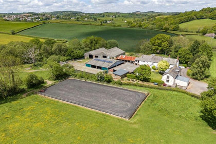
- Price
- Guide Price£1,550,000
- Size
- 40.85 acres
Tedburn St. Mary, Exeter, Devon, EX6, Tedburn St. Mary, Devon EX6 England
Added on 06/06/2026Farm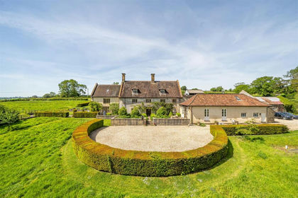
- Price
- Guide Price£2,250,000
- Size
- 29.63 acres
Higher Holway Farm, Cattistock, Dorchester, Cattistock, Dorset DT2 England
Added on 21/07/2026House with Land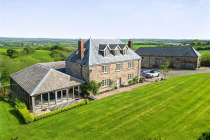
- Price
- Guide Price£1,700,000
- Size
- 45.7 acres
Ash Mill, South Molton, Devon, EX36, Rose Ash, Devon EX36 England
Added on 22/05/2026Smallholding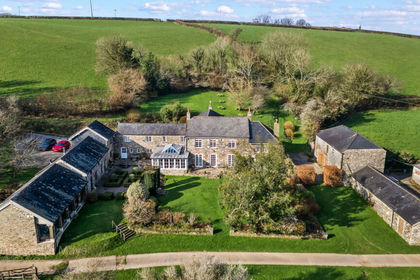
- Price
- Guide Price£1,950,000
- Size
- 33.08 acres
Added on 28/08/2026House with Land
- Price
- Guide Price£1,795,000
- Size
- 42.51 acres
Fifehead Neville, Sturminster Newton, Dorset, Fifehead Neville, Dorset DT10 England
Added on 08/04/2026Country Estate
- Price
- Guide Price£1,650,000
- Size
- 32.52 acres
Chittlehamholt, Chittlehamholt, Umberleigh, Devon, EX37, Chittlehamholt, Devon EX37 England
Added on 07/09/2026Country Estate