Higher Holway Farm, Cattistock, Dorchester
- Land size
- 29.63 acres
- Bedrooms
- 9
- Bathrooms
- 5
Key Features
- Grade II Listed country house dating from circa 1760
- Elevated and private rural setting with far-reaching countryside views
- Two-bedroom annexe and attached three-bedroom cottage
- Outdoor swimming pool and all-weather tennis court
- Extensive range of traditional barns, workshops and stabling
- Beautifully landscaped gardens, formal parterre and paddocks
- Set in 29.63 acres of gardens, pasture and grazing land
Description
A substantial Grade II Listed country house occupying an elevated private setting with cottage, swimming pool, tennis court, annex and extensive outbuildings sat within 29.63 acres of pasture and gardens.
The Property - Higher Holway Farm is a distinguished Grade II Listed farmhouse, believed to date from around 1760, occupying an elevated and private position within the Dorset countryside. Approached via a private driveway of approximately half a mile through its own paddocks, the property enjoys a strong sense of arrival and commands far-reaching views across its surrounding land and the wider landscape beyond.
Over the years, the house has been thoughtfully extended and carefully improved, resulting in a substantial family home that successfully combines period character with the requirements of modern living. The principal accommodation is arranged around a series of well-proportioned reception rooms, many of which enjoy a dual or triple aspect and outlooks across the gardens and countryside. A significant proportion of the ground floor benefits from stone flooring with underfloor heating, providing both practicality and comfort.
The drawing room is particularly impressive. Added as part of a later extension, its triple-aspect design makes the most of the property's elevated setting, allowing natural light to fill the room throughout the day while framing the surrounding views. The reception hall, currently arranged as a family room, provides an equally versatile space and is of a scale that would lend itself to a variety of uses.
Forming the heart of the house is the kitchen and breakfast room, an impressive open-plan space with a vaulted trussed ceiling and direct access to the terrace gardens. The kitchen is centred around a traditional six-oven Aga and substantial wooden island with maple worktop, while a granite-topped breakfast bar subtly separates the preparation area from the informal seating space beyond. There is ample room for dining and relaxed family living, making this a natural gathering place within the house.
The bedroom accommodation is arranged over the upper floors and provides considerable flexibility. The principal suite occupies a private position on the first floor and includes a mirrored dressing area, adjoining bathroom and a further dressing room, which could equally serve as a nursery or study. At the opposite end of the landing is a generous guest suite with its own bathroom and dressing room. The second floor provides three further bedrooms, two bathrooms, one of which is en suite, together with a spacious playroom.
A self-contained two-bedroom annexe is incorporated within the house and benefits from its own independent access, providing excellent ancillary accommodation for guests, extended family or staff.
In addition to the principal house is The Byre, a detached three-bedroom cottage with separate access and parking. Adjoining the cottage is a useful office building comprising two offices, creating an ideal environment for home working or the operation of a small business.
Outside - The gardens and grounds have been carefully developed to complement both the house and its setting. Extensive paved terraces wrap around three sides of the property, interspersed with herbaceous borders and providing a variety of areas for outdoor dining and entertaining. On the southern elevation, the terrace widens to create a particularly attractive entertaining space overlooking the gardens and surrounding countryside.
Beyond the house, a circular lawn extends towards a ha-ha, preserving uninterrupted views across the paddocks beyond. Adjacent to the tennis court is a formal parterre garden designed by Veronica Mackinnon, planted with roses and ornamental shrubs, providing an attractive contrast to the wider landscape.
A sheltered courtyard garden accommodates an outdoor swimming pool, framed by traditional stone and timber farm buildings. The pool is surrounded by generous paved terraces, creating a private and sheltered setting for relaxation and entertaining, while remaining entirely in keeping with the character of the wider property.
Complementing the residential accommodation is an extensive range of traditional barns, workshops and stabling, providing excellent ancillary facilities and offering considerable flexibility for equestrian, agricultural, storage or leisure uses.
The gardens are enclosed by established hedgerows and merge seamlessly with the surrounding pastureland, creating a notable sense of privacy and cohesion throughout the holding. The paddocks are well suited to equestrian or amenity use and surround the house on all sides, enhancing the property's rural character and setting.
In all, Higher Holway Farm sits in 29.63 acres, comprising formal gardens, paddocks and grazing land, and represents a rare opportunity to acquire a substantial country house in an elevated and private setting within the Dorset countryside.
Situation - Higher Holway Farm occupies a rural position on the edge of a valley, set amidst rolling West Dorset countryside. The property is located in an Area of Outstanding Natural Beauty between the villages of Evershot and Cattistock. Evershot is an attractive village with a church, public house, the Summer Lodge Hotel/Restaurant, a village shop and a primary school. Other villages of note in the area include Halstock, Rampisham and Maiden Newton, which have a variety of amenities. Towns in the locality include the county town of Dorchester, the regional centre of Yeovil, as well as Beaminster and Bridport, all of which provide an excellent variety of shopping, educational and recreational facilities. Independent schools include Sherborne Prep School, Sherborne School for Girls, Sherborne School for Boys, Milton Abbey, Bryanston, Leweston and Perrot Hill.
Sporting facilities in the area include hunting with the Cattistock Hunt and golf at Sherborne, Yeovil or Dorchester. Water sports are available along the Dorset coastline at Weymouth Bay, West Bay and Lyme Regis. There is horse racing at Wincanton, Exeter and Bath and league football at Yeovil. Communications in the area include a branch line station at Maiden Newton and mainline stations at Dorchester and Yeovil (to London Waterloo). For routes by car to London and Devon, the A303 is located to the North of Yeovil and the A31 can be joined at Bere Regis.
Directions - what3words///family.peanut.polishing
Services - Mains electricity.
Private spring water supply.
Domestic small sewage treatment system.
Oil-fired central heating and air source heat pump, open fire, and underfloor heating.
EV Charging
Broadband - Ultrafast speed available.
Wessex Internet available.
Mobile - There is mobile coverage in the area, please refer to Ofcom’s website for more details.
Council Tax Band: (Dorset Council - )
Higher Holway Farm - H
The Byre - B
Material Information - Photos were taken in May 2026.
Grade II Listed.
Public rights of access – Bridleway DT|S12|14 crosses the land.
All of the property is in a Nitrate Vulnerable Zone (NVZ)
All of the property is in the Dorset National Landscape (formerly AONB)
The land is classified as Grade 3 on the Agricultural Land Classification Maps
Map Location
Property details
- Tenure
- Freehold
- Council Tax Band
- H
- Date Posted
- 2026-07-21
Price history
| Date | Change | Price |
|---|---|---|
| 5 Sep 2026 | Reduced 10% (−£250,000) | £2,250,000 |
| Until 5 Sep 2026 | Asking price | £2,500,000 |
Market Value Analysis
Compared with 61 Homes with Land listings in South West England (25+ acres).
Utilities & Restrictions
Utilities
- Electricity
- Mains
- Water
- Private Supply
- Heating
- Oil Heating, Open Fire, Underfloor Heating
- Broadband
- Full Fibre (FTTP)
- Sewerage
- Septic Tank / Private
Rights & Restrictions
- Public Rights of Way
- Yes
- Private Rights of Way
- Ask Agent
- Listed Property
- Yes
- Restrictions
- Yes
Listed status, conservation areas and planning constraints for this location are in the full report.
Property Features
- Accessibility
- Ask Agent
- Parking
- Driveway, EV Charger
- Garden
- Garden
Beyond the particulars: planning activity, flood history, heritage and ground risks, checked for this exact spot.
Connectivity
Broadband
Fastest speed available at this postcode
1 Gbps
Gigabit full fibre · available to 25% of premises
Suitable for
- 4K streaming on every screen
- Full-time home working
- Online gaming & big downloads
Mobile signal
Predicted 4G and 5G signal; indoor signal depends on building materials.
Ofcom Connected Nations postcode-level predictions. Speeds and signal are modelled, not measured, and vary between addresses and providers.
Signal is the easy part. Planning activity, flood history and protected designations here are in the full report.
Nearest Schools
Primary
- Sticklands Church of England Voluntary Aided Primary School1.9 milesOfsted: Good *
- Ages
- 5 to 11
- Pupils
- 70
- Type
- Voluntary aided school
- Faith
- Church of England
- Maiden Newton, Greenford Church of England Primary School2.4 milesOfsted: Good
- Ages
- 4 to 11
- Pupils
- 137
- Type
- Voluntary controlled school
- Faith
- Church of England
- Cerne Abbas CofE VC First School4.8 milesOfsted: Good
- Ages
- 3 to 9
- Pupils
- 77
- Type
- Voluntary controlled school
- Faith
- Church of England
- Powerstock Church of England Voluntary Aided Primary School5.6 milesOfsted: Requires improvement
- Ages
- 4 to 11
- Pupils
- 33
- Type
- Voluntary aided school
- Faith
- Church of England
- St Andrew's Church of England Primary School5.8 milesOfsted report card · Mar 2026
- Ages
- 4 to 11
- Pupils
- 99
- Type
- Academy converter
- Faith
- Church of England
Secondary
- Beaminster School6.7 milesOfsted: Good
- Ages
- 11 to 18
- Pupils
- 673
- Type
- Voluntary controlled school
- Faith
- Christian
- The Sir John Colfox Academy8.3 milesNo Ofsted rating
- Ages
- 11 to 18
- Pupils
- 756
- Type
- Academy converter
- The Thomas Hardye School9.4 milesOfsted: Good *
- Ages
- 13 to 18
- Pupils
- 2,014
- Type
- Academy converter
- Dorchester Middle School9.5 milesOfsted report card · Jun 2026
- Ages
- 9 to 13
- Pupils
- 527
- Type
- Academy converter
- Preston School Academy9.6 milesOfsted: Good
- Ages
- 11 to 16
- Pupils
- 1,003
- Type
- Academy converter
* Latest graded judgement covers quality of education only; no overall grade was issued under the 2024-25 inspection framework.
Distances are straight-line from the advertised location. Source: the national school registers (DfE, Welsh Government, Scottish Government) and Ofsted.
Schools are just the start: sold prices nearby, planning activity and any flood history are in the full report.
Amenities
Supermarket
GP surgery
Pharmacy
Hospital
Green space
Straight-line distances from the advertised location. Sources: NHS records, Geolytix supermarket locations, OS Open Greenspace and the national trails registers.
The area stacks up? Now check the location itself: planning nearby, protected designations and past flooding.
Getting Around
Nearest station
Nearest bus stop
Typical drive times
Straight-line distances from the advertised location; drive times are typical free-flow times over OpenStreetMap road data, so allow more at peak. Public transport locations from DfT NaPTAN.
Easy to reach matters. So do planning activity, flood history and ground risks: all in the full report.
Flood Risk
Environment Agency open data, checked around the advertised map pin for the listed acreage. Long-term risk counts flood defences; the planning map's flood zones do not. Provided by LandSale, not the listing agent, and not part of the agent's particulars. Risk varies across a holding, so verify before committing.
Rivers and the sea
Planning map: Flood Zone 1.
Surface water
Not at the pin: mapped about 20 metres away.
These bandings are the summary. Where this location sits on the flood maps, plus planning activity, heritage and ground risks, is in the full report.
Important notice: Information, maps and tags on this page are drawn from the advertising agent's marketing materials or generated automatically. LandSale has not verified them. Relying on these details is at your own risk, always carry out independent checks before committing to a purchase.
LandSale full disclaimer
Marketing information only - not formal particulars. The details on this website are provided for general guidance and do not constitute an offer or contract. Neither LandSale nor the advertising estate/land agent accepts responsibility for any inaccuracy.
1. Source of information
- Listing content: Core description, asking price, tenure, measurements, photographs and planning history originate from the marketing materials of the advertising estate or land agent. LandSale does not author this content and cannot guarantee its accuracy.
- Automated tags & categorisation: Property type, land-use class, acreage bands and similar labels may be applied by machine-learning models. They are intended as a helpful guide only and may not reflect the property's legal status or permitted use.
- Third-party & enriched data layers: Maps, boundary outlines, planning designations, soil reports, broadband coverage and other environmental or location-based insights are licensed from external suppliers. Such data are supplied “as is", may be incomplete or out of date and are subject to change without notice.
2. Verification required
Prospective purchasers must verify critical matters, including but not limited to planning permission, title boundaries, public rights of way, environmental constraints, acreage, services, access and VAT status, through their own inspections, specialist surveys, legal advisers and the selling agent before relying on the information or entering into any contract.
3. No warranty or liability
LandSale gives no warranty, express or implied, as to the accuracy, completeness or fitness for any particular purpose of the information displayed. LandSale shall not be liable for any loss, damage, cost or expense arising directly or indirectly from any use of or reliance on such information, save where liability may not be excluded by law.
4. Updates & feedback
If you believe any detail on this listing is inaccurate, please let us know. We will investigate and, where appropriate, update the listing or notify the agent.
© LandSale | Version 1.3 - August 2026
Listing agent
Symonds & Sampson, Dorchester
9 Weymouth Avenue Brewery Square, Dorchester DT1 1QR
View agent profileSimilar properties for sale
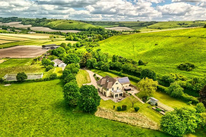
- Price
- Offers in Excess of£2,250,000
- Size
- 31.42 acres
Sydling Road, Cerne Abbas, Dorchester, DT2, Cerne Abbas, Dorset DT2 England
Added on 25/04/2026House with Land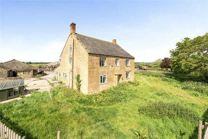
- Price
- Guide Price£2,500,000
- Size
- 159.25 acres
Chilthorne Domer, Yeovil, BA22, Yeovil, Somerset BA22 England
Added on 20/07/2026Livestock Farm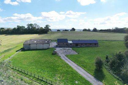
- Price
- Guide Price£1,795,000
- Size
- 42.51 acres
Fifehead Neville, Sturminster Newton, Dorset, Fifehead Neville, Dorset DT10 England
Added on 08/04/2026Country Estate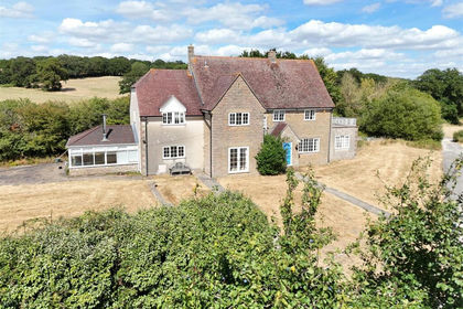
- Price
- Guide Price£1,825,000
- Size
- 21.6 acres
New Road, Broad Oak, Sturminster Newton, Sturminster Newton, Dorset DT10 England
Added on 29/08/2026House with Land
- Price
- Guide Price£1,850,000
- Size
- 26.25 acres
Added on 30/05/2026Farmhouse
- Price
- Guide Price£1,900,000
- Size
- 57.91 acres
Moor Lane, Rodgrove, Wincanton, Wincanton, Somerset BA9 England
Added on 10/05/2026Farm
- Price
- Guide Price£1,900,000
- Size
- 57.91 acres
Added on 30/04/2026Smallholding
- Price
- Guide Price£2,750,000
- Size
- 50 acres
50 acres, dev. potential, Hornblotton, Shepton Mallet, BA4, West Bradley, Somerset BA4 England
Added on 22/05/2026Country Estate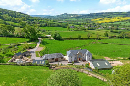
- Price
- Guide Price£2,000,000
- Size
- 30 acres
Pound Lane, Upottery, Honiton, Devon, Upottery, Devon EX14 England
Added on 25/07/2026House with Land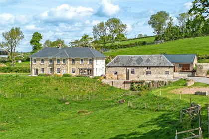
- Price
- Guide Price£2,250,000
- Size
- 50 acres
Pound Lane, Upottery, Honiton, Devon, Upottery, Devon EX14 England
Added on 20/07/2026House with Land