Thurvaston Lane, Longford, DE6
- Bedrooms
- 4
- Bathrooms
- 2
Key Features
- BEAUTIFUL 4 BEDROOM BARN CONVERSION
- GARAGE AND PRIVATE DRIVEWAY FOR SEVERAL VEHICLES
- RURAL LOCATION WITH STUNNING VIEWS OVER OPEN COUNTRYSIDE
- EPC RATING D
- PART CONVERTED GARAGE
Description
TUCKED AWAY BEHIND PRIVATE GATES IN THE SOUGHT-AFTER VILLAGE OF LONGFORD, THIS BEAUTIFUL BARN CONVERSION IS FULL OF CHARACTER, SPACE AND STUNNING COUNTRYSIDE VIEWS. IF YOU'VE BEEN DREAMING OF ESCAPING TO THE COUNTRYSIDE, THIS COULD BE THE ONE.
Our Agent Mikaela Says:
“Tucked away behind gated access in the sought-after village of Longford, this beautifully presented barn conversion enjoys stunning open countryside views and offers a wonderful blend of character, charm and modern family living.
From the moment you step inside, you'll notice the original beams and character features that give this home such a warm and welcoming feel. The spacious sitting room is a lovely place to relax, centred around a beautiful brick fireplace with a cosy log burner.
The kitchen diner is the real heart of the home, with plenty of space for family life and entertaining, plus direct access onto the patio, making it easy to enjoy the garden during the warmer months. A stylish ground floor shower room adds even more practicality.
Upstairs, there are four well-proportioned bedrooms, including three generous doubles, with the rear bedrooms enjoying beautiful views across the surrounding fields to wake up to each morning. A contemporary family bathroom completes the first floor.
Outside is where this home really shines. The south-facing garden offers a generous patio, a large lawn and uninterrupted countryside views beyond, creating a peaceful setting that's becoming increasingly difficult to find. To the front, there's a generous driveway leading to a detached double garage with electric doors, with part of the space converted into a home office or gym.
If you've been searching for a home full of character, with plenty of space and an idyllic village location, this could be the one. We'd love to show you around.”
Please note: The property is heated via oil-fired central heating and is served by a septic tank.
Our Sellers Thoughts:
“We moved into our property 10 years ago with our daughter and have been incredibly happy. We fell in love with the beautiful views from the back garden. It’s very peaceful. Every springtime we enjoy watching the baby lambs running around in the field at the bottom of the garden. We owned a dog and a horse, and it was great to be able to walk our dog down the field to tend to our horse. The countryside walks are lovely we have spent many hours over the years finding lots of new footpaths. If we could put the house on wheels and take it with us, we would.”
The Area:
Longford is one of South Derbyshire's most picturesque villages, offering a peaceful rural lifestyle surrounded by beautiful countryside while remaining well connected. The village is home to a welcoming community, a historic church and plenty of scenic walks, making it ideal for those who enjoy the outdoors. Everyday amenities can be found just a short drive away in Ashbourne, Etwall and Hilton, with supermarkets, cafés, pubs, healthcare facilities and a range of independent shops all within easy reach. Families are well catered for with a choice of well-regarded primary schools in the surrounding villages and secondary schooling nearby, while commuters benefit from convenient access to the A50, linking quickly to Derby, Stoke-on-Trent and the M1. Whether you're looking for countryside walks, a slower pace of life or excellent transport links for work, Longford offers the best of both worlds.
Parking - Driveway
Map Location
Property details
- Tenure
- Freehold
- Council Tax Band
- F
- Date Posted
- 2026-07-22
Utilities & Restrictions
Utilities
- Electricity
- Ask Agent
- Water
- Ask Agent
- Heating
- Oil Heating
- Broadband
- Ask Agent
- Sewerage
- Septic Tank / Private
Rights & Restrictions
- Public Rights of Way
- Ask Agent
- Private Rights of Way
- Ask Agent
- Listed Property
- Ask Agent
- Restrictions
- Ask Agent
Listed status, conservation areas and planning constraints for this location are in the full report.
Property Features
- Accessibility
- Ask Agent
- Parking
- Driveway
- Garden
- Private Garden
Beyond the particulars: planning activity, flood history, heritage and ground risks, checked for this exact spot.
Connectivity
Broadband
Fastest speed available at this postcode
80 Mbps
Superfast · available to 73% of premises
Suitable for
- HD streaming
- Video calls
- Web & social
Mobile signal
Outdoor predictions; indoor signal depends on building materials.
Ofcom Connected Nations postcode-level predictions. Speeds and signal are modelled, not measured, and vary between addresses and providers.
Signal is the easy part. Planning activity, flood history and protected designations here are in the full report.
Nearest Schools
Primary
- Longford CofE Primary School0.9 milesNo Ofsted rating
- Ages
- 4 to 11
- Pupils
- 70
- Type
- Academy converter
- Faith
- Church of England
- Long Lane Church of England Primary School1.3 milesOfsted: Requires improvement
- Ages
- 4 to 11
- Pupils
- 20
- Type
- Academy sponsor led
- Faith
- Church of England
- Church Broughton CofE Primary School2.7 milesNo Ofsted rating
- Ages
- 4 to 11
- Pupils
- 68
- Type
- Voluntary controlled school
- Faith
- Church of England
- Brailsford CofE Primary School3.2 milesNo Ofsted rating
- Ages
- 3 to 11
- Pupils
- 150
- Type
- Academy converter
- Faith
- Church of England
- Kirk Langley CofE Primary School3.7 milesNo Ofsted rating
- Ages
- 4 to 11
- Pupils
- 91
- Type
- Voluntary controlled school
- Faith
- Church of England
Secondary
- John Port Spencer Academy3.9 milesOfsted: Good
- Ages
- 11 to 18
- Pupils
- 2,034
- Type
- Academy sponsor led
- Murray Park Community School5.3 milesOfsted: Good
- Ages
- 11 to 16
- Pupils
- 1,277
- Type
- Foundation school
- Littleover Community School5.9 milesOfsted: Good
- Ages
- 11 to 18
- Pupils
- 1,828
- Type
- Community school
- Derby Moor Spencer Academy6.4 milesNo Ofsted rating
- Ages
- 11 to 18
- Pupils
- 1,740
- Type
- Academy converter
- The Bemrose School6.6 milesOfsted: Good
- Ages
- 3 to 19
- Pupils
- 1,429
- Type
- Foundation school
Distances are straight-line from the advertised location. Source: the national school registers (DfE, Welsh Government, Scottish Government) and Ofsted.
Schools are just the start: sold prices nearby, planning activity and any flood history are in the full report.
Amenities
Supermarket
GP surgery
Pharmacy
Hospital
Straight-line distances from the advertised location. Sources: NHS records, Geolytix supermarket locations, OS Open Greenspace and the national trails registers.
The area stacks up? Now check the location itself: planning nearby, protected designations and past flooding.
Getting Around
Nearest station
Nearest bus stop
Typical drive times
Straight-line distances from the advertised location; drive times are typical free-flow times over OpenStreetMap road data, so allow more at peak. Public transport locations from DfT NaPTAN.
Easy to reach matters. So do planning activity, flood history and ground risks: all in the full report.
Flood Risk
From Environment Agency flood map open data, checked around the advertised map pin and allowing for the listed acreage where known. This summary comes from LandSale, the advertising platform, not from the listing agent, and is not part of the agent's particulars. Risk can vary across a single holding, so verify anything critical through your own searches before committing.
Rivers and the sea
Surface water
These bandings are the summary. Where this location sits on the flood maps, plus planning activity, heritage and ground risks, is in the full report.
Important notice: Information, maps and tags on this page are drawn from the advertising agent's marketing materials or generated automatically. LandSale has not verified them. Relying on these details is at your own risk, always carry out independent checks before committing to a purchase.
LandSale full disclaimer
Marketing information only - not formal particulars. The details on this website are provided for general guidance and do not constitute an offer or contract. Neither LandSale nor the advertising estate/land agent accepts responsibility for any inaccuracy.
1. Source of information
- Listing content: Core description, asking price, tenure, measurements, photographs and planning history originate from the marketing materials of the advertising estate or land agent. LandSale does not author this content and cannot guarantee its accuracy.
- Automated tags & categorisation: Property type, land-use class, acreage bands and similar labels may be applied by machine-learning models. They are intended as a helpful guide only and may not reflect the property's legal status or permitted use.
- Third-party & enriched data layers: Maps, boundary outlines, planning designations, soil reports, broadband coverage and other environmental or location-based insights are licensed from external suppliers. Such data are supplied “as is", may be incomplete or out of date and are subject to change without notice.
2. Verification required
Prospective purchasers must verify critical matters, including but not limited to planning permission, title boundaries, public rights of way, environmental constraints, acreage, services, access and VAT status, through their own inspections, specialist surveys, legal advisers and the selling agent before relying on the information or entering into any contract.
3. No warranty or liability
LandSale gives no warranty, express or implied, as to the accuracy, completeness or fitness for any particular purpose of the information displayed. LandSale shall not be liable for any loss, damage, cost or expense arising directly or indirectly from any use of or reliance on such information, save where liability may not be excluded by law.
4. Updates & feedback
If you believe any detail on this listing is inaccurate, please let us know. We will investigate and, where appropriate, update the listing or notify the agent.
© LandSale | Version 1.3 - August 2026
Similar properties for sale
 Added on 16/04/2026Barn Conversion
 Added on 14/09/2026Barn Conversion
- Price
- £535,000
Added on 05/06/2026Barn Conversion
- Price
- Offers in Region of£650,000
- Size
- 1.86 acres
Marston Common, Marston Montgomery, Ashbourne, Marston Montgomery, Derbyshire DE6 England
Added on 17/09/2026House with Land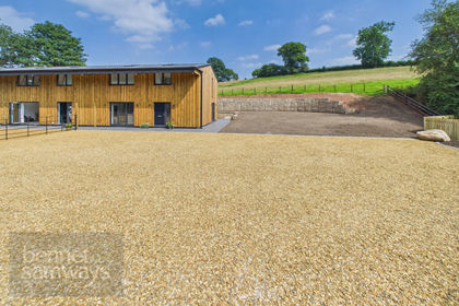
- Price
- Guide Price£575,000
Virgin Alley Lane, Snelston, DE6, Snelston, Derbyshire DE6 England
Added on 25/07/2026Barn Conversion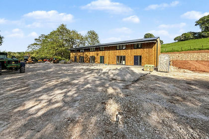
- Price
- Guide Price£500,000
Virginsalley Lane, Snelston, DE6, Snelston, Derbyshire DE6 England
Added on 08/03/2026Barn Conversion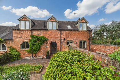
- Price
- Guide Price£500,000
Brookside, Rolleston-on-Dove, Rolleston on Dove, Staffordshire DE13 England
Added on 02/06/2026Barn Conversion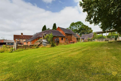
- Price
- £550,000
- Size
- 0.7 acres
Roston, Ashbourne, Norbury and Roston, Derbyshire DE6 England
Added on 29/01/2026Development Land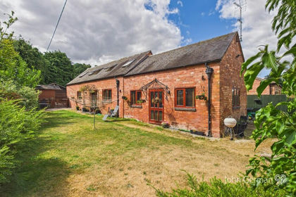 Added on 08/08/2026Barn Conversion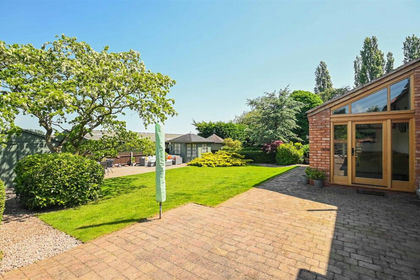
- Price
- £675,000
Moreton Lane, Draycott-In-The-Clay, Ashbourne, Draycott in the Clay, Staffordshire DE6 England
Added on 27/02/2026Barn Conversion