South Petherwin, Launceston - Cornwall
- Land size
- 33 acres
- Bedrooms
- 4
- Bathrooms
- 3
Key Features
- Victorian Farmhouse
- 4 Bedrooms
- 3 Reception Rooms
- Barns with planning consent
- 33 Acres
- Pastureland
- Woodland
- Pond
- Wildlife Haven
Description
Victorian farmhouse with 4 bedrooms, 3 reception rooms and barns with planning consent. Set within 33 acres of pastureland and wildlife-rich woodland. A peaceful rural haven offering space, seclusion and exceptional countryside living.
Burdown Farm is situated in a quiet rural hamlet of Tregada in the parish of South Petherwin. Lezant and Tre Pol Pen farm shop, café and restaurant are 1 mile to the southeast. The A30 and Launceston are 3 miles to the north offering day to day facilities, individual shops, supermarkets, recreational facilities, private and state schools. The coastal resort of Bude is 28 miles to the northwest and Tavistock is 13 miles to the southeast. Exeter to the east and Plymouth to the south, offer a more comprehensive range of educational, cultural, recreational and shopping facilities.
Burdown Farm is a quietly located 33 acre smallholding with a well presented Victorian 4 bedroom, 3 reception room farmhouse providing comfortable and flexible family living in lawned and landscaped gardens. There are extensive traditional barns with consent for a main dwelling and attached annexe. Pasture paddocks, woodland and stream. Far reaching countryside views.
Burdown farmhouse is a substantial, characterful Victoria country residence which has retained many of its original features including open fire places, slate flagstone floors with the addition of oil fired central heating and partial timber framed double glazed windows. The well presented accommodation provides comfortable and flexible family living and briefly comprises, Porch; double aspect with slate shelves, Entrance Hall; large, bright and airy, staircase rises to the first floor. Drawing / dining room; a triple aspect room with windows to the rear, side and front overlooking the garden and surrounding farmland. Slate flagstone floor, open fireplace. Exposed ceiling beam, sitting room a double aspect room overlooking the front terrace, garden and surrounding countryside, fireplace with Morso woodburning stove, exposed wooden floor. Kitchen / Breakfast room; a double aspect room, fitted wall and base units under granite effect roll top worksurfaces, oil fired Rayburn, electric cooker with extractor hood above, inset 1 ½ bowl stainless steel sink and drainer, space and plumbing for washing machine, dishwasher, fridge and freezer, slate flagstone floor. Inner Hall; understairs storage. Cloakroom; w/c, wash basin, slate flagstone floor, window to the rear. Utility / Boot Room; fitted base units with black granite effect roll top worksurface, 1 ½ bowl stainless steel sink and drainer, slate flagstone floor, windows overlooking the front terrace and door to the front and rear. On the First Floor; light and airy landing, with window to the rear overlooking the farmland, airing cupboard with water cylinder and fitted shelves. Bedroom 2; a double aspect room with views overlooking the land and surrounding countryside. En suite; shower, heated towel rail, wash basin. Cloakroom; w/c, window to the rear. Family Bathroom; bath with shower above, wash basin, w/c, heated towel rail, fitted storage shelves, window to the rear. Bedroom 1; window to the front overlooking the terrace garden and surrounding countryside, en suite shower enclosure, w/c, wash basin, heated towel rail, walk in wardrobe / store room. Bedroom 4; a double room, window to the front. Bedroom 3; a double aspect room overlooking the garden and surrounding countryside.
Outside - Burdown Farm is accessed from the road over a long drive which is flanked on either side by tree lined hedges and the pasture paddocks opening to a gravel parking area at the side of the house. Along the front, southerly aspect of the house is a stone paved patio which is ideal for alfresco dining and entertaining whilst enjoying the views over the surrounding countryside. At the side, is a lawned garden with low level box hedging and interspersed with a variety of evergreen and flowering shrubs leading to the middle lawned terrace with well established low level beech hedging. Granite steps descend to the lower lawn terrace which is bordered by mature deciduous and evergreen trees. At the rear is a gravel seating area bordered by well stocked flowerbed borders. From the rear courtyard a gate opens into the walled garden with ornamental flower and vegetable beds, fruit canes and bushes, an orchard with apple and plumb trees and two storage buildings to the rear of the house.
Buildings - The extensive complex of traditional stone barns has planning consent granted for conversion to residential dwelling and an annexe. The barns are currently used for storage, stabling with the original Victorian stable stalls / looseboxes and cobble tiled floors. The barns are of traditional stone construction with brick quoins and opening reveals under local slate roofs with decorative terracotta ridges. The barns are arranged over two floors and extend to approximately 735.23sq/m (7915sq/ft).
Outside the upper level is a large, enclosed courtyard which will provide garden and parking area and on the lower level is a large, enclosed area which is currently grassed over but has the original cobbles below.
The Land - The farm extends to approximately 33 acres which is divided into 9 easily manageable fields. A small area of deciduous woodland with a natural stream which runs along the southern boundary. The woodland and wildlife pond provide a haven for many difference species of wildlife including Deer, Foxes, Squirrels and Rabbits to name but a few. The land is accessed off the main access drive and is enclosed within traditional treelined Cornish bank hedges with post and wire fencing.
Services & Information - Water – Mains
Drainage – Septic Tank
Electricity – Mains
Heating – Oil fired central heating and woodburning stoves
Telephone & Broadband – Open Reach Connection checker.ofcom.org.uk
Mobile Availability - checker.ofcom.org.uk
Council Tax Currently Band – E
EPC – F37
Construction - Stone
Local Authority - Cornwall Council, County Hall, Treyew Road, Truro, Cornwall, TR1 3AY
Tenure - The property is offered for sale freehold with vacant possession on completion.
Viewing Arrangements - Strictly by appointment with D. R. Kivell Country Property . All viewings are to be accompanied without exception.
Agent's Notes - None of the services or appliances, plumbing, heating or electrical installations have been tested by the selling agent. Any maps used on the details are to assist identification of the property only and are not an indication of the actual surroundings, which may have changed since the map was printed. None of the statements contained in these particulars as to this property are to be relied on as statements or representations of fact. There are numerous power points throughout the property although not individually listed. All figures, measurements, floor plans and maps are for guidance purposes only. They are prepared and issued in good faith and are intended to give a fair description of the property but do not constitute any part of any offer or contract. The property is sold subject to and with the benefit of all outgoings, rights of way, easements and wayleaves there may be, whether mentioned in these general remarks and stipulations or particulars of sale or not.
Map Location
Property details
- Tenure
- Freehold
- Council Tax Band
- E
- Date Posted
- 2026-07-22
Market Value Analysis
Compared with 97 Farmland & Pasture listings in South West England (25+ acres).
Energy Performance Certificate
Energy Efficiency Rating
Based on UK Energy Performance Certificate standards (EU Directive 2002/91/EC)
Running costs are one side. Planning activity, flood history and ground risks for this location are in the full report.
Utilities & Restrictions
Utilities
- Electricity
- Mains
- Water
- Mains
- Heating
- Oil Heating, Wood Burner
- Broadband
- Standard Copper (ADSL)
- Sewerage
- Septic Tank / Private
Rights & Restrictions
- Public Rights of Way
- Ask Agent
- Private Rights of Way
- Ask Agent
- Listed Property
- Ask Agent
- Restrictions
- Ask Agent
Listed status, conservation areas and planning constraints for this location are in the full report.
Property Features
- Accessibility
- Ask Agent
- Parking
- Driveway
- Garden
- Garden
Beyond the particulars: planning activity, flood history, heritage and ground risks, checked for this exact spot.
Connectivity
Broadband
Fastest speed available at this postcode
1.8 Gbps
Gigabit full fibre · available to 86% of premises
Suitable for
- 4K streaming on every screen
- Full-time home working
- Online gaming & big downloads
Mobile signal
Predicted 4G and 5G signal; indoor signal depends on building materials.
Ofcom Connected Nations postcode-level predictions. Speeds and signal are modelled, not measured, and vary between addresses and providers.
Signal is the easy part. Planning activity, flood history and protected designations here are in the full report.
Nearest Schools
Primary
- Trekenner Community Primary School1.5 milesOfsted: Requires improvement
- Ages
- 2 to 11
- Pupils
- 69
- Type
- Foundation school
- Launceston Primary School1.8 milesOfsted: Good
- Ages
- 4 to 11
- Pupils
- 101
- Type
- Free schools
- South Petherwin Community Primary School2.2 milesOfsted: Good
- Ages
- 4 to 11
- Pupils
- 114
- Type
- Foundation school
- St Catherine's CofE Primary School2.3 milesNo Ofsted rating
- Ages
- 2 to 11
- Pupils
- 222
- Type
- Academy converter
- Faith
- Church of England
- Windmill Hill Academy2.3 milesNo Ofsted rating
- Ages
- 2 to 11
- Pupils
- 162
- Type
- Academy converter
Secondary
- Launceston College2 milesOfsted: Good
- Ages
- 11 to 18
- Pupils
- 1,205
- Type
- Academy converter
- Callington Community College6.8 milesOfsted: Good
- Ages
- 11 to 18
- Pupils
- 887
- Type
- Academy converter
- Tavistock College9.5 milesOfsted: Requires improvement
- Ages
- 11 to 18
- Pupils
- 1,200
- Type
- Academy converter
- Liskeard School and Community College11 milesNo Ofsted rating
- Ages
- 11 to 18
- Pupils
- 1,115
- Type
- Academy converter
- Holsworthy Community College15 milesNo Ofsted rating
- Ages
- 11 to 16
- Pupils
- 551
- Type
- Academy converter
Distances are straight-line from the advertised location. Source: the national school registers (DfE, Welsh Government, Scottish Government) and Ofsted.
Schools are just the start: sold prices nearby, planning activity and any flood history are in the full report.
Amenities
Supermarket
GP surgery
Pharmacy
Hospital
Straight-line distances from the advertised location. Sources: NHS records, Geolytix supermarket locations, OS Open Greenspace and the national trails registers.
The area stacks up? Now check the location itself: planning nearby, protected designations and past flooding.
Getting Around
Nearest station
Nearest bus stop
Typical drive times
Straight-line distances from the advertised location; drive times are typical free-flow times over OpenStreetMap road data, so allow more at peak. Public transport locations from DfT NaPTAN.
Easy to reach matters. So do planning activity, flood history and ground risks: all in the full report.
Flood Risk
Environment Agency open data, checked around the advertised map pin for the listed acreage. Long-term risk counts flood defences; the planning map's flood zones do not. The map pin for this listing is approximate, so these readings describe the surrounding area. Provided by LandSale, not the listing agent, and not part of the agent's particulars. Risk varies across a holding, so verify before committing.
Rivers and the sea
Not at the pin: mapped about 90 metres away.
Planning map: Flood Zone 3, about 90 metres away.
Surface water
Not at the pin: mapped about 140 metres away.
These bandings are the summary. Where this location sits on the flood maps, plus planning activity, heritage and ground risks, is in the full report.
Important notice: Information, maps and tags on this page are drawn from the advertising agent's marketing materials or generated automatically. LandSale has not verified them. Relying on these details is at your own risk, always carry out independent checks before committing to a purchase.
LandSale full disclaimer
Marketing information only - not formal particulars. The details on this website are provided for general guidance and do not constitute an offer or contract. Neither LandSale nor the advertising estate/land agent accepts responsibility for any inaccuracy.
1. Source of information
- Listing content: Core description, asking price, tenure, measurements, photographs and planning history originate from the marketing materials of the advertising estate or land agent. LandSale does not author this content and cannot guarantee its accuracy.
- Automated tags & categorisation: Property type, land-use class, acreage bands and similar labels may be applied by machine-learning models. They are intended as a helpful guide only and may not reflect the property's legal status or permitted use.
- Third-party & enriched data layers: Maps, boundary outlines, planning designations, soil reports, broadband coverage and other environmental or location-based insights are licensed from external suppliers. Such data are supplied “as is", may be incomplete or out of date and are subject to change without notice.
2. Verification required
Prospective purchasers must verify critical matters, including but not limited to planning permission, title boundaries, public rights of way, environmental constraints, acreage, services, access and VAT status, through their own inspections, specialist surveys, legal advisers and the selling agent before relying on the information or entering into any contract.
3. No warranty or liability
LandSale gives no warranty, express or implied, as to the accuracy, completeness or fitness for any particular purpose of the information displayed. LandSale shall not be liable for any loss, damage, cost or expense arising directly or indirectly from any use of or reliance on such information, save where liability may not be excluded by law.
4. Updates & feedback
If you believe any detail on this listing is inaccurate, please let us know. We will investigate and, where appropriate, update the listing or notify the agent.
© LandSale | Version 1.3 - August 2026
Listing agent
D. R. Kivell Country Property, Covering South WestCovering South West
Call agent
01822810810Contact D. R. Kivell Country Property, Covering South West
Covering South West
Call agent
01822810810Similar properties for sale
- Price
- Guide Price£1,000,000
- Size
- 33 acres
St Giles-on-the-Heath, Launceston, Devon, PL15, St. Giles on the Heath, Devon PL15 England
Added on 08/09/2026House with Land
- Price
- Guide Price£999,000
- Size
- 19 acres
Otterside, North Petherwin, Launceston, North Petherwin, Cornwall PL15 England
Added on 29/01/2026House with Land
- Price
- Guide Price£1,200,000
- Size
- 17.4 acres
Kit Hill Castle, Callington, Cornwall, Callington, Cornwall PL17 England
Added on 29/07/2026House with Land
- Price
- Guide Price£1,250,000
- Size
- 83.66 acres
Added on 02/09/2026Farm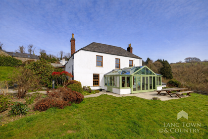
- Price
- Guide Price£1,250,000
- Size
- 21 acres
Morvah, Saltash, Cornwall, Landrake with St. Erney, Cornwall PL12 England
Added on 08/04/2026Farmhouse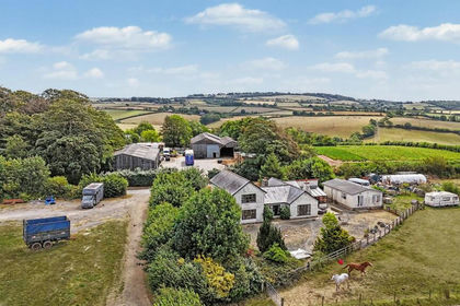
- Price
- Guide Price£925,000
- Size
- 36.51 acres
Trewidland, Liskeard, PL14, St. Keyne and Trewidland, Cornwall PL14 England
Added on 19/05/2026Smallholding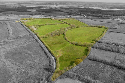
- Price
- £950,000
- Size
- 26 acres
Added on 01/07/2026House with Land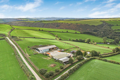
- Price
- Offers Over£1,000,000
- Size
- 60 acres
Added on 06/10/2026Farm
- Price
- £875,000
- Size
- 16.24 acres
Added on 11/08/2026House with Land
- Price
- £1,200,000
- Size
- 32 acres
Pancrasweek, Holsworthy - Devon, Pancrasweek, Devon EX22 England
Added on 29/06/2026Agricultural Land