
Burrington, Umberleigh, EX37
- Land size
- 6.14 acres
- Bedrooms
- 3
- Bathrooms
- 2
Key Features
- Grade II listed chocolate box cottage
- Three bedrooms
- Approx 6.14 acres
- Outbuildings
- No onward chain
Description
Nestled in the rolling Devon countryside, just outside the picturesque village of Burrington, this enchanting Grade II listed three bedroom chocolate box cottage offers a rare opportunity to own a quintessential country retreat with around 6.14 acres of land and outbuildings. No onward chain.
Pennyford is nestled within its own grounds and whether you're looking for a family home, smallholding package, or countryside escape, this idyllic cottage is a true gem in the heart of Devon.
The cottage is generous in size, and is believed to date back to the 1800’s in parts and has been sympathetically enlarged over the years. The accommodation, whilst perfectly habitable, does now require updating.
The accommodation is well proportioned and arranged over two floors. Entered via a pitched roof porch and then into the kitchen diner. The kitchen has a wonderful limestone tiled floor, oil fired Rayburn and a range of base units. Stairs rise to the first floor. Leading off to the right hand side is the living room, a wonderful character room with a superb inglenook fireplace with a woodburning stove and a bread oven. To the left hand side of the kitchen is the inner hallway with a shower room off of and a dining room completing the ground floor. This room is a versatile space and could also be used as a fourth bedroom.
To the first floor there is a galleried landing with the bedrooms leading off of. Bedroom one is a good sized double bedroom with fitted furniture and benefits from an ensuite bathroom. Bedroom two is also a double size bedroom with a built in wardrobe and bedroom three is a single bedroom currently used as a home office.
For the accommodation layout and approximate room measurements please refer to the enclosed floorplan.
OUTSIDE
Pennyford is nestled within its own grounds behind a gated entrance, with a delightful raised patio seating area wrapping around to the front aspect followed by a large lawned area. There is a stream to the front of the garden as well as being bordered by a beech hedge and stone wall. Within the garden are numerous outbuildings including a stone built workshop attached to the right hand side of the cottage and two further detached stone outhouses. There is also a well in the front garden.
Across the lane is a gated private drive leading to further outbuildings. There is a two storey barn which is accessed on the ground floor into a store room and to the first floor by internal steps and ground level access from the land, this space was formally used to house goats. At the end of the drive is a two bay car port with a further lean to on the right hand side. There is also a dilapidated double garage (no roof). The land extends in total to around 6.14 acres and consists of a gently sloping paddock with direct road access which is currently used for grazing. The meadows are beautiful with dammed ponds and fringed by beautiful unspoilt woodland consisting of mainly deciduous species such as oak, ash, beech, hazel and holly, with a variety of wild spring flowers, including primroses, daffodils, and bluebells. The woodland affords tremendous wildlife, conservation and amenity appeal, exhibiting an abundance of wildlife, with tracks and pathways providing charming walks. A natural stream runs down through the woodland, feeding into a pond situated on the edge of the gardens. There is also a further paddock that has direct access from the drive and to the former goat house and this has currently been left for rewilding but could easily be returned to further grazing. In total, Pennyford extends to approximately 6.14 acres.
SERVICES & OUTGOINGS
We understand that mains electricity is connected. Drainage to a private system. Please note, the drainage and water system are not compliant with current regulation and will require upgrading and prospective purchasers should carry out their own investigations. The property is offered to cash buyers only due to mortgage lenders criteria's.
Council Tax: Torridge District Council—Band E
ADDITIONAL INFORMATION
Broadband: FTTC—Fibre broadband is available—highest available download speed 76 Mbps, highest available upload speed 15 Mbps. (Based on Openreach data).
Mobile Coverage: Likely outdoor coverage available via EE and O2, limited coverage available via Three and VODAFONE. No indoor coverage. For an indication of specific speeds and supply or coverage in the area we recommend contacting your own provider. (Based on Ofcom data)
Flooding: The property is in an area at a VERY LOW RISK from River/Sea flooding (defined as the chance of flooding each year as less than 0.1%) and VERY LOW RISK from Surface Water flooding (defined as the chance of flooding each year as less than 0.1%) (Gov UK data).
Construction Type: Stone and cob.
SPORTING & MINERAL RIGHTS
The sporting and mineral rights across the holding, in so far as they are owned, will be included in the freehold sale.
Situated in a tranquil, semi-rural setting, the property offers peace and privacy while remaining conveniently close to local amenities. The charming village of Burrington is just a short walk away, with nearby Chulmleigh offering a range of shops, pubs, and schools. The market towns of Barnstaple and South Molton are within easy reach, and the stunning North Devon coastline is just a scenic drive away. Lying between Exmoor and Dartmoor, in the heart of Devon, the property is surrounded by gently undulating and unspoilt countryside, affording an agricultural landscape of mainly pasture and arable land interspersed with an abundance of pretty wooded valleys. The small town of Chulmleigh provides a thriving and very active local community which has managed to retain a good range of local services including highly regarded primary and secondary schools, a sports centre, post office, various shops, a health centre, dentist, public houses, restaurants and a historic town hall. Nearby Winkleigh also provides a primary school, parish church, doctors surgery and selection of local shops.
Despite its rural position the property still enjoys easy access to the surrounding districts and main routes of communication with the A377 providing an easy link to the larger towns of South Molton, Barnstaple Crediton and Exeter, all providing an extensive range of commercial, educational and recreational facilities.
From Tiverton the A361 provides quick and easy access to the M5 motorway (Junction 27). There are nearby rail stations on the Barnstaple to Exeter (Tarka) line at Eggesford and Kings Nympton. Main line rail services are available at Exeter and Tiverton Parkway, with international airports at Exeter and Bristol.
To the north east and south respectively the Exmoor and Dartmoor National Parks offer beautiful moorland scenery with many foot and bridle paths, whilst to the north west are the popular sandy beaches of Instow, Saunton Sands, Croyde Bay, Putsborough and Woolacombe. The surrounding countryside provides a wealth of recreational activities including walking, horse riding, cycling, fishing on the rivers Taw and Mole, and golf courses at The Mole resort and Libbaton.
Directions
What3words:/// funds.comenced.market
From South Molton head south easterly out of the town on the B3226 signed Crediton. Follow this road for about 9 miles and at the junction with the A377 at Fortescue Cross, turn left towards Exeter. After approximately 1 mile turn right at Colleton Mills signed for Burrington. Continue along this road, into the village of Burrington. As you get into the village, just after the church turn left down a country lane. Continue down the hill for about 0.4 miles whereupon the entrance to the property will be found.
Map Location
Property details
- Tenure
- Freehold
- Council Tax Band
- E
- Date Posted
- 2026-07-03
Market Value Analysis
Compared with 457 Homes with Land listings in South West England (5+ acres).
Energy Performance Certificate
Energy Efficiency Rating
Based on UK Energy Performance Certificate standards (EU Directive 2002/91/EC)
Running costs are one side. Planning activity, flood history and ground risks for this location are in the full report.
Property Brochure
Seen the details? The full report adds the independent checks: planning activity, flood history, heritage and ground.
Utilities & Restrictions
Utilities
- Electricity
- Ask Agent
- Water
- Ask Agent
- Heating
- Ask Agent
- Broadband
- Ask Agent
- Sewerage
- Ask Agent
Rights & Restrictions
- Public Rights of Way
- Ask Agent
- Private Rights of Way
- Ask Agent
- Listed Property
- Ask Agent
- Restrictions
- Ask Agent
Listed status, conservation areas and planning constraints for this location are in the full report.
Property Features
- Accessibility
- Ask Agent
- Parking
- Parking Available
- Garden
- Garden
Beyond the particulars: planning activity, flood history, heritage and ground risks, checked for this exact spot.
Connectivity
Broadband
Fastest speed available at this postcode
1.8 Gbps
Superfast
Suitable for
- 4K streaming on every screen
- Full-time home working
- Online gaming & big downloads
Mobile signal
Predicted 4G and 5G signal; indoor signal depends on building materials.
Ofcom Connected Nations postcode-level predictions. Speeds and signal are modelled, not measured, and vary between addresses and providers.
Signal is the easy part. Planning activity, flood history and protected designations here are in the full report.
Nearest Schools
Primary
- High Bickington Church of England Primary Academy3.2 milesOfsted report card · Mar 2026
- Ages
- 2 to 11
- Pupils
- 84
- Type
- Academy converter
- Faith
- Church of England
- Kings Nympton Community Primary School3.5 milesNo Ofsted rating
- Ages
- 4 to 11
- Pupils
- 17
- Type
- Foundation school
- Chulmleigh Primary School3.7 milesOfsted: Good
- Ages
- 2 to 11
- Pupils
- 226
- Type
- Academy converter
- Umberleigh Primary Academy4.7 milesNo Ofsted rating
- Ages
- 2 to 11
- Pupils
- 94
- Type
- Academy converter
- Dolton Church of England Primary School4.8 milesOfsted: Good
- Ages
- 2 to 11
- Pupils
- 31
- Type
- Academy converter
- Faith
- Church of England
Secondary
- Chulmleigh Community College3.5 milesNo Ofsted rating
- Ages
- 11 to 16
- Pupils
- 735
- Type
- Academy converter
- South Molton Community College7.4 milesOfsted: Good *
- Ages
- 11 to 16
- Pupils
- 656
- Type
- Foundation school
- Great Torrington School8.3 milesNo Ofsted rating
- Ages
- 11 to 16
- Pupils
- 863
- Type
- Academy converter
- The Park Community School10 milesOfsted: Good *
- Ages
- 11 to 16
- Pupils
- 1,408
- Type
- Academy converter
- Pilton Community College12 milesOfsted: Good
- Ages
- 11 to 16
- Pupils
- 1,165
- Type
- Academy converter
* Latest graded judgement covers quality of education only; no overall grade was issued under the 2024-25 inspection framework.
Distances are straight-line from the advertised location. Source: the national school registers (DfE, Welsh Government, Scottish Government) and Ofsted.
Schools are just the start: sold prices nearby, planning activity and any flood history are in the full report.
Amenities
Supermarket
GP surgery
Pharmacy
Hospital
Green space
Straight-line distances from the advertised location. Sources: NHS records, Geolytix supermarket locations, OS Open Greenspace and the national trails registers.
The area stacks up? Now check the location itself: planning nearby, protected designations and past flooding.
Getting Around
Nearest station
Nearest bus stop
Typical drive times
Straight-line distances from the advertised location; drive times are typical free-flow times over OpenStreetMap road data, so allow more at peak. Public transport locations from DfT NaPTAN.
Easy to reach matters. So do planning activity, flood history and ground risks: all in the full report.
Flood Risk
Environment Agency open data, checked around the advertised map pin for the listed acreage. Long-term risk counts flood defences; the planning map's flood zones do not. Provided by LandSale, not the listing agent, and not part of the agent's particulars. Risk varies across a holding, so verify before committing.
Rivers and the sea
Planning map: Flood Zone 1.
Surface water
Not at the pin: mapped about 10 metres away.
These bandings are the summary. Where this location sits on the flood maps, plus planning activity, heritage and ground risks, is in the full report.
Important notice: Information, maps and tags on this page are drawn from the advertising agent's marketing materials or generated automatically. LandSale has not verified them. Relying on these details is at your own risk, always carry out independent checks before committing to a purchase.
LandSale full disclaimer
Marketing information only - not formal particulars. The details on this website are provided for general guidance and do not constitute an offer or contract. Neither LandSale nor the advertising estate/land agent accepts responsibility for any inaccuracy.
1. Source of information
- Listing content: Core description, asking price, tenure, measurements, photographs and planning history originate from the marketing materials of the advertising estate or land agent. LandSale does not author this content and cannot guarantee its accuracy.
- Automated tags & categorisation: Property type, land-use class, acreage bands and similar labels may be applied by machine-learning models. They are intended as a helpful guide only and may not reflect the property's legal status or permitted use.
- Third-party & enriched data layers: Maps, boundary outlines, planning designations, soil reports, broadband coverage and other environmental or location-based insights are licensed from external suppliers. Such data are supplied “as is", may be incomplete or out of date and are subject to change without notice.
2. Verification required
Prospective purchasers must verify critical matters, including but not limited to planning permission, title boundaries, public rights of way, environmental constraints, acreage, services, access and VAT status, through their own inspections, specialist surveys, legal advisers and the selling agent before relying on the information or entering into any contract.
3. No warranty or liability
LandSale gives no warranty, express or implied, as to the accuracy, completeness or fitness for any particular purpose of the information displayed. LandSale shall not be liable for any loss, damage, cost or expense arising directly or indirectly from any use of or reliance on such information, save where liability may not be excluded by law.
4. Updates & feedback
If you believe any detail on this listing is inaccurate, please let us know. We will investigate and, where appropriate, update the listing or notify the agent.
© LandSale | Version 1.3 - August 2026
Listing agent
Greenslade Taylor Hunt, South Molton23 Broad Street, South Molton, EX36 3AQ
View agent profileSimilar properties for sale
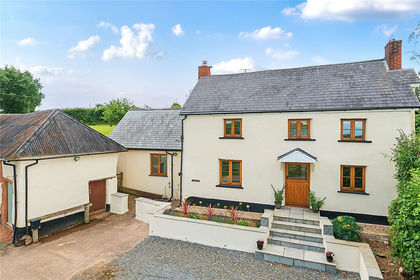
- Price
- Guide Price£560,000
- Size
- 1.75 acres
Burrington, Umberleigh, EX37, Umberleigh, Devon EX37 England
Added on 21/03/2026House with Land
- Price
- Offers in Region of£680,000
- Size
- 3.15 acres
Added on 20/07/2026Smallholding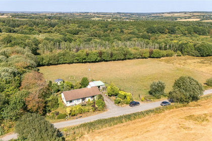
- Price
- Guide Price£375,000
- Size
- 1.81 acres
South Grendon - Lot 2, Grendon Lane, Witheridge, Tiverton, EX16, Tiverton, Devon EX16 England
Added on 10/09/2026House with Land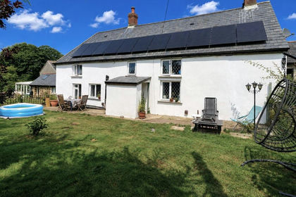
- Price
- Guide Price£677,000
- Size
- 9 acres
Shebbear, Beaworthy, Devon, EX21, Shebbear, Devon EX21 England
Added on 24/04/2026Farmhouse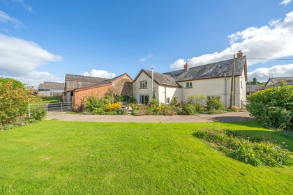
- Price
- Guide Price£650,000
- Size
- 1.5 acres
East Knowstone, South Molton, EX36, South Molton, Devon EX36 England
Added on 14/02/2026House with Land
- Price
- £650,000
- Size
- 3 acres
Buckland Brewer, Bideford, Devon, Buckland Brewer, Devon EX39 England
Added on 27/06/2026Barn Conversion
- Price
- Offers in Region of£400,000
- Size
- 11 acres
Added on 24/06/2026Smallholding
- Price
- Guide Price£650,000
- Size
- 1.5 acres
Added on 21/07/2026House with Land
- Price
- Guide Price£375,000
- Size
- 1.6 acres
Two Bridges, Yelverton, PL20, Dartmoor Forest, Devon PL20 England
Added on 04/06/2026House with LandLeasehold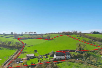
- Price
- Guide Price£675,000
- Size
- 10 acres
Whilborough, Newton Abbot, TQ12, Kingskerswell, Devon TQ12 England
Added on 12/08/2026Smallholding