3 Upper Netchwood, Monkhopton, Shropshire
- Land size
- 13.5 acres
- Bedrooms
- 3
- Bathrooms
- 1
Description
With around 13.5 acres, this delightful country cottage with a large range of outbuildings offers tremendous scope for either private or business use (subject to planning). Such opportunities are rare to find - approached by a private drive leading to the cottage and outbuildings, on arrival the property has 360 degree views across the paddocks and beautiful countryside beyond.
Ditton Priors - 2..2 miles, Bridgnorth - 7 miles, Ludlow - 16 miles, Telford - 15 miles, Shrewsbury - 19 miles, Birmingham - 38 miles.
(All distances are approximate).
Location - Upper Netchwood is a small cluster of houses and cottages in an elevated position above Weston and Monkhopton, on a route up to the Brown Clee. Just a couple of miles from the village of Ditton Priors, a village and to the south-west of the historic market town of Bridgnorth, the area is surrounded by stunning natural countryside, offering easy access to a wealth of walks and outdoor activities.
The village of Ditton Priors offers a good range of local amenities, including a primary school, church, garage, cafe, post office, medical practice, convenience store, a traditional butcher's shop and a pub. The village hall/community centre serves as a hub for local events throughout the year.
Summary - With no upward chain, this is a delightful opportunity to acquire a country residence in a most delightful setting, surrounded by 13.5 acres of its own land. A long private drive provides the access, situated near the Water Tower above Monkhopton. This is an elevated position with views and equally easy access to the road network. The cottage is quite habitable, but dated, linked to a large range of out-buildings fondly named ‘The West Wing’. This range of brick and tile out-buildings are more modern construction than the cottage with first floor loft rooms across most of the ground floor.
Accommodation - Throughout there are exposed beams and some double and secondary double glazing. Entering from the front porch into the sitting room, stairs rise to the first floor and there is an original fireplace with a Clearview log burner. Beyond is the sitting room also with a Clearview log burner. The breakfast kitchen has a range of fitted units and an AGA plus a shelved pantry. From the kitchen, the ground floor extends to an inner hall and access to the side porch, a WC guest cloakroom and then a utility with shelves and the boiler.
The first floor landing gives access to three bedrooms and the bathroom.
The West Wing - A selection of out-buildings through a gated entrance and having a concrete hard standing , form a courtyard. Having internal access from the cottage, there is a double garage with a roller shutter door, adjoining three rooms with three loft room on the first floor via a staircase. These include a WC and sinks.A further detached building provides stores and a workshop, whilst there are further timber sheds and log store.
Outside - The long drive winds up to the cottage, bearing left leads into a large parking area with a vegetable garden beyond, including a greenhouse and shed. The cottage has a pretty garden with an extensive range of mature flowering plants and shrubs, with a fence dividing into the paddocks.
Council Tax - Shropshire Council.
Tax Band: F
Tenure - We are advised the property is FREEHOLD. Please seek confirmation from your legal team.
Viewing Arrangements - Strictly by appointment only - Please contact our BRIDGNORTH OFFICE.
Fixtures And Fittings - Sold as seen - any items in the property will remain.
Services - We have been advised by our client there is mains water, electricity and private drainage. Oil fired central heating. Please ask for confirmation prior to proceeding.
Directions - Leaving Bridgnorth on the A458 towards Shrewsbury. On entering Morville, fork left onto the B4368 signposted Craven Arms. Follow this road along and after approximately 3 miles turning left signposted Ditton Priors. Continue for just over a mile where the water tower can be identified on the right. Take the next right and look for the driveway entrance on the left which has white painted post and rail fencing at the entrance/
Map Location
Property details
- Tenure
- Freehold
- Council Tax Band
- F
- Date Posted
- 2026-07-03
Market Value Analysis
Compared with 121 Homes with Land listings in West Midlands (10+ acres).
Utilities & Restrictions
Utilities
- Electricity
- Ask Agent
- Water
- Ask Agent
- Heating
- Ask Agent
- Broadband
- Ask Agent
- Sewerage
- Ask Agent
Rights & Restrictions
- Public Rights of Way
- Ask Agent
- Private Rights of Way
- Ask Agent
- Listed Property
- Ask Agent
- Restrictions
- Ask Agent
Listed status, conservation areas and planning constraints for this location are in the full report.
Property Features
- Accessibility
- Ask Agent
- Parking
- Parking Available
- Garden
- Garden
Beyond the particulars: planning activity, flood history, heritage and ground risks, checked for this exact spot.
Connectivity
Broadband
Fastest speed available at this postcode
8 Mbps
Under 10 Mbps here
Suitable for
- Basic browsing & email
Fixed wireless access may also be an option here.
Mobile signal
Outdoor predictions; indoor signal depends on building materials.
Ofcom Connected Nations postcode-level predictions. Speeds and signal are modelled, not measured, and vary between addresses and providers.
Signal is the easy part. Planning activity, flood history and protected designations here are in the full report.
Nearest Schools
Primary
- Brown Clee CofE Primary School1.8 milesNo Ofsted rating
- Ages
- 4 to 11
- Pupils
- 101
- Type
- Voluntary controlled school
- Faith
- Church of England
- Brockton CofE Primary School2.4 milesOfsted report card · Mar 2026
- Ages
- 2 to 11
- Pupils
- 51
- Type
- Voluntary controlled school
- Faith
- Church of England
- Morville CofE (Controlled) Primary School4 milesOfsted: Good
- Ages
- 5 to 11
- Pupils
- 59
- Type
- Academy sponsor led
- Faith
- Church of England
- Much Wenlock Primary School4.6 milesOfsted report card · May 2026
- Ages
- 3 to 11
- Pupils
- 171
- Type
- Academy converter
- Church Preen Primary School4.8 milesOfsted: Good
- Ages
- 4 to 11
- Pupils
- 41
- Type
- Community school
Secondary
- William Brookes School5.3 milesOfsted: Requires improvement
- Ages
- 11 to 16
- Pupils
- 748
- Type
- Academy converter
- Oldbury Wells School6.3 milesNo Ofsted rating
- Ages
- 11 to 16
- Pupils
- 740
- Type
- Academy converter
- Bridgnorth Endowed School6.6 milesOfsted: Good
- Ages
- 11 to 16
- Pupils
- 601
- Type
- Academy converter
- Haberdashers' Abraham Darby8.7 milesOfsted report card · Feb 2026
- Ages
- 11 to 18
- Pupils
- 1,084
- Type
- Academy sponsor led
- Madeley Academy9.5 milesOfsted: Good
- Ages
- 11 to 18
- Pupils
- 1,220
- Type
- Academy sponsor led
Distances are straight-line from the advertised location. Source: the national school registers (DfE, Welsh Government, Scottish Government) and Ofsted.
Schools are just the start: sold prices nearby, planning activity and any flood history are in the full report.
Amenities
Supermarket
GP surgery
Pharmacy
Hospital
Straight-line distances from the advertised location. Sources: NHS records, Geolytix supermarket locations, OS Open Greenspace and the national trails registers.
The area stacks up? Now check the location itself: planning nearby, protected designations and past flooding.
Getting Around
Nearest station
Nearest bus stop
Typical drive times
Straight-line distances from the advertised location; drive times are typical free-flow times over OpenStreetMap road data, so allow more at peak. Public transport locations from DfT NaPTAN.
Easy to reach matters. So do planning activity, flood history and ground risks: all in the full report.
Flood Risk
From Environment Agency flood map open data, checked around the advertised map pin and allowing for the listed acreage where known. This summary comes from LandSale, the advertising platform, not from the listing agent, and is not part of the agent's particulars. Risk can vary across a single holding, so verify anything critical through your own searches before committing.
Rivers and the sea
Surface water
Mapped within the area searched, not at the advertised map pin itself.
These bandings are the summary. Where this location sits on the flood maps, plus planning activity, heritage and ground risks, is in the full report.
Important notice: Information, maps and tags on this page are drawn from the advertising agent's marketing materials or generated automatically. LandSale has not verified them. Relying on these details is at your own risk, always carry out independent checks before committing to a purchase.
LandSale full disclaimer
Marketing information only - not formal particulars. The details on this website are provided for general guidance and do not constitute an offer or contract. Neither LandSale nor the advertising estate/land agent accepts responsibility for any inaccuracy.
1. Source of information
- Listing content: Core description, asking price, tenure, measurements, photographs and planning history originate from the marketing materials of the advertising estate or land agent. LandSale does not author this content and cannot guarantee its accuracy.
- Automated tags & categorisation: Property type, land-use class, acreage bands and similar labels may be applied by machine-learning models. They are intended as a helpful guide only and may not reflect the property's legal status or permitted use.
- Third-party & enriched data layers: Maps, boundary outlines, planning designations, soil reports, broadband coverage and other environmental or location-based insights are licensed from external suppliers. Such data are supplied “as is", may be incomplete or out of date and are subject to change without notice.
2. Verification required
Prospective purchasers must verify critical matters, including but not limited to planning permission, title boundaries, public rights of way, environmental constraints, acreage, services, access and VAT status, through their own inspections, specialist surveys, legal advisers and the selling agent before relying on the information or entering into any contract.
3. No warranty or liability
LandSale gives no warranty, express or implied, as to the accuracy, completeness or fitness for any particular purpose of the information displayed. LandSale shall not be liable for any loss, damage, cost or expense arising directly or indirectly from any use of or reliance on such information, save where liability may not be excluded by law.
4. Updates & feedback
If you believe any detail on this listing is inaccurate, please let us know. We will investigate and, where appropriate, update the listing or notify the agent.
© LandSale | Version 1.3 - August 2026
Similar properties for sale
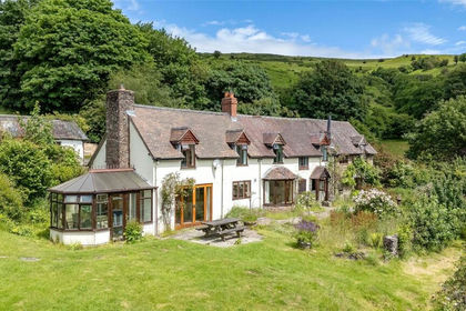
- Price
- Guide Price£850,000
- Size
- 7 acres
Abdon, Craven Arms, Shropshire, SY7, Abdon and Heath, Shropshire SY7 England
Added on 03/07/2026House with Land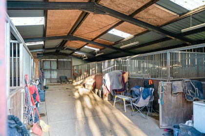
- Price
- Offers Over£600,000
- Size
- 15 acres
Clee St. Margaret, Craven Arms, SY7, Clee St. Margaret, Shropshire SY7 England
Added on 07/09/2026Equestrian property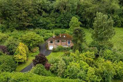
- Price
- £750,000
- Size
- 10 acres
Added on 22/06/2026House with Land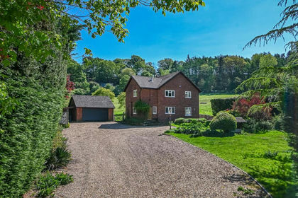
- Price
- Offers in Region of£850,000
- Size
- 6.8 acres
Quatford Grange, Sandyburn Lane, Quatford, Bridgnorth, Bridgnorth, Shropshire WV15 England
Added on 01/03/2026House with Land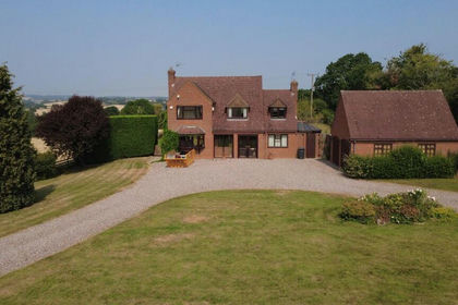
- Price
- Guide Price£700,000
- Size
- 22.44 acres
Covert Lane, Chelmarsh, Bridgnorth, Chelmarsh, Shropshire WV16 England
Added on 26/08/2026Smallholding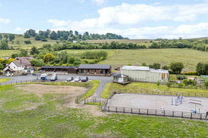
- Price
- Guide Price£875,000
- Size
- 11.75 acres
Cleeton St. Mary, Kidderminster, Shropshire, Hopton Wafers, Shropshire DY14 England
Added on 28/01/2026Equestrian property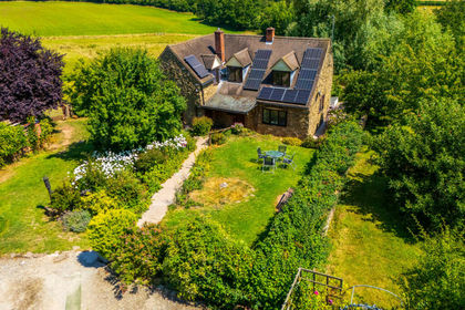
- Price
- Guide Price£825,000
- Size
- 20 acres
Neen Savage, Cleobury Mortimer, DY14, Neen Savage, Shropshire DY14 England
Added on 15/04/2026Smallholding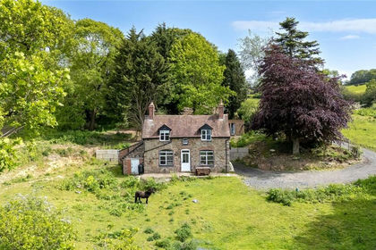
- Price
- Guide Price£595,000
- Size
- 6.96 acres
Knowbury, Ludlow, Shropshire, SY8, Caynham, Shropshire SY8 England
Added on 25/08/2026Cottage
- Price
- Offers in Region of£600,000
- Size
- 11.18 acres
Park Lane, Craven Arms, Shropshire, Craven Arms, Shropshire SY7 England
Added on 11/02/2026House with Land
- Price
- Offers Over£730,000
- Size
- 7 acres
Ashford Carbonel, Ludlow, SY8, Ashford Carbonel, Shropshire SY8 England
Added on 29/01/2026House with Land