Quatford Grange, Sandyburn Lane, Quatford, Bridgnorth
- Land size
- 6.8 acres
- Bedrooms
- 4
- Bathrooms
- 2
Description
Located around 2 miles from Bridgnorth town centre, Quatford Grange is a detached four bedroom home set within nearly 7 acres to include gardens, kennels, double garage, timber store and adjoining paddock land with views.
Kidderminster - 11 miles, Telford - 14 miles, Much Wenlock - 10 miles, Ironbridge - 12 miles, Shrewsbury - 23 miles, - Ludlow - 21 miles, Wolverhampton - 16 miles, Birmingham - 29 miles.
(All distances are approximate).
Location - Quatford is a small hamlet located south of the historic market town of Bridgnorth and is convenient for commuting to the West Midlands. Being approximately 2 miles from Bridgnorth Town centre it is easily accessible with public transport and a local pub available close by. Bridgnorth town is home to many places of interest such as the Severn Valley Railway, Cliff Railway and the River Severn. There is a wide selection of facilities that the town has to offer from shops, cafés, pubs and restaurants to primary and secondary schooling, leisure/sports clubs, golf clubs and health care services. There is also easy access to an abundance of countryside walks, Dudmaston Hall and lakes, the River Severn and riverside walks to Bridgnorth.
Accommodation - This is a spacious home, set well back from the road behind a long gated driveway. Two neighbours share the access with Quatford Grange set at the end with it's large gated driveway. This property stands apart given the large acreage in this wonderful setting.
Upon entering the property from the rear, there is an entrance hall with a guest WC off. A utility room provides good space with fitted base cupboards, sink unit, provision for a washing machine and dryer along with the oil fired central heating boiler. A door gives access to the front along with windows to the front and side elevations. A stable door opens into a large open dining kitchen with an outlook to the front. The kitchen is fitted with matching base cupboards and drawers, work tops over, sink unit, wall cabinets and the provision for appliances. There is a fitted Rayburn and centre island. From the dining area there are views looking out across the gardens. The lounge with exposed floorboards, features an open fireplace along with a door and window to the side. Double doors open into an adjoining reception room which could be used as a further sitting room or home office. A door opens into the inner hallway having under stairs storage and stairs off to the first floor.
From the hall stairs rise to a good sized first landing having loft access and doors off to; A principal double bedroom overlooking the front aspect with an adjoining an en-suite shower room fitted with a suite to comprise a WC, bidet, pedestal wash hand basin and a shower unit along with an storage cupboard and airing cupboard. There are three further double bedrooms all of which enjoys views. The house bathroom is fitted with a panelled bath, WC, wash hand basin and a separate shower with wo windows to the rear elevation.
Outside - Having a right of way in front of the neighbouring properties, gated access leads onto a large gravelled driveway with a lawned foregarden, well screened giving a high degree of privacy. There is a detached double garage having an electric roller shutter door, windows and a side door. There is a block of disused kennels and a large store to the rear. The gardens extend around to the rear and side of the property with adjoining fenced paddocks which have vehicle access bordered by woodland. In total the plot extends to around 6.8 acres.
Services - We are advised by our client that mains water, electricity and drainage are connected. Oil fired central heating. Verification should be obtained from your surveyor.
Tenure - We are advised by our client that the property is FREEHOLD. Verification should be obtained by your Solicitors. Vacant possession will be given upon completion.
Council Tax - Shropshire Council.
Tax Band: D.
Viewing Arrangements - Viewing strictly by appointment only. Please contact the BRIDGNORTH OFFICE.
Directions - Leaving Bridgnorth on the A442 towards Kidderminster, after nearly two miles you will enter Quatford. Proceed past the left hand turn into Chapel Lane and take the next turning left into a slip road where the gated entry is adjacent Fox House Cattery to the side of Chantry Lane
Map Location
Property details
- Tenure
- Freehold
- Council Tax Band
- D
- Date Posted
- 2026-03-01
Market Value Analysis
Compared with 281 Homes with Land listings in West Midlands (5+ acres).
Energy Performance Certificate
Energy Efficiency Rating
Based on UK Energy Performance Certificate standards (EU Directive 2002/91/EC)
Running costs are one side. Planning activity, flood history and ground risks for this location are in the full report.
Utilities & Restrictions
Utilities
- Electricity
- Ask Agent
- Water
- Ask Agent
- Heating
- Ask Agent
- Broadband
- Ask Agent
- Sewerage
- Ask Agent
Rights & Restrictions
- Public Rights of Way
- Ask Agent
- Private Rights of Way
- Ask Agent
- Listed Property
- Ask Agent
- Restrictions
- Ask Agent
Listed status, conservation areas and planning constraints for this location are in the full report.
Property Features
- Accessibility
- Ask Agent
- Parking
- Parking Available
- Garden
- Garden
Beyond the particulars: planning activity, flood history, heritage and ground risks, checked for this exact spot.
Connectivity
Broadband
Fastest speed available at this postcode
1.8 Gbps
Gigabit full fibre
Suitable for
- 4K streaming on every screen
- Full-time home working
- Online gaming & big downloads
Fixed wireless access may also be an option here.
Mobile signal
Predicted 4G and 5G signal; indoor signal depends on building materials.
Ofcom Connected Nations postcode-level predictions. Speeds and signal are modelled, not measured, and vary between addresses and providers.
Signal is the easy part. Planning activity, flood history and protected designations here are in the full report.
Nearest Schools
Primary
- St. Mary's Bluecoat Church of England Primary School1.5 milesOfsted: Good
- Ages
- 3 to 11
- Pupils
- 188
- Type
- Academy converter
- Faith
- Church of England
- Castlefields Primary School2 milesOfsted report card · May 2026
- Ages
- 3 to 11
- Pupils
- 226
- Type
- Academy converter
- St John's Catholic Primary School, A Voluntary Academy2.2 milesOfsted: Requires improvement
- Ages
- 4 to 11
- Pupils
- 193
- Type
- Academy converter
- Faith
- Catholic
- St Leonard's CofE Primary School2.2 milesOfsted report card · Mar 2026
- Ages
- 3 to 11
- Pupils
- 261
- Type
- Academy converter
- Faith
- Church of England
- Worfield Endowed Church Of England Primary School3.1 milesNo Ofsted rating
- Ages
- 3 to 11
- Pupils
- 154
- Type
- Academy converter
- Faith
- Church of England
Secondary
- Oldbury Wells School1.9 milesNo Ofsted rating
- Ages
- 11 to 16
- Pupils
- 740
- Type
- Academy converter
- Bridgnorth Endowed School2 milesOfsted: Good
- Ages
- 11 to 16
- Pupils
- 601
- Type
- Academy converter
- Kinver High School and Sixth Form7.9 milesOfsted: Good
- Ages
- 11 to 18
- Pupils
- 801
- Type
- Academy sponsor led
- Wombourne High School8.2 milesOfsted: Good
- Ages
- 11 to 18
- Pupils
- 995
- Type
- Academy sponsor led
- Haberdashers' Abraham Darby8.8 milesOfsted report card · Feb 2026
- Ages
- 11 to 18
- Pupils
- 1,084
- Type
- Academy sponsor led
Distances are straight-line from the advertised location. Source: the national school registers (DfE, Welsh Government, Scottish Government) and Ofsted.
Schools are just the start: sold prices nearby, planning activity and any flood history are in the full report.
Amenities
Supermarket
GP surgery
Pharmacy
Hospital
Straight-line distances from the advertised location. Sources: NHS records, Geolytix supermarket locations, OS Open Greenspace and the national trails registers.
The area stacks up? Now check the location itself: planning nearby, protected designations and past flooding.
Getting Around
Nearest station
Nearest bus stop
Typical drive times
Straight-line distances from the advertised location; drive times are typical free-flow times over OpenStreetMap road data, so allow more at peak. Public transport locations from DfT NaPTAN.
Easy to reach matters. So do planning activity, flood history and ground risks: all in the full report.
Flood Risk
Environment Agency open data, checked around the advertised map pin for the listed acreage. Long-term risk counts flood defences; the planning map's flood zones do not. Provided by LandSale, not the listing agent, and not part of the agent's particulars. Risk varies across a holding, so verify before committing.
Rivers and the sea
Not at the pin: mapped about 30 metres away.
Planning map: Flood Zone 3, about 20 metres away.
Surface water
Not at the pin: mapped about 30 metres away.
These bandings are the summary. Where this location sits on the flood maps, plus planning activity, heritage and ground risks, is in the full report.
Important notice: Information, maps and tags on this page are drawn from the advertising agent's marketing materials or generated automatically. LandSale has not verified them. Relying on these details is at your own risk, always carry out independent checks before committing to a purchase.
LandSale full disclaimer
Marketing information only - not formal particulars. The details on this website are provided for general guidance and do not constitute an offer or contract. Neither LandSale nor the advertising estate/land agent accepts responsibility for any inaccuracy.
1. Source of information
- Listing content: Core description, asking price, tenure, measurements, photographs and planning history originate from the marketing materials of the advertising estate or land agent. LandSale does not author this content and cannot guarantee its accuracy.
- Automated tags & categorisation: Property type, land-use class, acreage bands and similar labels may be applied by machine-learning models. They are intended as a helpful guide only and may not reflect the property's legal status or permitted use.
- Third-party & enriched data layers: Maps, boundary outlines, planning designations, soil reports, broadband coverage and other environmental or location-based insights are licensed from external suppliers. Such data are supplied “as is", may be incomplete or out of date and are subject to change without notice.
2. Verification required
Prospective purchasers must verify critical matters, including but not limited to planning permission, title boundaries, public rights of way, environmental constraints, acreage, services, access and VAT status, through their own inspections, specialist surveys, legal advisers and the selling agent before relying on the information or entering into any contract.
3. No warranty or liability
LandSale gives no warranty, express or implied, as to the accuracy, completeness or fitness for any particular purpose of the information displayed. LandSale shall not be liable for any loss, damage, cost or expense arising directly or indirectly from any use of or reliance on such information, save where liability may not be excluded by law.
4. Updates & feedback
If you believe any detail on this listing is inaccurate, please let us know. We will investigate and, where appropriate, update the listing or notify the agent.
© LandSale | Version 1.3 - August 2026
Listing agent
Berriman Eaton, Bridgnorth
23 Whitburn Street, Bridgnorth, WV16 4QN
Similar properties for sale
- Price
- Offers in Region of£995,000
- Size
- 4 acres
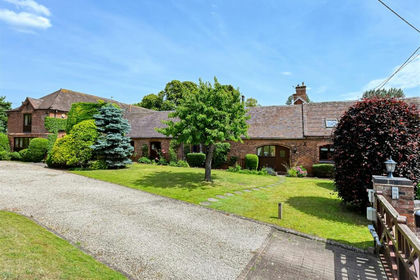
Little Orchard, Roughton, Nr Bridgnorth, WV15, Worfield, Shropshire WV15 England
Added on 02/08/2026Barn Conversion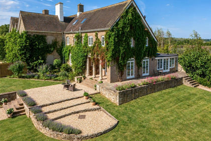
- Price
- £875,000
- Size
- 4 acres
Lower Glazeley Manor, Glazeley, Bridgnorth, Glazeley, Shropshire WV16 England
Added on 10/09/2026House with Land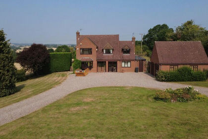
- Price
- Guide Price£700,000
- Size
- 22.44 acres
Covert Lane, Chelmarsh, Bridgnorth, Chelmarsh, Shropshire WV16 England
Added on 26/08/2026Smallholding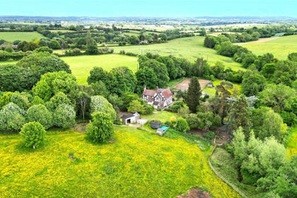
- Price
- £850,000
- Size
- 4 acres
Middleton Scriven, Bridgnorth, WV16, Middleton Scriven, Shropshire WV16 England
Added on 07/05/2026Cottage
- Price
- £895,000
- Size
- 10 acres
Kingsford Lane, Wolverley, Kidderminster, Kinver, Staffordshire DY11 England
Added on 09/07/2026House with Land
- Price
- Offers Over£700,000
- Size
- 4.75 acres
Kinlet Bank, Nr Cleobury Mortimer, DY14, Kinlet, Shropshire DY14 England
Added on 21/07/2026House with Land
- Price
- £799,000
- Size
- 4 acres
Kingsford Lane, Wolverley, Kidderminster, Wolverley and Cookley, Worcestershire DY11 England
Added on 04/04/2026House with Land
- Price
- Offers in Region of£800,000
- Size
- 4.5 acres
Added on 04/02/2026House with Land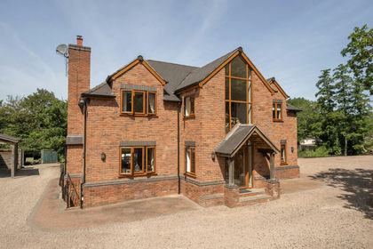
- Price
- Offers Over£1,000,000
- Size
- 3 acres
Kingsford Lane, Wolverley, DY11, Wolverley and Cookley, Worcestershire DY11 England
Added on 01/07/2026House with Land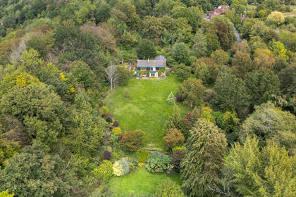
- Price
- £900,000
- Size
- 13 acres
Lincoln Hill, Ironbridge, TF8, The Gorge, Telford and Wrekin TF8 England
Added on 23/09/2026House with Land