Covert Lane, Chelmarsh, Bridgnorth
- Land size
- 22.44 acres
- Bedrooms
- 3
- Bathrooms
- 2
Key Features
- Garage
- Home office
- Double glazing
- Private Garden
- Outbuildings
- Land
- woodland
- workshop
- Wi-Fi
Description
Property Reference number : 608242
22 acre smallholding with house and outbuildingWell-proportioned detached 3-bedroom house
Bare land, woodland and agricultural buildings
Rural location
EPC Band D
Guide Price £700,000 (House, Buildings and c22.44 acres)
House, garage, garden and separate outbuildings set within 22.44 acres of land
Oak Tree Farm is subject to an Agricultural Occupancy Restriction
To be sold by tender on Wednesday 23rd September 2026
LOCATION
Situated in the heart of the Shropshire countryside off a quiet country lane just outside the village of Chelmarsh. Conveniently located 5.5 miles south of Bridgnorth, 26 miles from Shrewsbury and 15 miles from Telford which has a full range of amenities including a hospital, schools, bus service and shops and within easy reach of the A5 and M54. What3Words: ///chipper.breaches.household Grid Reference: SO720859
DESCRIPTION
Oak Tree Farm presents a unique opportunity to acquire a Shropshire smallholding extending in total to approximately 22.44 acres (9.08 hectares), available for sale as a whole. The 3 bedroom farmhouse and adjacent double garage benefit from a separate access off Covert Lane via a semi-circular in and out driveway. A pole barn and general purpose building sit to the north of the property off a separate farm track that runs adjacent to the house and garden. The land is primarily laid to pasture and has been used for producing hay. With gently rolling topography and grade 3 soil quality, the land could also be suitable for arable cropping. Additionally, the property features a charming wooded boundary on two sides that slopes down to a water course. The residential property includes a detached three-bedroom house offering approximately 186.70 square meters (2,010 square feet) of living space. Downstairs consists of a kitchen, living room, dining room, study, conservatory and downstairs WC. Upstairs benefits from a master bedroom with ensuite shower room, two further double bedrooms and a family bathroom with separate shower cubicle. While the home is in good condition, it would benefit from some modernisation, allowing buyers the opportunity to add personal touches. There is ample parking for several vehicles to the front of the house, and a 6.61m x 5.78m garage, making it convenient for both residents and visitors. The farm buildings are located at the end of a 135m track to the north of the residential accommodation. The buildings can be described as follows: • Monopitch pole barn with tin roof and open sides - c12.82m x 7.5m • Timber framed, corrigated sides and roof with part concrete floor and internal stores – 15.91m x 17.64m plus an extension to the rear c10.5m x 10.5m. The building is set on a slope which drops away from the front access towards the water course. There is a vehicle and separate pedestrian access at the front of the building.
LAND
The land extends to approximately 21.59 acres of which c15.51 acres is laid entirely to permanent pasture. With gently rolling topography, it is ideally suited for both grazing and arable purposes. It has a hedged boundary with Covert Lane and is fenced and bounded by mature woodland (c6.05acres) that slopes down to Borle brook to the west and a connecting drainage channel to the north. Access can be gained off Covert Lane and from the farm buildings. The land has been used for hay production and the crop has recently been taken. There is no third-party occupation. Vacant possession is granted on all parts upon completion.
ACCESS TO THE PROPERTY
The holding can be accessed directly off Covert Lane which is owned and managed by Shropshire County Council.
SERVICES
Mains Electricity and Mains Water are connected. Drainage from the house is to a septic tank located on the property. Meters for Electricity are located on the subject property and the water stop tap for the property is located in the kitchen. The residential property is centrally heated by an oil fired boiler. None of the services have been tested. Shropshire County Council – Council Tax band E.
TENURE AND POSSESSION
The property is offered for sale with Freehold Tenure and Vacant Possession on all parts upon completion.
TENDER DETAILS
The property is to be sold by Informal Tender. All tenders to be submitted on the specified forms, which must be received no later than Wednesday 23rd September 2026 at Midday.
PLANNING
As far as the vendors are aware there is no recent planning history associated with the property. Any purchasers will be responsible for carrying out their own planning searches.
IDENTIFICATION CHECKS In accordance with New Money Laundering Obligations for UK Property Transactions: The Money Laundering, Terrorist Financing and Transfer of Funds (Information on the Payer) Regulations 2017, perspective buyers must provide two forms of identification prior to submitting an offer.
WAYLEAVES, RIGHTS OF WAY AND EASEMENTS
The property will be sold subject to and with the benefit of all wayleaves, easements and rights of way, whether mentioned in these particulars or not.
BASIC PAYMENT AND ENVIRONMENTAL SCHEMES
There are no Entitlements included in the sale. As far as the Vendor is aware, the holding is not within any Environmental Stewardship Schemes.
AGRICULTURAL OCCUPANCY RESTRICTION
The property is subject to an Agricultural Occupancy Restriction (commonly known as an ‘agricultural tie’) under section 55 (or Section 171) of the Town and Country Planning Act.
WARNING: Never transfer funds to a property owner before viewing the property in person. If in doubt contact the marketing agent or the Citizens Advice Bureau.
GDPR: Submitting a viewing request for the above property means you are giving us permission to pass your contact details to the vendor or landlord for further communication related to viewing arrangement, or more information related to the above property. If you disagree, please write to us within the message field so we do not forward your details to the vendor or landlord or their managing company.
VIEWING DISCLAIMER: Quicklister endeavour to ensure the sales particulars of properties advertised are fair, accurate and reliable, however they are not exhaustive and viewing in person is highly recommended. If there is any point which is of particular importance to you, please contact Quicklister and we will be pleased to check the position for you, especially if you are contemplating traveling some distance to view the property.
Property Reference number : 608242
Map Location
Property details
- Tenure
- Freehold
- Council Tax Band
- Ask Agent
- Date Posted
- 2026-08-26
Market Value Analysis
Compared with 49 Farms & Smallholdings listings in West Midlands (10+ acres).
Utilities & Restrictions
Utilities
- Electricity
- Ask Agent
- Water
- Ask Agent
- Heating
- Ask Agent
- Broadband
- Ask Agent
- Sewerage
- Ask Agent
Rights & Restrictions
- Public Rights of Way
- Ask Agent
- Private Rights of Way
- Ask Agent
- Listed Property
- Ask Agent
- Restrictions
- Ask Agent
Listed status, conservation areas and planning constraints for this location are in the full report.
Property Features
- Accessibility
- Ask Agent
- Parking
- Parking Available
- Garden
- Garden
Beyond the particulars: planning activity, flood history, heritage and ground risks, checked for this exact spot.
Connectivity
Broadband
Fastest speed available at this postcode
80 Mbps
Superfast · available to 61% of premises
Suitable for
- HD streaming
- Video calls
- Web & social
Fixed wireless access may also be an option here.
Mobile signal
Predicted 4G and 5G signal; indoor signal depends on building materials.
Ofcom Connected Nations postcode-level predictions. Speeds and signal are modelled, not measured, and vary between addresses and providers.
Signal is the easy part. Planning activity, flood history and protected designations here are in the full report.
Nearest Schools
Primary
- Highley Community Primary School1.6 milesNo Ofsted rating
- Ages
- 5 to 11
- Pupils
- 234
- Type
- Community school
- Alveley Primary School2.7 milesOfsted: Good
- Ages
- 4 to 11
- Pupils
- 115
- Type
- Academy sponsor led
- Kinlet CofE Primary School3.7 milesOfsted: Requires improvement *
- Ages
- 4 to 11
- Pupils
- 41
- Type
- Voluntary controlled school
- Faith
- Church of England
- Stottesdon CofE Primary School3.8 milesOfsted: Good *
- Ages
- 2 to 11
- Pupils
- 118
- Type
- Academy converter
- Faith
- Church of England
- Castlefields Primary School4.1 milesOfsted report card · May 2026
- Ages
- 3 to 11
- Pupils
- 226
- Type
- Academy converter
Secondary
- Oldbury Wells School4 milesNo Ofsted rating
- Ages
- 11 to 16
- Pupils
- 740
- Type
- Academy converter
- Bridgnorth Endowed School4.5 milesOfsted: Good
- Ages
- 11 to 16
- Pupils
- 601
- Type
- Academy converter
- The Lacon Childe School7.2 milesOfsted: Requires improvement
- Ages
- 11 to 16
- Pupils
- 563
- Type
- Academy converter
- Wolverley CofE Secondary School7.6 milesOfsted report card · Feb 2026
- Ages
- 11 to 18
- Pupils
- 964
- Type
- Voluntary controlled school
- Faith
- Church of England
- Kinver High School and Sixth Form7.6 milesOfsted: Good
- Ages
- 11 to 18
- Pupils
- 801
- Type
- Academy sponsor led
* Latest graded judgement covers quality of education only; no overall grade was issued under the 2024-25 inspection framework.
Distances are straight-line from the advertised location. Source: the national school registers (DfE, Welsh Government, Scottish Government) and Ofsted.
Schools are just the start: sold prices nearby, planning activity and any flood history are in the full report.
Amenities
Supermarket
GP surgery
Pharmacy
Hospital
Green space
Straight-line distances from the advertised location. Sources: NHS records, Geolytix supermarket locations, OS Open Greenspace and the national trails registers.
The area stacks up? Now check the location itself: planning nearby, protected designations and past flooding.
Getting Around
Nearest station
Nearest bus stop
Typical drive times
Straight-line distances from the advertised location; drive times are typical free-flow times over OpenStreetMap road data, so allow more at peak. Public transport locations from DfT NaPTAN.
Easy to reach matters. So do planning activity, flood history and ground risks: all in the full report.
Flood Risk
Environment Agency open data, checked around the advertised map pin for the listed acreage. Long-term risk counts flood defences; the planning map's flood zones do not. Provided by LandSale, not the listing agent, and not part of the agent's particulars. Risk varies across a holding, so verify before committing.
Rivers and the sea
Planning map: Flood Zone 1.
Surface water
Not at the pin: mapped about 30 metres away.
These bandings are the summary. Where this location sits on the flood maps, plus planning activity, heritage and ground risks, is in the full report.
Important notice: Information, maps and tags on this page are drawn from the advertising agent's marketing materials or generated automatically. LandSale has not verified them. Relying on these details is at your own risk, always carry out independent checks before committing to a purchase.
LandSale full disclaimer
Marketing information only - not formal particulars. The details on this website are provided for general guidance and do not constitute an offer or contract. Neither LandSale nor the advertising estate/land agent accepts responsibility for any inaccuracy.
1. Source of information
- Listing content: Core description, asking price, tenure, measurements, photographs and planning history originate from the marketing materials of the advertising estate or land agent. LandSale does not author this content and cannot guarantee its accuracy.
- Automated tags & categorisation: Property type, land-use class, acreage bands and similar labels may be applied by machine-learning models. They are intended as a helpful guide only and may not reflect the property's legal status or permitted use.
- Third-party & enriched data layers: Maps, boundary outlines, planning designations, soil reports, broadband coverage and other environmental or location-based insights are licensed from external suppliers. Such data are supplied “as is", may be incomplete or out of date and are subject to change without notice.
2. Verification required
Prospective purchasers must verify critical matters, including but not limited to planning permission, title boundaries, public rights of way, environmental constraints, acreage, services, access and VAT status, through their own inspections, specialist surveys, legal advisers and the selling agent before relying on the information or entering into any contract.
3. No warranty or liability
LandSale gives no warranty, express or implied, as to the accuracy, completeness or fitness for any particular purpose of the information displayed. LandSale shall not be liable for any loss, damage, cost or expense arising directly or indirectly from any use of or reliance on such information, save where liability may not be excluded by law.
4. Updates & feedback
If you believe any detail on this listing is inaccurate, please let us know. We will investigate and, where appropriate, update the listing or notify the agent.
© LandSale | Version 1.3 - August 2026
Listing agent
Quicklister, Nationwide
16 - 18 High Street, Kingston Upon Thames, KT1 1EY
Similar properties for sale
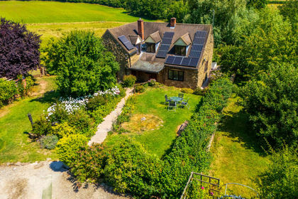
- Price
- Guide Price£825,000
- Size
- 20 acres
Neen Savage, Cleobury Mortimer, DY14, Neen Savage, Shropshire DY14 England
Added on 15/04/2026Smallholding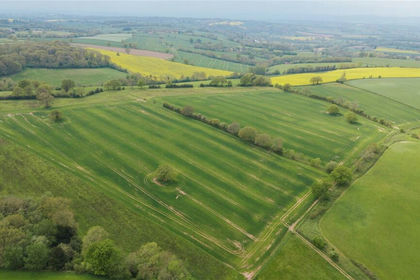
- Price
- £560,000
- Size
- 56.44 acres
Lot 5, Parsonage Farm, Kyre, Tenbury Wells, Worcestershire, Kyre, Worcestershire WR15 England
Added on 16/05/2026Farm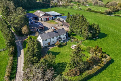
- Price
- Offers in Region of£800,000
- Size
- 26 acres
Added on 13/05/2026Farm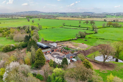
- Price
- Offers in Region of£695,000
- Size
- 12 acres
Soulton Road, Wem, Shrewsbury., Wem Rural, Shropshire SY4 England
Added on 24/04/2026Small Farm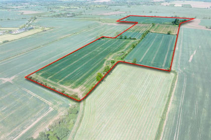
- Price
- Guide Price£750,000
- Size
- 56.79 acres
Land to the rear of Willis Croft, Warton, Tamworth, B79, Polesworth, Warwickshire B79 England
Added on 29/01/2026Arable Land