Redbrook Street, Woodchurch
- Land size
- 4.4 acres
- Bedrooms
- 4
- Bathrooms
- 2
Key Features
- Grade II listed farmhouse dating from circa 1625, rich in period character including exposed timbers, farmhouse tiling & impressive inglenook fireplaces
- Set within approx. 4.4 acres of mature gardens, paddocks & grounds with 2 substantial ponds & far-reaching rural surroundings
- 4 bedroom family home extending to over 2,150 sq. ft. with a versatile layout & beautifully preserved architectural features throughout
- Vaulted kitchen featuring exposed timber beams, extensive workspace & views across the surrounding gardens
- Comprehensive equestrian setup including 5 stables, tack room, hay barn, enclosed yard & 20m x 40m sand & fibre riding arena
- Direct access to hacking via a rear bridleway, creating immediate connectivity to the surrounding countryside without the need for roadwork
- Several enclosed paddocks equipped with water supplies & electric fencing
- Detached triple-bay barn-style garage incorporating workshop & gym space, with potential for conversion subject to the necessary consents
- Detached mobile home with planning permission for permanent structure - currently arranged as a high-quality 2 bedroom lodge
- Gated gravel driveway providing extensive parking, mature gardens with fruit trees & a peaceful setting backing onto open farmland
Description
Property Description: Guide price £1,50,000 - £1,250,000. Occupying approximately 4.4 acres and benefitting from direct bridleway access, Beales Farm combines a Grade II listed farmhouse dating from circa 1625 with an impressive range of equestrian facilities, ancillary accommodation and extensive outbuildings. Positioned on the edge of the sought after village of Woodchurch, the property presents a rare opportunity to acquire a character home equally suited to family life, equestrian pursuits and multi-generational living.
Approached via a gated entrance and sweeping gravel driveway, the farmhouse sits comfortably within its grounds, framed by mature gardens, paddocks and open countryside beyond. The property retains a wealth of period features including exposed timber beams, farmhouse tiling, inglenook fireplaces and original character details that reflect its rich history whilst remaining practical for modern living.
The property has a spacious living room and separate dining room, both with bay windows and centred around impressive fireplaces with Stovax log burners and characterful period detailing. The kitchen forms the heart of the home, featuring a vaulted ceiling with exposed timbers, a ceramic Belfast-style sink, integrated appliances including a dishwasher and washing machine, a gas hob and oven, together with extensive cabinetry and preparation space. Views across the gardens and grounds reinforce the property's connection to its rural setting. Completing the ground floor is the family shower room.
On the first floor there are two large double bedrooms. The principal bedroom has its own en suite bathroom with a separate shower and a roll top bath creating a touch of luxury, while the second bedroom has triple fitted wardrobes, providing ample storage. On the second floor are two further double bedrooms and a WC. Character features continue throughout, creating comfortable and individual spaces that remain true to the property's heritage.
A detached two-bedroom mobile home provides excellent flexibility for visiting family members, multi-generational living, guest accommodation or home working requirements. In addition, the triple bay barn-style garage incorporates workshop and gym space and may offer further potential, subject to any necessary consents.
Outside: The grounds extend to approximately 4.4 acres and have been thoughtfully arranged to support both equestrian and lifestyle use. Mature gardens surround the farmhouse and include established planting, expansive lawns, fruit trees and two substantial ponds which attract an abundance of wildlife throughout the year.
The equestrian facilities are particularly impressive and include five stables, a tack room, hay barn, enclosed yard and a professionally constructed 20m x 40m sand and fibre riding arena, provisions have also been made so that this could be extended to 20m x 60m. Several paddocks are enclosed with electric fencing and benefit from water supplies, creating a practical and well-organised setup for private equestrian use. Direct access to a rear bridleway allows riders to access the surrounding countryside without the need for significant roadwork, a feature rarely available and highly sought after by equestrian purchasers. The property backs onto open farmland, creating a wonderful sense of space, privacy and connection with the surrounding landscape.
Location: Woodchurch is widely regarded as one of Kent's most desirable villages, combining a strong community atmosphere with excellent accessibility. At the heart of the village are two well-regarded public houses, The Bonny Cravat and The Six Bells, together with a village shop, butcher, village green, recreation facilities and a Church of England primary school rated 'Good" (Ofsted 2023). The village also supports a range of clubs, societies and community events throughout the year, creating a thriving and welcoming environment.
The surrounding countryside is particularly attractive and has become increasingly recognised for its vineyards and wine production. Both Wayfarer Wines and Woodchurch Vineyard are located nearby, with Woodchurch Vineyard featuring a recently opened winery and wine bar where visitors can enjoy tastings and views across the vines.
For equestrian buyers, the surrounding network of quiet country lanes, bridleways and open countryside provides excellent riding opportunities, with direct access to hacking available from the property itself. The wider area is renowned for its countryside walks, riding routes, vineyards and attractive market towns, whilst nearby Tenterden offers an excellent range of independent shops, cafés and restaurants.
Despite its rural setting, the property remains exceptionally well connected. Ashford International and Pluckley stations are both approximately 15 minutes away, with high-speed services from Ashford International reaching London St Pancras in around 38 minutes. The M20 provides straightforward access to the Channel Tunnel, Kent coastline and wider motorway network, whilst Gatwick Airport can be reached in approximately 1 hour 15 minutes.
The current owners particularly value the balance between privacy, accessibility and countryside living, describing the location as peaceful whilst remaining remarkably well connected for both work and travel.
Directions: SatNav = TN26 3QS / What3Words = cobras.user.woke
Council Tax: Band G (correct at time of marketing). To check council tax for this property, please refer to the local authority website.
Local Authority: Ashford Borough Council . Kent County Council
Services: Gas central heating, mains water and electricity, private drainage. For broadband and mobile coverage, we advise you check your providers website or refer to an online checker.
Tenure: This property is freehold and is sold with vacant possession upon completion.
Disclaimer: Sandersons and their clients state that these details are for general guidance only and accuracy cannot be guaranteed. They do not form any part of any contract. All measurements are approximate, and floor plans are for general indication only and are not measured accurate drawings. No guarantees are given with any mentioned planning permission or fitness for purpose. No appliances, equipment, fixture or fitting has been tested by us and items shown in photographs are not necessarily included. Buyers must satisfy themselves on all matters by inspection or through the conveyancing process.
Identity verification: Please note, Sandersons UK are obligated by law to undertake Anti Money Laundering (AML) Regulations checks on any purchaser who has an offer accepted on a property. We are required to use a specialist third party service to verify your identity. The cost of these checks is £60 inc.VAT per property and accepted offer. This is payable at the point an offer is accepted and our purchaser information form is completed, prior to issuing Memorandum of Sales to both parties respective conveyancing solicitors. This is a legal requirement and the charge is non-refundable.
Disclaimer: Please note the image with the boundary line is for indicative purposes only and will be need to be confirmed via Land Registry during the conveyancing process.
Additional Property Notes: The property is of traditional construction and has had no adaptations for accessibility. There is a double garage and driveway parking for multiple vehicles next to the property.
Register for new listings before the portal launch
Map Location
Property details
- Tenure
- Freehold
- Council Tax Band
- G
- Date Posted
- 2026-06-29
Market Value Analysis
Compared with 1,735 Homes with Land listings in South East England (1+ acres).
Energy Performance Certificate
Energy Efficiency Rating
Based on UK Energy Performance Certificate standards (EU Directive 2002/91/EC)
Running costs are one side. Planning activity, flood history and ground risks for this location are in the full report.
Utilities & Restrictions
Utilities
- Electricity
- Mains
- Water
- Mains
- Heating
- Gas Heating
- Broadband
- Full Fibre (FTTP)
- Sewerage
- Septic Tank / Private
Rights & Restrictions
- Public Rights of Way
- Ask Agent
- Private Rights of Way
- Ask Agent
- Listed Property
- Ask Agent
- Restrictions
- Ask Agent
Listed status, conservation areas and planning constraints for this location are in the full report.
Property Features
- Accessibility
- Ask Agent
- Parking
- Off-Street Parking
- Garden
- Rear Garden
Beyond the particulars: planning activity, flood history, heritage and ground risks, checked for this exact spot.
Connectivity
Broadband
Fastest speed available at this postcode
1.8 Gbps
Gigabit full fibre
Suitable for
- 4K streaming on every screen
- Full-time home working
- Online gaming & big downloads
Fixed wireless access may also be an option here.
Mobile signal
Predicted 4G and 5G signal; indoor signal depends on building materials.
Ofcom Connected Nations postcode-level predictions. Speeds and signal are modelled, not measured, and vary between addresses and providers.
Signal is the easy part. Planning activity, flood history and protected designations here are in the full report.
Nearest Schools
Primary
- Woodchurch Church of England Primary School0.9 milesOfsted: Good
- Ages
- 4 to 11
- Pupils
- 165
- Type
- Voluntary controlled school
- Faith
- Church of England
- High Halden Church of England Primary School2 milesNo Ofsted rating
- Ages
- 4 to 11
- Pupils
- 105
- Type
- Voluntary controlled school
- Faith
- Church of England
- Bethersden Primary School2.5 milesOfsted: Good
- Ages
- 4 to 11
- Pupils
- 117
- Type
- Community school
- St Michael's Church of England Primary School3 milesOfsted: Good *
- Ages
- 4 to 11
- Pupils
- 177
- Type
- Academy converter
- Faith
- Church of England
- Tenterden Infant School3.4 milesNo Ofsted rating
- Ages
- 5 to 7
- Pupils
- 124
- Type
- Academy converter
Secondary
- Homewood School and Sixth Form Centre3 milesOfsted: Good
- Ages
- 11 to 18
- Pupils
- 1,772
- Type
- Academy converter
- Chilmington Green School3.7 milesOfsted report card · May 2026
- Ages
- 11 to 19
- Pupils
- 449
- Type
- Free schools
- The John Wallis Church of England Academy4.9 milesOfsted: Good
- Ages
- 3 to 19
- Pupils
- 1,650
- Type
- Academy sponsor led
- Faith
- Church of England
- Highworth Grammar School6.3 milesOfsted: Outstanding *
- Ages
- 11 to 18
- Pupils
- 1,553
- Type
- Academy converter
- Gender
- Girls
- The North School6.6 milesNo Ofsted rating
- Ages
- 11 to 19
- Pupils
- 1,237
- Type
- Academy converter
* Latest graded judgement covers quality of education only; no overall grade was issued under the 2024-25 inspection framework.
Distances are straight-line from the advertised location. Source: the national school registers (DfE, Welsh Government, Scottish Government) and Ofsted.
Schools are just the start: sold prices nearby, planning activity and any flood history are in the full report.
Amenities
Supermarket
GP surgery
Pharmacy
Hospital
Straight-line distances from the advertised location. Sources: NHS records, Geolytix supermarket locations, OS Open Greenspace and the national trails registers.
The area stacks up? Now check the location itself: planning nearby, protected designations and past flooding.
Getting Around
Nearest station
Nearest bus stop
Typical drive times
Straight-line distances from the advertised location; drive times are typical free-flow times over OpenStreetMap road data, so allow more at peak. Public transport locations from DfT NaPTAN.
Easy to reach matters. So do planning activity, flood history and ground risks: all in the full report.
Flood Risk
Environment Agency open data, checked around the advertised map pin for the listed acreage. Long-term risk counts flood defences; the planning map's flood zones do not. Provided by LandSale, not the listing agent, and not part of the agent's particulars. Risk varies across a holding, so verify before committing.
Rivers and the sea
Planning map: Flood Zone 1.
Surface water
Not at the pin: mapped about 30 metres away.
These bandings are the summary. Where this location sits on the flood maps, plus planning activity, heritage and ground risks, is in the full report.
Important notice: Information, maps and tags on this page are drawn from the advertising agent's marketing materials or generated automatically. LandSale has not verified them. Relying on these details is at your own risk, always carry out independent checks before committing to a purchase.
LandSale full disclaimer
Marketing information only - not formal particulars. The details on this website are provided for general guidance and do not constitute an offer or contract. Neither LandSale nor the advertising estate/land agent accepts responsibility for any inaccuracy.
1. Source of information
- Listing content: Core description, asking price, tenure, measurements, photographs and planning history originate from the marketing materials of the advertising estate or land agent. LandSale does not author this content and cannot guarantee its accuracy.
- Automated tags & categorisation: Property type, land-use class, acreage bands and similar labels may be applied by machine-learning models. They are intended as a helpful guide only and may not reflect the property's legal status or permitted use.
- Third-party & enriched data layers: Maps, boundary outlines, planning designations, soil reports, broadband coverage and other environmental or location-based insights are licensed from external suppliers. Such data are supplied “as is", may be incomplete or out of date and are subject to change without notice.
2. Verification required
Prospective purchasers must verify critical matters, including but not limited to planning permission, title boundaries, public rights of way, environmental constraints, acreage, services, access and VAT status, through their own inspections, specialist surveys, legal advisers and the selling agent before relying on the information or entering into any contract.
3. No warranty or liability
LandSale gives no warranty, express or implied, as to the accuracy, completeness or fitness for any particular purpose of the information displayed. LandSale shall not be liable for any loss, damage, cost or expense arising directly or indirectly from any use of or reliance on such information, save where liability may not be excluded by law.
4. Updates & feedback
If you believe any detail on this listing is inaccurate, please let us know. We will investigate and, where appropriate, update the listing or notify the agent.
© LandSale | Version 1.3 - August 2026
Listing agent
Sandersons, Covering Ashford
Covering Ashford
Similar properties for sale
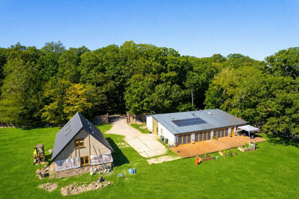
- Price
- Offers in Excess of£950,000
- Size
- 2.5 acres
Added on 27/08/2026House with Land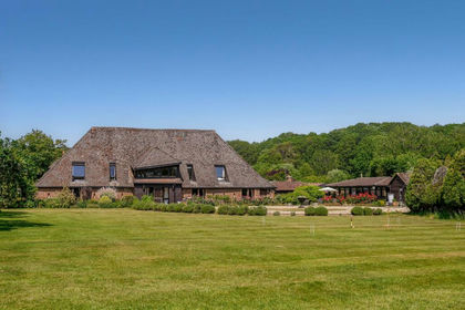
- Price
- Offers in Excess of£1,300,000
- Size
- 2.8 acres
Swain Road, St. Michaels, TN30, Tenterden, Kent TN30 England
Added on 06/06/2026Barn Conversion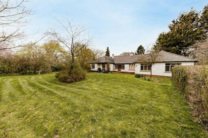
- Price
- Guide Price£1,100,000
- Size
- 9.4 acres
Ashford, Kent, Great Chart with Singleton, Kent TN26 England
Added on 28/03/2026Equestrian property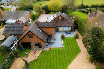
- Price
- Offers in Region of£1,250,000
- Size
- 3 acres
Bromley Green road, Ruckinge, Ashford, Kent, TN26, Ruckinge, Kent TN26 England
Added on 08/10/2026House with Land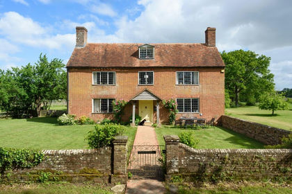
- Price
- Guide Price£1,150,000
- Size
- 5.6 acres
Added on 25/05/2026Farmhouse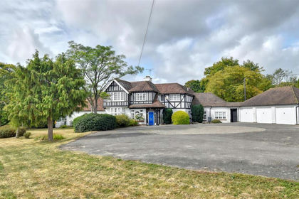
- Price
- Guide Price£1,250,000
- Size
- 8.06 acres
Added on 03/09/2026House with Land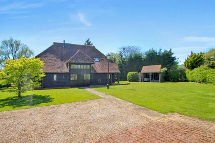
- Price
- Guide Price£1,250,000
- Size
- 5 acres
Added on 28/02/2026Country Home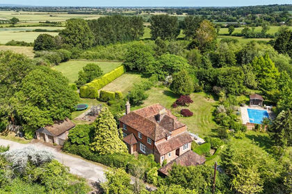
- Price
- Guide Price£1,350,000
- Size
- 2 acres
Stone Cum Ebony, Tenterden, Kent TN30, Stone-cum-Ebony, Kent TN30 England
Added on 13/03/2026Farmhouse
- Price
- Guide Price£1,295,000
- Size
- 5 acres
Tenterden Road, Biddenden, Kent, TN27, Biddenden, Kent TN27 England
Added on 21/07/2026House with Land
- Price
- £1,290,000
- Size
- 2.8 acres
Cot Lane, Biddenden, Ashford, Kent, TN27, Biddenden, Kent TN27 England
Added on 17/05/2026Farmhouse