Crowfield Lane, Dymock, GL18
- Land size
- 0.5 acres
- Bedrooms
- 4
- Bathrooms
- 2
Key Features
- Circa 2,500 sq ft Detached Cottage In Idyllic, Rural Dymock in Gloucestershire
- Period Charm & Character Throughout; Exposed Beams & Brick, Feature Fireplaces & Log Burning Stove
- Newly Fitted High-Specification Kitchen, Family Breakfast Room & 4 Versatile Receptions Rooms + Conservatory
- 4 Double Bedrooms, Traditional Family Bathroom & Impressive Galleried Landing/Study Area
- Gated Gravel Carriage Driveway, Large Detached Garage/Workshop & Stable Block
- Approx. 1/2 Acre Plot, Southerly Facing Rear Gardens & Uninterrupted Countryside Backdrop
- Offered To The Market With No Onward Chain
- A Private & Peaceful Setting Within A Vibrant & Friendly Village Community
- Accessible Transport Links & Open Countryside For Walking & Cycling
- Highly Regarded Schooling, Community Owned Pub, Cricket Club, Church & Village Hall Nearby
Description
Driving along the gated, tree-lined, gravelled driveway to visit this home for the first time reminded me of a short poem I once read:
"The leafy branches reach and meet, to form a quiet, green retreat. The branches curve, the shadows fall, and tall green giants guard it all.
They stand in rows, a marching line, a path of nature’s own design. The tyres hum a gentle tune, beneath the sun, beneath the moon.
The wooden pillars frame the way, and welcome home the end of day" - Welcome to Moor Oak Cottage.
The home lies just outside the village of Dymock, a peaceful community known for its daffodil meadows, historic church, and welcoming local pub, The Beauchamp Arms. Everyday essentials are easily found in nearby Newent, only a few miles away, where there are shops, cafés, and a weekly market. For more extensive shopping, dining, and rail connections, the charming market town of Ledbury is a short drive, offering direct trains to Hereford, Worcester, and Birmingham, with Gloucester and Cheltenham within comfortable reach by car.
The area is well placed for excellent schooling, with Dymock Primary rated highly and a range of independent and state options available in Ledbury, Newent, and Malvern. For those who enjoy outdoor pursuits, the surrounding countryside is a true playground: footpaths wind through woodland and wildflower meadows, while bridleways link to nearby farms and open land, making it ideal for riders, walkers, and cyclists. The Forest of Dean and the Malvern Hills are both within easy reach, offering some of the region’s finest scenery and outdoor leisure opportunities.
Despite its rural charm, Moor Oak Cottage remains well connected. The M50 motorway is a short drive away, linking smoothly to the M5 for travel to Bristol, Birmingham, and beyond. For those seeking a slower pace, the village and surrounding hamlets offer a vibrant sense of community, with local fairs, music events, and country shows providing year-round enjoyment.
For families, active retirees, and equestrian buyers alike, life at Moor Oak Cottage captures the best of the English countryside: peace without isolation, space without compromise, and character without pretence. It is a place where days are measured in quiet moments and open skies, where every season brings new colour to the garden, and where a deep sense of home is felt from the very first step inside.
Originally dating back to the 17th century, the cottage has evolved thoughtfully over the years through sensitive extensions and a skilful barn conversion, creating a generous, detached freehold residence of around 2,500 square feet. Every corner reveals a blend of old and new, from the exposed beams and thick stone walls with arrow-slit windows to the modern comforts of double glazing and oil-fired central heating.
Stepping inside, the entrance lobby leads to a welcoming farmhouse style, family breakfast room that flows through an archway into the newly fitted, high-specification kitchen. An inner reception hallway leads to a comfortable sitting room where a feature fireplace and log-burning stove create the perfect setting for cosy evenings. A tucked-away study area provides a quiet space for home working or reading.
The conversion of the attached stone barn has added remarkable flexibility to the home. The ground floor now includes two further reception rooms; a stunning living room or formal dining area with a vaulted ceiling, log burning stove, exposed trusses, and a large picture window drawing in soft natural light, and a versatile study which could be used as an additional guest bedroom. A cloakroom, useful utility/store cupboard and conservatory complete this level, providing extra relaxation and family space.
Upstairs, a split-level landing connects three double bedrooms and a family bathroom finished in a traditional style that suits the cottage’s character. From the galleried landing, an exposed beam archway leads into the converted barn section and impressive principal bedroom. This room feels both private and spacious, framed by exposed brickwork and original timbers that tell the home’s long story. It’s a peaceful retreat with a lovely outlook over the surrounding gardens and countryside beyond.
Outside, the setting is every bit as special as the interior. Approached by a tree-lined gravel driveway, the cottage sits within approximately half an acre of landscaped gardens. Mature trees, lawns, and colourful borders wrap around the property, creating both beauty and privacy. There’s a sheltered terrace for outdoor dining, a productive vegetable garden, and a small orchard offering seasonal fruit.
Practical outbuildings make this home as functional as it is picturesque. A large detached garage provides excellent storage and workshop space, while the stable block adds potential for hobbies, a pony, or conversion into a studio or home office (subject to permissions). There’s also a charming brick-built summer house and a greenhouse tucked neatly within the grounds. Every aspect of the outdoor space complements the easy, countryside lifestyle that families and relocating buyers will value most.
Map Location
Property details
- Tenure
- Freehold
- Council Tax Band
- Ask Agent
- Date Posted
- 2026-05-25
Energy Performance Certificate
Energy Efficiency Rating
Based on UK Energy Performance Certificate standards (EU Directive 2002/91/EC)
Running costs are one side. Planning activity, flood history and ground risks for this location are in the full report.
Utilities & Restrictions
Utilities
- Electricity
- Ask Agent
- Water
- Ask Agent
- Heating
- Ask Agent
- Broadband
- Ask Agent
- Sewerage
- Ask Agent
Rights & Restrictions
- Public Rights of Way
- Ask Agent
- Private Rights of Way
- Ask Agent
- Listed Property
- Ask Agent
- Restrictions
- Ask Agent
Listed status, conservation areas and planning constraints for this location are in the full report.
Property Features
- Accessibility
- Ask Agent
- Parking
- Parking Available
- Garden
- Garden
Beyond the particulars: planning activity, flood history, heritage and ground risks, checked for this exact spot.
Connectivity
Broadband
Fastest speed available at this postcode
17 Mbps
Standard (10-30 Mbps)
Suitable for
- Web & social
- Music streaming
- Standard video calls
Mobile signal
Predicted 4G and 5G signal; indoor signal depends on building materials.
Ofcom Connected Nations postcode-level predictions. Speeds and signal are modelled, not measured, and vary between addresses and providers.
Signal is the easy part. Planning activity, flood history and protected designations here are in the full report.
Nearest Schools
Primary
- Ann Cam Church of England Primary School875 metresOfsted: Good
- Ages
- 2 to 11
- Pupils
- 126
- Type
- Academy converter
- Faith
- Church of England
- Pauntley Church of England Primary School2 milesOfsted: Good
- Ages
- 4 to 11
- Pupils
- 25
- Type
- Voluntary controlled school
- Faith
- Church of England
- Redmarley Church of England Primary School2.9 milesOfsted: Good
- Ages
- 3 to 11
- Pupils
- 97
- Type
- Academy converter
- Faith
- Church of England
- Picklenash Junior School3.1 milesOfsted: Requires improvement *
- Ages
- 7 to 11
- Pupils
- 157
- Type
- Foundation school
- Glebe Infants' School3.1 milesOfsted: Good
- Ages
- 4 to 7
- Pupils
- 132
- Type
- Foundation school
Secondary
- Newent Community School and Sixth Form Centre3.5 milesNo Ofsted rating
- Ages
- 11 to 18
- Pupils
- 976
- Type
- Academy converter
- John Masefield High School3.8 milesNo Ofsted rating
- Ages
- 11 to 18
- Pupils
- 849
- Type
- Academy converter
- John Kyrle High School and Sixth Form Centre Academy7.3 milesOfsted: Good *
- Ages
- 11 to 18
- Pupils
- 1,274
- Type
- Academy converter
- Dene Magna and Sixth Form8.4 milesOfsted: Good *
- Ages
- 11 to 18
- Pupils
- 1,020
- Type
- Academy converter
- The Chase10 milesOfsted report card · Jan 2026
- Ages
- 11 to 18
- Pupils
- 1,449
- Type
- Academy converter
* Latest graded judgement covers quality of education only; no overall grade was issued under the 2024-25 inspection framework.
Distances are straight-line from the advertised location. Source: the national school registers (DfE, Welsh Government, Scottish Government) and Ofsted.
Schools are just the start: sold prices nearby, planning activity and any flood history are in the full report.
Amenities
Supermarket
GP surgery
Pharmacy
Hospital
Green space
Straight-line distances from the advertised location. Sources: NHS records, Geolytix supermarket locations, OS Open Greenspace and the national trails registers.
The area stacks up? Now check the location itself: planning nearby, protected designations and past flooding.
Getting Around
Nearest station
Nearest bus stop
Typical drive times
Straight-line distances from the advertised location; drive times are typical free-flow times over OpenStreetMap road data, so allow more at peak. Public transport locations from DfT NaPTAN.
Easy to reach matters. So do planning activity, flood history and ground risks: all in the full report.
Flood Risk
Environment Agency open data, checked around the advertised map pin for the listed acreage. Long-term risk counts flood defences; the planning map's flood zones do not. Provided by LandSale, not the listing agent, and not part of the agent's particulars. Risk varies across a holding, so verify before committing.
Rivers and the sea
Planning map: Flood Zone 1.
Surface water
These bandings are the summary. Where this location sits on the flood maps, plus planning activity, heritage and ground risks, is in the full report.
Important notice: Information, maps and tags on this page are drawn from the advertising agent's marketing materials or generated automatically. LandSale has not verified them. Relying on these details is at your own risk, always carry out independent checks before committing to a purchase.
LandSale full disclaimer
Marketing information only - not formal particulars. The details on this website are provided for general guidance and do not constitute an offer or contract. Neither LandSale nor the advertising estate/land agent accepts responsibility for any inaccuracy.
1. Source of information
- Listing content: Core description, asking price, tenure, measurements, photographs and planning history originate from the marketing materials of the advertising estate or land agent. LandSale does not author this content and cannot guarantee its accuracy.
- Automated tags & categorisation: Property type, land-use class, acreage bands and similar labels may be applied by machine-learning models. They are intended as a helpful guide only and may not reflect the property's legal status or permitted use.
- Third-party & enriched data layers: Maps, boundary outlines, planning designations, soil reports, broadband coverage and other environmental or location-based insights are licensed from external suppliers. Such data are supplied “as is", may be incomplete or out of date and are subject to change without notice.
2. Verification required
Prospective purchasers must verify critical matters, including but not limited to planning permission, title boundaries, public rights of way, environmental constraints, acreage, services, access and VAT status, through their own inspections, specialist surveys, legal advisers and the selling agent before relying on the information or entering into any contract.
3. No warranty or liability
LandSale gives no warranty, express or implied, as to the accuracy, completeness or fitness for any particular purpose of the information displayed. LandSale shall not be liable for any loss, damage, cost or expense arising directly or indirectly from any use of or reliance on such information, save where liability may not be excluded by law.
4. Updates & feedback
If you believe any detail on this listing is inaccurate, please let us know. We will investigate and, where appropriate, update the listing or notify the agent.
© LandSale | Version 1.3 - August 2026
Listing agent
TAUK, Covering Nationwide
Covering Nationwide
Similar properties for sale
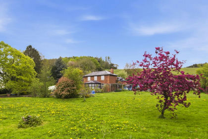
- Price
- Guide Price£750,000
- Size
- 2.2 acres
Ketford Nr Dymock GL18, Pauntley, Gloucestershire GL18 England
Added on 25/05/2026House with Land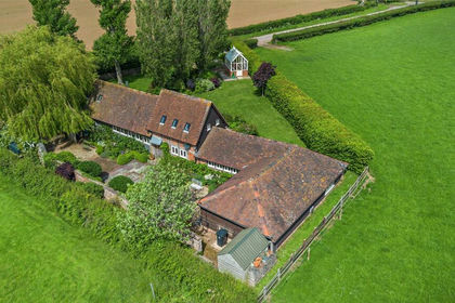
- Price
- Guide Price£765,000
Kempley Road, Dymock, Gloucestershire, GL18, Kempley, Gloucestershire GL18 England
Added on 05/06/2026Barn Conversion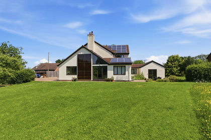
- Price
- Guide Price£750,000
- Size
- 1 acres
Kempley Green, Kempley, Dymock, Gloucestershire, GL18, Kempley, Gloucestershire GL18 England
Added on 25/05/2026House with Land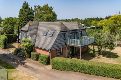
- Price
- Guide Price£770,000
- Size
- 5.3 acres
Strawberry Hill, Newent, Gloucestershire, GL18, Newent, Gloucestershire GL18 England
Added on 14/08/2026House with Land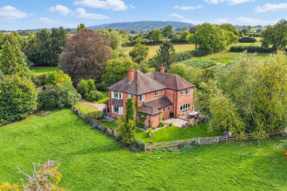
- Price
- Guide Price£750,000
- Size
- 1.5 acres
Bradfords Lane, Newent, Newent, Gloucestershire GL18 England
Added on 12/10/2026House with Land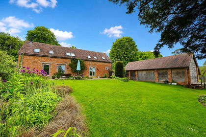
- Price
- Offers in Region of£850,000
- Size
- 6.5 acres
Dymock Road, Ledbury, Herefordshire, HR8, Ledbury, Herefordshire, County of HR8 England
Added on 28/05/2026Barn Conversion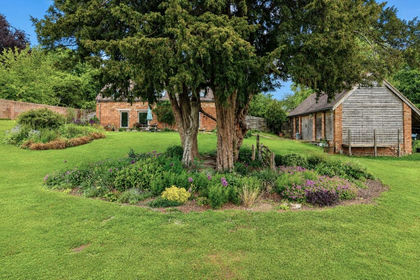
- Price
- Offers in Excess of£700,000
Dymock Road, Ledbury, Herefordshire, HR8, Ledbury, Herefordshire, County of HR8 England
Added on 14/07/2026Barn Conversion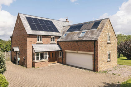
- Price
- Guide Price£699,950
- Size
- 1.28 acres
Added on 15/09/2026House with Land
- Price
- Guide Price£699,950
- Size
- 1.25 acres
Fortys Pitch, Gorsley, Ross-On-Wye, Linton (Penyard Ward), Herefordshire, County of HR9 England
Added on 16/09/2026House with Land
- Price
- Guide Price£750,000
Nr Kempley, Detached Barn Conversion, Upton Bishop, Herefordshire, County of HR9 England
Added on 29/01/2026Barn Conversion