Pasford Mill House, Patshull Road, Pattingham, Wolverhampton, WV6
- Land size
- 2 acres
- Bedrooms
- 5
- Bathrooms
- 5
Description
A former mill which lay derelict until the current owner purchased in 2010 and gave it a full make over, managing to keep several original features including the former mill central gear system.
This property offers well proportioned living areas over four storeys with beautiful countryside views and a total plot size of a little over two acres.
Location - The property stands just under a mile and a half from the centre of Pattingham which is a highly regarded village with a full complement of local facilities and an active village community. The further, more extensive amenities of both Albrighton and Codsall are within easy reach and there is convenient travelling to Wolverhampton City Centre, the former new town of Telford and the historic market town of Bridgnorth.
Communications are excellent with Codsall Station providing direct services to Shrewsbury, Birmingham and beyond and the M54 (J2 & J3) facilitating fast access to the entire motorway network.
Furthermore, the area is well served by schooling in both sectors with St Chads Primary School being in the village centre itself which has a Good Ofsted rating.
Description - Pasford Mill House is a former working mill which has been creatively brought back to life by the current owners. The property works on a smart system with individual room heating and automatic lighting controls throughout. There are rooms of superb proportions throughout taking advantage of the stunning countryside views. There is oak flooring to the majority, double glazing and a wealth of beams throughout.
The rear garden backs onto the paddock which has the benefit of a stable in the garage block making it the perfect opportunity for those with equestrian interests with the entire plot being a little over two acres.
Accommodation - A wrought iron staircase rises to the main entrance with an oak door opening into the HALL with a glass viewing point to the old mill and staircases leading to the first floor and the lower ground floor. The focal point of the house is the LIVING / DINING / KITCHEN with a range of wall and base units with granite working surfaces and a coordinating centre island with breakfast bar side. There are a range of integrated appliances including a dishwasher, bin drawer, electric range style cooker with filtration unit above, a steam oven, two microwaves, a wine fridge, there is space for an American style fridge freezer and ample space for seating with wiring for a wall mounted TV and far reaching views. A door from the kitchen opens into the DINING ROOM with views to two elevations and an external door to the front.
A staircase from the hall leads to the lower ground floor HALL with a glazed wall to the old mill. Double doors open into the RECEPTION SUITE with a GUEST CLOAKROOM, a STUDY with glass wall to provide views over the countryside. The LOUNGE has vaulted ceiling with exposed beams, floor to ceiling windows to two elevations.
A further staircase leads to the ENTERTAINMENT SUITE with a bar area opening onto a superb sitting area with an exposed brick inglenook fireplace with solid fuel burning stove. with double glazed bifold doors to two elevations. There is an open doorway to the GYM with wiring for a wall mounted TV and rooflights. Behind the bar a glass door opens into the BOOT ROOM with storage cupboards and a window to the mill. A brick archway opens into a REAR HALL with a stable style door to the rear garden. The SNUG houses the former mill workings with a solid fuel burning stove, wiring for wall lights and a storage cupboard. The LAUNDRY with wall and base units, space for a washing machine and tumble dryer and a GUEST CLOAKROOM with WC.
A staircase from the hall rises to the first floor landing with windows with far reaching views. There is a superb PRINCIPAL BEDROOM SUITE with a good size double bedrooms with far reaching countryside views, wiring for a wall mounted TV, a door opens into the DRESSING ROOM with several wardrobes and drawers with a kneehole dressing table and a brick recessed fireplace. Concealed double doors open into the EN-SUITE with a jacuzzi style two person bath, a wash basin with vanity cupboards beneath, WC and a shower with waterfall head and separate hose. The SECOND BEDROOM SUITE is a good size double room with fitted wardrobes with plinth lighting and an EN-SUITE SHOWER ROOM with a vanity unit with wash basin, WC and heated ladder towel rail.
A further staircase rises to the upper galleried landing with atrium style roof. The THIRD BEDROOM SUITE has an inner landing which could be used as a dressing area with a double BEDROOM with roof lights, fitted wardrobes and a desk. The EN-SUITE BATHROOM has a bath, WC and wash basin. The FOURTH BEDROOM has a double bedroom with wiring for wall lights BEDROOM FIVE has views to three elevation and fitted cupboards. The SHOWER ROOM has a shower with waterfall head, vanity unit with wash basin, WC and a heated ladder towel rail.
Outside - The property is approached over a private road with gated access to the ample frontage which provides ample parking for several vehicles. A side gate with steps lead to the PLANT ROOM which houses the biomass boiler and one of the pressurised hot water cylinders.
The garage block has a DOUBLE GARAGE with electric roller shutter door, there is a STABLE and a WORKSHOP. The workshop could be converted back into an additional stable and the entire block has mezzanine storage, electric light and power.
The GARDENS sweep around the property with views over rolling countryside. There are TWO PADDOCKS with vehicular access.
We are informed by the Vendors that all mains services are connected
COUNCIL TAX BAND G – South Staffordshire
POSSESSION Vacant possession will be given on completion.
VIEWING - Please contact the Tettenhall Office.
The property is FREEHOLD.
Broadband – Ofcom checker shows Standard broadband is available
Mobile data coverage is constantly changing, please use the property postcode and this link for the most up to date information from Ofcom:
Ofcom provides an overview of what is available, potential purchasers should contact their preferred supplier to check availability and speeds.
The long term flood defences website shows very low risk.
Directions - Turn off Patshull Road at What3words: ///computers.harsh.robot
The property is found at What3words ///octagonal.sisters.toads
Map Location
Property details
- Tenure
- Freehold
- Council Tax Band
- G
- Date Posted
- 2026-04-24
Market Value Analysis
Compared with 1,047 Homes with Land listings in West Midlands (1+ acres).
Energy Performance Certificate
Energy Efficiency Rating
Based on UK Energy Performance Certificate standards (EU Directive 2002/91/EC)
Running costs are one side. Planning activity, flood history and ground risks for this location are in the full report.
Utilities & Restrictions
Utilities
- Electricity
- Mains
- Water
- Private Supply
- Heating
- Biomass Boiler
- Broadband
- Ask Agent
- Sewerage
- Septic Tank / Private
Rights & Restrictions
- Public Rights of Way
- Ask Agent
- Private Rights of Way
- Yes
- Listed Property
- Ask Agent
- Restrictions
- Yes
Listed status, conservation areas and planning constraints for this location are in the full report.
Property Features
- Accessibility
- Ask Agent
- Parking
- Garage, Driveway
- Garden
- Garden
Beyond the particulars: planning activity, flood history, heritage and ground risks, checked for this exact spot.
Connectivity
Broadband
Fastest speed available at this postcode
7 Mbps
Under 10 Mbps here
Suitable for
- Basic browsing & email
Fixed wireless access may also be an option here.
Mobile signal
Outdoor predictions; indoor signal depends on building materials.
Ofcom Connected Nations postcode-level predictions. Speeds and signal are modelled, not measured, and vary between addresses and providers.
Signal is the easy part. Planning activity, flood history and protected designations here are in the full report.
Nearest Schools
Primary
- St Chad's CofE (VC) First School1.3 milesOfsted report card · Mar 2026
- Ages
- 3 to 9
- Pupils
- 101
- Type
- Voluntary controlled school
- Faith
- Church of England
- Beckbury Church of England Primary School and Nursery2.6 milesNo Ofsted rating
- Ages
- 2 to 11
- Pupils
- 51
- Type
- Academy converter
- Faith
- Church of England
- Albrighton Primary School & Nursery3 milesNo Ofsted rating
- Ages
- 2 to 11
- Pupils
- 344
- Type
- Academy converter
- St Mary's CofE Primary School3.3 milesNo Ofsted rating
- Ages
- 5 to 11
- Pupils
- 195
- Type
- Voluntary controlled school
- Faith
- Church of England
- Worfield Endowed Church Of England Primary School3.5 milesNo Ofsted rating
- Ages
- 3 to 11
- Pupils
- 154
- Type
- Academy converter
- Faith
- Church of England
Secondary
- Perton Middle School4.3 milesNo Ofsted rating
- Ages
- 9 to 13
- Pupils
- 399
- Type
- Community school
- Smestow Academy4.6 milesOfsted report card · Nov 2025
- Ages
- 11 to 18
- Pupils
- 589
- Type
- Academy converter
- St Regis Church of England Academy4.6 milesOfsted report card · Jan 2026
- Ages
- 11 to 18
- Pupils
- 798
- Type
- Academy sponsor led
- Faith
- Church of England
- Codsall Middle School4.9 milesOfsted: Good
- Ages
- 9 to 13
- Pupils
- 516
- Type
- Academy converter
- Codsall Community High School5.1 milesOfsted: Good
- Ages
- 13 to 18
- Pupils
- 1,046
- Type
- Community school
Distances are straight-line from the advertised location. Source: the national school registers (DfE, Welsh Government, Scottish Government) and Ofsted.
Schools are just the start: sold prices nearby, planning activity and any flood history are in the full report.
Amenities
Supermarket
GP surgery
Pharmacy
Hospital
Straight-line distances from the advertised location. Sources: NHS records, Geolytix supermarket locations, OS Open Greenspace and the national trails registers.
The area stacks up? Now check the location itself: planning nearby, protected designations and past flooding.
Getting Around
Nearest station
Nearest bus stop
Typical drive times
Straight-line distances from the advertised location; drive times are typical free-flow times over OpenStreetMap road data, so allow more at peak. Public transport locations from DfT NaPTAN.
Easy to reach matters. So do planning activity, flood history and ground risks: all in the full report.
Flood Risk
From Environment Agency flood map open data, checked around the advertised map pin and allowing for the listed acreage where known. This summary comes from LandSale, the advertising platform, not from the listing agent, and is not part of the agent's particulars. Risk can vary across a single holding, so verify anything critical through your own searches before committing.
Rivers and the sea
Surface water
These bandings are the summary. Where this location sits on the flood maps, plus planning activity, heritage and ground risks, is in the full report.
Important notice: Information, maps and tags on this page are drawn from the advertising agent's marketing materials or generated automatically. LandSale has not verified them. Relying on these details is at your own risk, always carry out independent checks before committing to a purchase.
LandSale full disclaimer
Marketing information only - not formal particulars. The details on this website are provided for general guidance and do not constitute an offer or contract. Neither LandSale nor the advertising estate/land agent accepts responsibility for any inaccuracy.
1. Source of information
- Listing content: Core description, asking price, tenure, measurements, photographs and planning history originate from the marketing materials of the advertising estate or land agent. LandSale does not author this content and cannot guarantee its accuracy.
- Automated tags & categorisation: Property type, land-use class, acreage bands and similar labels may be applied by machine-learning models. They are intended as a helpful guide only and may not reflect the property's legal status or permitted use.
- Third-party & enriched data layers: Maps, boundary outlines, planning designations, soil reports, broadband coverage and other environmental or location-based insights are licensed from external suppliers. Such data are supplied “as is", may be incomplete or out of date and are subject to change without notice.
2. Verification required
Prospective purchasers must verify critical matters, including but not limited to planning permission, title boundaries, public rights of way, environmental constraints, acreage, services, access and VAT status, through their own inspections, specialist surveys, legal advisers and the selling agent before relying on the information or entering into any contract.
3. No warranty or liability
LandSale gives no warranty, express or implied, as to the accuracy, completeness or fitness for any particular purpose of the information displayed. LandSale shall not be liable for any loss, damage, cost or expense arising directly or indirectly from any use of or reliance on such information, save where liability may not be excluded by law.
4. Updates & feedback
If you believe any detail on this listing is inaccurate, please let us know. We will investigate and, where appropriate, update the listing or notify the agent.
© LandSale | Version 1.3 - August 2026
Listing agent
Berriman Eaton, Tettenhall
15 High Street, Tettenhall, Wolverhampton, WV6 8QS
Contact Berriman Eaton, Tettenhall
15 High Street, Tettenhall, Wolverhampton, WV6 8QS
View agent profileSimilar properties for sale
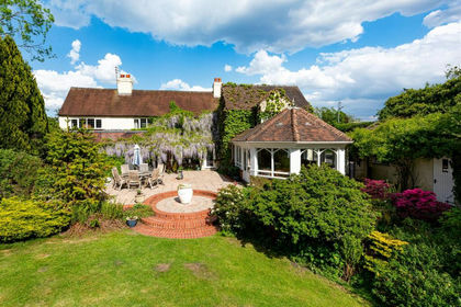
- Price
- Offers in Region of£1,125,000
- Size
- 1.14 acres
Added on 17/08/2026Cottage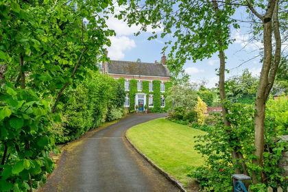
- Price
- Offers in Region of£1,500,000
- Size
- 4 acres
Added on 20/05/2026House with Land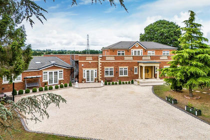
- Price
- Offers in Region of£1,650,000
- Size
- 4.9 acres
The Cottage, Bennetts Lane, Pattingham, Wolverhampton, WV6, Perton, Staffordshire WV6 England
Added on 01/07/2026House with Land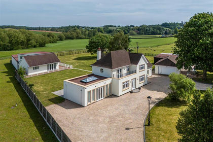
- Price
- Offers in Region of£1,395,000
- Size
- 5.25 acres
Added on 01/06/2026Country Home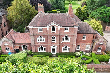
- Price
- Offers in Region of£1,650,000
- Size
- 1.1 acres
The Red House, Seisdon Road, Trysull, Wolverhampton, Trysull and Seisdon, Staffordshire WV5 England
Added on 22/03/2026Country Home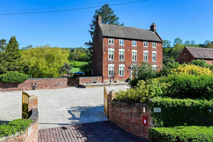
- Price
- Offers in Region of£1,274,000
- Size
- 4 acres
Orton House, Showell Lane, Lower Penn, Wolverhampton, Lower Penn, Staffordshire WV4 England
Added on 15/05/2026House with Land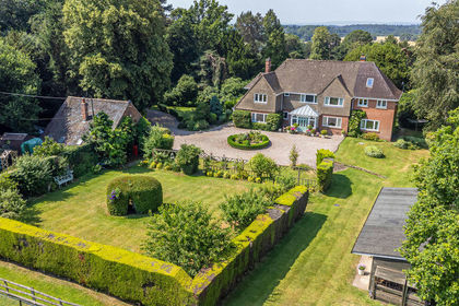
- Price
- Offers in Region of£1,250,000
- Size
- 3.5 acres
Added on 11/07/2026House with Land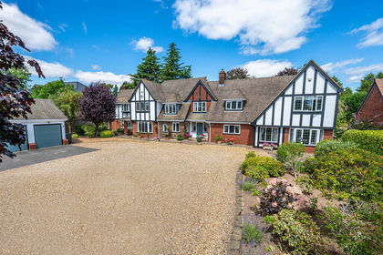
- Price
- Offers in Excess of£1,500,000
- Size
- 1.1 acres
Aspreys, Showell Lane, Lower Penn, Wombourne, Staffordshire WV4 England
Added on 01/09/2026House with Land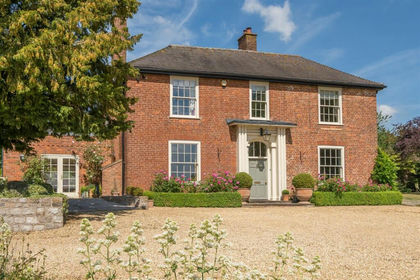
- Price
- Offers in Region of£1,350,000
- Size
- 1.02 acres
Added on 29/01/2026House with Land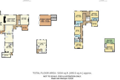
- Price
- £1,250,000
- Size
- 1.3 acres
Cross Lane Head, Bridgnorth, WV16, Astley Abbotts, Shropshire WV16 England
Added on 24/06/2026House with Land