The Cottage, Bennetts Lane, Pattingham, Wolverhampton, WV6
- Land size
- 4.9 acres
- Bedrooms
- 6
- Bathrooms
- 6
Description
An outstanding six bedroom, six bathroom and five reception room detached property standing in almost 5 acres with further planning permission passed for a three bay garage with gym.
Location - The Cottage stands in a convenient and accessible position lying just off the Wolverhampton to Bridgnorth Road (A454) and is within easy reach of Pattingham Village which offers an excellent selection of amenities to include shops, chemist, cafe, pubs, butchers, church and a thriving village hall. Nearby is Rudge Heath General Stores offering a wide selection of everyday essentials including fresh breads and local farmer produce.
Pattingham Village Primary School is highly regarded and there are public tennis courts, a play area on the village playing fields and many rural walks. Motor communications are excellent with the M5, M6, M6 Toll and M54 facilitating travel to Birmingham, Telford and the entire industrial West Midlands whilst national rail services run from Wolverhampton station. This is an ideal commuting location with regular Euston London trains from Wolverhampton City Station.
The area is well served by schooling in both sectors with numerous, highly regarded schools being nearby including Birchfield Preparatory School in Albrighton, St Dominics Grammar School in Brewood, Tettenhall College, Wolverhampton Grammar School and the Wolverhampton Girls' High School.
Description - The Cottage was purchased by the current owners who gained planning permission to create a substantial home. The extensions and improvements have been carried out to a high standard with LVT flooring throughout, underfloor heating to the ground floor, double glazing and well appointed kitchen and bathroom suites. There is versatile living with five reception rooms, six bedrooms and six bath / shower rooms. The first floor balcony is a wonderful entertainment space with views over surrounding countryside and there is ample parking.
Accommodation - A pillared open PORCH has oak glazed double doors opening into a superb RECEPTION HALL with an attractive electric fire, an understairs store and a GUEST CLOAKROOM. The LOUNGE has integrated ceiling lighting, windows to two elevations with ample space for seating and dining and an electric fire with formal surround. The DRAWING ROOM windows to two elevations and an electric fire with formal surround. There is a through FAMILY ROOM which can be used for a variety of purposes with windows to the front and rear with views of the surrounding countryside and an electric fire set in a formal surround. The KITCHEN has a contemporary range of wall and base units with working surfaces with tiled splash back, an undermounted Clearwater sink, space for a dishwasher, two Zanussi ovens, a Miele induction hob, ample space for fridges and freezer, a door to the side, a large shelved pantry and a SPICE KITCHEN with coordinating units to those in the kitchen, a five ring Miele gas hob with a Miele electric oven beneath and a filtration unit above. There is a fifth reception room which is being used as a GYMNASIUM and has integrated ceiling lighting.
From the family room a door with steps opens into a REAR HALL with an atrium roof light, a useful store, a PORCH to the front, a BOOT ROOM with a sink and storage space and a SHOWER ROOM with a shower cubicle, a vanity unit with wash basin and cupboards and a WC. The SITTING ROOM has two roof lights, double glazed doors and windows to the front. The LAUNDRY with a range of wall and base units with a double sink, ample space for washing machine and tumble dryers, two wall mounted Vaillant boilers and a pressurised hot water cylinder and a door to a REAR PORCH with access to the rear of the property. There is a SEWING ROOM with cupboards and roof light. There are THREE BEDROOM SUITES all with large double bedrooms and EN-SUITE BATHROOMS with a bath with shower over, a vanity unit with wash basin with cupboards and drawers beneath, WC and a heated ladder towel rail.
Stairs from the hall rise to the first floor landing with access to the loft, built in storage and French doors opening onto a large BALCONY / ROOF TERRACE with stone balustrading, ample space for entertainment and a circular staircase to the front of the property. The FOURTH BEDROOM SUITE has an EN-SUITE BATHROOM with a bath with shower over, a vanity unit with wash basin with cupboards and drawers beneath, WC and a heated ladder towel rail. BEDROOM FIVE has windows to three elevations. The PRAYER ROOM / BEDROOM SIX has a window to the front. The SHOWER ROOM has a large shower cubicle with multi jet shower, a vanity unit with wash basin with cupboards and drawers, a WC and a heated ladder towel rail.
Outside - There is gated access to a sweeping gravelled driveway through landscaped lawns leading to a large area of gravelled PARKING. The GARDENS surround the property with entertainment patios, large areas of lawn, an area of kitchen garden, there is paving around the outside of the property with areas for sheds, greenhouse and dog kennels. There is external lighting, cold water supply and electricity points. An area of agricultural land is currently fenced off and amounts to an area of approximately 3 acres and has a large pond. There is a total area of approximately 4.9 acres in total.
Planning Permission - Planning permission was passed for all the works carried out to the property. There is an additional part of permission for a detached triple garage with a large attached gym/recreational room with washroom facilities off.
Application Number: 18/00741/FUL
Proposed: “Demolition of existing structures and extensions and the extension and alterations to a single dwelling and garage”.
Date of decision: 8th November 2018
We are informed by the Vendors that mains electricity is connected, drainage is to a private treatment plant, there is a private water supply and the heating is LPG
COUNCIL TAX BAND D – South Staffordshire
POSSESSION Vacant possession will be given on completion.
VIEWING - Please contact the Tettenhall Office.
The property is FREEHOLD.
Broadband – Ofcom checker shows Standard broadband is available
Mobile date coverage is constantly changing, please use the property postcode and this link for the most up to date information from Ofcom:
Ofcom provides an overview of what is available, potential purchasers should contact their preferred supplier to check availability and speeds.
The long term flood defences website shows very low risk.
Map Location
Property details
- Tenure
- Freehold
- Council Tax Band
- G
- Date Posted
- 2026-07-01
Market Value Analysis
Compared with 1,031 Homes with Land listings in West Midlands (1+ acres).
Energy Performance Certificate
Energy Efficiency Rating
Based on UK Energy Performance Certificate standards (EU Directive 2002/91/EC)
Running costs are one side. Planning activity, flood history and ground risks for this location are in the full report.
Utilities & Restrictions
Utilities
- Electricity
- Mains
- Water
- Private Supply
- Heating
- Gas Heating, Underfloor Heating
- Broadband
- Ask Agent
- Sewerage
- Septic Tank / Private
Rights & Restrictions
- Public Rights of Way
- Ask Agent
- Private Rights of Way
- Ask Agent
- Listed Property
- Ask Agent
- Restrictions
- Yes
Listed status, conservation areas and planning constraints for this location are in the full report.
Property Features
- Accessibility
- Ask Agent
- Parking
- Driveway
- Garden
- Garden
Beyond the particulars: planning activity, flood history, heritage and ground risks, checked for this exact spot.
Connectivity
Broadband
Fastest speed available at this postcode
3 Mbps
Under 10 Mbps here
Suitable for
- Basic browsing & email
Mobile signal
Predicted 4G and 5G signal; indoor signal depends on building materials.
Ofcom Connected Nations postcode-level predictions. Speeds and signal are modelled, not measured, and vary between addresses and providers.
Signal is the easy part. Planning activity, flood history and protected designations here are in the full report.
Nearest Schools
Primary
- St Chad's CofE (VC) First School1.5 milesOfsted report card · Mar 2026
- Ages
- 3 to 9
- Pupils
- 101
- Type
- Voluntary controlled school
- Faith
- Church of England
- All Saints' CofE Primary School2.3 milesOfsted: Good
- Ages
- 3 to 11
- Pupils
- 107
- Type
- Academy converter
- Faith
- Church of England
- Perton First School2.3 milesNo Ofsted rating
- Ages
- 2 to 9
- Pupils
- 278
- Type
- Community school
- Perton Primary Academy2.4 milesOfsted: Good
- Ages
- 2 to 9
- Pupils
- 239
- Type
- Academy converter
- Castlecroft Primary School2.5 milesNo Ofsted rating
- Ages
- 3 to 11
- Pupils
- 228
- Type
- Community school
Secondary
- Smestow Academy2.5 milesOfsted report card · Nov 2025
- Ages
- 11 to 18
- Pupils
- 589
- Type
- Academy converter
- Perton Middle School2.7 milesNo Ofsted rating
- Ages
- 9 to 13
- Pupils
- 399
- Type
- Community school
- Highfields School2.8 milesOfsted report card · Feb 2026
- Ages
- 11 to 18
- Pupils
- 1,765
- Type
- Academy converter
- St Regis Church of England Academy3 milesOfsted report card · Jan 2026
- Ages
- 11 to 18
- Pupils
- 798
- Type
- Academy sponsor led
- Faith
- Church of England
- Wombourne High School3.2 milesOfsted: Good
- Ages
- 11 to 18
- Pupils
- 995
- Type
- Academy sponsor led
Distances are straight-line from the advertised location. Source: the national school registers (DfE, Welsh Government, Scottish Government) and Ofsted.
Schools are just the start: sold prices nearby, planning activity and any flood history are in the full report.
Amenities
Supermarket
GP surgery
Pharmacy
Hospital
Straight-line distances from the advertised location. Sources: NHS records, Geolytix supermarket locations, OS Open Greenspace and the national trails registers.
The area stacks up? Now check the location itself: planning nearby, protected designations and past flooding.
Getting Around
Nearest station
Nearest bus stop
Typical drive times
Straight-line distances from the advertised location; drive times are typical free-flow times over OpenStreetMap road data, so allow more at peak. Public transport locations from DfT NaPTAN.
Easy to reach matters. So do planning activity, flood history and ground risks: all in the full report.
Flood Risk
Environment Agency open data, checked around the advertised map pin for the listed acreage. Long-term risk counts flood defences; the planning map's flood zones do not. Provided by LandSale, not the listing agent, and not part of the agent's particulars. Risk varies across a holding, so verify before committing.
Rivers and the sea
Planning map: Flood Zone 1.
Surface water
These bandings are the summary. Where this location sits on the flood maps, plus planning activity, heritage and ground risks, is in the full report.
Important notice: Information, maps and tags on this page are drawn from the advertising agent's marketing materials or generated automatically. LandSale has not verified them. Relying on these details is at your own risk, always carry out independent checks before committing to a purchase.
LandSale full disclaimer
Marketing information only - not formal particulars. The details on this website are provided for general guidance and do not constitute an offer or contract. Neither LandSale nor the advertising estate/land agent accepts responsibility for any inaccuracy.
1. Source of information
- Listing content: Core description, asking price, tenure, measurements, photographs and planning history originate from the marketing materials of the advertising estate or land agent. LandSale does not author this content and cannot guarantee its accuracy.
- Automated tags & categorisation: Property type, land-use class, acreage bands and similar labels may be applied by machine-learning models. They are intended as a helpful guide only and may not reflect the property's legal status or permitted use.
- Third-party & enriched data layers: Maps, boundary outlines, planning designations, soil reports, broadband coverage and other environmental or location-based insights are licensed from external suppliers. Such data are supplied “as is", may be incomplete or out of date and are subject to change without notice.
2. Verification required
Prospective purchasers must verify critical matters, including but not limited to planning permission, title boundaries, public rights of way, environmental constraints, acreage, services, access and VAT status, through their own inspections, specialist surveys, legal advisers and the selling agent before relying on the information or entering into any contract.
3. No warranty or liability
LandSale gives no warranty, express or implied, as to the accuracy, completeness or fitness for any particular purpose of the information displayed. LandSale shall not be liable for any loss, damage, cost or expense arising directly or indirectly from any use of or reliance on such information, save where liability may not be excluded by law.
4. Updates & feedback
If you believe any detail on this listing is inaccurate, please let us know. We will investigate and, where appropriate, update the listing or notify the agent.
© LandSale | Version 1.3 - August 2026
Listing agent
Berriman Eaton, Tettenhall
15 High Street, Tettenhall, Wolverhampton, WV6 8QS
Contact Berriman Eaton, Tettenhall
15 High Street, Tettenhall, Wolverhampton, WV6 8QS
View agent profileSimilar properties for sale
- Price
- Offers in Region of£1,500,000
- Size
- 4 acres
Added on 20/05/2026House with Land
- Price
- Offers in Region of£1,274,000
- Size
- 4 acres
Orton House, Showell Lane, Lower Penn, Wolverhampton, Lower Penn, Staffordshire WV4 England
Added on 15/05/2026House with Land
- Price
- Offers in Region of£1,499,950
- Size
- 2 acres
Added on 24/04/2026Mill Conversion
- Price
- Offers in Region of£1,995,000
- Size
- 15.5 acres
Added on 23/07/2026House with Land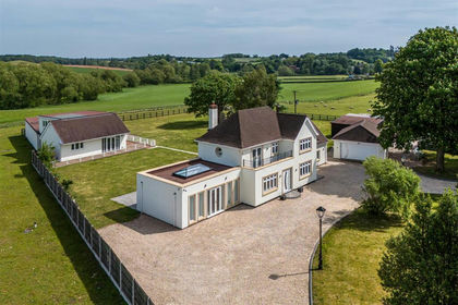
- Price
- Offers in Region of£1,395,000
- Size
- 5.25 acres
Added on 01/06/2026Country Home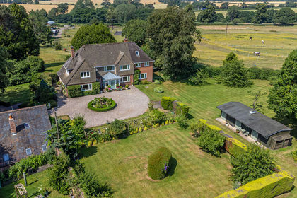
- Price
- Offers in Region of£1,250,000
- Size
- 3.5 acres
Added on 11/07/2026House with Land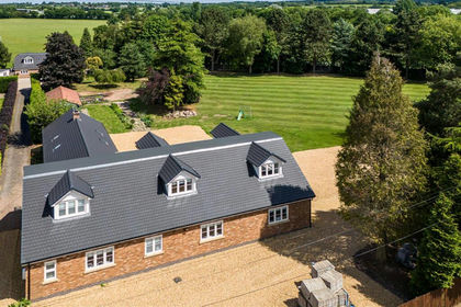
- Price
- Offers in Region of£1,299,950
- Size
- 2 acres
Added on 29/01/2026House with Land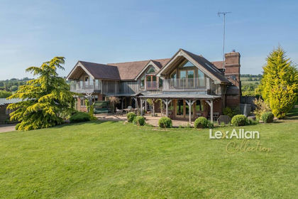
- Price
- £1,350,000
- Size
- 6 acres
Herongate Road, Compton, Kinver, Stourbridge, Kinver, Staffordshire DY7 England
Added on 29/01/2026House with Land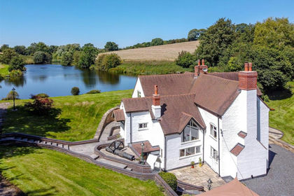
- Price
- Offers in Region of£1,495,000
- Size
- 10 acres
Hem Mill, The Hem, Shifnal, Shifnal, Shropshire TF11 England
Added on 02/04/2026House with Land
- Price
- Offers in Region of£1,650,000
- Size
- 8.5 acres
Added on 21/07/2026Country Estate