Hoy Lodge, Hoy, Orkney, KW16
- Land size
- 1 acres
- Bedrooms
- 7
- Bathrooms
- 3
Key Features
- CHARACTERFUL FORMER VICTORIAN SHOOTING LODGE
- SITS IN APROX ONE ACRE OF LAND
- TRADITIONAL FEATURES THROUGHOUT
- PANORAMIC COUNTRYSIDE VIEWS
- SPECTACULAR ISLAND LOCATION
- CLOSE TO OLD MAN OF HOY AND RACKWICK BAY
- VIRTUAL TOUR AVAILABLE ON OUR WEBSITE
- GRADE B LISTED BUILDING
- WHAT3WORDS LOCATION: ///accented.embellish.bride
- FOR MORE INFORMATION CONTACT K ALLAN PROPERTIES
Description
K Allan Properties are delighted to present this spectacular 1800’s former Shooting Lodge to the market. This property offers a rare opportunity to own a beautifully positioned island home on the North end of the breathtaking Isle of Hoy, offering expansive views, exceptional privacy, and a lifestyle shaped by nature, tranquillity, and wide-open skies.
This original B listed property is a rare find to the open market. Hoy Lodge is a charming and characterful residence set within approximately 1 acre of grounds, surrounded by some of Orkney’s most dramatic scenery. This home is in need of some modernisation, presenting an opportunity for those looking to reimagine a home in one of Scotland's most atmospheric island landscapes. With the right vision, this could become an extraordinary full-time residence, or peaceful retreat.
Spacious accommodation on the ground floor comprises an Entrance Porch, Entrance Hall, Passage, Study, Sitting-room, Inner Hall, Dining Room, Service Hall, Scullery, Kitchen, Laundry, Service
Passage, Pantry, Dairy and rear Porch.
There are 5 bedrooms and 2 bathrooms on the first floor and a further 2 bedrooms and bathrooms on the servants floor.
Outside is a detached garage, currently divided into a workshop/garage area and separate store. A parcel of foreshore also comes with the property and is positioned a short walk from Hoy Lodge.
Information About Hoy - Positioned in breath-taking landscape and scenery, Hoy Lodge is steeped in history. Situated on the iconic Isle of Hoy—famed for its rugged coastline, towering sea cliffs, and rich wildlife—the lodge enjoys uninterrupted views across the landscape and easy access to walking routes, including to the world-famous 'Old Man of Hoy', beaches including Rackwick Bay, and local heritage sites. The island’s community is friendly and close knit, and there are a wide range of local amenities including a primary school, shop, swimming pool, hotels with restaurants, cafes, pub and galleries. The Hoy Kirk with regular exhibitions and events and is only a short distance away. Hoy Lodge is situated in the north end of the island and is regularly serviced by a foot-passenger ferry from Moaness pier to Stromness which is conveniently close to the property. A Ro-Ro vehicle and passenger ferry travels to the island from Houton Bay to Lyness several times a day making Hoy a commutable island with Orkney Mainland.
Travelling To Hoy - Hoy is accessible via a foot passenger ferry from the town of Stromness and a vehicle ferry from Houton. For information and times of crossings please have a look on the Orkney Ferries website.
Council Tax Band - F -
Services - - Land - Approx. 1 acre
Enclosed within its own walled grounds
Electricity: Mains
Water: Mains
Drainage: Private septic tank
Telephone:
Heating: Electric Storage Heaters with open fireplaces throughout the Lodge
Best Estate Agent Guide - When you choose to work with us, you are officially working with one of the UK's Best Estate Agents. We received this award in 2023 and again in 2024. The very best agents are listed in The Best Estate Agent Guide – a website for sellers to help them choose who the best agents are in their area. If you want to achieve the best results for your property sale, combined with receiving the best customer service, we would love to help.
Viewings - VIEWINGS
By appointment only, arranged through K Allan Properties.
Call or email
VIEWINGS FOLLOWING ACCEPTANCE OF AN OFFER
Once an offer has been accepted and the property is marked as "Under Offer", K Allan Properties will not arrange or facilitate any further viewings of the property.
Any requests for access following acceptance of an offer will be considered only where required by the terms of the concluded missives, by agreement between the seller and purchaser, or where otherwise legally necessary.
K Allan Properties reserves the right to refuse requests for additional viewings or inspections which are not required under the terms of the transaction.
Offers To - K Allan Properties
Watergate
Kirkwall
KW15 1PD
OR VIA EMAIL WHICH CAN BE FOUND ON
OUR WEBSITE
Disclaimer - Whilst we endeavour to make these particulars accurate, they do not offer/form any part of a contract on offer and are not guaranteed. Measurements are approximate. We have not tested electricity, gas or water services or any appliances. Photographs may have been taken with a wide angle lens.
Map Location
Property details
- Tenure
- Freehold
- Council Tax Band
- F
- Date Posted
- 2026-02-03
Market Value Analysis
Compared with 457 Homes with Land listings in Scotland (1+ acres).
Energy Performance Certificate
Energy Efficiency Rating
Based on UK Energy Performance Certificate standards (EU Directive 2002/91/EC)
Running costs are one side. Planning activity, flood history and ground risks for this location are in the full report.
Utilities & Restrictions
Utilities
- Electricity
- Mains
- Water
- Mains
- Heating
- Electric Heating
- Broadband
- Ask Agent
- Sewerage
- Septic Tank / Private
Rights & Restrictions
- Public Rights of Way
- Ask Agent
- Private Rights of Way
- Ask Agent
- Listed Property
- Yes
- Restrictions
- Ask Agent
Listed status, conservation areas and planning constraints for this location are in the full report.
Property Features
- Accessibility
- Lateral Living
- Parking
- Parking Available
- Garden
- Garden
Beyond the particulars: planning activity, flood history, heritage and ground risks, checked for this exact spot.
Connectivity
Broadband
Available at this postcode
Under 10 Mbps here
Suitable for
- Basic browsing & email
Mobile signal
Predicted 4G and 5G signal; indoor signal depends on building materials.
Ofcom Connected Nations postcode-level predictions. Speeds and signal are modelled, not measured, and vary between addresses and providers.
Signal is the easy part. Planning activity, flood history and protected designations here are in the full report.
Nearest Schools
Primary
- Stromness Primary School3.7 miles
- Pupils
- 127
- Type
- Non-denominational
- Stenness Community School6.7 miles
- Pupils
- 26
- Type
- Non-denominational
- Orphir Community School7.1 miles
- Pupils
- 31
- Type
- Non-denominational
- North Walls Community School8.3 miles
- Pupils
- 20
- Type
- Non-denominational
- Flotta Community School10 miles
- Pupils
- 2
- Type
- Non-denominational
Secondary
- Stromness Academy4.3 miles
- Pupils
- 338
- Type
- Non-denominational
- Kirkwall Grammar School15 miles
- Pupils
- 861
- Type
- Non-denominational
- Thurso High School24 miles
- Pupils
- 753
- Type
- Non-denominational
- Stronsay Junior High School30 miles
- Pupils
- 16
- Type
- Non-denominational
- Westray Junior High School31 miles
- Pupils
- 35
- Type
- Non-denominational
Distances are straight-line from the advertised location. Source: the national school registers (DfE, Welsh Government, Scottish Government) and Ofsted.
Schools are just the start: planning activity, heritage and any flood history here are in the full report.
Amenities
Supermarket
GP surgery
Pharmacy
Walking trail
Straight-line distances from the advertised location. Sources: NHS records, Geolytix supermarket locations, OS Open Greenspace and the national trails registers.
The area stacks up? Now check the location itself: planning nearby, protected designations and past flooding.
Getting Around
Nearest station
Nearest bus stop
Typical drive times
Straight-line distances from the advertised location; drive times are typical free-flow times over OpenStreetMap road data, so allow more at peak. Public transport locations from DfT NaPTAN.
Easy to reach matters. So do planning activity, flood history and ground risks: all in the full report.
Flood Risk
SEPA open data, checked around the advertised map pin for the listed acreage. Provided by LandSale, not the listing agent, and not part of the agent's particulars. Risk varies across a holding, so verify before committing.
Rivers and the sea
Surface water
Not at the pin: mapped about 10 metres away.
These bandings are the summary. Where this location sits on the flood maps, plus planning activity, heritage and ground risks, is in the full report.
Important notice: Information, maps and tags on this page are drawn from the advertising agent's marketing materials or generated automatically. LandSale has not verified them. Relying on these details is at your own risk, always carry out independent checks before committing to a purchase.
LandSale full disclaimer
Marketing information only - not formal particulars. The details on this website are provided for general guidance and do not constitute an offer or contract. Neither LandSale nor the advertising estate/land agent accepts responsibility for any inaccuracy.
1. Source of information
- Listing content: Core description, asking price, tenure, measurements, photographs and planning history originate from the marketing materials of the advertising estate or land agent. LandSale does not author this content and cannot guarantee its accuracy.
- Automated tags & categorisation: Property type, land-use class, acreage bands and similar labels may be applied by machine-learning models. They are intended as a helpful guide only and may not reflect the property's legal status or permitted use.
- Third-party & enriched data layers: Maps, boundary outlines, planning designations, soil reports, broadband coverage and other environmental or location-based insights are licensed from external suppliers. Such data are supplied “as is", may be incomplete or out of date and are subject to change without notice.
2. Verification required
Prospective purchasers must verify critical matters, including but not limited to planning permission, title boundaries, public rights of way, environmental constraints, acreage, services, access and VAT status, through their own inspections, specialist surveys, legal advisers and the selling agent before relying on the information or entering into any contract.
3. No warranty or liability
LandSale gives no warranty, express or implied, as to the accuracy, completeness or fitness for any particular purpose of the information displayed. LandSale shall not be liable for any loss, damage, cost or expense arising directly or indirectly from any use of or reliance on such information, save where liability may not be excluded by law.
4. Updates & feedback
If you believe any detail on this listing is inaccurate, please let us know. We will investigate and, where appropriate, update the listing or notify the agent.
© LandSale | Version 1.3 - August 2026
Listing agent
K Allan Properties Ltd, Kirkwall
Watergate House Watergate, St. Ola, Orkney, KW15 1PD
View agent profileSimilar properties for sale
- Price
- Offers Over£395,000
- Size
- 4.6 acres
Ocean View, Longhope, Hoy, Orkney, KW16, Orkney and Shetland, Orkney Islands KW16 Scotland
Added on 28/03/2026House with Land
- Price
- Offers Over£360,000
- Size
- 3.5 acres
Lochside, Dounby, Orkney, KW17, Orkney and Shetland, Orkney Islands KW17 Scotland
Added on 16/05/2026House with Land
- Price
- Offers Over£375,000
- Size
- 1 acres
Bankburn Farm, St. Margarets Hope, Orkney, Orkney and Shetland, Orkney Islands KW17 Scotland
Added on 28/01/2026Development Land
- Price
- Offers Over£275,000
- Size
- 2.3 acres
Scarfskerry, Thurso, Highland. KW14, Caithness, Sutherland and Easter Ross, Highland KW14 Scotland
Added on 03/07/2026House with Land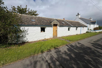
- Price
- Offers Over£330,000
- Size
- 6 acres
Brough, Thurso, Highland. KW14, Caithness, Sutherland and Easter Ross, Highland KW14 Scotland
Added on 28/05/2026Cottage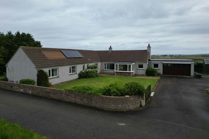
- Price
- Offers Over£275,000
- Size
- 1 acres
Longa, Dunnet, Caithness, Sutherland and Easter Ross, Highland KW14 Scotland
Added on 20/07/2026Cottage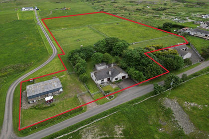
- Price
- Offers Over£315,000
- Size
- 5 acres
Weydale, Thurso, Caithness, Sutherland and Easter Ross, Highland KW14 Scotland
Added on 20/07/2026House with Land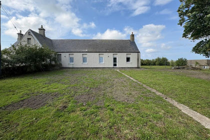
- Price
- Offers Over£265,000
- Size
- 1 acres
Janetstown, Thurso, Highland. KW14, Caithness, Sutherland and Easter Ross, Highland KW14 Scotland
Added on 09/10/2026House with Land
- Price
- Offers Over£345,000
- Size
- 3.6 acres
Bower, Wick, Highland. KW1, Caithness, Sutherland and Easter Ross, Highland KW1 Scotland
Added on 03/10/2026House with Land
- Price
- Offers in Excess of£365,000
- Size
- 4 acres
Added on 29/01/2026House with Land