
Land at Hebden, Skipton
- Land size
- 678.65 acres
Key Features
- A compact and well-keepered moor providing challenging walked-up grouse and moorland fringe game shooting
- Significant natural capital value
- About 678.65 acres (274.64 ha)
- For sale freehold as a whole
Description
A compact moor situated in the stunning Yorkshire Dales National Park
About 678.65 acres (274.64 ha)
For sale freehold as a whole
Situation - The moor is set in spectacular countryside within the renowned Yorkshire Dales National Park on the western periphery of the Nidderdale National Landscape Area. The allotments are located immediately to the northwest of Grimwith Reservoir, adjacent to Grimwith Moor on the east, Hebden High Moor to the north and Grassington Moor on the west. The market towns of Pateley Bridge (4 miles) and Skipton (10 miles) provide a range of local shops and services as well as an excellent selection of country pubs, accustomed to providing shoot lunches.
Description - The moor is made up of two adjoining allotments; Jowitt’s and Bell’s, extending in total to about 678.65 acres (274.64 ha), comprising white hill and heather. The land is classified as Grade 5 with blanket bog and peat soils. It is gently undulating, lying between 380m to 450m above sea level and bound by stone walls with natural water sources for livestock. The moor has formed part of an extensive driven shoot in collaboration with a neighbouring estate and has also provided the current owner a number of days walked-up shooting each year. No formal shoot records have been kept, however, there is an abundance of game, including red grouse, red-legged partridge, pheasant and the occasion black game, supported by the close proximity of well-keepered neighbouring estate moors. Part of the property has been keepered by the Grimwith Estate in support of significant pheasant and partridge drives along the southeastern boundary. Vacant possession will be available upon completion of sale.
Natural Capital - The land represents a significant natural capital asset; the diverse ecology and vast upland areas on the estate naturally provide a carbon sequestration resource, which could be through enhanced woodland creation or re-wilding activities. An initial natural capital assessment has not been undertaken. However, the striking upland landscape and natural assets suggest that it will command a significant level of natural value and in turn could provide alternate income stream opportunities in the future.
Access - The land is accessed off the B6265 onto Grimwith Road. The access track is hardcored and comprising sections of both publicly maintained and unclassified ‘open’ road. A further access route can be taken over Blackstone Edge Lane. Please note, this access is partially stoned and only accessible with a 4x4 vehicle. Points of access are marked with an ‘X’ on the attached plan and are permitted either on foot or with an ATV. Further details available from the Selling Agent(s).
Designations - Yorkshire Dales National Park.
The remnants of Red Scar lead mine and ore works (a Scheduled Monument) lies on the eastern periphery of the property.
Basic Payment Scheme - No BPS entitlements are included is the sale.
Countryside Stewardship / Sfi Agreements - We are not aware of any Countryside Stewardship or High Level Stewardship agreements.
Method Of Sale - The land is offered for sale by private treaty. All potential purchasers are advised to register their interest with the Selling Agent(s) so that they can be advised as to how the sale will be concluded.
Services - There are no public services connected to the land.
Viewing And Health & Safety - By appointment through the Selling Agents by calling:
T - .
Please take care when viewing the property particularly as this is a working grouse moor.. For your own personal safety, you should remain as vigilant as possible particularly around livestock or buildings.
Purchase Price - Upon exchange of contracts, a non-returnable deposit of 10% of the purchase price shall be paid. The balance will fall due for payment on completion at a date to be agreed and whether entry is taken or not with interest accruing at the rate of 5% above the Bank of England base rate.
Tenure - The property is to be sold Freehold with vacant possession on legal completion. The land is registered with HM Land Registry under Title Numbers: NYK343634 and NYK353650.
Sporting Rights - The sporting rights are included in the sale in so far as they are owned.
Mineral Rights - The mineral rights are included in the sale in so far as they are owned.
Wayleaves, Easements And Rights Of Way - The property is sold subject to and with the benefit of all existing rights, including rights of way, whether public or private, light, drainage, water and electricity supplies and all other rights obligations, easements, quasi-easements and all wayleaves and covenants, whether disclosed or not.
Boundaries - The Seller will only sell such interests as they have in the boundary hedges and fences. Responsibility for the fences will be as indicated by ‘T’ marks of the transfer plan.
Vat - Any guide prices quoted or discussed are exclusive of VAT. Should any part of the sale or any rights attached to it become chargeable items for the purpose of VAT then this will be payable by the purchaser. No option to tax has been made.
Directions - From Pateley Bridge, head west on the B6265 for approximately 8 miles. Turn right onto Grimwith Road Lane and proceed for a further 3.5 miles around Grimwith Reservoir. Points of access are marked with an ‘X’ on the attached plan and are permitted either on foot or with an ATV.
Postcode: BD23 5ED
what3words: ///dogs.equity.daring
Purchase Price - Upon exchange of contracts, a non-returnable deposit of 10% of the purchase price shall be paid. The balance will fall due for payment on completion at a date to be agreed and whether entry is taken or not with interest accruing at the rate of 5% above the Bank of England base rate.
Disputes - Should any discrepancy arise within these particulars of sale or the interpretation of them, the question shall be referred to the arbitration of the Selling Agent(s) whose decision acting as experts will be final.
Plans, Areas And Schedules - These are based on the Ordnance Survey and Rural Land Register and are there for reference only. They have been carefully checked by the selling agents and the purchaser shall be deemed to have satisfied himself as to the description of the property and any error or mis-statement shall not annul the sale nor entitle either party to compensation in respect thereof.
Disclaimer Notice: - PLEASE READ: GSC Grays gives notice to anyone who may read these particulars as follows:
1. These particulars, including any plan, are a general guide only and do not form any part of any offer or contract.
2. All descriptions, including photographs, dimensions and other details are given in good faith but do not amount to our presentation or warranty. This should not be relied upon as statements of facts and anyone interested must satisfy themselves as to their corrections by inspection or otherwise.
3. Neither GSC Grays nor the vendors accept responsibility for any error that these particulars may contain however caused.
4. Any plan is for guidance once only and is not drawn to scale. All dimensions, shapes, and compass bearings are approximate and you should not rely on them without checking them first.
5. Nothing in these particulars shall be deemed to be a statement that the property is in good condition, repair or otherwise nor that any services or facilities are in good working order.
6. Please discuss with us any aspects that are important to you prior to travelling to the property.
Particulars written: Spring 2025
Photographs taken: Spring 2025
Map Location
Property details
- Tenure
- Freehold
- Council Tax Band
- Ask Agent
- Date Posted
- 2026-01-29
Market Value Analysis
Compared with 3 land-only listings in Yorkshire and The Humber (500+ acres).
Utilities & Restrictions
Utilities
- Electricity
- Ask Agent
- Water
- Ask Agent
- Heating
- Ask Agent
- Broadband
- Ask Agent
- Sewerage
- Ask Agent
Rights & Restrictions
- Public Rights of Way
- Ask Agent
- Private Rights of Way
- Ask Agent
- Listed Property
- Ask Agent
- Restrictions
- Ask Agent
Listed status, conservation areas and planning constraints for this location are in the full report.
Property Features
- Accessibility
- Ask Agent
- Parking
- Parking Available
- Garden
- Ask Agent
Beyond the particulars: planning activity, flood history, heritage and ground risks, checked for this exact spot.
Connectivity
Broadband
Fastest speed available at this postcode
1.8 Gbps
Gigabit full fibre · available to 82% of premises
Suitable for
- 4K streaming on every screen
- Full-time home working
- Online gaming & big downloads
Fixed wireless access may also be an option here.
Mobile signal
Predicted 4G and 5G signal; indoor signal depends on building materials.
Ofcom Connected Nations postcode-level predictions. Speeds and signal are modelled, not measured, and vary between addresses and providers.
Signal is the easy part. Planning activity, flood history and protected designations here are in the full report.
Nearest Schools
Primary
- Burnsall Voluntary Aided Primary School1.1 milesNo Ofsted rating
- Ages
- 4 to 11
- Pupils
- 47
- Type
- Voluntary aided school
- Faith
- Christian
- Grassington Church of England Voluntary Controlled Primary School1.8 milesNo Ofsted rating
- Ages
- 3 to 11
- Pupils
- 56
- Type
- Voluntary controlled school
- Faith
- Church of England
- Threshfield Primary School2 milesOfsted: Good
- Ages
- 2 to 11
- Pupils
- 115
- Type
- Academy converter
- Cracoe and Rylstone Voluntary Controlled Church of England Primary School4.1 milesNo Ofsted rating
- Ages
- 4 to 11
- Pupils
- 44
- Type
- Voluntary controlled school
- Faith
- Church of England
- Embsay Church of England Primary School6 milesOfsted: Good
- Ages
- 4 to 11
- Type
- Academy converter
- Faith
- Church of England
Secondary
- Upper Wharfedale School2.3 milesNo Ofsted rating
- Ages
- 11 to 16
- Pupils
- 351
- Type
- Community school
- Ermysted's Grammar School7.6 milesOfsted: Good
- Ages
- 11 to 18
- Pupils
- 836
- Type
- Voluntary aided school
- Gender
- Boys
- Skipton Girls' High School7.6 milesOfsted: Good
- Ages
- 11 to 18
- Pupils
- 862
- Type
- Academy converter
- Gender
- Girls
- Nidderdale High School7.6 milesOfsted report card · Apr 2026
- Ages
- 11 to 16
- Pupils
- 404
- Type
- Academy converter
- The Skipton Academy7.8 milesOfsted: Good
- Ages
- 11 to 16
- Pupils
- 736
- Type
- Academy sponsor led
Distances are straight-line from the advertised location. Source: the national school registers (DfE, Welsh Government, Scottish Government) and Ofsted.
Schools are just the start: sold prices nearby, planning activity and any flood history are in the full report.
Amenities
Supermarket
GP surgery
Pharmacy
Hospital
Green space
Straight-line distances from the advertised location. Sources: NHS records, Geolytix supermarket locations, OS Open Greenspace and the national trails registers.
The area stacks up? Now check the location itself: planning nearby, protected designations and past flooding.
Getting Around
Nearest station
Nearest bus stop
Typical drive times
Straight-line distances from the advertised location; drive times are typical free-flow times over OpenStreetMap road data, so allow more at peak. Public transport locations from DfT NaPTAN.
Easy to reach matters. So do planning activity, flood history and ground risks: all in the full report.
Flood Risk
Environment Agency open data, checked around the advertised map pin for the listed acreage. Long-term risk counts flood defences; the planning map's flood zones do not. Provided by LandSale, not the listing agent, and not part of the agent's particulars. Risk varies across a holding, so verify before committing.
Rivers and the sea
Not at the pin: mapped about 360 metres away.
Planning map: Flood Zone 3, about 350 metres away.
Surface water
Not at the pin: mapped about 140 metres away.
These bandings are the summary. Where this location sits on the flood maps, plus planning activity, heritage and ground risks, is in the full report.
Important notice: Information, maps and tags on this page are drawn from the advertising agent's marketing materials or generated automatically. LandSale has not verified them. Relying on these details is at your own risk, always carry out independent checks before committing to a purchase.
LandSale full disclaimer
Marketing information only - not formal particulars. The details on this website are provided for general guidance and do not constitute an offer or contract. Neither LandSale nor the advertising estate/land agent accepts responsibility for any inaccuracy.
1. Source of information
- Listing content: Core description, asking price, tenure, measurements, photographs and planning history originate from the marketing materials of the advertising estate or land agent. LandSale does not author this content and cannot guarantee its accuracy.
- Automated tags & categorisation: Property type, land-use class, acreage bands and similar labels may be applied by machine-learning models. They are intended as a helpful guide only and may not reflect the property's legal status or permitted use.
- Third-party & enriched data layers: Maps, boundary outlines, planning designations, soil reports, broadband coverage and other environmental or location-based insights are licensed from external suppliers. Such data are supplied “as is", may be incomplete or out of date and are subject to change without notice.
2. Verification required
Prospective purchasers must verify critical matters, including but not limited to planning permission, title boundaries, public rights of way, environmental constraints, acreage, services, access and VAT status, through their own inspections, specialist surveys, legal advisers and the selling agent before relying on the information or entering into any contract.
3. No warranty or liability
LandSale gives no warranty, express or implied, as to the accuracy, completeness or fitness for any particular purpose of the information displayed. LandSale shall not be liable for any loss, damage, cost or expense arising directly or indirectly from any use of or reliance on such information, save where liability may not be excluded by law.
4. Updates & feedback
If you believe any detail on this listing is inaccurate, please let us know. We will investigate and, where appropriate, update the listing or notify the agent.
© LandSale | Version 1.3 - August 2026
Listing agent
GSC Grays, Farm Agency5-6 Bailey Court, Colburn Business Park, Catterick Garrison, DL9 4QL
Contact GSC Grays, Farm Agency
5-6 Bailey Court, Colburn Business Park, Catterick Garrison, DL9 4QL
View agent profileSimilar properties for sale
- Price
- Offers in Region of£600,000
Moor and Pheasant Dalton Moor, Thirsk, YO7, Dalton, North Yorkshire YO7 England
Added on 29/01/2026Commercial Land
- Price
- £695,000
- Size
- 70.47 acres
Syke Side Farm, Kirkby Stephen, Cumbria, CA17, Soulby, Westmorland and Furness CA17 England
Added on 10/08/2026Farmland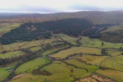
- Price
- Offers Over£750,000
- Size
- 129.9 acres
Bretherdale Woodland, Orton, Westmorland and Furness CA10 England
Added on 29/01/2026Timberland
- Price
- Guide Price£665,000
- Size
- 81.89 acres
Added on 17/07/2026Agricultural Land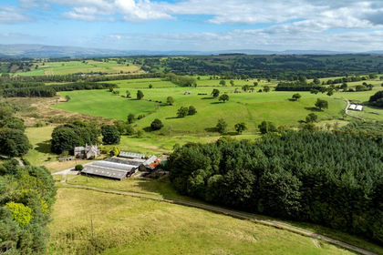
- Price
- £1,300,000
- Size
- 144.89 acres
Added on 15/10/2026Agricultural Land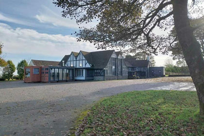
- Price
- £1,000,000
NW-424313 - Bull i th Thorn, Ashbourne Road, Buxton SK17, High Peak, Derbyshire SK17 England
Added on 29/01/2026Camping Land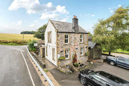
- Price
- £1,300,000
- Size
- 2.2 acres
NW-424276 - Royal Oak, Hurdlow, Buxton SK17, Hartington Middle Quarter, Derbyshire SK17 England
Added on 05/07/2026Pub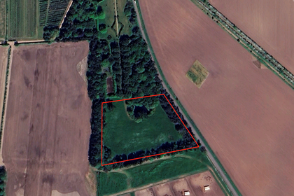
- Price
- Guide Price£1,000,000
- Size
- 5 acres
Added on 29/01/2026Development Land
- Price
- £750,000
- Size
- 0.5 acres
Orchard Cottage, Wetheral Shields, Wetheral, Carlisle, CA4, Wetheral, Cumberland CA4 England
Added on 04/07/2026Development Land
- Price
- Guide Price£890,000
Added on 03/09/2026Agricultural Land