Craigllwyn, Oswestry.
- Land size
- 10 acres
- Bedrooms
- 3
- Bathrooms
- 3
Key Features
- Grade II listed farmhouse with striking curved glass eco extension
- Set in about 10 acres of gardens, pasture and woodland
- Concrete structure built into natural rock
- Living roof and solar PV panels
- Passive Haus-inspired design with with powerful log burner and underfloor heating
- Range of outbuildings including barns and double garages (one with inspection pit)
Description
An exceptional Grade II listed farmhouse with a contemporary eco extension built into natural rock, set in about 10 acres (Title SL204187) of gardens, pasture and woodland.
Location And Situation - Pentre Cefn Bach lies four miles west of Oswestry and half a mile from the Welsh border, surrounded by rolling countryside with long-distance views towards Moelydd and Mynydd Myfyr. Nearby Trefonen and Oswestry offer shops, restaurants, art galleries and a twice-weekly market. The property sits near the Offa’s Dyke Path and provides easy access to the Welsh Coast and Mount Snowdon (Yr Wyddfa), combining tranquil living with convenient connections.
Road: Linking to the A5 for Shrewsbury, Wrexham and Chester Pentre Cefn Bach is accessed via a quiet road off Trefonen Road towards Candy and Llansilin, followed by a short single track road leading to the property.
Rail: Gobowen Station (20 minutes) provides services to Shrewsbury, Birmingham and London Euston (˜ 2 hrs 45 mins).
Air: Manchester and Birmingham Airports are approximately 90 minutes away for UK and international travel.
Schools: Local options include Moreton Hall, Oswestry School, Ellesmere College, Packwood Haugh and Shrewsbury School.
Sporting: Golf at Llanymynech, local equestrian facilities and sports centre.
The Accommodation - The Modern Extension A curved glass-fronted structure built into the natural rock, to a 'Passive Haus' standard with concrete structure and a living roof. The interior features triple glazing, underfloor heating and excellent thermal efficiency. An open-plan kitchen, dining and living area forms the heart of the home with bespoke Bole flooring, contemporary kitchen units, walk-in pantry and ample space for people to cook together. Full-height glazing frames countryside views and opens to the terrace. The principal bedroom suite includes a large walk-in wardrobe and luxury bathroom with bespoke tiling.
There are two studies, one of which is used as a single guest room, and a further shower and cloakroom The Farmhouse the original stone farmhouse retains oak beams, Welsh slate floors on the ground level and oak flooring above. It features a cosy snug with a powerful log burner, a small kitchen with an oak island, and a generous dining area
Upstairs leads to two bedrooms and a wet room/WC. the layout of the Modern Extension.
The Farmhouse lends itself to two-generation living, home working or guest accommodation.
Outbuildings - Two double garages with electric doors (one with an inspection pit) plus traditional stone barns and stores offering scope for future use (subject to planning).
Gardens And Grounds - The grounds extend to around 10 acres, including gardens, pasture, and woodland. A diverted public footpath runs beyond the southern boundary, rarely used and screened by landscaping at the southern end of the extension. Features include a pond, polytunnel (4 × 6 m), rabbit-fenced vegetable garden, fruit trees (Apricot, Greengage, Mirabelle, Apple), and rainwater harvesting from the extension roof with pump and power supply. The former quarry has been retained as a secure wildlife haven, supporting a range of flora and fauna including hares and hedgehogs. Low light pollution and a quiet setting create a peaceful environment amid rolling countryside.
Method Of Sale - The property is offered for sale by private treaty.
Tenure & Possession - We understand that the property is of freehold tenure and vacant possession will be given on completion of the purchase.
Services - We understand that the property benefits from mains water, mains electricity and private drainage. The extension does not normally require heating, but underfloor heating via the hot water system is available when needed.
The farmhouse benefits from a log burner which also provides hot water for the underfloor heating. Solar PV generation and rainwater collection support sustainability.
Airband broadband (20–30 Mbps download, 10 Mbps upload); EE mobile coverage is good.
Local Authority - Shropshire Council, Shirehall, Abbey Foregate,
Shrewsbury, Shropshire, SY2 6ND.
Tel:
Council Tax - Council Tax Band – C
Directions - Entrance Gate – ///skirt.sheepish.rivers
House Parking – ///forever.member.villager
From Oswestry, proceed along Upper Brook Street and Trefonen Road for around 1.5 miles. Turn right to Candy, Croeso Bach and Llansilin. Follow this road uphill for about 3 miles past a converted chapel and a farm on the right. Take the next left, signposted Pentre Cefn and Sychtyn. Continue past Pentre Hall on the left, then down the hill and around a sharp right bend; the entrance to Pentre Cefn Bach is about 50 yards on the right, marked by gabion walls and a five-bar gate.
Right Of Way & Easements - A footpath re-routed at the request of the present owners runs behind the extension, confirmed by Shropshire Council.
Boundaries, Roads & Fences - Boundaries as per Land Registry Title SL204187.
Access via private drive.
Anti-Money Laundering (Aml) Checks - We are legally obligated to undertake anti-money laundering checks on all property purchasers. Whilst we are responsible for ensuring that these checks, and any ongoing monitoring, are conducted properly; the initial checks will be handled on our behalf by a specialist company, Movebutler, who will reach out to you once your offer has been accepted. The charge for these checks is £30 (plus VAT) per purchaser, which covers the necessary data collection and any manual checks or monitoring that may be required. This cost must be paid in advance, directly to Movebutler, before a memorandum of sale can be issued, and is non-refundable. We thank you for your cooperation.
Map Location
Property details
- Tenure
- Freehold
- Council Tax Band
- Ask Agent
- Date Posted
- 2026-01-29
Market Value Analysis
Compared with 108 Homes with Land listings in West Midlands (10+ acres).
Energy Performance Certificate
Energy Efficiency Rating
Based on UK Energy Performance Certificate standards (EU Directive 2002/91/EC)
Running costs are one side. Planning activity, flood history and ground risks for this location are in the full report.
Utilities & Restrictions
Utilities
- Electricity
- Ask Agent
- Water
- Ask Agent
- Heating
- Ask Agent
- Broadband
- Ask Agent
- Sewerage
- Ask Agent
Rights & Restrictions
- Public Rights of Way
- Ask Agent
- Private Rights of Way
- Ask Agent
- Listed Property
- Ask Agent
- Restrictions
- Ask Agent
Listed status, conservation areas and planning constraints for this location are in the full report.
Property Features
- Accessibility
- Ask Agent
- Parking
- Parking Available
- Garden
- Garden
Beyond the particulars: planning activity, flood history, heritage and ground risks, checked for this exact spot.
Connectivity
Broadband
Fastest speed available at this postcode
19 Mbps
Standard (10-30 Mbps)
Suitable for
- Web & social
- Music streaming
- Standard video calls
Fixed wireless access may also be an option here.
Mobile signal
Predicted 4G and 5G signal; indoor signal depends on building materials.
Ofcom Connected Nations postcode-level predictions. Speeds and signal are modelled, not measured, and vary between addresses and providers.
Signal is the easy part. Planning activity, flood history and protected designations here are in the full report.
Nearest Schools
Primary
- Trefonen CofE Primary School1.7 milesNo Ofsted rating
- Ages
- 5 to 11
- Pupils
- 120
- Type
- Voluntary controlled school
- Faith
- Church of England
- Morda CofE Primary School3.4 milesOfsted: Good
- Ages
- 5 to 11
- Pupils
- 126
- Type
- Voluntary controlled school
- Faith
- Church of England
- Our Lady and St Oswald's Catholic Primary School, A Voluntary Academy3.5 milesOfsted: Good
- Ages
- 4 to 11
- Pupils
- 130
- Type
- Academy converter
- Faith
- Roman Catholic
- Bryn Offa CofE Primary School4 milesNo Ofsted rating
- Ages
- 5 to 11
- Pupils
- 115
- Type
- Voluntary controlled school
- Faith
- Church of England
- Woodside Primary School4.1 milesNo Ofsted rating
- Ages
- 3 to 11
- Pupils
- 558
- Type
- Academy converter
Secondary
- The Marches School3.4 milesOfsted: Good
- Ages
- 11 to 18
- Pupils
- 1,346
- Type
- Academy converter
- St Martins School (3-16 Learning Community)7.5 milesOfsted: Good
- Ages
- 3 to 16
- Pupils
- 703
- Type
- Academy sponsor led
- Lakelands Academy11 milesOfsted report card · Jun 2026
- Ages
- 11 to 16
- Pupils
- 590
- Type
- Academy converter
- The Corbet School12 milesNo Ofsted rating
- Ages
- 11 to 16
- Pupils
- 691
- Type
- Academy converter
- Mary Webb School and Science College17 milesOfsted: Good
- Ages
- 11 to 16
- Pupils
- 632
- Type
- Academy converter
Distances are straight-line from the advertised location. Source: the national school registers (DfE, Welsh Government, Scottish Government) and Ofsted.
Schools are just the start: sold prices nearby, planning activity and any flood history are in the full report.
Amenities
Supermarket
GP surgery
Pharmacy
Hospital
Walking trail
Straight-line distances from the advertised location. Sources: NHS records, Geolytix supermarket locations, OS Open Greenspace and the national trails registers.
The area stacks up? Now check the location itself: planning nearby, protected designations and past flooding.
Getting Around
Nearest station
Nearest bus stop
Typical drive times
Straight-line distances from the advertised location; drive times are typical free-flow times over OpenStreetMap road data, so allow more at peak. Public transport locations from DfT NaPTAN.
Easy to reach matters. So do planning activity, flood history and ground risks: all in the full report.
Flood Risk
Environment Agency open data, checked around the advertised map pin for the listed acreage. Long-term risk counts flood defences; the planning map's flood zones do not. Provided by LandSale, not the listing agent, and not part of the agent's particulars. Risk varies across a holding, so verify before committing.
Rivers and the sea
Planning map: Flood Zone 1.
Surface water
Not at the pin: mapped about 50 metres away.
These bandings are the summary. Where this location sits on the flood maps, plus planning activity, heritage and ground risks, is in the full report.
Important notice: Information, maps and tags on this page are drawn from the advertising agent's marketing materials or generated automatically. LandSale has not verified them. Relying on these details is at your own risk, always carry out independent checks before committing to a purchase.
LandSale full disclaimer
Marketing information only - not formal particulars. The details on this website are provided for general guidance and do not constitute an offer or contract. Neither LandSale nor the advertising estate/land agent accepts responsibility for any inaccuracy.
1. Source of information
- Listing content: Core description, asking price, tenure, measurements, photographs and planning history originate from the marketing materials of the advertising estate or land agent. LandSale does not author this content and cannot guarantee its accuracy.
- Automated tags & categorisation: Property type, land-use class, acreage bands and similar labels may be applied by machine-learning models. They are intended as a helpful guide only and may not reflect the property's legal status or permitted use.
- Third-party & enriched data layers: Maps, boundary outlines, planning designations, soil reports, broadband coverage and other environmental or location-based insights are licensed from external suppliers. Such data are supplied “as is", may be incomplete or out of date and are subject to change without notice.
2. Verification required
Prospective purchasers must verify critical matters, including but not limited to planning permission, title boundaries, public rights of way, environmental constraints, acreage, services, access and VAT status, through their own inspections, specialist surveys, legal advisers and the selling agent before relying on the information or entering into any contract.
3. No warranty or liability
LandSale gives no warranty, express or implied, as to the accuracy, completeness or fitness for any particular purpose of the information displayed. LandSale shall not be liable for any loss, damage, cost or expense arising directly or indirectly from any use of or reliance on such information, save where liability may not be excluded by law.
4. Updates & feedback
If you believe any detail on this listing is inaccurate, please let us know. We will investigate and, where appropriate, update the listing or notify the agent.
© LandSale | Version 1.3 - August 2026

Listing agent
Halls Estate Agents, Oswestry
20 Church Street Oswestry SY11 2SP
Similar properties for sale
- Price
- Offers Over£900,000
- Size
- 7.4 acres
Maesbrook, Oswestry, Llanymynech and Pant, Shropshire SY10 England
Added on 24/09/2026Barn Conversion
- Price
- Guide Price£950,000
- Size
- 10.17 acres
Daywell Manor, Oswestry, Shropshire, Selattyn and Gobowen, Shropshire SY10 England
Added on 08/09/2026Country Home
- Price
- Guide Price£950,000
- Size
- 10.17 acres
Daywell, Oswestry., Selattyn and Gobowen, Shropshire SY10 England
Added on 11/09/2026Country Home
- Price
- Offers in Region of£950,000
- Size
- 7 acres
Added on 09/07/2026House with Land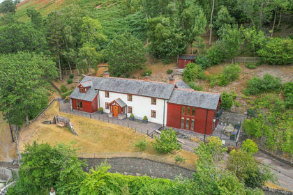
- Price
- £850,000
- Size
- 144.65 acres
Tan Y Fron Lane, Llangollen, Llantysilio, Denbighshire LL20 Wales
Added on 20/08/2026House with Land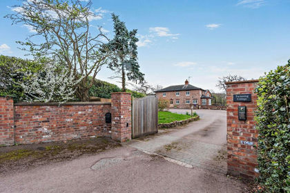
- Price
- Offers Over£995,000
- Size
- 5.7 acres
Added on 17/04/2026House with Land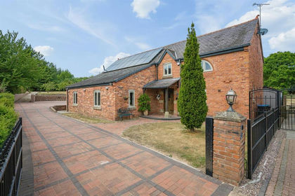
- Price
- Guide Price£1,100,000
- Size
- 12 acres
2 Fennant Court, Pentre Bychan, Wrexham, LL14, Esclusham, Wrexham LL14 Wales
Added on 24/08/2026House with Land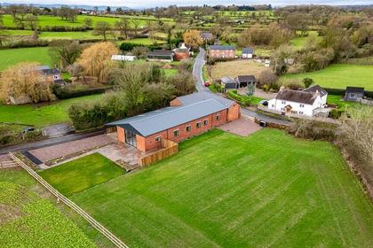
- Price
- Offers in Region of£995,000
- Size
- 11.21 acres
Brown Heath, Nr Ellesmere., Loppington, Shropshire SY12 England
Added on 08/04/2026Barn Conversion
- Price
- £750,000
- Size
- 31.8 acres
Llanwddyn, Oswestry, Powys, SY10, Llanwddyn, Powys SY10 Wales
Added on 29/01/2026Small Farm
- Price
- £775,000
- Size
- 27 acres
Castle Caereinion, Welshpool, Powys, Castle Caereinion, Powys SY21 Wales
Added on 08/07/2026Smallholding