Norton Manor Park, Norton, LD8
- Land size
- 1.4 acres
- Bedrooms
- 14
- Bathrooms
- 13
Key Features
- 14 bedrooms
- Income opportunities
- 15000 sq
- Biomass boiler
- Large reception rooms
Description
An extremely handsome Grade II Listed Jacobethan country house, Norton Manor offers a rare combination of architectural grandeur, lifestyle flexibility and income opportunity. Set within private grounds of around 1.4 acres, this landmark residence is steeped in history and beautifully positioned for both country living and commercial potential.
The Main House
Built in 1858 for Sir Richard Green-Price, Norton Manor is a fine example of Jacobethan architecture. Constructed in Ashlar stone, the house features a symmetrical façade with gabled bays, tall diagonal chimneys, gable parapets and finials. The entrance is marked by a four-centred arch under a hood mould, leading into a full-height reception hall with oak flooring, marble embossed pillars and a sweeping Italian-style staircase with gold leaf spindles.
The accommodation spans two principal floors, an attic and extensive cellarage, including a wine cellar, plant room, fuel store and workshop. All windows are sash with secondary glazing, most retaining their original shutters.
The formal reception rooms include a double aspect drawing room with a multifuel stove and a striking granite bar, a nod to its former life as a hotel, and a dining room with a working fireplace and garden views. The kitchen, once the ballroom, is now a stunning large family space with granite worktops, a double Range oven, two dishwashers, a central island and a wood burning stove. Ornate plasterwork, gold-painted ceilings and decorative coving add to the sense of grandeur.
Additional spaces include a cloakroom, boot room and larder/utility room.
Upstairs, seven double bedrooms each benefit from ensuite facilities, accessed via a galleried landing lit by stained glass roof lights.
The Wing & Ancillary Accommodation
The secondary wing has been sensitively restored and includes a flagstone entrance hall, kitchen/dining room, a ground floor ensuite bedroom and snug, two cloakrooms, four ensuite bedrooms on the first floor, and a second floor with two bedrooms, a bathroom and games room.
Configured as a separate Airbnb/holiday let, this wing includes a fully equipped outdoor kitchen with BBQ, pizza ovens, smokers and undercover dining- ideal for lifestyle, income or multi-generational living.
Grounds & Outbuildings
Approached via a long, shared driveway through parkland, the property opens into a gated gravel courtyard with ample parking. The grounds include a sunken lawn with stone steps and panoramic views over the Radnorshire Hills, a rear lawn and courtyard. There is hardstanding for four lodges, two already in place, ideal for staff or guest accommodation.
Business Potential
With its scale, elegance and layout, Norton Manor lends itself perfectly to corporate retreats, boutique hospitality or wedding functions. Previously operated as a hotel, the property has hosted numerous events and offers a compelling commercial opportunity alongside its residential appeal.
Practical Details
Tenure: Freehold
Council Tax: Band I (Main House)
Services: Mains water, borehole, Calor gas, private drainage
Energy: Biomass system with two P4 Froling Pellet Boilers, app-controlled
Planning: All restoration works signed off by building control
What3Words: ///treaty.squares.points
N.B. Anti-Money Laundering Checks (AML)
Regulations require us to conduct identity and AML checks and gather information about every buyer's financial circumstances. These checks are essential in fulfilling our Customer Due Diligence obligations, which must be done before any property can be marked as sold subject to contract. The rules are set by law and enforced by trading standards. We will start these checks once you have made a provisionally agreeable offer on a property. The cost is £80 (exc. VAT). This fee covers the expense of obtaining relevant data and any necessary manual checks and monitoring. It's paid in advance via our onboarding system, Kotini, and is non-refundable.
Garden
Outdoor Kitchen and dining area
Garden
Large flat lawn to the front and a smaller lawn to the side of the house
Map Location
Property details
- Tenure
- Freehold
- Council Tax Band
- H
- Date Posted
- 2026-01-29
Market Value Analysis
Compared with 1,208 Homes with Land listings in Wales (1+ acres).
Utilities & Restrictions
Utilities
- Electricity
- Mains
- Water
- Private Supply
- Heating
- Biomass Boiler
- Broadband
- Full Fibre (FTTP)
- Sewerage
- Septic Tank / Private
Rights & Restrictions
- Public Rights of Way
- Ask Agent
- Private Rights of Way
- Ask Agent
- Listed Property
- Yes
- Restrictions
- Ask Agent
Listed status, conservation areas and planning constraints for this location are in the full report.
Property Features
- Accessibility
- Ask Agent
- Parking
- Parking Available
- Garden
- Private Garden
Beyond the particulars: planning activity, flood history, heritage and ground risks, checked for this exact spot.
Connectivity
Broadband
Fastest speed available at this postcode
1.8 Gbps
Gigabit full fibre · available to 93% of premises
Suitable for
- 4K streaming on every screen
- Full-time home working
- Online gaming & big downloads
Fixed wireless access may also be an option here.
Mobile signal
Outdoor predictions; indoor signal depends on building materials.
Ofcom Connected Nations postcode-level predictions. Speeds and signal are modelled, not measured, and vary between addresses and providers.
Signal is the easy part. Planning activity, flood history and protected designations here are in the full report.
Nearest Schools
Primary
- Presteigne C.P. School1.9 miles
- Pupils
- 173
- Type
- Nursery, Infants & Juniors
- Language
- English medium school / provision
- Knighton Church In Wales Primary School3.2 miles
- Pupils
- 168
- Type
- Nursery, Infants & Juniors
- Language
- English medium school / provision
- Radnor Valley C.P. School6.2 miles
- Pupils
- 48
- Type
- Nursery, Infants & Juniors
- Language
- English medium school / provision
- Gladestry C.I.W. School8.2 miles
- Pupils
- 34
- Type
- Nursery, Infants & Juniors
- Language
- English medium school / provision
- Llanbister C.P. School12 miles
- Pupils
- 58
- Type
- Nursery, Infants & Juniors
- Language
- English medium school / provision
Secondary
- Ysgol Calon Cymru19 miles
- Pupils
- 948
- Type
- Secondary (ages 11-19)
- Language
- Dual language school / provision (Welsh and English) (including transitional)
- Newtown High School19 miles
- Pupils
- 896
- Type
- Secondary (ages 11-19)
- Language
- English medium school / provision
- Gwernyfed High School20 miles
- Pupils
- 505
- Type
- Secondary (ages 11-19)
- Language
- English medium school / provision
- Llanidloes High School24 miles
- Pupils
- 703
- Type
- Secondary (ages 11-19)
- Language
- Dual language school / provision (Welsh and English) (including transitional)
- Welshpool High School26 miles
- Pupils
- 816
- Type
- Secondary (ages 11-19)
- Language
- English medium school / provision
Distances are straight-line from the advertised location. Source: the national school registers (DfE, Welsh Government, Scottish Government) and Ofsted.
Schools are just the start: sold prices nearby, planning activity and any flood history are in the full report.
Amenities
Supermarket
GP surgery
Pharmacy
Walking trail
Straight-line distances from the advertised location. Sources: NHS records, Geolytix supermarket locations, OS Open Greenspace and the national trails registers.
The area stacks up? Now check the location itself: planning nearby, protected designations and past flooding.
Getting Around
Nearest station
Nearest bus stop
Typical drive times
Straight-line distances from the advertised location; drive times are typical free-flow times over OpenStreetMap road data, so allow more at peak. Public transport locations from DfT NaPTAN.
Easy to reach matters. So do planning activity, flood history and ground risks: all in the full report.
Flood Risk
From Natural Resources Wales flood map open data, checked around the advertised map pin and allowing for the listed acreage where known. This summary comes from LandSale, the advertising platform, not from the listing agent, and is not part of the agent's particulars. Risk can vary across a single holding, so verify anything critical through your own searches before committing.
Rivers and the sea
Surface water
The detail behind these bandings
The full report pinpoints where this location sits on the flood maps, and runs the deeper checks that usually only surface after an offer.
- Exact flood zones & annual chances (included in the full report)
- Any recorded past flooding (included in the full report)
- Planning activity nearby (included in the full report)
- Heritage & conservation (included in the full report)
- Protected nature designations (included in the full report)
- Ground risks (included in the full report)
- Sold prices nearby (included in the full report)
£14.99 · one-off purchase
By LandSale, the platform. Not provided by the listing agent. Ready in about a minute.
Important notice: Information, maps and tags on this page are drawn from the advertising agent's marketing materials or generated automatically. LandSale has not verified them. Relying on these details is at your own risk, always carry out independent checks before committing to a purchase.
LandSale full disclaimer
Marketing information only - not formal particulars. The details on this website are provided for general guidance and do not constitute an offer or contract. Neither LandSale nor the advertising estate/land agent accepts responsibility for any inaccuracy.
1. Source of information
- Listing content: Core description, asking price, tenure, measurements, photographs and planning history originate from the marketing materials of the advertising estate or land agent. LandSale does not author this content and cannot guarantee its accuracy.
- Automated tags & categorisation: Property type, land-use class, acreage bands and similar labels may be applied by machine-learning models. They are intended as a helpful guide only and may not reflect the property's legal status or permitted use.
- Third-party & enriched data layers: Maps, boundary outlines, planning designations, soil reports, broadband coverage and other environmental or location-based insights are licensed from external suppliers. Such data are supplied “as is", may be incomplete or out of date and are subject to change without notice.
2. Verification required
Prospective purchasers must verify critical matters, including but not limited to planning permission, title boundaries, public rights of way, environmental constraints, acreage, services, access and VAT status, through their own inspections, specialist surveys, legal advisers and the selling agent before relying on the information or entering into any contract.
3. No warranty or liability
LandSale gives no warranty, express or implied, as to the accuracy, completeness or fitness for any particular purpose of the information displayed. LandSale shall not be liable for any loss, damage, cost or expense arising directly or indirectly from any use of or reliance on such information, save where liability may not be excluded by law.
4. Updates & feedback
If you believe any detail on this listing is inaccurate, please let us know. We will investigate and, where appropriate, update the listing or notify the agent.
© LandSale | Version 1.3 - August 2026
Listing agent
Chartwell Noble, Covering Central England
Chartwell Noble, The Hayloft, Offerton Barns Business Centre, Offerton Lane, Worcester, Worcestershire, WR3 8SX
Contact Chartwell Noble, Covering Central England
Chartwell Noble, The Hayloft, Offerton Barns Business Centre, Offerton Lane, Worcester, Worcestershire, WR3 8SX
View agent profileSimilar properties for sale
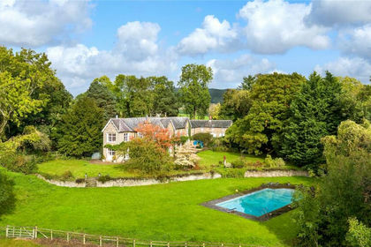
- Price
- Guide Price£1,350,000
- Size
- 12.52 acres
Titley, Kington, Herefordshire, County, HR5, Staunton on Arrow, Herefordshire, County of HR5 England
Added on 29/01/2026Country Estate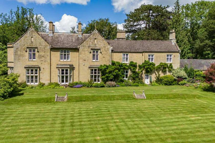
- Price
- £1,350,000
- Size
- 6 acres
Shobdon, Leominster, Shobdon, Herefordshire, County of HR6 England
Added on 16/04/2026Country Estate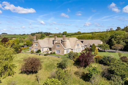
- Price
- Guide Price£1,250,000
- Size
- 7 acres
Dolau, Llandrindod Wells, Powys, LD1, Llanfihangel Rhydithon, Powys LD1 Wales
Added on 29/01/2026Country Home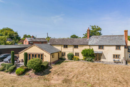
- Price
- Offers in Region of£1,000,000
- Size
- 2.5 acres
Added on 28/08/2026Farmhouse
- Price
- Guide Price£1,300,000
- Size
- 20 acres
Added on 05/03/2026Country Home
- Price
- £950,000
- Size
- 4 acres
Eardisland, Eardisland, Herefordshire, County of HR6 England
Added on 25/03/2026Country Home
- Price
- Guide Price£980,000
- Size
- 1.4 acres
Woonton, Hereford, Almeley, Herefordshire, County of HR3 England
Added on 11/02/2026Country Home
- Price
- Guide Price£1,125,000
- Size
- 9 acres
Winforton, Hereford, Willersley and Winforton, Herefordshire, County of HR3 England
Added on 29/01/2026Country Home
- Price
- Offers in Region of£1,000,000
- Size
- 1.67 acres
Richards Castle, Ludlow, Richard's Castle (Shropshire), Shropshire SY8 England
Added on 11/05/2026Country Home
- Price
- Guide Price£1,000,000
- Size
- 1.68 acres
Added on 07/05/2026Country Home