Drumdelgie Steading, Drumdelgie, Huntly, Aberdeenshire, AB54
- Land size
- 4.03 acres
Description
A unique commercial opportunity to acquire an extensive site with excellent potential with excellent access from the A96 yet maintaining a private setting. Site extending to approximately 4.03 acres.
Situation
Situated within the picturesque countryside around Huntly, the property lies approximately 4.5 miles northwest of Huntly town centre. The City of Aberdeen is located 40 miles to the southeast. Drumdelgie is only 1 mile west of the A96 which affords good access South to Aberdeen or North to Inverness. The nearest train station is located within Huntly where mainline services are available. Aberdeen Airport provides a range of international and domestic flights. Huntly is well served with an array of independent shops, supermarkets, leisure businesses, golf course, community facilities and established industrial estates.
Access
Excellent access from the A96 via a unnamed road.
What3words: dabbled.fine.blurs
Directions
Heading North along the A96 continue through Huntly and along the A96 for approximately 1.7 miles. Take a left signposted for Drumdelgie, continue along this road for 1 mile. Take the first right signposted for Drumdelgie which takes you along a tree lined tarmacked driveway. Pass two houses and the property can be found on your right.
Description
A useful site with a range of buildings including workshop, three General purpose buildings and traditional steading. The buildings lend themselves to a very wide range of uses with the extensive site allowing potential for future development and expansion.
Building 1 – Workshop 1500 sqm (16,145 sqft)
Steel portal frame building with a concrete floor and shuttered concrete walls.
Building 2 – General Purpose store
Steel portal frame building with a concrete floor and fibre cement sheet roof. Previously used as a broiler hen shed.
Building 3 – General Purpose store
Steel portal frame building with a concrete floor and fibre cement sheet roof. Previously used as a broiler hen shed.
Building 4 – General Purpose store
Steel portal frame building with a concrete floor and fibre cement sheet roof. Previously used as a broiler hen shed.
The site extends to 4.03ac (1.63ha) or thereby. This is mainly laid to concrete yard and shelterbelts.
Services
The property benefits from three phase electricity and water supply (buyers will accept the burden of ensuring the system is compliant).
Planning & Development
There are no known recent planning applications on this property.
Sporting Rights
Any sporting rights are included in the sale in so far as they are owned.
Mineral Rights
To the extent they are included within the vendor’s title.
Local Authority
Aberdeenshire Council
Huntly Business Centre
Hunty
Aberdeenshire
AB54 8FG
Plans, Areas and Schedules
These are based on the Ordnance Survey and Title Deeds and are for reference only. They have been carefully checked and computed by the selling agents and the purchaser shall be deemed to have satisfied themselves as to the description of the property and any error or misstatement shall not annul the sale nor entitle either party to compensation in respect thereof.
Solicitor
Stewart and Watson, 59 High Street, Turriff, AB53 4AD
Viewing
By strict appointment with the Selling Agents: Davidson & Robertson Ltd. Telephone: or via email: All viewings are to be arranged with the selling agents.
Date of Entry
By mutual agreement.
Deposit
A deposit of 10% of the purchase price will be payable on conclusion of missives. This will be non-refundable in the event of the transaction failing to reach completion for reasons not attributable to the vendors or their agents.
Offers and Anti-Money Laundering (AML) Regulations
Formal offers, in the acceptable Scottish form, should be submitted through a Scottish Solicitor to the Selling Agent. Under The Money Laundering, Terrorist Financing and Transfer of Funds (Information on the Payer) Regulations 2017 we are required to carry out money laundering checks on purchasers. To facilitate this and to proceed promptly with submitting an offer, the following documentation must be provided to us in advance (i.e. prior to or alongside the formal offer submission):
- Valid proof of identification
- Proof of current address
- Evidence of purchase method (e.g., Mortgage in Principle, Proof of Funds)
Upon verbal acceptance of an offer, we require to verify the purchaser’s identity and use an online verification service provider to do so. We cannot enter a business relationship with a purchaser until they have been identified. Failure to provide required identification may result in an offer not being considered.
Broadband/Mobile signal
We understand that broadband & mobile reception is available. Buyers are advised to visit OFCOM website for an indication of supply and speeds: //checker.ofcom.org.uk/en-gb/broadband-coverage and carry out their own further due diligence.
Map Location
Property details
- Tenure
- Freehold
- Council Tax Band
- TBC
- Date Posted
- 2026-01-29
Utilities & Restrictions
Utilities
- Electricity
- Ask Agent
- Water
- Ask Agent
- Heating
- Ask Agent
- Broadband
- Ask Agent
- Sewerage
- Ask Agent
Rights & Restrictions
- Public Rights of Way
- Ask Agent
- Private Rights of Way
- Ask Agent
- Listed Property
- Ask Agent
- Restrictions
- Ask Agent
Listed status, conservation areas and planning constraints for this location are in the full report.
Property Features
- Accessibility
- Ask Agent
- Parking
- Parking Available
- Garden
- Garden
Beyond the particulars: planning activity, flood history, heritage and ground risks, checked for this exact spot.
Connectivity
Broadband
Fastest speed available at this postcode
1.8 Gbps
Gigabit full fibre · available to 88% of premises
Suitable for
- 4K streaming on every screen
- Full-time home working
- Online gaming & big downloads
Mobile signal
Predicted 4G and 5G signal; indoor signal depends on building materials.
Ofcom Connected Nations postcode-level predictions. Speeds and signal are modelled, not measured, and vary between addresses and providers.
Signal is the easy part. Planning activity, flood history and protected designations here are in the full report.
Nearest Schools
Primary
- Cairney School1.3 miles
- Pupils
- 22
- Type
- Non-denominational
- Gordon Primary School3.3 miles
- Pupils
- 357
- Type
- Non-denominational
- Glass School4 miles
- Pupils
- 15
- Type
- Non-denominational
- Rothiemay Primary School5.4 miles
- Pupils
- 55
- Type
- Non-denominational
- St Thomas RC Primary School5.8 miles
- Pupils
- 38
- Type
- Roman Catholic
Secondary
- The Gordon Schools3.3 miles
- Pupils
- 665
- Type
- Non-denominational
- Keith Grammar School5.9 miles
- Pupils
- 370
- Type
- Non-denominational
- Milne's High School13 miles
- Pupils
- 477
- Type
- Non-denominational
- Speyside High School13 miles
- Pupils
- 395
- Type
- Non-denominational
- Buckie High School14 miles
- Pupils
- 826
- Type
- Non-denominational
Distances are straight-line from the advertised location. Source: the national school registers (DfE, Welsh Government, Scottish Government) and Ofsted.
Schools are just the start: planning activity, heritage and any flood history here are in the full report.
Amenities
Supermarket
GP surgery
Pharmacy
Straight-line distances from the advertised location. Sources: NHS records, Geolytix supermarket locations, OS Open Greenspace and the national trails registers.
The area stacks up? Now check the location itself: planning nearby, protected designations and past flooding.
Getting Around
Nearest station
Nearest bus stop
Typical drive times
Straight-line distances from the advertised location; drive times are typical free-flow times over OpenStreetMap road data, so allow more at peak. Public transport locations from DfT NaPTAN.
Easy to reach matters. So do planning activity, flood history and ground risks: all in the full report.
Flood Risk
SEPA open data, checked around the advertised map pin for the listed acreage. Provided by LandSale, not the listing agent, and not part of the agent's particulars. Risk varies across a holding, so verify before committing.
Rivers and the sea
Surface water
Not at the pin: mapped about 10 metres away.
These bandings are the summary. Where this location sits on the flood maps, plus planning activity, heritage and ground risks, is in the full report.
Important notice: Information, maps and tags on this page are drawn from the advertising agent's marketing materials or generated automatically. LandSale has not verified them. Relying on these details is at your own risk, always carry out independent checks before committing to a purchase.
LandSale full disclaimer
Marketing information only - not formal particulars. The details on this website are provided for general guidance and do not constitute an offer or contract. Neither LandSale nor the advertising estate/land agent accepts responsibility for any inaccuracy.
1. Source of information
- Listing content: Core description, asking price, tenure, measurements, photographs and planning history originate from the marketing materials of the advertising estate or land agent. LandSale does not author this content and cannot guarantee its accuracy.
- Automated tags & categorisation: Property type, land-use class, acreage bands and similar labels may be applied by machine-learning models. They are intended as a helpful guide only and may not reflect the property's legal status or permitted use.
- Third-party & enriched data layers: Maps, boundary outlines, planning designations, soil reports, broadband coverage and other environmental or location-based insights are licensed from external suppliers. Such data are supplied “as is", may be incomplete or out of date and are subject to change without notice.
2. Verification required
Prospective purchasers must verify critical matters, including but not limited to planning permission, title boundaries, public rights of way, environmental constraints, acreage, services, access and VAT status, through their own inspections, specialist surveys, legal advisers and the selling agent before relying on the information or entering into any contract.
3. No warranty or liability
LandSale gives no warranty, express or implied, as to the accuracy, completeness or fitness for any particular purpose of the information displayed. LandSale shall not be liable for any loss, damage, cost or expense arising directly or indirectly from any use of or reliance on such information, save where liability may not be excluded by law.
4. Updates & feedback
If you believe any detail on this listing is inaccurate, please let us know. We will investigate and, where appropriate, update the listing or notify the agent.
© LandSale | Version 1.3 - August 2026
Listing agent
Davidson & Robertson, Edinburgh
The Rural Centre West Mains Ingliston Edinburgh EH28 8LT
Contact Davidson & Robertson, Edinburgh
The Rural Centre West Mains Ingliston Edinburgh EH28 8LT
View agent profileSimilar properties for sale
- Price
- Offers Over£145,000
- Size
- 0.78 acres
Land at Braewynner, Near Fochabers, AB55, Aberdeenshire North and Moray East, Moray AB55 Scotland
Added on 25/08/2026Building Plot
- Price
- Offers in Region of£165,000
- Size
- 0.08 acres
Port Long Road, Cullen, Buckie, Moray, Aberdeenshire North and Moray East, Moray AB56 Scotland
Added on 02/04/2026Commercial Land
- Price
- Offers Over£90,000
Crown Street, Turriff, AB53, Gordon and Buchan, Aberdeenshire AB53 Scotland
Added on 18/09/2026Building Plot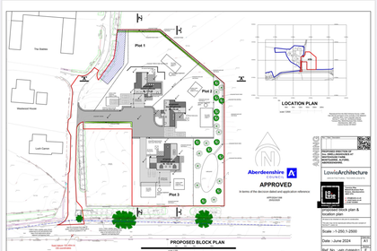
- Price
- Offers in Excess of£90,000
West Of Whitehouse Farm, Montgarrie, AB33, Gordon and Buchan, Aberdeenshire AB33 Scotland
Added on 29/01/2026Building Plot
- Price
- Offers Over£110,000
- Size
- 1.5 acres
House Sites at Little Greenford, Daviot, AB51, Gordon and Buchan, Aberdeenshire AB51 Scotland
Added on 17/07/2026Vacant Land
- Price
- Offers Over£115,000
Added on 26/02/2026Development Land
- Price
- Offers in Region of£150,000
- Size
- 1.51 acres
Added on 03/09/2026Development Land
- Price
- Offers Over£95,000
- Size
- 0.58 acres
Cottown Steading, Strathdon, AB36, West Aberdeenshire and Kincardine, Aberdeenshire AB36 Scotland
Added on 17/07/2026Development Land
- Price
- Offers Over£110,000
Hay Place, Elgin, Moray West, Nairn and Strathspey, Moray IV30 Scotland
Added on 29/01/2026Building Plot
- Price
- Offers Over£90,000
- Size
- 0.52 acres
Added on 25/06/2026Vacant Land