Lot 1 - Balchimmy Farm, Cushnie, Alford, Aberdeenshire
- Land size
- 1.51 acres
Key Features
- Fertile brown soils, free-draining and well suited to grass and arable
- Mixed unit offering both livestock grazing and arable cropping
- Planning permission for four modern houses to replace the existing three-bedroom farmhouse and farm steadings.
- Extensive range of traditional and modern farm buildings
- Ranging opportunities, from individual grass paddocks and agricultural parcels to a multi-house residential development site.
Description
Lot 1 – 0.61 Hectares – Offers Over £150,000
Lot 2 – 47.67 Hectares – Offers Over £700,000
Lot 3 – 4.20 Hectares – Offers Over £80,000
Lot 4 – 3.16 Hectares – Offers Over £45,000
Lot 5 – 5.34 Hectares – Offers Over £50,000
Lot 6 – 37.56 Hectares – Offers Over £550,000
Lot 7 – 6.48 Hectares – Offers Over £95,000
Lot 8 – 5.49 Hectares – Offers Over £90,000
Location
Balchimmy Farm occupies an attractive and accessible position near Cushnie in rural Aberdeenshire, in the gently rolling countryside south of the Howe of Alford. The market town of Alford lies approximately seven miles to the north, providing day-to-day services including shops, a primary school and secondary school. The city of Aberdeen, with its airport, mainline rail connections and full range of amenities, is around a 40-minute drive to the east.
The surrounding area is well-established farming country, characterised by a productive mix of livestock and arable enterprises, and the property sits within easy reach of agricultural merchants, contractors and markets serving the wider region. Despite its rural setting, the farm is conveniently placed for the towns of Inverurie and Huntly and the main road network, offering a rare combination of seclusion and connectivity.
Directions and Access
From Alford, head south on the A980 signed Muir of Fowlis. After approximately three miles, turn right onto the public road signed Ley. Turn left and follow the road for approximately one mile, where the entrance to Balchimmy Farm will be found as shown on the sale plan.
Postcode: AB33 8LE, please note that satellite navigation may not direct visitors precisely to the farm entrance.
The farm benefits from good, direct access off the public road network, well suited to the movement of agricultural machinery, livestock floats and large vehicles. Internally, a network of farm tracks provides serviceable access to the main blocks of land and steadings, allowing efficient day-to-day management across the holding.
Description
Balchimmy extends to approximately 110.51 hectares (273.08 acres) and is offered for sale in eight lots, as shown on the sale plan.
The holding combines arable and grassland with a farm steading and a residential development opportunity. Predominantly free-draining brown soils, classified by the James Hutton Institute as Land Capability for Agriculture Grades 4.1 and 4.2, support a mixed farming rotation. Recent management has included spring barley, temporary grass and Ecological Focus Area (EFA) fallow.
Lot 1 – Farmhouse, Buildings and Residential Development
A three-bedroom farmhouse and two adjoining general-purpose agricultural buildings, with planning permission for their demolition and replacement with four modern houses.
The buildings extend to approximately 39m × 29m and 32m × 19m. The larger has stone walls with Yorkshire boarding, while the smaller is of steel portal-frame construction
with part-stone walls and Yorkshire boarding. Both have corrugated roofs.
Further details of the planning permission are provided on the following page.
Lot 2 – Farmland and Steading
A substantial block of arable and grassland surrounding a farm steading, comprising:
• Silage clamp: approximately 60m × 15m, with earth walls and a concrete floor.
• Machinery shed: approximately 20m × 6m, of steel portal-frame construction with concrete panel walls.
• General-purpose building: approximately 41m × 9m, of steel portal-frame construction with concrete panel and corrugated sheet walls.
• Modern livestock building: approximately 73m × 12m, of steel-frame construction with corrugated side walls. All three buildings have concrete floors and corrugated sheet roofs.
Lot 3 – Level Grass Paddock
A level grass paddock suitable for livestock grazing or equestrian use.
Lot 4 – Grazing Land
A separate grass field suitable for grazing livestock or horses.
Lot 5 – Grass Paddock
A grass field suitable for livestock grazing or equestrian use.
Lot 6 – Arable and Grassland
Two well-shaped arable fields of a practical working size, both of which have recently produced good crops of spring barley, together with a grass field suitable for grazing.
Lots 7 and 8 – Individual Grass Paddocks
Two separate grass fields, each offered as an individual lot and suitable for livestock grazing or equestrian use. Their respective areas and guide prices are set out in the lotting
table, with boundaries shown on the sale plan.
Development potential
Lots 3, 4, 5, 7 and 8 may offer potential for residential dwellings, subject to obtaining the necessary planning consents. No formal investigations have been undertaken to
establish this potential, and purchasers should make their own enquiries.
Planning Permission — Lot 1
Full Planning Permission was granted by Aberdeenshire Council on 31 March 2026 (ref. APP/2025/0665) for the demolition of the existing farmhouse and agricultural buildings and the erection of four dwellinghouses at Balchimmy steading The consent represents regeneration the steading. The permission replaces the farmhouse — originally dating from around the 1850s but substantially altered in the 1970s, together with disused 1960s/70s slatted cattle courts, adjoining sheds and associated agricultural infrastructure. In their place, four detached houses are consented, arranged in a traditional courtyard layout designed to sit comfortably within the rural setting. The combined footprint of the new houses is materially smaller than that of the buildings they replace, with the scheme delivering additional landscaping, new hedgerows and tree planting, and the removal of redundant hardstanding and silage towers.
The development is served entirely by private infrastructure appropriate to its rural location. Each plot has its own package sewage treatment plant discharging to soakaway, drawing on a private water supply serving the site, with sustainable drainage arrangements for surface water. Heating is provided by air source heat pumps, and each house benefits from electric vehicle charging provision, with the houses designed to a modern, energy-efficient standard incorporating photovoltaic panels. Vehicular access is taken from the adopted road along the eastern boundary via a new access and lay-by, with parking and turning within each plot.
The houses are two-storey in form, finished in buttermilk render with anthracite grey Cedral cladding, natural slate roofs, and anthracite grey windows, doors and rainwater goods. Plots 3 and 4 provide generous four-bedroom family accommodation over two floors, with an integral garage, open-plan family and dining space, a separate lounge and dining room, and en-suite and family bathrooms at first floor. Approved plans are also in place for plots 1 and 2, offering a purchaser a consented scheme across all four plots.
The permission runs for three years from the date of decision, lapsing on 31 March 2029 unless development is begun within that period. It is subject to a number of standard conditions for a rural development of this type, including a predemolition photographic building survey, a contaminated land site investigation, formation of access visibility splays and a lay-by, a water safety and management plan and private water treatment system for each house, and an Energy Statement for each house.
Full details of the consent, approved plans and conditions are available from the selling agent upon request.
BPS Entitlements
The vendor’s Basic Payment Scheme entitlements will be transferred to the purchaser at completion. Further details, including the number and region of entitlements, are available from the selling agents.
Boundaries
Neighbouring boundaries are to be maintained to a stockproof condition with neighbouring land owners at 50:50 basis.
Wayleaves & Third-Party Rights
The property will be sold with the benefit of, and subject to, all existing rights and burdens within the Titles.
Mineral Rights
The mineral rights are included in the freehold sale in so far as they are owned.
Sporting Rights
The sporting rights are unlet and included in the sale.
Map Location
Property details
- Tenure
- Freehold
- Council Tax Band
- Ask Agent
- Date Posted
- 2026-09-03
Market Value Analysis
Compared with 148 Development Land listings in Scotland (1+ acres).
Utilities & Restrictions
Utilities
- Electricity
- Ask Agent
- Water
- Ask Agent
- Heating
- Ask Agent
- Broadband
- Ask Agent
- Sewerage
- Ask Agent
Rights & Restrictions
- Public Rights of Way
- Ask Agent
- Private Rights of Way
- Ask Agent
- Listed Property
- Ask Agent
- Restrictions
- Ask Agent
Listed status, conservation areas and planning constraints for this location are in the full report.
Property Features
- Accessibility
- Ask Agent
- Parking
- Ask Agent
- Garden
- Ask Agent
Beyond the particulars: planning activity, flood history, heritage and ground risks, checked for this exact spot.
Connectivity
Broadband
Fastest speed available at this postcode
80 Mbps
Superfast · available to 36% of premises
Suitable for
- HD streaming
- Video calls
- Web & social
Mobile signal
Predicted 4G and 5G signal; indoor signal depends on building materials.
Ofcom Connected Nations postcode-level predictions. Speeds and signal are modelled, not measured, and vary between addresses and providers.
Signal is the easy part. Planning activity, flood history and protected designations here are in the full report.
Nearest Schools
Primary
- Craigievar School4.2 miles
- Pupils
- 35
- Type
- Non-denominational
- Tarland School4.3 miles
- Pupils
- 85
- Type
- Non-denominational
- Towie School4.3 miles
- Pupils
- 38
- Type
- Non-denominational
- Alford Primary School4.8 miles
- Pupils
- 343
- Type
- Non-denominational
- Tullynessle School5.6 miles
- Pupils
- 14
- Type
- Non-denominational
Secondary
- Alford Academy4.8 miles
- Pupils
- 733
- Type
- Non-denominational
- Aboyne Academy7.9 miles
- Pupils
- 669
- Type
- Non-denominational
- Kemnay Academy14 miles
- Pupils
- 993
- Type
- Non-denominational
- Banchory Academy15 miles
- Pupils
- 865
- Type
- Non-denominational
- Inverurie Academy18 miles
- Pupils
- 1,292
- Type
- Non-denominational
Distances are straight-line from the advertised location. Source: the national school registers (DfE, Welsh Government, Scottish Government) and Ofsted.
Schools are just the start: planning activity, heritage and any flood history here are in the full report.
Amenities
Supermarket
GP surgery
Pharmacy
Straight-line distances from the advertised location. Sources: NHS records, Geolytix supermarket locations, OS Open Greenspace and the national trails registers.
The area stacks up? Now check the location itself: planning nearby, protected designations and past flooding.
Getting Around
Nearest station
Nearest bus stop
Typical drive times
Straight-line distances from the advertised location; drive times are typical free-flow times over OpenStreetMap road data, so allow more at peak. Public transport locations from DfT NaPTAN.
Easy to reach matters. So do planning activity, flood history and ground risks: all in the full report.
Flood Risk
SEPA open data, checked around the advertised map pin for the listed acreage. Provided by LandSale, not the listing agent, and not part of the agent's particulars. Risk varies across a holding, so verify before committing.
Rivers and the sea
Surface water
These bandings are the summary. Where this location sits on the flood maps, plus planning activity, heritage and ground risks, is in the full report.
Important notice: Information, maps and tags on this page are drawn from the advertising agent's marketing materials or generated automatically. LandSale has not verified them. Relying on these details is at your own risk, always carry out independent checks before committing to a purchase.
LandSale full disclaimer
Marketing information only - not formal particulars. The details on this website are provided for general guidance and do not constitute an offer or contract. Neither LandSale nor the advertising estate/land agent accepts responsibility for any inaccuracy.
1. Source of information
- Listing content: Core description, asking price, tenure, measurements, photographs and planning history originate from the marketing materials of the advertising estate or land agent. LandSale does not author this content and cannot guarantee its accuracy.
- Automated tags & categorisation: Property type, land-use class, acreage bands and similar labels may be applied by machine-learning models. They are intended as a helpful guide only and may not reflect the property's legal status or permitted use.
- Third-party & enriched data layers: Maps, boundary outlines, planning designations, soil reports, broadband coverage and other environmental or location-based insights are licensed from external suppliers. Such data are supplied “as is", may be incomplete or out of date and are subject to change without notice.
2. Verification required
Prospective purchasers must verify critical matters, including but not limited to planning permission, title boundaries, public rights of way, environmental constraints, acreage, services, access and VAT status, through their own inspections, specialist surveys, legal advisers and the selling agent before relying on the information or entering into any contract.
3. No warranty or liability
LandSale gives no warranty, express or implied, as to the accuracy, completeness or fitness for any particular purpose of the information displayed. LandSale shall not be liable for any loss, damage, cost or expense arising directly or indirectly from any use of or reliance on such information, save where liability may not be excluded by law.
4. Updates & feedback
If you believe any detail on this listing is inaccurate, please let us know. We will investigate and, where appropriate, update the listing or notify the agent.
© LandSale | Version 1.3 - August 2026

Listing agent
GOLDCREST LAND & FORESTRY GROUP LLP, Edinburgh
18 Great Stuart Street Edinburgh EH3 7TN
Contact GOLDCREST LAND & FORESTRY GROUP LLP, Edinburgh
18 Great Stuart Street Edinburgh EH3 7TN
View agent profileSimilar properties for sale
- Price
- Offers Over£180,000
Lumphanan, Banchory, AB31, West Aberdeenshire and Kincardine, Aberdeenshire AB31 Scotland
Added on 17/07/2026Development Land
- Price
- Offers in Region of£125,000
- Size
- 0.28 acres
Aboyne, Banchory AB31, West Aberdeenshire and Kincardine, Aberdeenshire AB31 Scotland
Added on 29/01/2026Building Plot
- Price
- Offers Over£150,000
- Size
- 4.03 acres
Added on 29/01/2026Commercial Land
- Price
- Fixed Price£125,000
- Size
- 2.63 acres
Added on 29/01/2026Building Plot
- Price
- Offers Over£180,000
- Size
- 0.45 acres
Added on 29/01/2026Building Plot
- Price
- Offers Over£145,000
- Size
- 0.78 acres
Land at Braewynner, Near Fochabers, AB55, Aberdeenshire North and Moray East, Moray AB55 Scotland
Added on 25/08/2026Building Plot
- Price
- Offers Over£125,000
- Size
- 0.6 acres
Lochgorm Neuk House Site, Grantown on Spey, Moray West, Nairn and Strathspey, Highland PH26 Scotland
Added on 29/01/2026Building Plot
- Price
- Offers Over£140,000
Stannochy Farm, Brechin, Angus, DD9, Angus and Perthshire Glens, Angus DD9 Scotland
Added on 29/01/2026Self Build Plot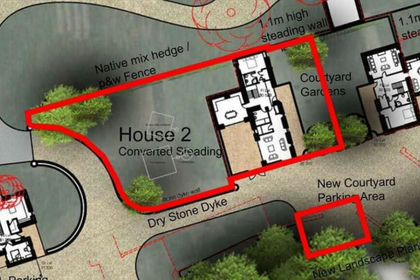
- Price
- Offers Over£130,000
- Size
- 0.25 acres
Stannochy Farm, Brechin, Angus, DD9, Angus and Perthshire Glens, Angus DD9 Scotland
Added on 29/01/2026Self Build Plot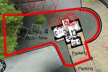
- Price
- Offers Over£130,000
- Size
- 0.2 acres
Stannochy Farm, Brechin, Angus, DD9, Angus and Perthshire Glens, Angus DD9 Scotland
Added on 29/01/2026Self Build Plot