
Glemsford, Sudbury, Suffolk
- Land size
- 0.35 acres
- Bedrooms
- 5
- Bathrooms
- 2
Key Features
- Detached Grade II* listed period home
- Remarkable period features with the house dating back to around 1485
- Newly installed AGA kitchen
- Five bedrooms and Two bath/shower rooms
- Sitting room, living room, dining room and playroom
- Ground floor cloakroom
- Attractive gardens with open field view
- Double garage/workshop
- Ample off-street parking
- Close to village amenities
Description
LOCATION: Glemsford is a popular village situated to the West of Long Melford. There is a strong sense of community with an ever expanding list of clubs and societies to suit all ages. The village offers many amenities including a school, doctors surgery, public transport facilities and has a selection of shops and public houses. Surrounded by open countryside and farmland, the village is conveniently situated for Long Melford, Sudbury with its commuter rail link to London's Liverpool Street (about 7 miles) and the Cathedral town of Bury St Edmunds to the north (about 12 miles).
SUMMARY: Peverells is an exceptionally attractive Grade II* Listed Medieval manor house dating from the late 15th century. It is a traditional Suffolk hall house which remains remarkably true to its original form. The house was originally built for one Ranulph Peverell, a Norman and trusted knight of William the Conqueror. The house today provides accommodation remarkably well suited to modern living and yet showcases a wealth of original features including exposed timbers, panelled doors and Tudor four centred arches. One of the oldest properties in the village, Peverells sits overlooking the charming village green to the front, and farmland to the rear and has the benefit of ample off-road parking and a garage/workshop. In all about 0.35 acres (sts).
Front door leading to:
RECEPTION HALL: An impressive entrance with exposed brick work, tall ceilings and exposed timbers. Expanding into the:-
LIVING ROOM: 7.12m x 5.92m (23'4" x 19'5") An attractive room, heavily timbered, with a high ceiling and a central chimney stack with dual aspect fireplace complemented by leaded windows overlooking the garden and the green. A brick floor runs throughout and there is evidence of Tudor archways.
SITTING ROOM: 4.51m x 4.19m (14'10" x 13'9") A large leaded glass window provides a good deal of natural light and overlooks the front garden and green beyond. Exposed beams and a fireplace.
DINING ROOM: 5.99m x 4.14m (19'8" x 13'7") A charming room with heavy oak framework and an open fireplace. Leaded glass windows overlook the garden and the green.
PLAY ROOM: 4.19m x 2.88m (13'9" x 9'5") A light room with views over the rear garden and the potential to be used as either a playroom (as it currently is), a study, or indeed a ground floor bedroom if required.
AGA KITCHEN: 4.52m x 4.24m (14'10" x 13'11") Recently upgraded and finished to a high standard with a matching range of base and wall level shaker style units with solid wood work surfaces incorporating a one-and-a-half sink with mixer tap above and drainer to side. Integrated appliances include a full-height refrigerator, separate freezer, space and plumbing for a washing machine and space for tumble dryer. Gas fired AGA range cooker with twin warming plates and a separate electric, Bosch combination oven with a 4 ring electric hob over. Thumb latch door leading onto a rear vestibule which opens onto the driveway. An attractive feature has been made of an old inglenook fireplace with oak bressummer beam and exposed mellow red brick.
CLOAKROOM: Fitted WC and wash hand basin.
First floor
LANDING: A spacious area that measures about 43ft long with views over the garden and fields beyond. Exposed oak beams and arches.
BEDROOM ONE: 4.46m x 3.70m (14'8" x 12'2") An impressive room overlooking the rear garden with a high, vaulted ceiling showing exposed beams and ceiling timbers.
BEDROOM TWO: 4.70m x 3.74m (15'5" x 12'3") A heavily timbered room with leaded glass window overlooking the front garden and green beyond.
BEDROOM THREE: 4.46m x 3.38m (14'8" x 11'1") Leaded glass window providing views over the garden and the green beyond.
BEDROOM FOUR: 4.19m x 3.38m (13'9" x 11'1") Wide oak floorboards and leaded glass window overlooking the front garden and the green beyond.
BEDROOM FIVE: 4.19m x 2.92m (13'9" x 9'7") Currently used as a dressing room but which also functions nicely as an additional bedroom overlooking the rear garden with countryside beyond. Also with a range of integrated wardrobes.
FAMILY BATHROOM: With solid oak flooring, frosted leaded light windows, a double-ended bath with mixer tap and shower attachment over, a W.C. and a wash hand basin.
SHOWER ROOM: With exposed beams, finished with a shower cubicle, W.C., wash hand basin and a heated towel rail.
CLOAKROOM: Containing a W.C. and a wash hand basin.
Outside The front boundary is defined by a privet hedge with a five-bar gate opening to a gravel drive which provides parking for a number of vehicles. The front garden includes a brick paved terrace leading up to the front door. To the side is an area of gravel which leads onto a:-
GARAGE/WORKSHOP: With light and power connected, two sets of double doors and a personnel door to the side.
The gardens are a wonderful feature of the property with a predominately south west facing aspect taking advantage of the afternoon/evening sun. Areas of lawn include a number of fruit trees including, apple, pear and cherry. The boundary to the rear abuts open countryside to provide far reaching countryside views.
In all about 0.35 acres.
SERVICES: Mains water, drainage and electricity are connected. Gas fired heating by radiators.
LOCAL AUTHORITY: Babergh District Council
COUNCIL TAX BAND: G
VIEWING: Strictly by prior appointment only through DAVID BURR.
TENURE: Freehold
CONSTRUCTION TYPE: Timber framed
WHAT3WORDS: printout.jumbled.slider
NOTICE: Whilst every effort has been made to ensure the accuracy of these sales details, they are for guidance purposes only and prospective purchasers or lessees are advised to seek their own professional advice as well as to satisfy themselves by inspection or otherwise as to their correctness. No representation or warranty whatsoever is made in relation to this property by David Burr or its employees nor do such sales details form part of any offer or contract.
Map Location
Property details
- Tenure
- Freehold
- Council Tax Band
- G
- Date Posted
- 2026-11-16
Utilities & Restrictions
Utilities
- Electricity
- Mains
- Water
- Mains
- Heating
- Gas Central Heating
- Broadband
- Fibre (FTTC)
- Sewerage
- Mains
Rights & Restrictions
- Public Rights of Way
- Ask Agent
- Private Rights of Way
- Ask Agent
- Listed Property
- Yes
- Restrictions
- Yes
Listed status, conservation areas and planning constraints for this location are in the full report.
Property Features
- Accessibility
- Ask Agent
- Parking
- Garage, On-Street Parking, Off-Street Parking
- Garden
- Garden
Beyond the particulars: planning activity, flood history, heritage and ground risks, checked for this exact spot.
Connectivity
Broadband
Fastest speed available at this postcode
1 Gbps
Gigabit full fibre · available to 75% of premises
Suitable for
- 4K streaming on every screen
- Full-time home working
- Online gaming & big downloads
Fixed wireless access may also be an option here.
Mobile signal
Predicted 4G and 5G signal; indoor signal depends on building materials.
Ofcom Connected Nations postcode-level predictions. Speeds and signal are modelled, not measured, and vary between addresses and providers.
Signal is the easy part. Planning activity, flood history and protected designations here are in the full report.
Nearest Schools
Primary
- Glemsford Primary Academy205 metresNo Ofsted rating
- Ages
- 2 to 11
- Pupils
- 243
- Type
- Academy sponsor led
- Cavendish Church of England Primary School1.7 milesOfsted: Inadequate
- Ages
- 4 to 11
- Pupils
- 52
- Type
- Academy sponsor led
- Faith
- Church of England
- Hartest Church of England Primary School2.7 milesOfsted: Good
- Ages
- 4 to 11
- Pupils
- 42
- Type
- Academy sponsor led
- Faith
- Church of England
- Long Melford Church of England Primary School3 milesNo Ofsted rating
- Ages
- 3 to 11
- Pupils
- 207
- Type
- Academy sponsor led
- Faith
- Church of England
- Clare Community Primary School3.9 milesOfsted: Good
- Ages
- 4 to 11
- Pupils
- 199
- Type
- Academy sponsor led
Secondary
- Stour Valley Community School3.5 milesOfsted: Good
- Ages
- 11 to 16
- Pupils
- 569
- Type
- Free schools
- Ormiston Sudbury Academy4.7 milesOfsted report card · Feb 2026
- Ages
- 11 to 19
- Pupils
- 710
- Type
- Academy sponsor led
- Thomas Gainsborough School6.5 milesOfsted: Good *
- Ages
- 11 to 18
- Pupils
- 1,603
- Type
- Academy converter
- Hedingham School and Sixth Form8.6 milesNo Ofsted rating
- Ages
- 11 to 18
- Pupils
- 1,177
- Type
- Academy converter
- Samuel Ward Academy9.3 milesOfsted: Good
- Ages
- 11 to 18
- Pupils
- 1,076
- Type
- Academy converter
* Latest graded judgement covers quality of education only; no overall grade was issued under the 2024-25 inspection framework.
Distances are straight-line from the advertised location. Source: the national school registers (DfE, Welsh Government, Scottish Government) and Ofsted.
Schools are just the start: sold prices nearby, planning activity and any flood history are in the full report.
Amenities
Supermarket
GP surgery
Pharmacy
Hospital
Green space
Straight-line distances from the advertised location. Sources: NHS records, Geolytix supermarket locations, OS Open Greenspace and the national trails registers.
The area stacks up? Now check the location itself: planning nearby, protected designations and past flooding.
Getting Around
Nearest station
Nearest bus stop
Typical drive times
Straight-line distances from the advertised location; drive times are typical free-flow times over OpenStreetMap road data, so allow more at peak. Public transport locations from DfT NaPTAN.
Easy to reach matters. So do planning activity, flood history and ground risks: all in the full report.
Flood Risk
Environment Agency open data, checked around the advertised map pin for the listed acreage. Long-term risk counts flood defences; the planning map's flood zones do not. Provided by LandSale, not the listing agent, and not part of the agent's particulars. Risk varies across a holding, so verify before committing.
Rivers and the sea
Planning map: Flood Zone 1.
Surface water
These bandings are the summary. Where this location sits on the flood maps, plus planning activity, heritage and ground risks, is in the full report.
Important notice: Information, maps and tags on this page are drawn from the advertising agent's marketing materials or generated automatically. LandSale has not verified them. Relying on these details is at your own risk, always carry out independent checks before committing to a purchase.
LandSale full disclaimer
Marketing information only - not formal particulars. The details on this website are provided for general guidance and do not constitute an offer or contract. Neither LandSale nor the advertising estate/land agent accepts responsibility for any inaccuracy.
1. Source of information
- Listing content: Core description, asking price, tenure, measurements, photographs and planning history originate from the marketing materials of the advertising estate or land agent. LandSale does not author this content and cannot guarantee its accuracy.
- Automated tags & categorisation: Property type, land-use class, acreage bands and similar labels may be applied by machine-learning models. They are intended as a helpful guide only and may not reflect the property's legal status or permitted use.
- Third-party & enriched data layers: Maps, boundary outlines, planning designations, soil reports, broadband coverage and other environmental or location-based insights are licensed from external suppliers. Such data are supplied “as is", may be incomplete or out of date and are subject to change without notice.
2. Verification required
Prospective purchasers must verify critical matters, including but not limited to planning permission, title boundaries, public rights of way, environmental constraints, acreage, services, access and VAT status, through their own inspections, specialist surveys, legal advisers and the selling agent before relying on the information or entering into any contract.
3. No warranty or liability
LandSale gives no warranty, express or implied, as to the accuracy, completeness or fitness for any particular purpose of the information displayed. LandSale shall not be liable for any loss, damage, cost or expense arising directly or indirectly from any use of or reliance on such information, save where liability may not be excluded by law.
4. Updates & feedback
If you believe any detail on this listing is inaccurate, please let us know. We will investigate and, where appropriate, update the listing or notify the agent.
© LandSale | Version 1.3 - August 2026
Listing agent
David Burr Estate Agents, Long MelfordWalnut Tree House Hall Street, Long Melford, CO10 9JG
Contact David Burr Estate Agents, Long Melford
Walnut Tree House Hall Street, Long Melford, CO10 9JG
View agent profileSimilar properties for sale
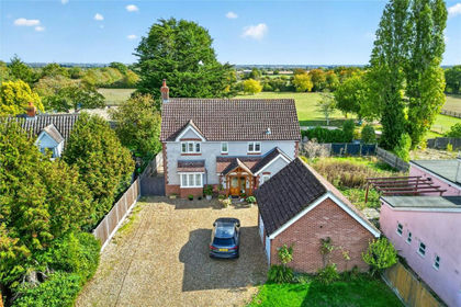
- Price
- £775,000
- Size
- 1.5 acres
Pinkuah Lane, Pentlow, Sudbury, Essex, CO10, Pentlow, Essex CO10 England
Added on 06/10/2026House with Land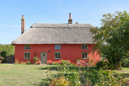
- Price
- Guide Price£675,000
- Size
- 0.85 acres
Belchamp St. Paul, Sudbury, Suffolk, Belchamp St. Paul, Essex CO10 England
Added on 16/11/2026Cottage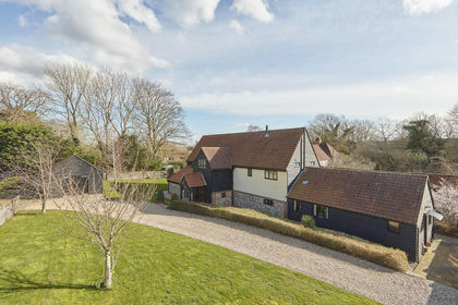
- Price
- Offers in Excess of£925,000
- Size
- 0.72 acres
Added on 07/09/2026Barn Conversion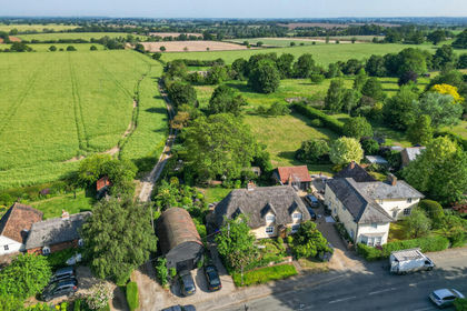
- Price
- £600,000
- Size
- 0.4 acres
Bulmer Street, Bulmer, Sudbury, Essex, CO10, Bulmer, Essex CO10 England
Added on 16/11/2026Cottage
- Price
- Guide Price£895,000
- Size
- 2.1 acres
Added on 21/10/2026Barn Conversion
- Price
- Guide Price£895,000
- Size
- 0.5 acres
Cockfield, Bury St. Edmunds, Suffolk, Cockfield, Suffolk IP30 England
Added on 22/09/2026Barn Conversion
- Price
- Offers in Excess of£650,000
- Size
- 0.8 acres
Whepstead Road, Hawstead, Bury St. Edmunds, Suffolk, IP29, Hawstead, Suffolk IP29 England
Added on 16/11/2026Farmhouse
- Price
- Guide Price£865,000
- Size
- 0.27 acres
Baythorne End, Halstead, Essex, CO9, Birdbrook, Essex CO9 England
Added on 12/05/2026Barn Conversion
- Price
- Guide Price£650,000
- Size
- 0.67 acres
The Green, Twinstead, Sudbury, CO10, Twinstead, Essex CO10 England
Added on 16/11/2026Cottage
- Price
- Guide Price£750,000
- Size
- 14.1 acres
Development Opportunity at Tye Farm, Monks Eleigh, Suffolk, Monks Eleigh, Suffolk IP7 England
Added on 19/10/2026Development Land