Clare, Sudbury, Suffolk
- Land size
- 0.72 acres
- Bedrooms
- 5
- Bathrooms
- 3
Key Features
- Substantial unlisted barn conversion
- Peaceful, semi-rural location
- Situated on the outskirts of Clare
- Character features and modern luxuries
- Range of useful outbuildings
- Home Office, Party Barn, Store and Garage
- Private driveway
- In all about 0.72 acres
Description
Clare is an attractive and historic town boasting many fine examples of period architecture, a Priory, Norman Keep and the magnificent St. Peter and St. Paul Sudbury with its branch line commuter service to London Liverpool Street lies 8 miles to the east. Bury St Edmunds lies approximately 16 miles to the north, whilst Cambridge is 25 miles to the west.
This substantial detached unlisted barn conversion is situated in a peaceful, semi-rural location on the outskirts of the popular and sought after market town of Clare. The property, which was converted in 2002, offers spacious and flexible living accommodation with a range of character features complimented by more modern luxuries and benefits from a range of useful outbuildings including a home office, store and garage. The property is approached via a private driveway and is set within 0.72 of an acre.
INTERIOR Entrance into RECEPTION HALL an impressive and welcoming entrance to the property with vaulted ceilings with exposed timbers and brickwork leading into the GALLERIED DRAWING ROOM this impressive room centers around a double-sided brick fireplace with a log burning stove and character features continue with exposed timbers and flint walls with full height windows and double doors opening onto the rear terrace. FAMILY ROOM featuring a brick fireplace with log burning stove with exposed timbers and flint walls. KITCHEN/BREAKFAST ROOM the hub of the home, the custom Knights Country Kitchen has been extensively fitted with a stylish range of shaker-style wall and floor units under stone worktops with Belfast sink inset. High quality appliances include a double Aga with dual hotplates and four ring hob set into the chimney recess, with decorative tiled splash backs, space for an American-style fridge/freezer and plumbing for a dishwasher. A large central preparation island offers a wonderful space to entertain. There is also a walk-in shelved larder Double doors open onto the rear garden. UTILITY ROOM fitted with a further range of units under worktops, water softener and space and plumbing for a washing machine, space for a tumble dryer. CLOAKROOM with WC, wash hand basin and ceramic tiled floor. REAR HALL with stairs to the first floor with cupboard under. Door to BEDROOM 4 a double aspect room with exposed timbers and pleasant outlook over the rear garden. BATHROOM stylishly equipped with a white suite comprising WC, vanity sink unit, roll top bath with shower attachment over, tiled shower cubicle, heated towel rail and a range of storage cupboards. STUDY/BEDROOM 5 with an attractive flint wall, enjoying a pleasant outlook to the front and side.
FIRST FLOOR
GALLERIED LANDING overlooking the Drawing Room and featuring exposed timbers and a linen cupboard. MASTER BEDROOM approached via a Dressing Area with custom wardrobes. This light, triple aspect room enjoys superb views over open countryside and features exposed timbers. En-Suite comprising a white suite with WC, vanity sink unit, double shower cubicle and a heated towel rail. BEDROOM 2 with exposed timbers and access to the loft space. BEDROOM 3 of double aspect with exposed timbers. BATHROOM fitted with a white suite comprising a WC, vanity sink unit, panelled bath with shower over, heated towel rail, airing cupboard and exposed timbers.
EXTERIOR The property is approached via a sweeping gravel driveway abutting open fields, leading to an extensive parking area and GARAGE. The front gardens are mostly lawned with mature beds and borders with access via either side of the property to the rear. The rear gardens are enclosed by the various outbuildings and have been landscaped for low maintenance and summer entertaining with a variety of paved terraces, interspersed with raised flower beds and borders. The property benefits from an extensive range of outbuildings as follows: PARTY BARN finished to a very high standard with light and power connected. OFFICE newly renovated offering a great space away from the house to work, power connected. STORE/WORKSHOP. Currently used for storage.
In all about 0.72 acres.
MATERIAL INFORMATION SERVICES: Mains water and sewage treatment plant. Mains electricity connected. Oil-fired heating. NOTE: None of these services have been tested by the agent.
LOCAL AUTHORITY: West Suffolk Council, West Suffolk House, Western Way, Bury St Edmunds, Suffolk IP33 3YU. Telephone: .
COUNCIL TAX BAND: G. £3,919.12 per annum.
PROPERTY POSTCODE: CO10 8RR.
TENURE: Freehold.
CONSTRUCTION TYPE: Wood frame.
COMMUNICATION SERVICES: (Source Ofcom):
Broadband: Yes. Speed up to 76 mpbs download, up to 20 mpbs upload. Telephone Signal: Yes.
NOTE: David Burr make no guarantees or representations as to the existence or quality of any services supplied by third parties. Speeds and services may vary and any information pertaining to such is indicative only and may be subject to change. Purchasers should satisfy themselves on any matters relating to internet
or telephone services by visiting
SUBSIDENCE HISTORY: None.
PLANNING APPLICATIONS/DEVELOPMENTS/PROPOSALS: None.
ASBESTOS/CLADDING: None Known.
RESTRICTIONS ON USE OR COVENANTS: A right exists for the neighboring property to access with notice the property in terms of maintenance to services, water pipes, electricity, pipes and cables laid on or under the Property (b) the right to enter onto the Property upon giving reasonable notice except in the case of emergency for the purpose of repairing maintaining renewing or replacing the said pipes and or cables and to break up the surface of the Property for that purpose causing as little damage as possible and making good all such damage caused (c) to enter onto the Property upon giving reasonable notice except in the case of emergency for the purpose of repairing maintaining renewing or replacing any walls fences or other structures adjoining the boundary. A restriction is in place with regard to contains a provision as to light or air and a provision relating to the creation and/or passing of easements
FLOOD RISK: None.
ACCESSIBILITY ADAPTIONS: None.
NOTICE: Whilst every effort has been made to ensure the accuracy of these sales details, they are for guidance purposes only and prospective purchasers or lessees are advised to seek their own professional advice as well as to satisfy themselves by inspection or otherwise as to their correctness. No representation or warranty whatsoever is made in relation to this property by David Burr or its employees nor do such sales details form part of any offer or contract.
Map Location
Property details
- Tenure
- Freehold
- Council Tax Band
- G
- Date Posted
- 2026-09-07
Energy Performance Certificate
View the official EPC certificate for detailed energy efficiency information.
View official EPC certificate ↗
Running costs are one side. Planning activity, flood history and ground risks for this location are in the full report.
Utilities & Restrictions
Utilities
- Electricity
- Mains
- Water
- Mains
- Heating
- Oil Heating
- Broadband
- Standard Copper (ADSL)
- Sewerage
- Septic Tank / Private
Rights & Restrictions
- Public Rights of Way
- Ask Agent
- Private Rights of Way
- Ask Agent
- Listed Property
- Ask Agent
- Restrictions
- Ask Agent
Listed status, conservation areas and planning constraints for this location are in the full report.
Property Features
- Accessibility
- Ask Agent
- Parking
- Garage, Off-Street Parking
- Garden
- Garden
Beyond the particulars: planning activity, flood history, heritage and ground risks, checked for this exact spot.
Connectivity
Broadband
Fastest speed available at this postcode
76 Mbps
Superfast
Suitable for
- HD streaming
- Video calls
- Web & social
Mobile signal
Outdoor predictions; indoor signal depends on building materials.
Ofcom Connected Nations postcode-level predictions. Speeds and signal are modelled, not measured, and vary between addresses and providers.
Signal is the easy part. Planning activity, flood history and protected designations here are in the full report.
Nearest Schools
Primary
- Clare Community Primary School1.1 milesOfsted: Good
- Ages
- 4 to 11
- Pupils
- 199
- Type
- Academy sponsor led
- Hundon Community Primary School1.6 milesOfsted: Good
- Ages
- 4 to 11
- Pupils
- 64
- Type
- Community school
- Cavendish Church of England Primary School3 milesOfsted: Inadequate
- Ages
- 4 to 11
- Pupils
- 52
- Type
- Academy sponsor led
- Faith
- Church of England
- Kedington Primary Academy3.2 milesNo Ofsted rating
- Ages
- 4 to 11
- Pupils
- 208
- Type
- Academy converter
- Belchamp St Paul Church of England Primary School3.7 milesOfsted: Good
- Ages
- 4 to 11
- Pupils
- 46
- Type
- Academy converter
- Faith
- Church of England
Secondary
- Stour Valley Community School1.5 milesOfsted: Good
- Ages
- 11 to 16
- Pupils
- 569
- Type
- Free schools
- Samuel Ward Academy4.9 milesOfsted: Good
- Ages
- 11 to 18
- Pupils
- 1,076
- Type
- Academy converter
- Castle Manor Academy5.8 milesNo Ofsted rating
- Ages
- 11 to 16
- Pupils
- 760
- Type
- Academy converter
- Hedingham School and Sixth Form7.6 milesNo Ofsted rating
- Ages
- 11 to 18
- Pupils
- 1,177
- Type
- Academy converter
- Ormiston Sudbury Academy8 milesOfsted report card · Feb 2026
- Ages
- 11 to 19
- Pupils
- 710
- Type
- Academy sponsor led
Distances are straight-line from the advertised location. Source: the national school registers (DfE, Welsh Government, Scottish Government) and Ofsted.
Schools are just the start: sold prices nearby, planning activity and any flood history are in the full report.
Amenities
Supermarket
GP surgery
Pharmacy
Hospital
Straight-line distances from the advertised location. Sources: NHS records, Geolytix supermarket locations, OS Open Greenspace and the national trails registers.
The area stacks up? Now check the location itself: planning nearby, protected designations and past flooding.
Getting Around
Nearest station
Nearest bus stop
Typical drive times
Straight-line distances from the advertised location; drive times are typical free-flow times over OpenStreetMap road data, so allow more at peak. Public transport locations from DfT NaPTAN.
Easy to reach matters. So do planning activity, flood history and ground risks: all in the full report.
Flood Risk
From Environment Agency flood map open data, checked around the advertised map pin and allowing for the listed acreage where known. This summary comes from LandSale, the advertising platform, not from the listing agent, and is not part of the agent's particulars. Risk can vary across a single holding, so verify anything critical through your own searches before committing.
Rivers and the sea
Surface water
The detail behind these bandings
The full report pinpoints where this location sits on the flood maps, and runs the deeper checks that usually only surface after an offer.
- Exact flood zones & annual chances (included in the full report)
- Any recorded past flooding (included in the full report)
- Planning activity nearby (included in the full report)
- Heritage & conservation (included in the full report)
- Protected nature designations (included in the full report)
- Ground risks (included in the full report)
- Sold prices nearby (included in the full report)
£14.99 · one-off purchase
By LandSale, the platform. Not provided by the listing agent. Ready in about a minute.
Important notice: Information, maps and tags on this page are drawn from the advertising agent's marketing materials or generated automatically. LandSale has not verified them. Relying on these details is at your own risk, always carry out independent checks before committing to a purchase.
LandSale full disclaimer
Marketing information only - not formal particulars. The details on this website are provided for general guidance and do not constitute an offer or contract. Neither LandSale nor the advertising estate/land agent accepts responsibility for any inaccuracy.
1. Source of information
- Listing content: Core description, asking price, tenure, measurements, photographs and planning history originate from the marketing materials of the advertising estate or land agent. LandSale does not author this content and cannot guarantee its accuracy.
- Automated tags & categorisation: Property type, land-use class, acreage bands and similar labels may be applied by machine-learning models. They are intended as a helpful guide only and may not reflect the property's legal status or permitted use.
- Third-party & enriched data layers: Maps, boundary outlines, planning designations, soil reports, broadband coverage and other environmental or location-based insights are licensed from external suppliers. Such data are supplied “as is", may be incomplete or out of date and are subject to change without notice.
2. Verification required
Prospective purchasers must verify critical matters, including but not limited to planning permission, title boundaries, public rights of way, environmental constraints, acreage, services, access and VAT status, through their own inspections, specialist surveys, legal advisers and the selling agent before relying on the information or entering into any contract.
3. No warranty or liability
LandSale gives no warranty, express or implied, as to the accuracy, completeness or fitness for any particular purpose of the information displayed. LandSale shall not be liable for any loss, damage, cost or expense arising directly or indirectly from any use of or reliance on such information, save where liability may not be excluded by law.
4. Updates & feedback
If you believe any detail on this listing is inaccurate, please let us know. We will investigate and, where appropriate, update the listing or notify the agent.
© LandSale | Version 1.3 - August 2026
Listing agent
David Burr Estate Agents, Clare
11 Market Hill, Clare, CO10 8NN
Similar properties for sale
- Price
- Guide Price£895,000
- Size
- 2.2 acres
Added on 18/03/2026Farmhouse
- Price
- Guide Price£1,150,000
- Size
- 1.15 acres
Stoke By Clare, Sudbury, Suffolk, Stoke-by-Clare, Suffolk CO10 England
Added on 01/09/2026House with Land
- Price
- Guide Price£895,000
- Size
- 1.5 acres
Added on 10/07/2026House with Land
- Price
- Offers Over£1,000,000
Added on 09/06/2026Barn Conversion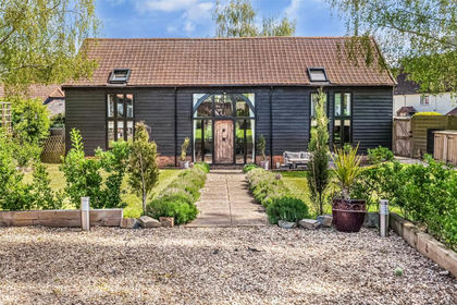
- Price
- Guide Price£865,000
- Size
- 0.27 acres
Baythorne End, Halstead, Essex, CO9, Birdbrook, Essex CO9 England
Added on 12/05/2026Barn Conversion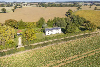
- Price
- Guide Price£750,000
- Size
- 1.09 acres
Boxted, Bury St Edmunds, Suffolk, Boxted, Suffolk IP29 England
Added on 18/04/2026House with Land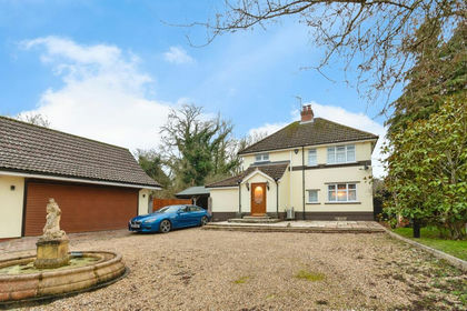
- Price
- £800,000
- Size
- 1 acres
Sturmer Road, New England, Halstead, Birdbrook, Essex CO9 England
Added on 13/02/2026House with Land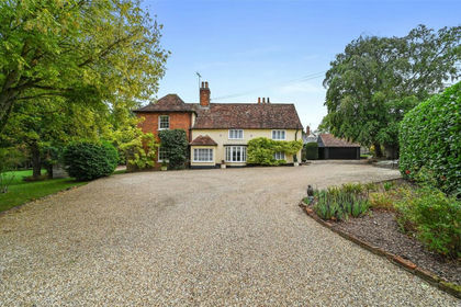
- Price
- Guide Price£900,000
- Size
- 1.1 acres
The Street, Sturmer, Haverhill, Essex, CB9, Sturmer, Essex CB9 England
Added on 29/01/2026Country Home
- Price
- £850,000
- Size
- 1.81 acres
North End Road, Little Yeldham, Halstead, Essex, CO9, Little Yeldham, Essex CO9 England
Added on 27/06/2026House with Land
- Price
- Guide Price£1,150,000
- Size
- 8.3 acres
Added on 18/07/2026House with Land