Main Street, Seaton, LE15
- Land size
- 0.36 acres
- Bedrooms
- 6
- Bathrooms
- 3
Key Features
- Grade II Listed Rutland Farmhouse
- Kitchen and Dining Space at the Heart of the Home
- Sitting Room Centred Around a Feature Fireplace
- Garden Room Opening Directly onto the Terrace
- Three First-Floor Bedrooms Arranged Across the Main Home
- Private Wing Providing Two Additional Bedrooms
- Two Distinctive Gardens - One Lawned, One Terraced
- Black Barn Garaging and Workshop with Additional Ancillary Buildings
- Stone Outbuilding with Approved Planning Permission for Residential Use
- Tranquil Village Setting in Seaton
Description
Positioned within Seaton’s conservation area in the heart of the Welland Valley, West Farm is a beautifully preserved Grade II listed Rutland farmhouse constructed of coursed ironstone beneath steeply pitched slate roofs. Rich in atmosphere and authenticity, the late eighteenth-century home balances heritage, warmth and modern family living with remarkable ease, unfolding through a series of characterful spaces connected to landscaped gardens and far-reaching rural views.
Welcome to West Farm
Original features including exposed stonework, timber beams, shuttered windows, ledged timber doors and broad oak floorboards create a home of immense warmth and permanence. Thick walls, deep-set openings and wood burning stoves reinforce the sense of history throughout, whilst the softened rusticity of the interiors ensures the home feels deeply welcoming rather than formal.
Elevated Living
Arrival at West Farm immediately draws the eye towards the magnificent oak-framed extension of the garden room, where vaulted ceilings, exposed trusses and expansive glazing create a spectacular first impression. Elevated above the terraced gardens beyond, this remarkable room is immersed in natural light, with French doors opening directly onto the stone terrace below. Balancing dramatic volume with an unmistakable sense of comfort, it forms the natural heart of the home. Flowing naturally from here, the handcrafted kitchen combines timeless cabinetry with a warmth and texture befitting the home’s agricultural heritage. Exposed beams, broad oak floorboards and a substantial central island create an inviting space designed equally for everyday family life and entertaining.
Flowing Spaces
Beyond the kitchen, the dining room rises dramatically beneath a vaulted ceiling crossed by exposed timbers, introducing a wonderful sense of scale and occasion. Despite its generous proportions, the room retains an intimate atmosphere, with a door opening directly through to a secret walled garden enclosed by mature planting and traditional stone walls. Retracing steps back through the kitchen, a highly practical utility prep kitchen provides further workspace, complete with built-in sink, integrated dishwashers and dedicated appliance spaces, perfectly suited to busy family life and larger scale entertaining.
Fireside Retreats
Beyond, the family snug offers a calmer retreat centred around a wood-burning stove, whilst original shuttered windows overlook the front approach. Across the principal entrance hallway, where doors connect both front and rear terraces, the dual aspect sitting room unfolds beyond, filled with natural light and centred around a second wood-burning stove and deep window seat overlooking the gardens.
When Slumber Calls
Ascending to the first floor, the first three bedrooms unfold, each enjoying individual character and elevated countryside views, served by a well-appointed shower room. Continuing upwards, the final bedroom at this end of the home occupies the second floor, offering a wonderfully private retreat tucked beneath the eaves. Returning to the ground floor and moving beyond the dining room, the former hayloft has been thoughtfully incorporated to create a private secondary wing preserving the home’s agricultural heritage whilst offering exceptional flexibility for modern living. Here, two further bedrooms are accompanied by an additional ground floor shower room, creating an ideal arrangement for guests, older children or multigenerational living.
Gardens and Grounds
Outside, the gardens unfold through beautifully landscaped terraced levels framed by clipped box hedging, reclaimed brick pathways and mature planting, balancing structure with a softer, organic character entirely in keeping with the age and atmosphere of the home. Stone terraces provide multiple places to sit and entertain throughout the day, whilst the secret walled garden introduces another layer of charm and privacy. Beyond the principal home, the substantial black barn provides excellent garaging and workshop space, whilst further ancillary buildings including former stables and lairage offer exceptional versatility. Yet perhaps the final and most intriguing opportunity lies within the charming stone outbuilding formerly serving as the old village butchery. With approved planning permission already in place for conversion into a one-bedroom cottage, it offers exceptional scope for guest accommodation, multigenerational living or ancillary income.
What We Love
Set within one of Rutland’s most attractive villages and surrounded by rolling countryside, West Farm combines period character, flexible living and remarkable future potential in a setting that feels both deeply rural and exceptionally well connected.
The Finer Details
Freehold / Detached / Constructed 18th century / Grade II listed / Conservation area / Plot approx. 0.36 acre / Gas central heating / Mains electricity, water and sewage / Rutland County Council, tax band G / Planning permission in place for the conversion of an agricultural barn to residential use (Rutland County Council, #2020/0394/FUL)
Dimensions
Cellar: approx. 8 sq. metres (86.5 sq. feet) / Ground Floor: approx. 188.1 sq. metres (2,024.7 sq. feet) / First Floor: approx. 97.6 sq. metres (1,051 sq. feet) / Second Floor: approx. 37 sq. metres (398 sq. feet) / Total Main Home: approx. 330.8 sq. metres (3,560.2 sq. feet) / Outbuildings: approx. 182.2 sq. metres (1,961.4 sq. feet) / Annexe: approx. 69.4 sq. metres (746.8 sq. feet)
Near and Far
Tucked into the rolling Welland Valley, Seaton is one of Rutland’s quieter village settings: a place of stone cottages, wide skies and country lanes, with All Hallows Church and the village hall bringing a gentle rhythm to community life. At its heart, The George & Dragon offers a welcoming spot for Sunday lunches, relaxed suppers and a drink close to home. For walkers, footpaths and lanes lead out into the surrounding countryside, including circular routes from the village, while the striking Welland Viaduct sweeps across the valley nearby. Rutland Water and Eyebrook Reservoir are both within easy reach for walking, cycling, sailing, fishing and birdwatching.
Explore The Locale
Everyday amenities are close by in Uppingham, with its independent shops, cafés, galleries and market-town character, while Oakham and Stamford offer a wider choice of restaurants, boutiques, supermarkets and leisure facilities. Families are well placed for schooling, with primary and secondary options in Uppingham, alongside independent schools including Uppingham, Oakham and Stamford. Despite its peaceful rural feel, Seaton remains well connected. Uppingham is around 10 minutes away, and Corby, Stamford and Peterborough provide further road and rail links, including services towards London from Corby and Peterborough.
Local Distances
Uppingham 2.4 miles (5 minutes) / Corby 7.6 miles (16 minutes) / Oakham 9.4 miles (17 minutes) / Stamford 11 miles (22 minutes) / Peterborough 21 miles (35 minutes) / Leicester 23 miles (45 minutes)
Watch Our Property Tour
Enjoy our walkthrough tour video, where Lottie personally guides you through this distinctive home and its surroundings. After watching the tour, we would be delighted to arrange a viewing to experience the home in person.
Disclaimer
Pelham James use all reasonable endeavours to supply accurate property information in line with the Consumer Protection from Unfair Trading Regulations 2008. These property details do not constitute any part of the offer or contract and all measurements are approximate. The matters in these particulars should be independently verified by prospective buyers. It should not be assumed that this property has all the necessary planning, building regulation or other consents. Any services, appliances and heating system(s) listed have not been checked or tested. Purchasers should make their own enquiries to the relevant authorities regarding the connection of any service. No person in the employment of Pelham James has any authority to make or give any representations or warranty whatever in relation to this property or these particulars or enter into any contract relating to this property on behalf of the vendor.
Map Location
Property details
- Tenure
- Freehold
- Council Tax Band
- G
- Date Posted
- 2026-11-16
Utilities & Restrictions
Utilities
- Electricity
- Mains
- Water
- Mains
- Heating
- Gas Central Heating
- Broadband
- Full Fibre (FTTP)
- Sewerage
- Mains
Rights & Restrictions
- Public Rights of Way
- Ask Agent
- Private Rights of Way
- Ask Agent
- Listed Property
- Yes
- Restrictions
- Ask Agent
Listed status, conservation areas and planning constraints for this location are in the full report.
Property Features
- Accessibility
- Ask Agent
- Parking
- Ask Agent
- Garden
- Garden
Beyond the particulars: planning activity, flood history, heritage and ground risks, checked for this exact spot.
Connectivity
Broadband
Fastest speed available at this postcode
1.8 Gbps
Gigabit full fibre
Suitable for
- 4K streaming on every screen
- Full-time home working
- Online gaming & big downloads
Mobile signal
Predicted 4G and 5G signal; indoor signal depends on building materials.
Ofcom Connected Nations postcode-level predictions. Speeds and signal are modelled, not measured, and vary between addresses and providers.
Signal is the easy part. Planning activity, flood history and protected designations here are in the full report.
Nearest Schools
Primary
- Leighfield Primary School2.5 milesNo Ofsted rating
- Ages
- 3 to 11
- Pupils
- 198
- Type
- Academy converter
- Uppingham Church of England Primary School2.5 milesOfsted: Good
- Ages
- 4 to 11
- Pupils
- 98
- Type
- Academy converter
- Faith
- Church of England
- Gretton Primary Academy2.7 milesNo Ofsted rating
- Ages
- 4 to 11
- Pupils
- 145
- Type
- Academy converter
- St Mary and St John CofE VA Primary School3.8 milesOfsted: Good
- Ages
- 3 to 11
- Pupils
- 167
- Type
- Voluntary aided school
- Faith
- Church of England
- Edith Weston Academy4.5 milesNo Ofsted rating
- Ages
- 2 to 11
- Pupils
- 57
- Type
- Academy converter
Secondary
- Uppingham Community College2.1 milesNo Ofsted rating
- Ages
- 11 to 16
- Pupils
- 919
- Type
- Academy converter
- Corby Business Academy4.8 milesOfsted: Good
- Ages
- 11 to 18
- Pupils
- 1,188
- Type
- Academy sponsor led
- Lodge Park Academy5.5 milesOfsted report card · Apr 2026
- Ages
- 11 to 18
- Pupils
- 703
- Type
- Academy sponsor led
- Corby Technical School6.1 milesOfsted: Good *
- Ages
- 11 to 18
- Pupils
- 952
- Type
- Free schools
- Weldon Village Academy6.2 milesNo Ofsted rating
- Ages
- 11 to 19
- Pupils
- 475
- Type
- Free schools
* Latest graded judgement covers quality of education only; no overall grade was issued under the 2024-25 inspection framework.
Distances are straight-line from the advertised location. Source: the national school registers (DfE, Welsh Government, Scottish Government) and Ofsted.
Schools are just the start: sold prices nearby, planning activity and any flood history are in the full report.
Amenities
Supermarket
GP surgery
Pharmacy
Hospital
Green space
Straight-line distances from the advertised location. Sources: NHS records, Geolytix supermarket locations, OS Open Greenspace and the national trails registers.
The area stacks up? Now check the location itself: planning nearby, protected designations and past flooding.
Getting Around
Nearest station
Nearest bus stop
Typical drive times
Straight-line distances from the advertised location; drive times are typical free-flow times over OpenStreetMap road data, so allow more at peak. Public transport locations from DfT NaPTAN.
Easy to reach matters. So do planning activity, flood history and ground risks: all in the full report.
Flood Risk
Environment Agency open data, checked around the advertised map pin for the listed acreage. Long-term risk counts flood defences; the planning map's flood zones do not. Provided by LandSale, not the listing agent, and not part of the agent's particulars. Risk varies across a holding, so verify before committing.
Rivers and the sea
Planning map: Flood Zone 1.
Surface water
Not at the pin: mapped about 20 metres away.
These bandings are the summary. Where this location sits on the flood maps, plus planning activity, heritage and ground risks, is in the full report.
Important notice: Information, maps and tags on this page are drawn from the advertising agent's marketing materials or generated automatically. LandSale has not verified them. Relying on these details is at your own risk, always carry out independent checks before committing to a purchase.
LandSale full disclaimer
Marketing information only - not formal particulars. The details on this website are provided for general guidance and do not constitute an offer or contract. Neither LandSale nor the advertising estate/land agent accepts responsibility for any inaccuracy.
1. Source of information
- Listing content: Core description, asking price, tenure, measurements, photographs and planning history originate from the marketing materials of the advertising estate or land agent. LandSale does not author this content and cannot guarantee its accuracy.
- Automated tags & categorisation: Property type, land-use class, acreage bands and similar labels may be applied by machine-learning models. They are intended as a helpful guide only and may not reflect the property's legal status or permitted use.
- Third-party & enriched data layers: Maps, boundary outlines, planning designations, soil reports, broadband coverage and other environmental or location-based insights are licensed from external suppliers. Such data are supplied “as is", may be incomplete or out of date and are subject to change without notice.
2. Verification required
Prospective purchasers must verify critical matters, including but not limited to planning permission, title boundaries, public rights of way, environmental constraints, acreage, services, access and VAT status, through their own inspections, specialist surveys, legal advisers and the selling agent before relying on the information or entering into any contract.
3. No warranty or liability
LandSale gives no warranty, express or implied, as to the accuracy, completeness or fitness for any particular purpose of the information displayed. LandSale shall not be liable for any loss, damage, cost or expense arising directly or indirectly from any use of or reliance on such information, save where liability may not be excluded by law.
4. Updates & feedback
If you believe any detail on this listing is inaccurate, please let us know. We will investigate and, where appropriate, update the listing or notify the agent.
© LandSale | Version 1.3 - August 2026
Contact Pelham James, Stamford & Rutland
3 Saddlers Court Barleythorpe Oakham LE15 7GH
View agent profileSimilar properties for sale
- Price
- Guide Price£1,175,000
- Size
- 6.5 acres
Added on 17/06/2026House with Land
- Price
- Offers in Excess of£1,750,000
- Size
- 0.75 acres
High Street, Great Easton, Market Harborough, LE16, Great Easton, Leicestershire LE16 England
Added on 16/11/2026Multiple Dwelling Property
- Price
- Guide Price£1,250,000
Added on 30/09/2026Barn Conversion
- Price
- Offers Over£1,500,000
- Size
- 1.9 acres
East Norton, Leicestershire, LE7, Leicester, Leicestershire LE7 England
Added on 05/10/2026Country Home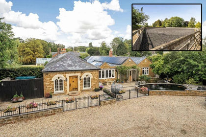
- Price
- Offers Over£1,300,000
- Size
- 4.3 acres
Dairy Farm Stables, Barleythorpe, Barleythorpe, Rutland LE15 England
Added on 24/09/2026House with Land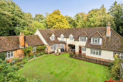
- Price
- Offers Over£1,200,000
- Size
- 12 acres
Spinney Cottage and Ludgates, Cottesmore, Cottesmore, Rutland LE15 England
Added on 09/11/2026House with Land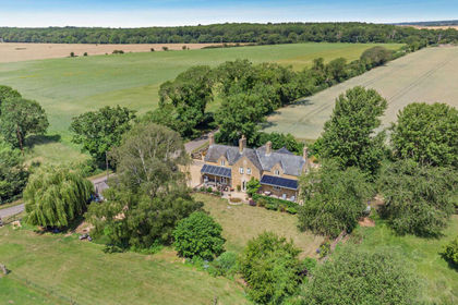
- Price
- Guide Price£1,650,000
- Size
- 3 acres
Sulehay Road, Wansford, Northamptonshire, PE8, Yarwell, North Northamptonshire PE8 England
Added on 29/06/2026House with Land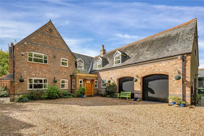
- Price
- Guide Price£1,250,000
- Size
- 1.6 acres
Meadowside, Skeffington, Skeffington, Leicestershire LE7 England
Added on 31/03/2026House with Land
- Price
- Offers Over£1,200,000
- Size
- 0.83 acres
The Hedgerows, Stonton Wyville, Market Harborough, Stonton Wyville, Leicestershire LE16 England
Added on 30/05/2026Barn Conversion
- Price
- £1,550,000
Castle Mound, Fotheringhay, Northamptonshire, PE8, Fotheringhay, North Northamptonshire PE8 England
Added on 13/10/2026Barn Conversion