The Old House, Caldecott
- Land size
- 6.5 acres
Key Features
- Entrance Hall
- Sitting Room
- Dining Room
- Snug & Family Room
- Country Kitchen
- Boot Room/Utility
- Orangery
- Seven Bedrooms
- Two Ensuite, Shower Room and Family Bathroom
- Landscaped Garden
Description
Market Harborough 13 miles (HST to St Pancras International)
Corby (to St Pancras International) 5 miles, Stamford 16 miles
Uppingham 5 miles
Oakham 11 miles
Oundle 15 miles
(All distances approximate)
The Situation
This attractive village is situated on Rutland’s most southerly border, in the picturesque Welland Valley just south of Uppingham. Caldecott is an archetypal rural village containing a church, village hall and public house.
Communications in the area is excellent with the market town of Uppingham providing comprehensive local amenities and a weekly market.
There is easy access to the A47 which connects to the cities of Leicester and Peterborough. To the west the A5003 provides good road access to the town of Kettering where a mainline rail service connects to London St Pancras in under the hour, in addition Corby benefits from mainline rail services to London St Pancras.
The Property
The house dates from 1789 and is Grade II listed. It is constructed of mellow stone elevations under a thatch and slate roof, is arranged over two storeys and offers extensive well-proportioned accommodation, displaying period features throughout. During the current owners’ tenure, the property has been well maintained and updated with additions, including an extensive light filled orangery. The ground floor accommodation benefits from underfloor heating. Entered via a timber door to the entrance hall with steps down to the spacious sitting room with feature stone fireplace, engineered oak floor and door to the garden patio. The entrance hall opens to the dining room having feature fireplace, stone floor with stairs rising to the first-floor accommodation with door to cozy snug with wood burner.
The inner hall with second staircase rising to the first-floor accommodation, cloakroom with separate shower and doors to the country kitchen and orangery. The welcoming and spacious country kitchen is the perfect area for the family, having a walk-in pantry, range of floor and wall mounted units, with Aga, separate oven and hob and a range of built in appliances with double opening doors to the orangery and door to rear hall. The rear hall gives access to the utility/boot room and spacious family room which overlooks the garden. The orangery is a real feature of the property offering a multitude of uses throughout the year and overlooking a walled patio.
The bedrooms are set over two floors, with the well-proportioned principal bedroom arranged to the first floor. The spacious principal bedroom benefits from a dressing room and ensuite bathroom. There are three further double bedrooms, two having en-suite, a single bedroom and family bathroom. On the second floor there are two double bedrooms, which are served by a shower room.
Outside
To the rear of the property is a raised patio area ideal for entertaining in the summer months, this leads to an extensive gravelled parking and an enclosed private lawned garden. There is a separate stone barn, having electric car charging point, stairs rising to useful mezzanine and having separate store and garage. Stable, one double, three standard, tack room and hay store with yard. The property has in all around 6.5acres.
Services
No services have been tested by the agents.
Statutory Authority
Rutland County Council
Council Tax Band
Council Tax Band G
Energy Performance
Energy Performance
Energy Performance Rating E
Viewing
The property may only be inspected by prior arrangement through King West. .
Important Notice
King West, their joint Agents (if any) and clients give notice that:
1. These property particulars should not be regarded as an offer, or contract or part of one. You should not rely on any statements by King West in the particulars, or by word of mouth or in writing as being factually accurate about the property, nor its condition or its value. We have no authority to make any representations or warranties in relation to the property either here or elsewhere and accordingly any information given is entirely without responsibility.
2. The photographs, videos and/or virtual tours illustrate parts of the property as were apparent at the time they were taken. Any areas, measurements or distances are approximate only.
3. Any reference to the use or alterations of any part of the property does not imply that the necessary planning, building regulations or other consents have been obtained. It is the responsibility of a purchaser or lessee to confirm that these have been dealt with properly and that all information is correct.
4. All dimensions, descriptions, areas, reference to condition and permission for use and occupation and their details are given in good faith and are believed to be correct, but intending purchasers should not rely upon them as statements of fact but must satisfy themselves by inspection or otherwise as to the accuracy of each item.
5. King West have not tested any services, equipment or facilities, the buyer or lessee must satisfy themselves by inspection or otherwise.
6. MONEY LAUNDERING REGULATIONS: Intending purchasers will be asked to produce satisfactory proof of their identification, address and source of funds at the point any sale is agreed in order to comply with The Money Laundering, Terrorist Financing and Transfer of Funds (Information on the Payer) Regulations 2017. King West asks for your co-operation in this regard.
7. These particulars should not be reproduced without prior consent of King West. January 2026.
Map Location
Property details
- Tenure
- Ask Agent
- Council Tax Band
- G
- Date Posted
- 2026-06-17
Price history
| Date | Change | Price |
|---|---|---|
| 2 Sep 2026 | Reduced 7.8% (−£100,000) | £1,175,000 |
| Until 2 Sep 2026 | Asking price | £1,275,000 |
Market Value Analysis
Compared with 183 Homes with Land listings in East Midlands (5+ acres).
Energy Performance Certificate
Energy Efficiency Rating
Based on UK Energy Performance Certificate standards (EU Directive 2002/91/EC)
Running costs are one side. Planning activity, flood history and ground risks for this location are in the full report.
Utilities & Restrictions
Utilities
- Electricity
- Mains
- Water
- Mains
- Heating
- Gas Heating
- Broadband
- Ask Agent
- Sewerage
- Ask Agent
Rights & Restrictions
- Public Rights of Way
- Ask Agent
- Private Rights of Way
- Ask Agent
- Listed Property
- Yes
- Restrictions
- Ask Agent
Listed status, conservation areas and planning constraints for this location are in the full report.
Property Features
- Accessibility
- Ask Agent
- Parking
- Parking Available
- Garden
- Garden
Beyond the particulars: planning activity, flood history, heritage and ground risks, checked for this exact spot.
Connectivity
Broadband
Fastest speed available at this postcode
1.8 Gbps
Gigabit full fibre · available to 34% of premises
Suitable for
- 4K streaming on every screen
- Full-time home working
- Online gaming & big downloads
Mobile signal
Outdoor predictions; indoor signal depends on building materials.
Ofcom Connected Nations postcode-level predictions. Speeds and signal are modelled, not measured, and vary between addresses and providers.
Signal is the easy part. Planning activity, flood history and protected designations here are in the full report.
Nearest Schools
Primary
- Bringhurst Primary School1.6 milesNo Ofsted rating
- Ages
- 4 to 11
- Pupils
- 157
- Type
- Academy converter
- Gretton Primary Academy2 milesNo Ofsted rating
- Ages
- 4 to 11
- Pupils
- 145
- Type
- Academy converter
- Studfall Infant Academy2.4 milesNo Ofsted rating
- Ages
- 3 to 7
- Pupils
- 363
- Type
- Academy converter
- Studfall Junior Academy2.4 milesNo Ofsted rating
- Ages
- 7 to 11
- Pupils
- 467
- Type
- Academy converter
- Woodnewton- A Learning Community2.5 milesOfsted: Good
- Ages
- 2 to 11
- Pupils
- 771
- Type
- Academy converter
Secondary
- Lodge Park Academy2.2 milesOfsted report card · Apr 2026
- Ages
- 11 to 18
- Pupils
- 703
- Type
- Academy sponsor led
- Uppingham Community College3.2 milesNo Ofsted rating
- Ages
- 11 to 16
- Pupils
- 919
- Type
- Academy converter
- Corby Technical School3.4 milesOfsted: Good *
- Ages
- 11 to 18
- Pupils
- 952
- Type
- Free schools
- Corby Business Academy3.7 milesOfsted: Good
- Ages
- 11 to 18
- Pupils
- 1,188
- Type
- Academy sponsor led
- Kingswood Secondary Academy3.8 milesNo Ofsted rating
- Ages
- 11 to 18
- Pupils
- 1,208
- Type
- Academy sponsor led
* Latest graded judgement covers quality of education only; no overall grade was issued under the 2024-25 inspection framework.
Distances are straight-line from the advertised location. Source: the national school registers (DfE, Welsh Government, Scottish Government) and Ofsted.
Schools are just the start: sold prices nearby, planning activity and any flood history are in the full report.
Amenities
Supermarket
GP surgery
Pharmacy
Hospital
Green space
Straight-line distances from the advertised location. Sources: NHS records, Geolytix supermarket locations, OS Open Greenspace and the national trails registers.
The area stacks up? Now check the location itself: planning nearby, protected designations and past flooding.
Getting Around
Nearest station
Nearest bus stop
Typical drive times
Straight-line distances from the advertised location; drive times are typical free-flow times over OpenStreetMap road data, so allow more at peak. Public transport locations from DfT NaPTAN.
Easy to reach matters. So do planning activity, flood history and ground risks: all in the full report.
Flood Risk
From Environment Agency flood map open data, checked around the advertised map pin and allowing for the listed acreage where known. This summary comes from LandSale, the advertising platform, not from the listing agent, and is not part of the agent's particulars. Risk can vary across a single holding, so verify anything critical through your own searches before committing.
Rivers and the sea
Surface water
Mapped within the area searched, not at the advertised map pin itself.
These bandings are the summary. Where this location sits on the flood maps, plus planning activity, heritage and ground risks, is in the full report.
Important notice: Information, maps and tags on this page are drawn from the advertising agent's marketing materials or generated automatically. LandSale has not verified them. Relying on these details is at your own risk, always carry out independent checks before committing to a purchase.
LandSale full disclaimer
Marketing information only - not formal particulars. The details on this website are provided for general guidance and do not constitute an offer or contract. Neither LandSale nor the advertising estate/land agent accepts responsibility for any inaccuracy.
1. Source of information
- Listing content: Core description, asking price, tenure, measurements, photographs and planning history originate from the marketing materials of the advertising estate or land agent. LandSale does not author this content and cannot guarantee its accuracy.
- Automated tags & categorisation: Property type, land-use class, acreage bands and similar labels may be applied by machine-learning models. They are intended as a helpful guide only and may not reflect the property's legal status or permitted use.
- Third-party & enriched data layers: Maps, boundary outlines, planning designations, soil reports, broadband coverage and other environmental or location-based insights are licensed from external suppliers. Such data are supplied “as is", may be incomplete or out of date and are subject to change without notice.
2. Verification required
Prospective purchasers must verify critical matters, including but not limited to planning permission, title boundaries, public rights of way, environmental constraints, acreage, services, access and VAT status, through their own inspections, specialist surveys, legal advisers and the selling agent before relying on the information or entering into any contract.
3. No warranty or liability
LandSale gives no warranty, express or implied, as to the accuracy, completeness or fitness for any particular purpose of the information displayed. LandSale shall not be liable for any loss, damage, cost or expense arising directly or indirectly from any use of or reliance on such information, save where liability may not be excluded by law.
4. Updates & feedback
If you believe any detail on this listing is inaccurate, please let us know. We will investigate and, where appropriate, update the listing or notify the agent.
© LandSale | Version 1.3 - August 2026
Listing agent
King West, Market Harborough
10 Church Square, Market Harborough, LE16 7NB
Similar properties for sale
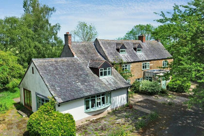
- Price
- Guide Price£1,100,000
- Size
- 5.5 acres
Lambley Lodge Road, Belton In Rutland LE15, Leighfield, Rutland LE15 England
Added on 22/06/2026House with Land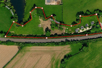
- Price
- £1,100,000
- Size
- 4 acres
Added on 29/07/2026Holiday Let Property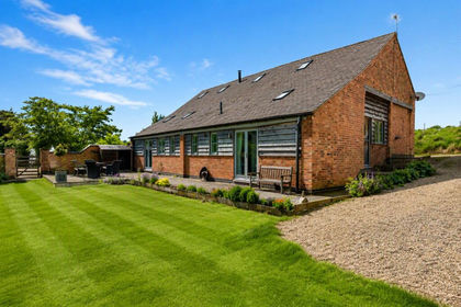
- Price
- £915,000
- Size
- 3.95 acres
Launde, Leicester, Leicestershire, Launde, Leicestershire LE7 England
Added on 26/06/2026Barn Conversion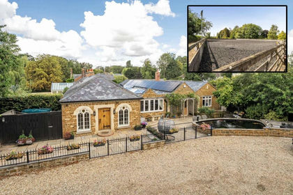
- Price
- Offers Over£1,300,000
- Size
- 4.3 acres
Dairy Farm Stables, Barleythorpe, Barleythorpe, Rutland LE15 England
Added on 11/09/2026House with Land
- Price
- £985,000
- Size
- 9 acres
Kettering Road, Broughton NN14, Broughton, North Northamptonshire NN14 England
Added on 28/04/2026House with Land
- Price
- Guide Price£1,000,000
- Size
- 3.25 acres
Chestnut Grove, Clipston, Clipston, West Northamptonshire LE16 England
Added on 19/03/2026Equestrian property
- Price
- £1,250,000
- Size
- 5 acres
Norlinton Close, Orlingbury, Northamptonshire, NN14, Orlingbury, North Northamptonshire NN14 England
Added on 07/09/2026Equestrian property
- Price
- Guide Price£1,400,000
- Size
- 7.4 acres
Westhorpe, Sibbertoft, Market Harborough, LE16, Sibbertoft, West Northamptonshire LE16 England
Added on 11/07/2026House with Land
- Price
- £1,200,000
- Size
- 5 acres
Stapleford Road, Leesthorpe, Melton Mowbray, Somerby, Leicestershire LE14 England
Added on 05/08/2026Barn Conversion
- Price
- Guide Price£1,169,500
- Size
- 7 acres
Added on 20/05/2026House with Land