Church Street, Stradbroke, Eye, Suffolk, UK, IP21
- Land size
- 1 acres
- Bedrooms
- 7
- Bathrooms
- 3
Description
A substantial Grade II Listed village residence of considerable historical significance, offering beautifully proportioned seven bedroom accommodation together with an exceptional range of outbuildings and grounds extending to approximately one acre (STS).
Believed to date principally from the fifteenth century, with significant additions during the sixteenth and eighteenth centuries, Hartfield House is an impressive period home occupying a prominent position within the heart of Stradbroke, directly opposite the magnificent All Saints Church. The property displays a wealth of original architectural features, including exposed timber framing, inglenook fireplaces, pamment and brick flooring, traditional joinery and numerous features reflecting its long and varied history.
Historically, the property has served a number of uses including a butcher's premises and subsequently an antiques business before becoming the exceptional family home seen today.
The accommodation extends to three floors and provides highly versatile living space, ideally suited to modern family occupation whilst retaining immense period character throughout. EPC E, Council tax band G
Reception Hall / Family Room
21'10" reducing to 14'8" x 18'3"
(6.65m reducing to 4.47m x 5.56m)
A magnificent principal reception area featuring exposed wall and ceiling timbers, traditional brick flooring and an impressive red brick fireplace incorporating a multi-fuel stove beneath an oak bressummer beam. The room provides an excellent central entertaining space with staircase rising to the first floor and access to the principal reception rooms.
Dining Room
14'0" x 11'0"
(4.27m x 3.35m)
Positioned to enjoy views across the rear gardens, this delightful room enjoys glazed doors opening directly onto the terrace together with exposed brickwork and ample space for formal entertaining.
Drawing Room
23'3" reducing to 16'7" x 16'8"
(7.09m reducing to 5.05m x 5.08m)
A particularly atmospheric reception room with windows to both front and rear elevations and centred around a superb inglenook fireplace incorporating a wood-burning stove. Exposed timbers and period detailing combine to create an exceptional formal sitting room.
Study
13'8" x 12'9"
(4.17m x 3.89m)
Formerly part of the property's commercial history, the room retains an attractive former shop frontage and provides an ideal home office or snug.
Library / Games Room
19'1" x 15'10"
(5.82m x 4.83m)
A highly versatile room enjoying a pair of former display windows and providing excellent ancillary reception accommodation suitable for a playroom, library, studio or further office space.
Kitchen / Breakfast Room
15'8" x 10'1"
(4.78m x 3.07m)
Fitted with a range of traditional units beneath work surfaces incorporating twin sinks and centred around an oil-fired Aga. The room enjoys a dual aspect and provides ample space for informal dining.
Utility Room
11'8" x 7'11"
(3.56m x 2.41m)
Fitted with additional storage units and providing plumbing for domestic appliances together with access to the outbuildings and rear gardens.
Cloakrooms
Two ground floor cloakrooms serve the reception accommodation.
First Floor Landing / Music Room
17'7" x 11'1"
(5.36m x 3.38m)
A particularly attractive and spacious landing area, currently utilised as a music room and informal sitting area, with exposed timbers and staircase rising to the second floor.
Principal Bedroom Suite
15'11" x 15'8"
(4.85m x 4.78m)
A beautifully proportioned double bedroom enjoying windows to two elevations and benefitting from a substantial en-suite bathroom.
En-Suite Bathroom
10'2" x 9'4"
(3.10m x 2.84m)
Comprising bath, wash basin, WC, airing cupboard and walk-in wardrobe.
Bedroom Two
18'4" x 14'6"
(5.59m x 4.42m)
A superb double bedroom with views towards the parish church and retaining a number of interesting historic features believed to represent elements of earlier external walls.
Bedroom Three
17'0" x 10'6"
(5.18m x 3.20m)
An exceptionally characterful room with exposed timbers, cast iron fireplace and walk-in wardrobe.
En-Suite Shower Room
6'8" x 5'7"
(2.03m x 1.70m)
Comprising shower cubicle, WC and wash basin.
Bedroom Four
15'11" x 8'7"
(4.85m x 2.62m)
A good double bedroom overlooking the church.
Bedroom Five
12'2" x 8'3"
(3.71m x 2.51m)
A further bedroom ideal as guest accommodation or nursery.
Family Bathroom
10'6" x 10'1"
(3.20m x 3.07m)
Comprehensively fitted with bath, separate shower enclosure, vanity unit and WC.
Second Floor
Bedroom Six
16'1" x 11'11"
(4.90m x 3.63m)
A charming attic bedroom with exposed timbers and views towards the church.
Bedroom Seven
15'6" x 12'7"
(4.72m x 3.84m)
A further atmospheric attic bedroom with dormer windows and useful storage.
OUTBUILDINGS
One of the property's most attractive features is its extensive range of ancillary buildings, offering enormous flexibility for a variety of uses subject to the necessary consents.
Former Butcher's Hanging Store / Boiler Room
20'11" x 16'1" (6.38m x 4.90m)
Workshop
16'6" x 8'7" (5.03m x 2.62m)
Former Garage / Hot Tub Room
16'8" x 13'8" (5.08m x 4.17m)
Garden Room / Bike Store
15'6" x 10'8" (4.72m x 3.25m)
Garden Store
10'2" x 6'1" (3.10m x 1.85m)
First Floor Studio / Workshop
22'6" x 11'2" (6.86m x 3.40m)
Double Garage
21'0" x 14'10" (6.40m x 4.52m)
Barn / Cart Lodge with Hay Loft
24'5" x 15'8" (7.44m x 4.78m)
Stable Building
14'6" x 9'2" (4.42m x 2.79m)
Greenhouse
7'4" x 6'11" (2.24m x 2.11m)
OUTSIDE
Hartfield House stands within mature grounds extending to approximately 1 acre (subject to survey) and includes formal gardens, extensive lawns, productive areas, orchard, pond and numerous seating areas.
To the rear is a substantial lawned area with mature boundaries and feature pond, whilst immediately adjoining the house are attractive courtyard gardens enclosed by brick walls and the surrounding outbuildings, creating a sheltered and private setting ideal for entertaining.
The property benefits from secure gated access leading to extensive parking areas and garaging.
LOCATION
Stradbroke is one of North Suffolk's most desirable villages and provides an excellent range of everyday amenities including village shops, public houses, doctors surgery, schools, library and leisure facilities. Diss lies approximately nine miles distant and provides mainline rail services to London Liverpool Street with journey times of approximately ninety minutes
Listed Building Status & Heritage Restrictions
Hartfield House is understood to be a Grade II Listed building, believed to date principally from the 15th century, with subsequent additions during the 16th and 18th centuries.
As a listed property, the building benefits from statutory heritage protection. Listed Building Consent may be required for alterations, extensions, demolition or other works that affect its special architectural or historic character, including certain internal works.
Buyers should also be aware that some ancillary buildings and structures within the property's curtilage may be protected by the listing.
Prospective purchasers are advised to consult the relevant local planning authority and conservation officer before undertaking alterations or changing the use of any buildings.
The precise extent of the listing, any associated restrictions and the history of previous consents should be verified through the relevant records and legal enquiries.
Construction & Building Characteristics
The property is of historic construction, incorporating traditional timber framing, exposed structural timbers, brickwork and period flooring.
Given the property's age and listed status, purchasers should be aware that maintenance, repairs and alterations may require specialist materials, techniques and professional advice.
The construction and condition of the roof, structural timbers, foundations and other significant elements should be assessed by a suitably qualified surveyor experienced in historic and listed buildings.
Heating & Energy
Heating: Oil-fired Aga within the kitchen. The main central heating system, heating fuel and hot water arrangements are to be confirmed.
Fireplaces: Multi-fuel and wood-burning stoves are present within the principal reception rooms.
EPC Rating: E
Purchasers should establish the age, condition, servicing requirements and compliance of all heating appliances, chimneys and associated installations.
Utilities & Services
Electricity Supply: To Be Confirmed
Water Supply: To Be Confirmed
Drainage: Mains or Private Drainage – To Be Confirmed
Central Heating: System and Fuel Type to Be Confirmed
Hot Water: To Be Confirmed
Where private drainage or other non-standard services are present, purchasers should establish the ownership, maintenance responsibilities, condition and applicable regulatory requirements.
Broadband & Mobile Connectivity
Broadband and mobile phone services may be available at the property, subject to local infrastructure and network coverage.
Prospective purchasers are advised to check available broadband connection types, estimated download and upload speeds, and indoor and outdoor mobile reception using the Ofcom broadband and mobile coverage checker.
Availability and performance may vary between providers and individual areas of the property.
Ofcom Broadband & Mobile Checker:
Land, Boundaries & Outbuildings
The property occupies mature grounds extending to approximately one acre, subject to survey.
The grounds include formal gardens, lawns, an orchard, pond, courtyard areas, parking facilities and numerous outbuildings.
Purchasers should verify the precise boundaries and extent of the land against the registered title and any associated plans.
The outbuildings offer potential for a variety of ancillary uses, subject to their condition, any applicable planning restrictions and the necessary consents.
No representation is made that the outbuildings have existing permission for residential accommodation, commercial use or conversion.
The ownership, permitted use and listed status of each outbuilding should be confirmed through legal and planning enquiries.
Access, Parking & Rights of Way
The property benefits from gated access leading to substantial parking areas and garaging.
Purchasers should confirm the legal access arrangements, any rights of way, easements, covenants or third-party rights affecting the property, its driveway and surrounding land.
Flood Risk & Environmental Information
The property includes a pond and extensive grounds.
Flood risk from rivers, surface water, groundwater and other relevant sources has not yet been confirmed.
Prospective purchasers are advised to consult the Environment Agency's flood risk information and obtain relevant property-specific searches.
Any known historic flooding, drainage issues, environmental hazards or land contamination should be disclosed following appropriate enquiries.
Planning, Conservation & Restrictions
Due to the property's Grade II Listed status and historic importance, purchasers should satisfy themselves regarding:
Listed Building Consent requirements and previous approvals.
Any conservation area designation.
Restrictions affecting alterations and extensions.
Planning permissions and lawful uses of the outbuildings.
Any relevant Tree Preservation Orders.
Covenants, easements and other restrictions affecting the property.
Any previous unauthorised alterations or outstanding enforcement matters.
The property's former commercial uses should not be taken as confirmation that commercial use is currently authorised.
Accessibility
The accommodation is arranged over three floors, with stairs providing access between the levels.
Due to the property's historic layout and period construction, accessibility may be more limited than in a modern property.
Specific accessibility adaptations have not been confirmed.
Additional Information
All measurements, land areas and descriptions are provided for general guidance and should be verified independently.
Prospective purchasers are encouraged to arrange an appropriate building survey and undertake legal, planning and environmental enquiries, particularly in relation to the property's listed status, historic construction, outbuildings and land.
Map Location
Property details
- Tenure
- Ask Agent
- Council Tax Band
- G
- Date Posted
- 2026-11-11
Market Value Analysis
Compared with 1,068 Homes with Land listings in East Anglia (1+ acres).
Energy Performance Certificate
Energy Efficiency Rating
Based on UK Energy Performance Certificate standards (EU Directive 2002/91/EC)
Running costs are one side. Planning activity, flood history and ground risks for this location are in the full report.
Utilities & Restrictions
Utilities
- Electricity
- Ask Agent
- Water
- Ask Agent
- Heating
- Ask Agent
- Broadband
- Ask Agent
- Sewerage
- Ask Agent
Rights & Restrictions
- Public Rights of Way
- Ask Agent
- Private Rights of Way
- Ask Agent
- Listed Property
- Ask Agent
- Restrictions
- Ask Agent
Listed status, conservation areas and planning constraints for this location are in the full report.
Property Features
- Accessibility
- Ask Agent
- Parking
- Garage
- Garden
- Garden
Beyond the particulars: planning activity, flood history, heritage and ground risks, checked for this exact spot.
Connectivity
Broadband
Fastest speed available at this postcode
56 Mbps
Superfast
Suitable for
- HD streaming
- Video calls
- Web & social
Mobile signal
Predicted 4G and 5G signal; indoor signal depends on building materials.
Ofcom Connected Nations postcode-level predictions. Speeds and signal are modelled, not measured, and vary between addresses and providers.
Signal is the easy part. Planning activity, flood history and protected designations here are in the full report.
Nearest Schools
Primary
- Stradbroke Church of England Primary School415 metresOfsted: Good
- Ages
- 4 to 11
- Pupils
- 112
- Type
- Academy converter
- Faith
- Church of England
- Wilby Church of England Primary School1.3 milesOfsted: Good
- Ages
- 3 to 11
- Pupils
- 99
- Type
- Academy converter
- Faith
- Church of England
- Fressingfield Church of England Primary School2.6 milesNo Ofsted rating
- Ages
- 4 to 11
- Pupils
- 91
- Type
- Academy converter
- Faith
- Church of England
- St Edmund's Primary School3.1 milesNo Ofsted rating
- Ages
- 2 to 11
- Pupils
- 57
- Type
- Academy converter
- Worlingworth Church of England primary school3.5 milesNo Ofsted rating
- Ages
- 3 to 11
- Pupils
- 58
- Type
- Academy converter
- Faith
- Church of England
Secondary
- Stradbroke High School309 metresNo Ofsted rating
- Ages
- 11 to 16
- Pupils
- 353
- Type
- Academy converter
- The Harleston Sancroft Academy (a 3-16 Church of England School)5.7 milesOfsted: Good *
- Ages
- 3 to 16
- Pupils
- 824
- Type
- Academy converter
- Faith
- Church of England
- Hartismere School5.9 milesOfsted: Good *
- Ages
- 11 to 18
- Pupils
- 1,062
- Type
- Academy converter
- Thomas Mills High School & Sixth Form6.6 milesOfsted: Good
- Ages
- 11 to 18
- Pupils
- 1,056
- Type
- Academy converter
- Debenham High School7.9 milesOfsted: Good
- Ages
- 11 to 16
- Pupils
- 714
- Type
- Academy converter
- Faith
- Church of England
* Latest graded judgement covers quality of education only; no overall grade was issued under the 2024-25 inspection framework.
Distances are straight-line from the advertised location. Source: the national school registers (DfE, Welsh Government, Scottish Government) and Ofsted.
Schools are just the start: sold prices nearby, planning activity and any flood history are in the full report.
Amenities
Supermarket
GP surgery
Pharmacy
Hospital
Green space
Straight-line distances from the advertised location. Sources: NHS records, Geolytix supermarket locations, OS Open Greenspace and the national trails registers.
The area stacks up? Now check the location itself: planning nearby, protected designations and past flooding.
Getting Around
Nearest station
Nearest bus stop
Typical drive times
Straight-line distances from the advertised location; drive times are typical free-flow times over OpenStreetMap road data, so allow more at peak. Public transport locations from DfT NaPTAN.
Easy to reach matters. So do planning activity, flood history and ground risks: all in the full report.
Flood Risk
Environment Agency open data, checked around the advertised map pin for the listed acreage. Long-term risk counts flood defences; the planning map's flood zones do not. Provided by LandSale, not the listing agent, and not part of the agent's particulars. Risk varies across a holding, so verify before committing.
Rivers and the sea
Planning map: Flood Zone 1.
Surface water
These bandings are the summary. Where this location sits on the flood maps, plus planning activity, heritage and ground risks, is in the full report.
Important notice: Information, maps and tags on this page are drawn from the advertising agent's marketing materials or generated automatically. LandSale has not verified them. Relying on these details is at your own risk, always carry out independent checks before committing to a purchase.
LandSale full disclaimer
Marketing information only - not formal particulars. The details on this website are provided for general guidance and do not constitute an offer or contract. Neither LandSale nor the advertising estate/land agent accepts responsibility for any inaccuracy.
1. Source of information
- Listing content: Core description, asking price, tenure, measurements, photographs and planning history originate from the marketing materials of the advertising estate or land agent. LandSale does not author this content and cannot guarantee its accuracy.
- Automated tags & categorisation: Property type, land-use class, acreage bands and similar labels may be applied by machine-learning models. They are intended as a helpful guide only and may not reflect the property's legal status or permitted use.
- Third-party & enriched data layers: Maps, boundary outlines, planning designations, soil reports, broadband coverage and other environmental or location-based insights are licensed from external suppliers. Such data are supplied “as is", may be incomplete or out of date and are subject to change without notice.
2. Verification required
Prospective purchasers must verify critical matters, including but not limited to planning permission, title boundaries, public rights of way, environmental constraints, acreage, services, access and VAT status, through their own inspections, specialist surveys, legal advisers and the selling agent before relying on the information or entering into any contract.
3. No warranty or liability
LandSale gives no warranty, express or implied, as to the accuracy, completeness or fitness for any particular purpose of the information displayed. LandSale shall not be liable for any loss, damage, cost or expense arising directly or indirectly from any use of or reliance on such information, save where liability may not be excluded by law.
4. Updates & feedback
If you believe any detail on this listing is inaccurate, please let us know. We will investigate and, where appropriate, update the listing or notify the agent.
© LandSale | Version 1.3 - August 2026
Contact Pennington Surveyors Limited, Ipswich
45 Woodbridge Road East, Ipswich. IP4 5QN
View agent profileSimilar properties for sale
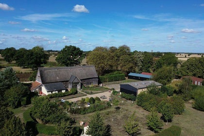
- Price
- £1,100,000
- Size
- 11 acres
Added on 08/09/2026Barn Conversion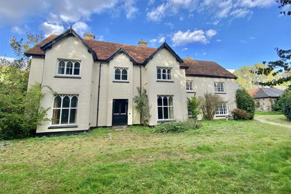
- Price
- Guide Price£750,000
- Size
- 2.83 acres
Added on 10/10/2026House with Land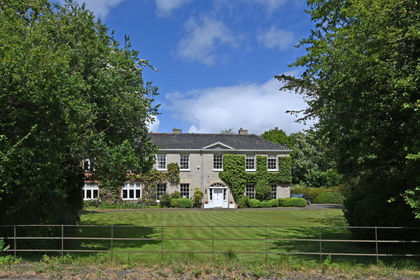
- Price
- Guide Price£1,150,000
- Size
- 12 acres
Elm House, Green Street, Hoxne, Nr Diss, Hoxne, Suffolk IP21 England
Added on 29/05/2026Country Home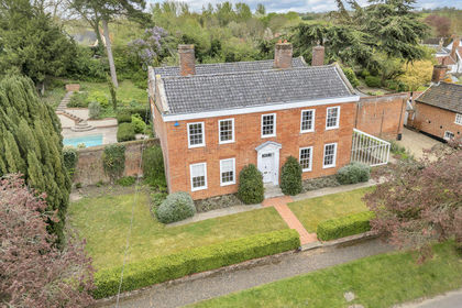
- Price
- Guide Price£1,000,000
- Size
- 1.2 acres
Added on 26/04/2026House with Land
- Price
- Guide Price£950,000
- Size
- 1.5 acres
Added on 29/01/2026Farmhouse
- Price
- Guide Price£750,000
Added on 29/01/2026Residential
- Price
- Guide Price£895,000
- Size
- 1.24 acres
Hall Lane, Rushall, Diss, Norfolk, IP21, Dickleburgh and Rushall, Norfolk IP21 England
Added on 29/01/2026Country Home
- Price
- £1,250,000
- Size
- 8.7 acres
Added on 23/05/2026Farmhouse
- Price
- Guide Price£1,100,000
- Size
- 6.3 acres
Added on 11/06/2026Farmhouse
- Price
- Guide Price£750,000
- Size
- 2.8 acres
Added on 31/07/2026House with Land