Redehall Road, Smallfield, RH6
- Land size
- 7 acres
- Bedrooms
- 4
- Bathrooms
- 3
Key Features
- NO CHAIN
- 4 double bedrooms
- Includes Annexe area
- Circa 7 acres of total land (TBV)
- Double garage
- Large frontage with ample parking available
- Private and secluded plot with gated access and telecom entry system
- Modern and stylish interior décor
- Popular semi-rural location
- Council Tax Band 'F' and EPC 'C'
Description
OFFERED WITH NO CHAIN
A beautifully presented 4 bedroom detached bungalow, the likes rarely seen on the open market. Undergone a full internal renovation, and recently acquiring an addition 6.5 acres (TBV) whilst being offered to the market with NO CHAIN. The home also benefits from a wonderfully private surrounding, gated entrance and double garage. The property is located in the popular and semi-rural Redehall Road, Smallfield and is conveniently located close to local villages, transport links, schools and amenities.
On approach to the home, a gated entrance enters the plot, with a large pathed driveway with ample parking available. This leads to the double garage, which benefits from power and lighting, and the main property itself. Entering the home, a spacious hallway gives access to the open plan living accommodation, and hall leading to all 3 internal bedrooms. The open plan living space is a superb space with the kitchen, dining room and living room all set to an open plan layout. Here, there is a host of stylish kitchen units, fitted appliances and wood work surfaces. There is also a breakfast bar and access to utility, with further units and appliances and a patio door to the front of the property. The living/dining space is bright and airy with ample space for multiple large family sofas, 8 person dining table and any freestanding furniture you may wish. The room is flooded with light from the dual aspect windows and doors, an benefits from newly installed flooring throughout. A homely touch of a log burner is also here.
All 3 internal bedrooms are comfortable double rooms, accommodating at least a double bed and furniture. Bedroom 1 also benefits from a modern en-suite shower room. The family bathroom is fully tiled, with a full length panelled bath with shower unit over, w/c, wash hand basin and opaque window. Bedroom 4, is a separate studio/annexe area. It boasts its own separate entrance, with a large double bedroom, fitted storage and en-suite shower room.
Outside to rear, is a real highlight to the home. Encompassing a large manicured area laid to lawn, and decking abutting the property. A gravel path leads to the 6.5 acres of woodland busting with trees, flowers and wildlife. We recommend visiting the home to fully appreciate this area.
Internal viewings welcomed and recommended.
EPC Rating: C
Anti Money Laundering
In accordance with the requirements of the Anti Money Laundering Act 2022, Mansell McTaggart Horley LTD mandates that prospective purchaser(s) who have an offer accepted on one of our properties undergo identification verification. To facilitate this, we utilise MoveButler, an online platform for identity verification. The cost for each identification check is £30, including VAT charged by MoveButler at the point of onboarding, per individual (or company) listed as a purchaser in the memorandum of sale. This fee is non-refundable, regardless of the circumstances.
Referral Fee
We are pleased to offer our customers a range of additional services to help them with moving home. None of these services are obligatory and you are free to use service providers of your choice. Current regulations require all estate agents to inform their customers of the fees they earn for recommending third party services. If you choose to use a service provider recommended by Mansell McTaggart, please be assured that this will not increase the fees you pay to our service providers, which remain as quoted directly to you.
Disclaimer
Consumer Protection from Unfair Trading Regulations 2008. We have not tested any apparatus, equipment, fixtures, fittings or services and so cannot verify that they are in working order or fit for purpose. You are advised to obtain verification from your solicitor or surveyor. References to the tenure of a property are based on information supplied by the seller. We have not had sight of the title documents and a buyer is advised to obtain verification from their solicitor. Items shown in photographs are not included unless specifically mentioned within the sales particulars, but may be available by separate negotiation.
Map Location
Property details
- Tenure
- Freehold
- Council Tax Band
- F
- Date Posted
- 2026-11-05
Market Value Analysis
Compared with 368 Homes with Land listings in South East England (5+ acres).
Energy Performance Certificate
Energy Efficiency Rating
Based on UK Energy Performance Certificate standards (EU Directive 2002/91/EC)
Running costs are one side. Planning activity, flood history and ground risks for this location are in the full report.
Utilities & Restrictions
Utilities
- Electricity
- Mains
- Water
- Mains
- Heating
- Gas Central Heating
- Broadband
- Full Fibre (FTTP)
- Sewerage
- Mains
Rights & Restrictions
- Public Rights of Way
- Ask Agent
- Private Rights of Way
- Ask Agent
- Listed Property
- Ask Agent
- Restrictions
- Ask Agent
Listed status, conservation areas and planning constraints for this location are in the full report.
Property Features
- Accessibility
- Ask Agent
- Parking
- Parking Available
- Garden
- Garden
Beyond the particulars: planning activity, flood history, heritage and ground risks, checked for this exact spot.
Connectivity
Broadband
Fastest speed available at this postcode
1.8 Gbps
Gigabit full fibre
Suitable for
- 4K streaming on every screen
- Full-time home working
- Online gaming & big downloads
Mobile signal
Predicted 4G and 5G signal; indoor signal depends on building materials.
Ofcom Connected Nations postcode-level predictions. Speeds and signal are modelled, not measured, and vary between addresses and providers.
Signal is the easy part. Planning activity, flood history and protected designations here are in the full report.
Nearest Schools
Primary
- Burstow Primary School0.8 milesNo Ofsted rating
- Ages
- 3 to 11
- Pupils
- 385
- Type
- Academy converter
- Copthorne CofE Junior School1.6 milesOfsted: Good
- Ages
- 7 to 11
- Pupils
- 223
- Type
- Voluntary controlled school
- Faith
- Church of England
- Fairway Infant School, Copthorne1.7 milesNo Ofsted rating
- Ages
- 4 to 7
- Pupils
- 171
- Type
- Community school
- Langshott Primary School2 milesNo Ofsted rating
- Ages
- 5 to 11
- Pupils
- 411
- Type
- Community school
- Trinity Oaks Church of England Primary School2.2 milesOfsted report card · Jun 2026
- Ages
- 3 to 11
- Pupils
- 227
- Type
- Voluntary aided school
- Faith
- Church of England
Secondary
- Oakwood School2 milesOfsted report card · Feb 2026
- Ages
- 11 to 16
- Pupils
- 1,610
- Type
- Community school
- The Gatwick School2.6 milesOfsted: Good
- Ages
- 4 to 16
- Pupils
- 861
- Type
- Free schools
- Hazelwick School3.4 milesOfsted: Outstanding
- Ages
- 11 to 18
- Pupils
- 1,913
- Type
- Academy converter
- Imberhorne School3.9 milesNo Ofsted rating
- Ages
- 11 to 18
- Pupils
- 1,558
- Type
- Community school
- Oriel High School4.3 milesOfsted: Good *
- Ages
- 11 to 18
- Pupils
- 1,441
- Type
- Community school
* Latest graded judgement covers quality of education only; no overall grade was issued under the 2024-25 inspection framework.
Distances are straight-line from the advertised location. Source: the national school registers (DfE, Welsh Government, Scottish Government) and Ofsted.
Schools are just the start: sold prices nearby, planning activity and any flood history are in the full report.
Amenities
Supermarket
GP surgery
Pharmacy
Hospital
Green space
Straight-line distances from the advertised location. Sources: NHS records, Geolytix supermarket locations, OS Open Greenspace and the national trails registers.
The area stacks up? Now check the location itself: planning nearby, protected designations and past flooding.
Getting Around
Nearest station
Nearest bus stop
Typical drive times
Straight-line distances from the advertised location; drive times are typical free-flow times over OpenStreetMap road data, so allow more at peak. Public transport locations from DfT NaPTAN.
Easy to reach matters. So do planning activity, flood history and ground risks: all in the full report.
Flood Risk
Environment Agency open data, checked around the advertised map pin for the listed acreage. Long-term risk counts flood defences; the planning map's flood zones do not. Provided by LandSale, not the listing agent, and not part of the agent's particulars. Risk varies across a holding, so verify before committing.
Rivers and the sea
Not at the pin: mapped about 30 metres away.
Planning map: Flood Zone 3, about 10 metres away.
Surface water
Not at the pin: mapped about 10 metres away.
These bandings are the summary. Where this location sits on the flood maps, plus planning activity, heritage and ground risks, is in the full report.
Important notice: Information, maps and tags on this page are drawn from the advertising agent's marketing materials or generated automatically. LandSale has not verified them. Relying on these details is at your own risk, always carry out independent checks before committing to a purchase.
LandSale full disclaimer
Marketing information only - not formal particulars. The details on this website are provided for general guidance and do not constitute an offer or contract. Neither LandSale nor the advertising estate/land agent accepts responsibility for any inaccuracy.
1. Source of information
- Listing content: Core description, asking price, tenure, measurements, photographs and planning history originate from the marketing materials of the advertising estate or land agent. LandSale does not author this content and cannot guarantee its accuracy.
- Automated tags & categorisation: Property type, land-use class, acreage bands and similar labels may be applied by machine-learning models. They are intended as a helpful guide only and may not reflect the property's legal status or permitted use.
- Third-party & enriched data layers: Maps, boundary outlines, planning designations, soil reports, broadband coverage and other environmental or location-based insights are licensed from external suppliers. Such data are supplied “as is", may be incomplete or out of date and are subject to change without notice.
2. Verification required
Prospective purchasers must verify critical matters, including but not limited to planning permission, title boundaries, public rights of way, environmental constraints, acreage, services, access and VAT status, through their own inspections, specialist surveys, legal advisers and the selling agent before relying on the information or entering into any contract.
3. No warranty or liability
LandSale gives no warranty, express or implied, as to the accuracy, completeness or fitness for any particular purpose of the information displayed. LandSale shall not be liable for any loss, damage, cost or expense arising directly or indirectly from any use of or reliance on such information, save where liability may not be excluded by law.
4. Updates & feedback
If you believe any detail on this listing is inaccurate, please let us know. We will investigate and, where appropriate, update the listing or notify the agent.
© LandSale | Version 1.3 - August 2026
Similar properties for sale
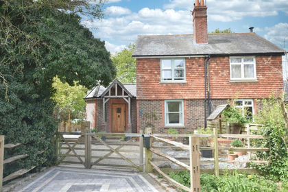
- Price
- £825,000
- Size
- 3 acres
Smallfield Road, Horley, Surrey, RH6, Horley, Surrey RH6 England
Added on 02/05/2026Cottage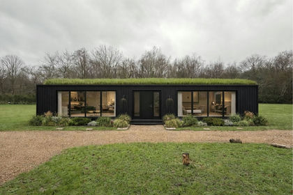
- Price
- Guide Price£750,000
- Size
- 5.61 acres
Copthorne Common, Copthorne, RH10, Worth, West Sussex RH10 England
Added on 14/10/2026Building Plot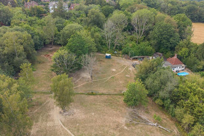
- Price
- £895,000
- Size
- 8 acres
Cottage with 8 Acres, East Grinstead, Dormansland, Surrey RH19 England
Added on 09/07/2026House with Land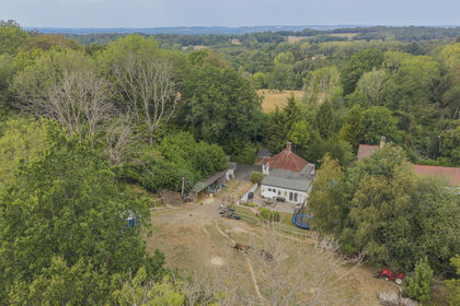
- Price
- £895,000
- Size
- 8 acres
Added on 07/10/2026House with Land
- Price
- Guide Price£875,000
- Size
- 3 acres
London Road, Forest Row, RH18, Forest Row, East Sussex RH18 England
Added on 28/06/2026House with Land
- Price
- £825,000
- Size
- 16 acres
Added on 29/01/2026Equestrian property
- Price
- Guide Price£750,000
- Size
- 11.6 acres
Sheffield Park, Uckfield, Fletching, East Sussex TN22 England
Added on 26/08/2026House with Land
- Price
- Guide Price£575,000
- Size
- 3.4 acres
Horsham Road, Walliswood, Surrey, Abinger, Surrey RH5 England
Added on 19/10/2026House with Land
- Price
- Guide Price£585,000
- Size
- 3.5 acres
Lower Church Farm, Speldhurst Hill, Speldhurst, Kent TN3 England
Added on 29/01/2026House with Land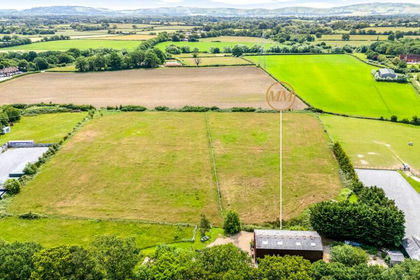
- Price
- Guide Price£900,000
- Size
- 7.5 acres
Wheatsheaf Road, Woodmancote, BN5, Henfield, West Sussex BN5 England
Added on 29/06/2026House with Land