Hare Lane, Hare, Buckland St. Mary
- Land size
- 1.36 acres
- Bedrooms
- 3
- Bathrooms
- 1
Key Features
- Detached Grade II listed former farmhouse
- Set in 1.36 acres (0.55 hectares)
- On the edge of the Blackdown Hills National Landscape
- Full of character and offering great potential
- Gardens, land and outbuildings
- Offered for sale with no onward chain
Description
Offered for sale with no onward chain, this idyllic and characterful Grade II listed period home is set in 1.36 acres (0.55 hectares) and enjoys a picturesque location on the very edge of the Blackdown Hills National Landscape.
The Property - Enjoying an enviable position within a small yet accessible hamlet, this attractive period home offers the best of both worlds, a rural setting and far-reaching views but without feeling remote. Believed to date back to the 17th century, the property is reputed to have served as a local alehouse during the 19th century and has been a cosy and characterful home for many decades. Whilst retaining the broad principles of its traditional cross-passage layout, it has evolved over the centuries to reflect the needs of successive owners, and now presents an opportunity for a new owner to continue that evolution and make it their own. With generous grounds and a range of outbuildings, there is a great deal of potential on offer. Various improvement works and checks have been carried out by the current owners in line with the insurance requirements including the thatch, electrical system and drainage checks.
Accommodation - The traditional cross-passage hall immediately sets the tone for the character and layout of the accommodation. To one side is a substantial sitting room, centred around a large inglenook fireplace, with an adjoining recess adapted by a previous owner to provide downstairs facilities. Across the hall, the generous dining room offers a further inglenook, currently housing an electric AGA, together with one of the two staircases leading to the first floor.
Beyond, the former scullery provides a more traditional kitchen area with a walk-in pantry, whilst across the hall a similar room beneath the catslide roof is currently used for storage and connects to one of the attached outbuildings, presently arranged as a workshop. The second staircase provides an alternative route to the first floor, allowing access to the upstairs rooms from both sides of the property and providing added versatility.
Upstairs, there are three good-sized bedrooms, with the central bedroom currently serving as a through-room, together with a family bathroom incorporating a freestanding bath. As is often the case with period properties, a variety of built-in cupboards and smaller storage recesses are found throughout, adding to the character and practicality of the accommodation. The vendors understand that traditional flagstone flooring remains beneath the carpets on the ground floor.
Outside - The property sits in 1.36 acres, with a traditional cottage-style garden to the front bounded by the old stone wall and picket gate. To the west the gardens wrap around the house with a more traditional garden with raised beds making the perfect space to grow-your-own. Beyond is a sizeable greenhouse. The remainder of the land extends away from the property to the north, with a good size vehicular access on the east side via gates, providing ample off road parking at the rear of the house and access to the detached outbuilding formerly used as a double garage. Adjoining the house, there are further outbuildings including the workshop which is accessible from inside the house and offers scope for conversion to more accommodation. There is an attached wood store accessible from the rear, and a further substantial outbuilding lying perpendicular to the house and offering great versatility for a variety of uses.
Situation - Surrounded by countryside and just a short distance from the edge of the Blackdown Hills National Landscape, Hare is a small rural hamlet enjoying peace and tranquillity and yet just a short drive from the pretty market town of Ilminster. It's also within easy reach of both Broadway and Horton, two adjoining villages which have a great range of local village facilities. There is a post office in Horton, and a local GP surgery in Broadway, along with a range of clubs and societies for those who like to get involved in the community including a well supported Cricket Club which is a hub of social activity. Their parish websites provide extensive details. There are two popular local pubs - The Five Dials in Horton and The Bell in Broadway. For families there are two playgrounds, a pre-school and the very well respected Neroche Primary School in Broadway. The property is just a short drive from the A358 and A303. Ilminster has a wonderful range of independent stores including award winning butchers, delicatessen, cheese / dairy shop, and greengrocers as well as two town centre supermarkets for your everyday essentials. Ilminster also offers further amenities such as hairdressing salons / beauticians, dry cleaners and wonderful well-stocked hardware store. The Arts centre is a popular local venue, as is the well supported Warehouse Theatre in Brewery Lane.
Directions - What3words///beakers.flaunting.ladders
Services - Mains electricity and water are connected. Private drainage.
Ultrafast broadband is available. There is mobile coverage. Please refer to Ofcom's website for further details.
Material Information - Somerset Council
Council Tax Band F
The property is Grade II listed. The hamlet of Hare is located close to, but just outside the Blackdown Hills National Landscape (formerly know as AONB).
There is CCTV recording at the property and this may be recording at the time of any viewings.
There is an approved planning application reference 25/02815/FUL for conversion of the barn next door into residential accommodation.
Photographs taken October 2026 - © Symonds and Sampson
Map Location
Property details
- Tenure
- Freehold
- Council Tax Band
- F
- Date Posted
- 2026-10-29
Market Value Analysis
Compared with 1,547 Homes with Land listings in South West England (1+ acres).
Utilities & Restrictions
Utilities
- Electricity
- Mains
- Water
- Mains
- Heating
- Ask Agent
- Broadband
- Ask Agent
- Sewerage
- Septic Tank / Private
Rights & Restrictions
- Public Rights of Way
- Ask Agent
- Private Rights of Way
- Ask Agent
- Listed Property
- Yes
- Restrictions
- Ask Agent
Listed status, conservation areas and planning constraints for this location are in the full report.
Property Features
- Accessibility
- Ask Agent
- Parking
- Garage, Driveway
- Garden
- Garden
Beyond the particulars: planning activity, flood history, heritage and ground risks, checked for this exact spot.
Connectivity
Broadband
Fastest speed available at this postcode
1.8 Gbps
Gigabit full fibre
Suitable for
- 4K streaming on every screen
- Full-time home working
- Online gaming & big downloads
Mobile signal
Predicted 4G and 5G signal; indoor signal depends on building materials.
Ofcom Connected Nations postcode-level predictions. Speeds and signal are modelled, not measured, and vary between addresses and providers.
Signal is the easy part. Planning activity, flood history and protected designations here are in the full report.
Nearest Schools
Primary
- Buckland St Mary Church of England Primary School1.8 milesOfsted: Requires improvement
- Ages
- 2 to 11
- Pupils
- 54
- Type
- Academy sponsor led
- Faith
- Church of England
- Neroche Primary School2.1 milesOfsted: Good *
- Ages
- 2 to 11
- Pupils
- 233
- Type
- Academy converter
- Ashill Community Primary School2.2 milesOfsted: Good
- Ages
- 2 to 11
- Pupils
- 34
- Type
- Academy converter
- Combe St Nicholas Church of England VA Primary School2.6 milesNo Ofsted rating
- Ages
- 4 to 11
- Pupils
- 117
- Type
- Voluntary aided school
- Faith
- Church of England
- Hatch Beauchamp Church of England Primary School3.2 milesOfsted: Requires improvement
- Ages
- 2 to 11
- Pupils
- 33
- Type
- Academy sponsor led
- Faith
- Church of England
Secondary
- Holyrood Academy4.4 milesOfsted: Good
- Ages
- 11 to 18
- Pupils
- 1,282
- Type
- Academy converter
- Bishop Fox's School6.2 milesNo Ofsted rating
- Ages
- 11 to 16
- Pupils
- 1,123
- Type
- Academy converter
- Monkton Wood Academy7.4 milesOfsted: Inadequate
- Ages
- 11 to 18
- Pupils
- 1,267
- Type
- Academy sponsor led
- The Castle School7.5 milesOfsted: Outstanding
- Ages
- 11 to 19
- Pupils
- 1,207
- Type
- Academy converter
- Pyrland School8.2 milesOfsted: Inadequate *
- Ages
- 11 to 16
- Type
- Academy sponsor led
- Faith
- Church of England
* Latest graded judgement covers quality of education only; no overall grade was issued under the 2024-25 inspection framework.
Distances are straight-line from the advertised location. Source: the national school registers (DfE, Welsh Government, Scottish Government) and Ofsted.
Schools are just the start: sold prices nearby, planning activity and any flood history are in the full report.
Amenities
Supermarket
GP surgery
Pharmacy
Hospital
Straight-line distances from the advertised location. Sources: NHS records, Geolytix supermarket locations, OS Open Greenspace and the national trails registers.
The area stacks up? Now check the location itself: planning nearby, protected designations and past flooding.
Getting Around
Nearest station
Nearest bus stop
Typical drive times
Straight-line distances from the advertised location; drive times are typical free-flow times over OpenStreetMap road data, so allow more at peak. Public transport locations from DfT NaPTAN.
Easy to reach matters. So do planning activity, flood history and ground risks: all in the full report.
Flood Risk
Environment Agency open data, checked around the advertised map pin for the listed acreage. Long-term risk counts flood defences; the planning map's flood zones do not. Provided by LandSale, not the listing agent, and not part of the agent's particulars. Risk varies across a holding, so verify before committing.
Rivers and the sea
Planning map: Flood Zone 1.
Surface water
These bandings are the summary. Where this location sits on the flood maps, plus planning activity, heritage and ground risks, is in the full report.
Important notice: Information, maps and tags on this page are drawn from the advertising agent's marketing materials or generated automatically. LandSale has not verified them. Relying on these details is at your own risk, always carry out independent checks before committing to a purchase.
LandSale full disclaimer
Marketing information only - not formal particulars. The details on this website are provided for general guidance and do not constitute an offer or contract. Neither LandSale nor the advertising estate/land agent accepts responsibility for any inaccuracy.
1. Source of information
- Listing content: Core description, asking price, tenure, measurements, photographs and planning history originate from the marketing materials of the advertising estate or land agent. LandSale does not author this content and cannot guarantee its accuracy.
- Automated tags & categorisation: Property type, land-use class, acreage bands and similar labels may be applied by machine-learning models. They are intended as a helpful guide only and may not reflect the property's legal status or permitted use.
- Third-party & enriched data layers: Maps, boundary outlines, planning designations, soil reports, broadband coverage and other environmental or location-based insights are licensed from external suppliers. Such data are supplied “as is", may be incomplete or out of date and are subject to change without notice.
2. Verification required
Prospective purchasers must verify critical matters, including but not limited to planning permission, title boundaries, public rights of way, environmental constraints, acreage, services, access and VAT status, through their own inspections, specialist surveys, legal advisers and the selling agent before relying on the information or entering into any contract.
3. No warranty or liability
LandSale gives no warranty, express or implied, as to the accuracy, completeness or fitness for any particular purpose of the information displayed. LandSale shall not be liable for any loss, damage, cost or expense arising directly or indirectly from any use of or reliance on such information, save where liability may not be excluded by law.
4. Updates & feedback
If you believe any detail on this listing is inaccurate, please let us know. We will investigate and, where appropriate, update the listing or notify the agent.
© LandSale | Version 1.3 - August 2026
Similar properties for sale
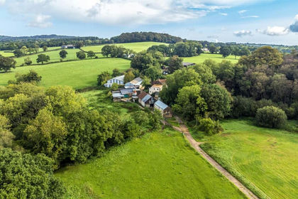
- Price
- Guide Price£675,000
- Size
- 15.81 acres
Whitestaunton, Chard, Somerset, Whitestaunton, Somerset TA20 England
Added on 18/06/2026Farm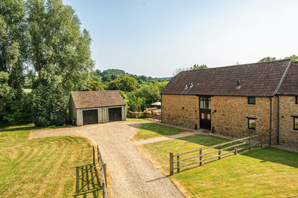
- Price
- Guide Price£625,000
- Size
- 1.45 acres
Added on 06/06/2026Barn Conversion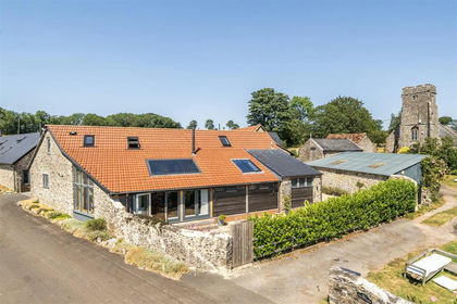
- Price
- Guide Price£700,000
Church Barton, Otterford, Taunton, Otterford, Somerset TA3 England
Added on 24/07/2026Barn Conversion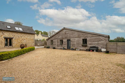
- Price
- Guide Price£725,000
- Size
- 0.5 acres
Churchinford, Taunton, TA3, Churchstanton, Somerset TA3 England
Added on 15/10/2026Barn Conversion
- Price
- Offers in Region of£630,000
Moor Lane, Churchinford, Taunton, Somerset, Churchstanton, Somerset TA3 England
Added on 12/05/2026Barn Conversion
- Price
- Guide Price£725,000
- Size
- 1 acres
Bewley Down, Axminster, Devon, Chardstock, Devon EX13 England
Added on 25/08/2026Cottage
- Price
- £675,000
Added on 22/07/2026Barn Conversion
- Price
- Guide Price£650,000
- Size
- 1 acres
Added on 12/10/2026Cottage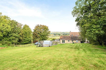
- Price
- Guide Price£650,000
- Size
- 1.6 acres
Higher Chillington, Ilminster, TA19, Ilminster, Somerset TA19 England
Added on 06/10/2026House with Land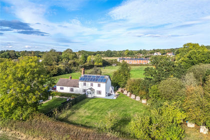
- Price
- £650,000
- Size
- 1.2 acres
Mount Pleasant, Perry Street, Chard, TA20, Chard, Somerset TA20 England
Added on 09/10/2026House with Land