Bewley Down, Axminster, Devon
- Land size
- 1 acres
- Bedrooms
- 3
- Bathrooms
- 3
Key Features
- Period cottage with origins in the 17th century
- Retaining many character features
- Tucked away at the head of a long driveway
- Secluded setting and a haven for wildlife
- Exceptional established gardens of about 1 acre
- 1-bedroom detached annexe
- Garage, parking and several garden stores
Description
THE PROPERTY.
Applebarn Cottage is a particularly attractive detached residence which is located in a unique, secluded position at the head of a long driveway within the Blackdown Hills National Landscape. The cottage has origins dating back to the late 17th century and has been under the same ownership for over 23 years. During this time has been the subject of a comprehensive programme of improvement and extension resulting in the spacious and beautifully presented home we find today. The original cottage is of traditional construction with colourwashed stone elevations, whilst the more recent extensions to the east and west are rendered with brick quoins, all nestling under a tiled roof. It has beautifully presented accommodation which retains a wealth of character features, however, has all the modern conveniences one would expect and is presented in excellent order.
Worthy of particular mention is the lovely sitting room which has a large brick fireplace with woodburner, antique pine floor and French doors opening onto the front terrace, and also the kitchen which has been fitted with oak bespoke units and granite work surfaces with a 2-oven Aga. The dining hall is a room of interest and this has an oak floor and beamed ceiling together with an inglenook fireplace with Villager woodburner and an interesting carved motif on the bressummer beam which we understand reads ‘Jehovah is the Light’.
Applebarn Cottage benefits from two good sized double bedrooms with en–suite bathrooms in the principal house which are accessed from two separate staircases. It also has great adaptability with a one-bedroom detached annexe within the grounds. This is called The Lambert Suite and is a detached rendered and tiled building which has a ‘Mediterranean’ feel with its brick archways and roof lines. This provides fantastic annexe accommodation and there is a large bed/sitting room, entrance dining area, kitchenette and bathroom. To the rear of this building is a laundry room.
It is worth noting that Applebarn Cottage previously had planning approval for an extension to the westerly gable which would add a third first-floor bedroom.
GARDENS & GROUNDS.
Undoubtedly one of the main features at Applebarn Cottage is its superb garden which has been thoughtfully designed, landscaped and beautifully manicured by the current owners over many years. It creates the most stunning setting, perfect for those with a love of flora and fauna, peace and serenity, with only birdsong and no traffic noise. This makes the home and garden very special and being south/south easterly facing gives the garden the feel of its own eco climate with palm trees, Indian Bean Tree, and early flowering shrubs galore. There are far reaching view towards Chardstock village, beyond which are views to Lamberts Castle and Pilsdon Pen.
From the country lane, a long track leads to the private driveway which drops down to the property to a turning area providing parking for several vehicles. Adjacent to this is a detached single garage. An archway leads around to the front of the property where there is a splendid paved terrace which is interspersed with profusely stocked flower and shrub beds. Pathways meander through the grounds to a lower level of lawn passing several buildings where there is a sunken fountain garden around which are a great variety of shrubs and specimen trees. To the north east of the property is a more natural area of ground where there is a superb water garden and woodland walks.
SITUATION.
Applebarn Cottage is located in the small hamlet of Bewley Down, which in turn sits amongst some of East Devon's most attractive rolling countryside. There are beautiful walks close at hand over the myriad of footpaths with much of the surrounding land being privately owned by the Cotley Estate. Although semi rural, Applebarn Cottage has good accessibility being within approximately 3 miles of the villages of Membury, Chardstock and Wambrook and these villages offer strong communities as well as amenities such as shops, post offices, public houses, primary schools, churches etc.
Approximately 4 miles to the north east is the town of Chard which offers an extensive range of shopping facilities, whilst to the south is the busy market town of Axminster which also has a main line rail link to London Waterloo. Applebarn Cottage lies about 9 miles away from the beautiful World Heritage Jurassic Coast at Lyme Bay and the popular town of Lyme Regis with its famous cobb and harbour. This picturesque and ancient stretch of coastline is a popular destination for tourists and boasts beautiful scenery with the towns of Seaton and Sidmouth, and the villages of Beer and Branscombe, all being within easy reach.
DIRECTIONS.
From Honiton, take the A30 in an easterly direction and continue for approximately 3 miles taking the right hand turning onto the old A30 towards Chard and Crewkerne. Pass through the village of Yarcombe and after about 1 mile turn right just after the garage. Continue along this lane and up the hill for about 1 mile and at the top of James' Cross, turn left signposted Wambrook and Chard. After a short distance turn right signposted Membury and continue for about 1 ½ miles to Broadcroft Cross turning left towards Cotley and Ridge. Continue down the hill for about 1 mile and the driveway to Applebarn Cottage will be found on your right hand side.
what3words: ///lollipop.solicitor.home
TENURE & SERVICES.
Freehold. Mains electricity. Private water and drainage (septic tank). Oil-fired central heating.
LOCAL AUTHORITY.
East Devon District Council - .
Council Tax Band: F.
ENERGY PERFORMANCE CERTIFICATE.
Rating: E.
FLOOD RISK.
Flood risk information can be checked through the following:
BROADBAND & MOBILE.
The seller has advised us that they use the provider Starlink for superfast broadband. Broadband availability at this location can be checked through: checker.ofcom.org.uk/
Mobile coverage can be checked through: checker.ofcom.org.uk/en-gb/mobile-coverage
Map Location
Property details
- Tenure
- Freehold
- Council Tax Band
- F
- Date Posted
- 2026-08-25
Market Value Analysis
Compared with 1,628 Homes with Land listings in South West England (1+ acres).
Energy Performance Certificate
Energy Efficiency Rating
Based on UK Energy Performance Certificate standards (EU Directive 2002/91/EC)
Running costs are one side. Planning activity, flood history and ground risks for this location are in the full report.
Utilities & Restrictions
Utilities
- Electricity
- Ask Agent
- Water
- Ask Agent
- Heating
- Ask Agent
- Broadband
- Ask Agent
- Sewerage
- Ask Agent
Rights & Restrictions
- Public Rights of Way
- Ask Agent
- Private Rights of Way
- Ask Agent
- Listed Property
- Ask Agent
- Restrictions
- Ask Agent
Listed status, conservation areas and planning constraints for this location are in the full report.
Property Features
- Accessibility
- Ask Agent
- Parking
- Parking Available
- Garden
- Garden
Beyond the particulars: planning activity, flood history, heritage and ground risks, checked for this exact spot.
Connectivity
Broadband
Fastest speed available at this postcode
1 Mbps
Under 10 Mbps here
Suitable for
- Basic browsing & email
Mobile signal
Predicted 4G and 5G signal; indoor signal depends on building materials.
Ofcom Connected Nations postcode-level predictions. Speeds and signal are modelled, not measured, and vary between addresses and providers.
Signal is the easy part. Planning activity, flood history and protected designations here are in the full report.
Nearest Schools
Primary
- St Andrew's CofE Primary Academy1.7 milesOfsted: Requires improvement
- Ages
- 2 to 11
- Pupils
- 120
- Type
- Academy converter
- Faith
- Church of England
- Membury Primary Academy2 milesOfsted: Good *
- Ages
- 3 to 11
- Pupils
- 8
- Type
- Academy converter
- Tatworth Primary School2.4 milesOfsted: Good
- Ages
- 4 to 11
- Pupils
- 196
- Type
- Academy converter
- Manor Court Community Primary School2.4 milesOfsted: Good
- Ages
- 2 to 11
- Pupils
- 448
- Type
- Academy sponsor led
- The Redstart Primary School2.9 milesOfsted: Good
- Ages
- 2 to 11
- Pupils
- 444
- Type
- Academy converter
Secondary
- Holyrood Academy2.7 milesOfsted: Good
- Ages
- 11 to 18
- Pupils
- 1,282
- Type
- Academy converter
- Axe Valley Academy4.6 milesOfsted: Good
- Ages
- 11 to 16
- Pupils
- 741
- Type
- Academy sponsor led
- Honiton Community College8.6 milesOfsted: Good *
- Ages
- 11 to 16
- Pupils
- 637
- Type
- Academy converter
- The Woodroffe School8.6 milesOfsted: Good
- Ages
- 11 to 18
- Pupils
- 886
- Type
- Foundation school
- Colyton Grammar School8.8 milesOfsted: Outstanding
- Ages
- 11 to 18
- Pupils
- 1,083
- Type
- Academy converter
* Latest graded judgement covers quality of education only; no overall grade was issued under the 2024-25 inspection framework.
Distances are straight-line from the advertised location. Source: the national school registers (DfE, Welsh Government, Scottish Government) and Ofsted.
Schools are just the start: sold prices nearby, planning activity and any flood history are in the full report.
Amenities
Supermarket
GP surgery
Pharmacy
Hospital
Straight-line distances from the advertised location. Sources: NHS records, Geolytix supermarket locations, OS Open Greenspace and the national trails registers.
The area stacks up? Now check the location itself: planning nearby, protected designations and past flooding.
Getting Around
Nearest station
Nearest bus stop
Typical drive times
Straight-line distances from the advertised location; drive times are typical free-flow times over OpenStreetMap road data, so allow more at peak. Public transport locations from DfT NaPTAN.
Easy to reach matters. So do planning activity, flood history and ground risks: all in the full report.
Flood Risk
Environment Agency open data, checked around the advertised map pin for the listed acreage. Long-term risk counts flood defences; the planning map's flood zones do not. Provided by LandSale, not the listing agent, and not part of the agent's particulars. Risk varies across a holding, so verify before committing.
Rivers and the sea
Planning map: Flood Zone 1.
Surface water
These bandings are the summary. Where this location sits on the flood maps, plus planning activity, heritage and ground risks, is in the full report.
Important notice: Information, maps and tags on this page are drawn from the advertising agent's marketing materials or generated automatically. LandSale has not verified them. Relying on these details is at your own risk, always carry out independent checks before committing to a purchase.
LandSale full disclaimer
Marketing information only - not formal particulars. The details on this website are provided for general guidance and do not constitute an offer or contract. Neither LandSale nor the advertising estate/land agent accepts responsibility for any inaccuracy.
1. Source of information
- Listing content: Core description, asking price, tenure, measurements, photographs and planning history originate from the marketing materials of the advertising estate or land agent. LandSale does not author this content and cannot guarantee its accuracy.
- Automated tags & categorisation: Property type, land-use class, acreage bands and similar labels may be applied by machine-learning models. They are intended as a helpful guide only and may not reflect the property's legal status or permitted use.
- Third-party & enriched data layers: Maps, boundary outlines, planning designations, soil reports, broadband coverage and other environmental or location-based insights are licensed from external suppliers. Such data are supplied “as is", may be incomplete or out of date and are subject to change without notice.
2. Verification required
Prospective purchasers must verify critical matters, including but not limited to planning permission, title boundaries, public rights of way, environmental constraints, acreage, services, access and VAT status, through their own inspections, specialist surveys, legal advisers and the selling agent before relying on the information or entering into any contract.
3. No warranty or liability
LandSale gives no warranty, express or implied, as to the accuracy, completeness or fitness for any particular purpose of the information displayed. LandSale shall not be liable for any loss, damage, cost or expense arising directly or indirectly from any use of or reliance on such information, save where liability may not be excluded by law.
4. Updates & feedback
If you believe any detail on this listing is inaccurate, please let us know. We will investigate and, where appropriate, update the listing or notify the agent.
© LandSale | Version 1.3 - August 2026
Listing agent
Humberts, Honiton
Plympton House, 59 High Street, Honiton, Devon EX14 1PW
Similar properties for sale
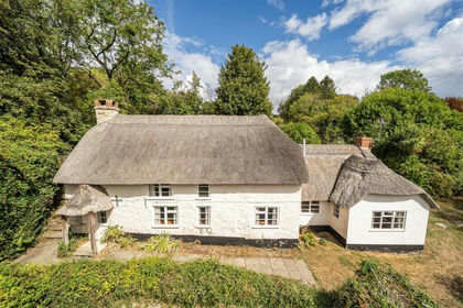
- Price
- Guide Price£595,000
- Size
- 1.17 acres
Added on 04/09/2026Cottage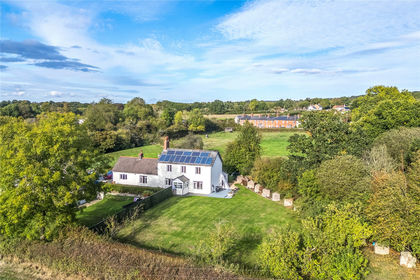
- Price
- £650,000
- Size
- 1.2 acres
Mount Pleasant, Perry Street, Chard, TA20, Chard, Somerset TA20 England
Added on 09/10/2026House with Land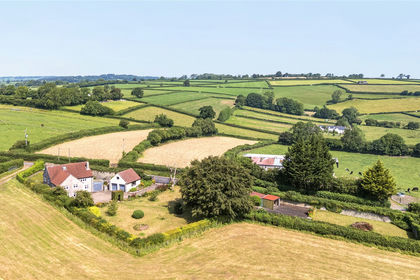
- Price
- Guide Price£795,000
- Size
- 4 acres
Combe St. Nicholas, Chard, TA20, Chard, Somerset TA20 England
Added on 07/07/2026House with Land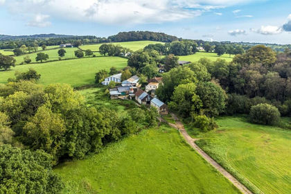
- Price
- Guide Price£675,000
- Size
- 15.81 acres
Whitestaunton, Chard, Somerset, Whitestaunton, Somerset TA20 England
Added on 18/06/2026Farm
- Price
- Guide Price£900,000
- Size
- 4.5 acres
Added on 01/10/2026House with Land
- Price
- Guide Price£595,000
Fordhayes Farm, Kilmington, Axminster, Kilmington, Devon EX13 England
Added on 12/05/2026Barn Conversion
- Price
- Guide Price£795,000
- Size
- 3.09 acres
Added on 01/07/2026House with Land
- Price
- £825,000
- Size
- 6.5 acres
Fore Street, Winsham, Chard, TA20, Chard, Somerset TA20 England
Added on 29/01/2026House with Land
- Price
- Guide Price£850,000
- Size
- 7.6 acres
Added on 23/09/2026Smallholding
- Price
- Guide Price£775,000
- Size
- 4.36 acres
Added on 01/08/2026Smallholding