Whitestaunton, Chard, Somerset
- Land size
- 15.81 acres
- Bedrooms
- 6
- Bathrooms
- 2
Key Features
- Attractive residential/stock farm on Devon/Somerset border
- Detached farmhouse with annexe for restoration
- Potential to extend accommodation
- Range of farm buildings
- Excellent pastureland in a ring fence
- Native woodland with conservation appeal
- In all 15.81 acres (6.40 ha)
- Knapp Farm Lot One - for Sale by private treaty as a whole or in up to four lots
Description
An attractive15.81 acre residential farm, located in the Blackdown Hills, on the Devon/Somerset border. Period farmhouse with annexe for improvement, range of farm buildings, ring fenced by pastureland and woodland.
Situation - Knapp Farm occupies a secluded but accessible position in the heart of the Blackdown Hills National Landscape (AONB). The small village of Marsh is less than a mile away and has access to the A303 providing excellent links to London and Exeter. The market towns of Honiton and Chard (9 and 5 miles respectively), which cater for daily needs, including shops, schools and recreational facilities. Honiton has a mainline rail link to London Waterloo (2 hours 50 minutes). Taunton the county town of Somerset (12 miles) offers excellent retail, commercial and educational opportunities. Equestrian facilities at Chard Equestrian Centre & Bicton Park are within easy reach.
Lot One Farmhouse, Farm Buildings And 16.24 Acres - Knapp Farm comes to the open market for the first time since 1928 and was formerly part of the Whitestaunton Estate. It was a dairy farm until the late 1980’s and in recent years has been a beef unit. Its sale now offers purchasers the opportunity to acquire a substantial period farmhouse for renovation with annexe, a range of traditional and modern farm buildings and about 15.81 acres of very attractive pasture and woodland in a ring fence. The period farmhouse is built of mellow local stone with brick quoins and dressings under a pantile roof. The front façade is rendered and faces the garden. The original farmhouse has had several extensions added, to create the kitchen and the two-bedroom annexe. The core of the property epitomises the style of the Victorian era with generous sized rooms, high ceilings and period features such as picture rails and fireplaces. The farmhouse is spacious and light-filled but is now in need of modernisation and renovation. There is potential to extend the accommodation into the adjacent stone buildings (STPP). The annexe, which has a more cottagey feel, could provide separate accommodation for multi-generational living or rental income, equally it could be reintegrated into the farmhouse.
Please see floorplan for accommodation and measurements.
Outside - The farmstead is accessed from the farm drive which is flanked by pastureland and rises up to the farmhouse, passing by some of the farm buildings which could have potential for development (STPP). To the south of the farmhouse is a largely level garden laid to lawn with attractive stone walls providing the boundary.
Farm Buildings - In the lower yard to the left of the farm drive:
Block built former Dairy (14.98m x 5.91m) with a profile roof
Stone and block Barn (18.93m x 9.22m) with a profile and tiled roof Lean-to
Traditional Stone Barn (22.56m x 7.11m) with profile roof and rear Lean-to (18.28m x 11.06)
Concrete portal Silage Shed with side Lean-to (22m x 11.46m) in a poor state of repair
Adjacent steel framed former Silage Shed (22.93m x 15.30m) with a box profile roof
The Land - Lot One comprises three main enclosures of mainly gently sloping pasture, lying either side of the farm driveway extending to some 10.23 acres. The remainder is the farmstead and areas of native woodland with a pond and natural water supplies, the main part known as Cinder Hill Covert. In all about 15.81 acres (6.40 ha).
Services - Lot One: Private water connected. Main electricity and private drainage.
Broadband : Standard available. Mobile Network Coverage : Likely outside. Limited inside. Source - Ofcom.org.uk
Tenure - Freehold with vacant possession upon completion.
Rights Of Way - No public rights of way cross Lot One.
Designations - Knapp Farm is located in the Blackdown Hills National Landscape. The land is not situated within a Nitrate Vulnerable Zone (NVZ).
Agricultural Schemes - The farm is currently not in any subsidy schemes.
Fencing Obligations - If sold in lots, fencing obligations will become the purchaser’s responsibility, with any shared boundaries being 50/50.
Sporting - All rights are understood to be owned and included in the sale. Racing at Exeter orTaunton. Golf at Cricket St Thomas or Taunton and Pickeridge. Sailing on the coast atSeaton or Lyme Regis.
Material Information - 1. We cannot confirm if the septic tank conforms to the current regulations.
2. Knapp Farm is at very low risk of flooding from surface water, rivers and seas.
Dispersal Sale - The vendors reserve the right to hold a dispersal sale on the property prior to completion.
Local Authority - Somerset District Council Tel:
Council Tax Band: F
Education - Primary schooling at Buckland St Mary. State secondary schools at Holyrood Academy, Chard and the excellent Colyton Grammar School. Independent Schools in the area include Taunton (Kings, Queens and Taunton),Tiverton (Blundells) and Exeter independent schools.
Map Location
Property details
- Tenure
- Freehold
- Council Tax Band
- F
- Date Posted
- 2026-06-18
Market Value Analysis
Compared with 81 Farms & Smallholdings listings in South West England (10+ acres).
Energy Performance Certificate
Energy Efficiency Rating
Based on UK Energy Performance Certificate standards (EU Directive 2002/91/EC)
Running costs are one side. Planning activity, flood history and ground risks for this location are in the full report.
Utilities & Restrictions
Utilities
- Electricity
- Mains
- Water
- Private Supply
- Heating
- Ask Agent
- Broadband
- Ask Agent
- Sewerage
- Septic Tank / Private
Rights & Restrictions
- Public Rights of Way
- Ask Agent
- Private Rights of Way
- Ask Agent
- Listed Property
- Ask Agent
- Restrictions
- Ask Agent
Listed status, conservation areas and planning constraints for this location are in the full report.
Property Features
- Accessibility
- Ask Agent
- Parking
- Parking Available
- Garden
- Garden
Beyond the particulars: planning activity, flood history, heritage and ground risks, checked for this exact spot.
Connectivity
Broadband
Fastest speed available at this postcode
56 Mbps
Superfast · available to 75% of premises
Suitable for
- HD streaming
- Video calls
- Web & social
Mobile signal
Outdoor predictions; indoor signal depends on building materials.
Ofcom Connected Nations postcode-level predictions. Speeds and signal are modelled, not measured, and vary between addresses and providers.
Signal is the easy part. Planning activity, flood history and protected designations here are in the full report.
Nearest Schools
Primary
- Buckland St Mary Church of England Primary School1.5 milesOfsted: Requires improvement
- Ages
- 2 to 11
- Pupils
- 54
- Type
- Academy sponsor led
- Faith
- Church of England
- Combe St Nicholas Church of England VA Primary School2.2 milesNo Ofsted rating
- Ages
- 4 to 11
- Pupils
- 117
- Type
- Voluntary aided school
- Faith
- Church of England
- The Redstart Primary School3.6 milesOfsted: Good
- Ages
- 2 to 11
- Pupils
- 444
- Type
- Academy converter
- Manor Court Community Primary School3.8 milesOfsted: Good
- Ages
- 2 to 11
- Pupils
- 448
- Type
- Academy sponsor led
- Stockland Church of England Primary Academy4.2 milesOfsted: Good
- Ages
- 0 to 11
- Pupils
- 75
- Type
- Academy converter
- Faith
- Church of England
Secondary
- Holyrood Academy3.7 milesOfsted: Good
- Ages
- 11 to 18
- Pupils
- 1,282
- Type
- Academy converter
- Axe Valley Academy7.9 milesOfsted: Good
- Ages
- 11 to 16
- Pupils
- 741
- Type
- Academy sponsor led
- Bishop Fox's School8.1 milesNo Ofsted rating
- Ages
- 11 to 16
- Pupils
- 1,123
- Type
- Academy converter
- Honiton Community College9 milesOfsted: Good *
- Ages
- 11 to 16
- Pupils
- 637
- Type
- Academy converter
- The Castle School9.1 milesOfsted: Outstanding
- Ages
- 11 to 19
- Pupils
- 1,207
- Type
- Academy converter
* Latest graded judgement covers quality of education only; no overall grade was issued under the 2024-25 inspection framework.
Distances are straight-line from the advertised location. Source: the national school registers (DfE, Welsh Government, Scottish Government) and Ofsted.
Schools are just the start: sold prices nearby, planning activity and any flood history are in the full report.
Amenities
Supermarket
GP surgery
Pharmacy
Hospital
Straight-line distances from the advertised location. Sources: NHS records, Geolytix supermarket locations, OS Open Greenspace and the national trails registers.
The area stacks up? Now check the location itself: planning nearby, protected designations and past flooding.
Getting Around
Nearest station
Nearest bus stop
Typical drive times
Straight-line distances from the advertised location; drive times are typical free-flow times over OpenStreetMap road data, so allow more at peak. Public transport locations from DfT NaPTAN.
Easy to reach matters. So do planning activity, flood history and ground risks: all in the full report.
Flood Risk
From Environment Agency flood map open data, checked around the advertised map pin and allowing for the listed acreage where known. This summary comes from LandSale, the advertising platform, not from the listing agent, and is not part of the agent's particulars. Risk can vary across a single holding, so verify anything critical through your own searches before committing.
Rivers and the sea
Surface water
Mapped within the area searched, not at the advertised map pin itself.
These bandings are the summary. Where this location sits on the flood maps, plus planning activity, heritage and ground risks, is in the full report.
Important notice: Information, maps and tags on this page are drawn from the advertising agent's marketing materials or generated automatically. LandSale has not verified them. Relying on these details is at your own risk, always carry out independent checks before committing to a purchase.
LandSale full disclaimer
Marketing information only - not formal particulars. The details on this website are provided for general guidance and do not constitute an offer or contract. Neither LandSale nor the advertising estate/land agent accepts responsibility for any inaccuracy.
1. Source of information
- Listing content: Core description, asking price, tenure, measurements, photographs and planning history originate from the marketing materials of the advertising estate or land agent. LandSale does not author this content and cannot guarantee its accuracy.
- Automated tags & categorisation: Property type, land-use class, acreage bands and similar labels may be applied by machine-learning models. They are intended as a helpful guide only and may not reflect the property's legal status or permitted use.
- Third-party & enriched data layers: Maps, boundary outlines, planning designations, soil reports, broadband coverage and other environmental or location-based insights are licensed from external suppliers. Such data are supplied “as is", may be incomplete or out of date and are subject to change without notice.
2. Verification required
Prospective purchasers must verify critical matters, including but not limited to planning permission, title boundaries, public rights of way, environmental constraints, acreage, services, access and VAT status, through their own inspections, specialist surveys, legal advisers and the selling agent before relying on the information or entering into any contract.
3. No warranty or liability
LandSale gives no warranty, express or implied, as to the accuracy, completeness or fitness for any particular purpose of the information displayed. LandSale shall not be liable for any loss, damage, cost or expense arising directly or indirectly from any use of or reliance on such information, save where liability may not be excluded by law.
4. Updates & feedback
If you believe any detail on this listing is inaccurate, please let us know. We will investigate and, where appropriate, update the listing or notify the agent.
© LandSale | Version 1.3 - August 2026
Listing agent
Symonds & Sampson, Axminster
Trinity Square, Axminster, EX13 5AW
Similar properties for sale
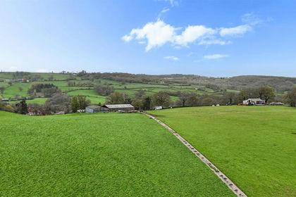
- Price
- Guide Price£485,000
- Size
- 42.57 acres
Whitestaunton, Chard, Somerset, Whitestaunton, Somerset TA20 England
Added on 22/06/2026Grazing Land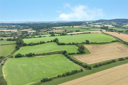
- Price
- Guide Price£575,000
- Size
- 56.85 acres
Added on 26/08/2026Agricultural Land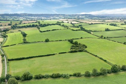
- Price
- Guide Price£675,000
- Size
- 66.6 acres
Added on 26/08/2026Agricultural Land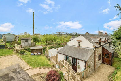
- Price
- Guide Price£550,000
- Size
- 1.5 acres
Added on 25/04/2026House with Land
- Price
- Guide Price£650,000
- Size
- 2.2 acres
Ironwood House, Moorland, Bridgwater, Somerset, TA7, North Petherton, Somerset TA7 England
Added on 16/05/2026Smallholding
- Price
- £850,000
- Size
- 8 acres
Added on 30/05/2026Smallholding
- Price
- Guide Price£700,000
- Size
- 1.25 acres
Cheriton Fitzpaine, Crediton, EX17, Stockleigh English, Devon EX17 England
Added on 17/05/2026Mill Conversion
- Price
- Guide Price£650,000
- Size
- 1.5 acres
East Knowstone, South Molton, Devon, EX36, Knowstone, Devon EX36 England
Added on 14/02/2026Farmhouse
- Price
- Offers in Excess of£500,000
- Size
- 2.2 acres
Added on 15/04/2026Development Land
- Price
- Guide Price£800,000
- Size
- 10 acres
Knowstone, South Molton, Devon, EX36, Knowstone, Devon EX36 England
Added on 16/08/2026Smallholding