
The Covert, Aston Lane, Chellaston, Derby, DE73
- Land size
- 16.06 acres
- Bedrooms
- 4
- Bathrooms
- 3
Key Features
- Spacious Bungalow
- Four Bedrooms
- Large Kitchen/Diner
- 16.06 Acres
- Outbuildings, Stables and Kennels
- Development Opportunities
- Excellent Road Links
- No Chain
- Enquiries to Ashbourne Office
Description
An exceptional opportunity to purchase 16.06 acres and a spacious bungalow that is on the market for the first time in its history. There may be developmental opportunities on part of the land.
Description
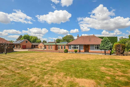
The Covert is on the market for the very first time in its history. This is an exceptional opportunity to purchase a very spacious and graceful bungalow set within outstanding grounds of 16.06 Acres on the edge of Derby.
There are a large number of outbuildings, mostly forming a dog boarding kennel business but there are also some stables and a hay barn. There may be development opportunities on part of the land and the property is sold with no overage. Just 2 miles to the A50 and A38 providing excellent road links to M1 and M6.
The House
The front door from the driveway enters via a porch into a vast, impressive kitchen/dining room/sitting room. This is the working hub of the property and full length glass doors open onto a covered deck terrace overlooking the grounds. The kitchen area has fully fitted units and a range cooker.
A door from this room leads to the sitting room, another huge room with a fireplace with wood burner and great views over the lawns.
On the other side of the kitchen, a door leads into the bedroom wing which has full length glass walls overlooking the gardens. From this passage, doors open into four double bedrooms, one of which has large walk in wardrobe and an ensuite bathroom, there is a further WC and a shower room.
The size of the rooms in this property and the views from the principle rooms including the master bedroom have to be inspected in order to really appreciate the magnificence of the building.
The Buildings
For many years the property has been run as a dog boarding and agility training kennels,, and this option is clearly possible for a new owner. Alternatively it may easily be altered to accommodate equestrian or other interests.
The buildings include a range of kennels, stables and garages nearest to the house together with a workshop and two WCs.
Some distance behind these is another set of buildings and opposite there is a further range of stables/stores.
In addition, there is a large enclosed building (approximately 36m x 12 m) used a a dog training arena which could be adapted for other uses. A portal framed hay barn lies some way beyond at the entrance to one of the fields.
There are some timber field shelters and chicken houses.
The Land
The bungalow and buildings are well situated within the land which is delightfully composed of large sweeping lawns, mature woodland and grass paddocks.
The woodland has a variety of species of trees and form a natural boundary to the majority of the property giving peace and privacy, which is quite exceptional considering its close locations to Derby and the main trunk roads.
There are a number of beautiful walks maintained through the woodland and fields.
Services
Mains water, gas, electricity and private drainage.
There are 20 solar panels with a capacity of approximately 8kw backed up with battery storage system and this currently produces an annual income.
There are high levels of insulation within the construction of the house, and double glazed windows filled with Argon which gives the bungalow an EPC of A.
Tenure and Possession
The property is sold freehold with vacant possession upon completion.
Rights of Way, Wayleaves and Easements
The property is sold subject to and with the benefit of all rights of way, easements and wayleaves whether or not defined in these particulars.
There are a number of gated accesses from the lane into the property including one that leads to a hard surfaced car park.
Fixtures and Fittings
Only those fixtures and fittings referred to in the sale particulars are included in the purchase price. Bagshaws have not tested any equipment, fixtures, fittings or services and no guarantee is given that they are in good working order.
Local Planning Authority
South Derbyshire District Council & Derby City Council
Council Tax Band
Band A
Sporting, Timber and Mineral Rights
All sporting, timber and mineral rights are included within the sale as far as we are aware.
Method of Sale
The property is to be offered by private treaty
Viewings
Strictly by appointment through the Ashbourne Office of Bagshaw's as sole agents on 01335 342201 or e-mail: ashbourne@bagshaws.com.
Directions
From A50, take the signs to Derby City Centre and proceed into Chellaston. Pass Lidl on your left and at the traffic lights turn right into the High Street. Follow this for about three quarters of a mile and Aston Lane is on the right. The Covert is the first property on the left.
Agents Notes
Bagshaws LLP have made every reasonable effort to ensure these details offer an accurate and fair description of the property. The particulars are produced in good faith, for guidance only and do not constitute or form an offer or part of the contract for sale. Bagshaws LLP and their employees are not authorised to give any warranties or representations in relation to the sale and give notice that all plans, measurements, distances, areas and any other details referred to are approximate and based on information available at the time of printing.
Map Location
Property details
- Tenure
- Freehold
- Council Tax Band
- Ask Agent
- Date Posted
- 2026-10-27
Market Value Analysis
Compared with 46 Farms & Smallholdings listings in East Midlands (10+ acres).
Energy Performance Certificate
Energy Efficiency Rating
Based on UK Energy Performance Certificate standards (EU Directive 2002/91/EC)
Running costs are one side. Planning activity, flood history and ground risks for this location are in the full report.
Property Brochure
Seen the details? The full report adds the independent checks: planning activity, flood history, heritage and ground.
Utilities & Restrictions
Utilities
- Electricity
- Ask Agent
- Water
- Ask Agent
- Heating
- Ask Agent
- Broadband
- Ask Agent
- Sewerage
- Ask Agent
Rights & Restrictions
- Public Rights of Way
- Ask Agent
- Private Rights of Way
- Ask Agent
- Listed Property
- Ask Agent
- Restrictions
- Ask Agent
Listed status, conservation areas and planning constraints for this location are in the full report.
Property Features
- Accessibility
- Ask Agent
- Parking
- Ask Agent
- Garden
- Ask Agent
Beyond the particulars: planning activity, flood history, heritage and ground risks, checked for this exact spot.
Connectivity
Broadband
Fastest speed available at this postcode
1.8 Gbps
Gigabit full fibre
Suitable for
- 4K streaming on every screen
- Full-time home working
- Online gaming & big downloads
Mobile signal
Predicted 4G and 5G signal; indoor signal depends on building materials.
Ofcom Connected Nations postcode-level predictions. Speeds and signal are modelled, not measured, and vary between addresses and providers.
Signal is the easy part. Planning activity, flood history and protected designations here are in the full report.
Nearest Schools
Primary
- Chellaston Infant School527 metresOfsted: Good *
- Ages
- 5 to 7
- Pupils
- 215
- Type
- Academy converter
- Chellaston Junior School713 metresNo Ofsted rating
- Ages
- 7 to 11
- Pupils
- 420
- Type
- Academy converter
- Chellaston Fields Spencer Academy858 metresOfsted: Good
- Ages
- 4 to 11
- Pupils
- 187
- Type
- Free schools
- Homefields Primary School0.8 milesOfsted: Good
- Ages
- 3 to 11
- Pupils
- 340
- Type
- Academy converter
- Clover Leys Spencer Academy0.9 milesOfsted: Good
- Ages
- 4 to 11
- Pupils
- 135
- Type
- Free schools
Secondary
- Chellaston Academy830 metresOfsted: Good
- Ages
- 11 to 18
- Pupils
- 1,790
- Type
- Academy converter
- Noel-Baker Academy1.1 milesOfsted: Good
- Ages
- 11 to 16
- Pupils
- 1,230
- Type
- Academy sponsor led
- Alvaston Moor Academy1.6 milesOfsted: Requires improvement
- Ages
- 11 to 19
- Pupils
- 851
- Type
- Academy sponsor led
- City of Derby Academy2.8 milesOfsted: Requires improvement
- Ages
- 11 to 16
- Pupils
- 925
- Type
- Academy sponsor led
- UTC Derby Pride Park3.4 milesOfsted: Good
- Ages
- 13 to 19
- Pupils
- 534
- Type
- University technical college
* Latest graded judgement covers quality of education only; no overall grade was issued under the 2024-25 inspection framework.
Distances are straight-line from the advertised location. Source: the national school registers (DfE, Welsh Government, Scottish Government) and Ofsted.
Schools are just the start: sold prices nearby, planning activity and any flood history are in the full report.
Amenities
Supermarket
GP surgery
Pharmacy
Hospital
Green space
Straight-line distances from the advertised location. Sources: NHS records, Geolytix supermarket locations, OS Open Greenspace and the national trails registers.
The area stacks up? Now check the location itself: planning nearby, protected designations and past flooding.
Getting Around
Nearest station
Nearest bus stop
Typical drive times
Straight-line distances from the advertised location; drive times are typical free-flow times over OpenStreetMap road data, so allow more at peak. Public transport locations from DfT NaPTAN.
Easy to reach matters. So do planning activity, flood history and ground risks: all in the full report.
Flood Risk
Environment Agency open data, checked around the advertised map pin for the listed acreage. Long-term risk counts flood defences; the planning map's flood zones do not. The map pin for this listing is approximate, so these readings describe the surrounding area. Provided by LandSale, not the listing agent, and not part of the agent's particulars. Risk varies across a holding, so verify before committing.
Rivers and the sea
Planning map: Flood Zone 1.
Surface water
Not at the pin: mapped about 30 metres away.
These bandings are the summary. Where this location sits on the flood maps, plus planning activity, heritage and ground risks, is in the full report.
Important notice: Information, maps and tags on this page are drawn from the advertising agent's marketing materials or generated automatically. LandSale has not verified them. Relying on these details is at your own risk, always carry out independent checks before committing to a purchase.
LandSale full disclaimer
Marketing information only - not formal particulars. The details on this website are provided for general guidance and do not constitute an offer or contract. Neither LandSale nor the advertising estate/land agent accepts responsibility for any inaccuracy.
1. Source of information
- Listing content: Core description, asking price, tenure, measurements, photographs and planning history originate from the marketing materials of the advertising estate or land agent. LandSale does not author this content and cannot guarantee its accuracy.
- Automated tags & categorisation: Property type, land-use class, acreage bands and similar labels may be applied by machine-learning models. They are intended as a helpful guide only and may not reflect the property's legal status or permitted use.
- Third-party & enriched data layers: Maps, boundary outlines, planning designations, soil reports, broadband coverage and other environmental or location-based insights are licensed from external suppliers. Such data are supplied “as is", may be incomplete or out of date and are subject to change without notice.
2. Verification required
Prospective purchasers must verify critical matters, including but not limited to planning permission, title boundaries, public rights of way, environmental constraints, acreage, services, access and VAT status, through their own inspections, specialist surveys, legal advisers and the selling agent before relying on the information or entering into any contract.
3. No warranty or liability
LandSale gives no warranty, express or implied, as to the accuracy, completeness or fitness for any particular purpose of the information displayed. LandSale shall not be liable for any loss, damage, cost or expense arising directly or indirectly from any use of or reliance on such information, save where liability may not be excluded by law.
4. Updates & feedback
If you believe any detail on this listing is inaccurate, please let us know. We will investigate and, where appropriate, update the listing or notify the agent.
© LandSale | Version 1.3 - August 2026
Similar properties for sale
- Price
- Guide Price£1,250,000
- Size
- 9.1 acres
Greenways, Church Road, Egginton, DE65, Egginton, Derbyshire DE65 England
Added on 30/07/2026House with Land
- Price
- £1,350,000
- Size
- 9.74 acres
Added on 23/07/2026House with Land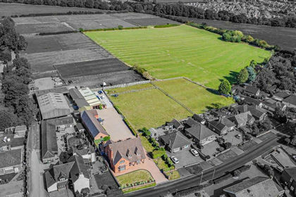
- Price
- £1,125,000
- Size
- 10 acres
Craythorne Road, Stretton, Burton-On-Trent, Stretton, Staffordshire DE13 England
Added on 28/01/2026House with Land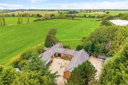
- Price
- Guide Price£1,000,000
- Size
- 32 acres
Wymeswold Road, Hoton, Loughborough, Hoton, Leicestershire LE12 England
Added on 18/09/2026Smallholding
- Price
- £995,000
- Size
- 8.62 acres
Efflinch Lane, Barton-under-Needwood, Barton-under-Needwood, Staffordshire DE13 England
Added on 28/09/2026House with Land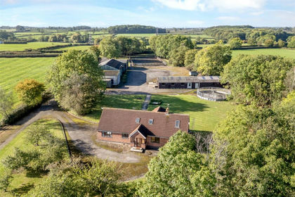
- Price
- £1,400,000
- Size
- 17.54 acres
Willoughby Lane, Thorpe-In-The-Glebe, Wysall, Willoughby on the Wolds, Nottinghamshire LE12 England
Added on 29/10/2026Equestrian property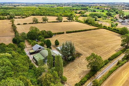
- Price
- Guide Price£1,000,000
- Size
- 17 acres
Mill Lane, Edingale, Tamworth, B79, Edingale, Staffordshire B79 England
Added on 21/08/2026Smallholding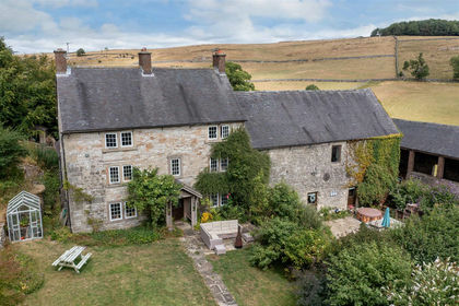
- Price
- Guide Price£1,500,000
- Size
- 9.14 acres
Roystone Grange Farm, Pikehall, Matlock, DE4, Matlock, Derbyshire DE4 England
Added on 17/08/2026Smallholding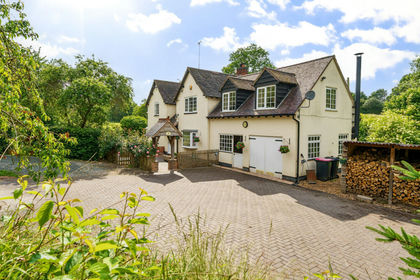
- Price
- Offers in Excess of£1,250,000
- Size
- 11 acres
Added on 08/10/2026Smallholding
- Price
- Offers in Region of£980,000
- Size
- 10 acres
Atherstone Road, Nuneaton CV10, Hartshill, Warwickshire CV10 England
Added on 15/09/2026Smallholding