Abenhall Road, Mitcheldean, Gloucestershire, GL17
- Land size
- 4 acres
- Bedrooms
- 6
- Bathrooms
- 4
Key Features
- Imposing Country Residence in 4 Acres of Land
- Beautiful Location, Heart of Forest of Dean
- Period Character, Exceptionally Spacious
- 4 Reception Rooms, 6 Bedrooms
- Substantial Outbuildings, Studio, Stables, Storage
- Planning Consent for Self Catering Holiday Units
- Close to the Village, Easy Access to Major Road Network
Description
This imposing country residence is situated in glorious countryside in the heart of the beautiful Forest of Dean. It stands in approximately four acres of level ground with a range of substantial outbuildings approaching 3‚900 square feet. Planning consent is granted to develop former commercial workshops into self catering holiday units‚ (reference - P0637/24/FUL). The accommodation is exceptionally spacious‚ the rooms boast generous proportions with original features including period fireplaces‚ hardwood floors and high ceilings. There are four bright reception rooms and an impressive family kitchen dining room. The layout incorporates a fully equipped‚ first floor disabled suite that lends itself to a self contained annex. There are five further double bedrooms‚ 3 being en-suite‚ and a huge attic. Space and flexibility is what this remarkable house offers in abundance. There is great potential for equestrian use and numerous business opportunities including extensive storage facilities‚ all achievable with some investment. Alternatively‚ Ferneyfield Manor is a unique country home in a superb location that lends itself to extended family occupation. The village is close by‚ Ross on Wye‚ M50‚ Monmouth and Gloucester are in easy commuting distance.
Agent Note
Planning Consent
Full planning consent is granted (P0637/24/FUL) to convert the attached the former commercial carpentry workshop into three self-catering tourism units, along with the creation of a bio-diversity nature area within part of the garden. Additionally, minor external and internal alterations to existing two storey dwelling house and new site access and associated hard and soft landscaping upon retained smaller residential curtilage.
Ground Floor
A pretty vaulted entrance porch with arched windows opens to the spacious main and inner halls both featuring attractive hardwood flooring.
The ground floor rooms are of very generous proportions each with high ceilings and dual aspect views over the gardens.
There are four bright airy reception rooms with the principal sitting room and snug retaining period style fireplaces.
The family kitchen breakfast room is fitted with solid wood cabinets, a range cooker and a Rayburn stove. It is open plan to the dining room which has patio doors to the garden - a lovely place to dine.
Beyond the kitchen breakfast room is a cloakroom and large utility/laundry room which is fully fitted with cabinets and plumbing for white goods.
From the other side of the kitchen is an additional cloakroom and useful reception room which would serve very well as a home office or play room.
First Floor
A bespoke hardwood staircase leads to the galleried landing. This generous area is fitted with hardwood flooring and leads to all the bedrooms, family bathroom and first floor annex/guest apartment.
There are five double bedrooms, three of which have well appointed en-suite bathrooms. The other two bedrooms are served by the family bathroom. They are all bright sunny rooms with far reaching views over the garden to lovely surrounding countryside.
Stairs from the landing lead to the huge attic roof space - a perfect storage area or potential conversion space.
Annex / Guest Apartment
The first floor annex/guest apartment can be accessed via steps at the rear of the property or from the main house. It comprises an exceptionally spacious reception/sitting room, generous bedroom and a large wet room.
From the sitting room there is access onto a large balcony sunny balcony with lovely views over the grounds and surrounding countryside.
It can be independent or part and parcel to the main house if preferred.
Garden Room
The studio/garden room is independently accessed from the garden. It is finished with attractive wood panelling and features bi-folding doors. It is an ideal function/meeting room, gym or home office.
Outbuildings
Accessed from the house or externally are the extensive former carpentry workshops. There is planning consent in place to convert this considerable area to three self contained holiday cottages.
Other substantial outbuildings include-:
Integral double garage measuring 9.42m x 4.52m. The plant room within houses two wall mounted LPG gas central heating boilers and the pressurised hot water system.
Timber stables x 2 with integrated tack/store room.
A large poly tunnel presently utilised for storing wood.
An extra large barn/garden machinery store room measuring 11.26m x 8.65m.
Outside
Access is through automatic gates onto a wide drive that continues past the house to further ample parking and garages at the rear.
To the front and side of the house the gardens are laid to lawn overlooked from a raised terrace.
The majority of the ground lies to the rear of the house. It is a good level plot divided into two main fenced paddocks with numerous substantial outbuildings. It would work well for those with equestrian interests or as a small holding.
There is a large formal pond (requires some attention), mature trees, a boundary of natural hedges and a superb outlook over surrounding countryside and forest.
Directions
What3Words - ///appealed.outdone.starfish
From the mini roundabout in the centre of Mitcheldean, take the exit into Abenhall Road. Follow the road past Dene Magna School. The property is a little further ahead set back on the left hand side.
Material Information
Tenure - Freehold
Heating Type - Gas
Mains Water - Yes
Drainage - TBC
Solar - No
Council Tax Band - G
Information & Advice
Prior to a sale being agreed, prospective buyers will be required to provide identification documents to help us comply with anti-money laundering regulations. Your cooperation with this process is appreciated and will assist in the efficient and smooth progression of your purchase.
Disclaimer - Every effort has been taken in preparing these details as carefully as possible, however, intending purchasers should be aware that their accuracy is not guaranteed. All measurements are approximate and this does not form any part of any contract. Ferrino & Partners has not tested any apparatus, fixtures, fittings, central heating systems or services mentioned in these particulars and intending purchasers are advised to satisfy themselves as to their working order or condition.
Map Location
Property details
- Tenure
- Freehold
- Council Tax Band
- G
- Date Posted
- 2026-10-26
Market Value Analysis
Compared with 1,543 Homes with Land listings in South West England (1+ acres).
Energy Performance Certificate
Energy Efficiency Rating
Based on UK Energy Performance Certificate standards (EU Directive 2002/91/EC)
Running costs are one side. Planning activity, flood history and ground risks for this location are in the full report.
Utilities & Restrictions
Utilities
- Electricity
- Ask Agent
- Water
- Ask Agent
- Heating
- Ask Agent
- Broadband
- Ask Agent
- Sewerage
- Ask Agent
Rights & Restrictions
- Public Rights of Way
- Ask Agent
- Private Rights of Way
- Ask Agent
- Listed Property
- Ask Agent
- Restrictions
- Ask Agent
Listed status, conservation areas and planning constraints for this location are in the full report.
Property Features
- Accessibility
- Ask Agent
- Parking
- Parking Available
- Garden
- Garden
Beyond the particulars: planning activity, flood history, heritage and ground risks, checked for this exact spot.
Connectivity
Broadband
Fastest speed available at this postcode
54 Mbps
Superfast
Suitable for
- HD streaming
- Video calls
- Web & social
Mobile signal
Predicted 4G and 5G signal; indoor signal depends on building materials.
Ofcom Connected Nations postcode-level predictions. Speeds and signal are modelled, not measured, and vary between addresses and providers.
Signal is the easy part. Planning activity, flood history and protected designations here are in the full report.
Nearest Schools
Primary
- Mitcheldean Endowed Primary School948 metresNo Ofsted rating
- Ages
- 4 to 11
- Pupils
- 205
- Type
- Voluntary aided school
- Faith
- Church of England
- Hope Brook CofE Primary School1.5 milesNo Ofsted rating
- Ages
- 3 to 11
- Pupils
- 134
- Type
- Academy converter
- Faith
- Church of England
- Drybrook Primary School1.5 milesOfsted: Requires improvement *
- Ages
- 2 to 11
- Pupils
- 147
- Type
- Academy sponsor led
- Steam Mills Primary School1.8 milesOfsted report card · Jun 2026
- Ages
- 4 to 11
- Pupils
- 128
- Type
- Community school
- Forest View Primary School2.1 milesNo Ofsted rating
- Ages
- 4 to 11
- Pupils
- 365
- Type
- Academy converter
Secondary
- Dene Magna and Sixth Form362 metresOfsted: Good *
- Ages
- 11 to 18
- Pupils
- 1,020
- Type
- Academy converter
- SGS Forest High School2 milesOfsted: Requires improvement
- Ages
- 11 to 16
- Pupils
- 255
- Type
- Academy sponsor led
- Newent Community School and Sixth Form Centre5.7 milesNo Ofsted rating
- Ages
- 11 to 18
- Pupils
- 976
- Type
- Academy converter
- John Kyrle High School and Sixth Form Centre Academy6.2 milesOfsted: Good *
- Ages
- 11 to 18
- Pupils
- 1,274
- Type
- Academy converter
- Five Acres High School6.4 milesOfsted report card · Jun 2026
- Ages
- 11 to 16
- Pupils
- 786
- Type
- Academy sponsor led
* Latest graded judgement covers quality of education only; no overall grade was issued under the 2024-25 inspection framework.
Distances are straight-line from the advertised location. Source: the national school registers (DfE, Welsh Government, Scottish Government) and Ofsted.
Schools are just the start: sold prices nearby, planning activity and any flood history are in the full report.
Amenities
Supermarket
GP surgery
Pharmacy
Hospital
Green space
Straight-line distances from the advertised location. Sources: NHS records, Geolytix supermarket locations, OS Open Greenspace and the national trails registers.
The area stacks up? Now check the location itself: planning nearby, protected designations and past flooding.
Getting Around
Nearest station
Nearest bus stop
Typical drive times
Straight-line distances from the advertised location; drive times are typical free-flow times over OpenStreetMap road data, so allow more at peak. Public transport locations from DfT NaPTAN.
Easy to reach matters. So do planning activity, flood history and ground risks: all in the full report.
Flood Risk
Environment Agency open data, checked around the advertised map pin for the listed acreage. Long-term risk counts flood defences; the planning map's flood zones do not. Provided by LandSale, not the listing agent, and not part of the agent's particulars. Risk varies across a holding, so verify before committing.
Rivers and the sea
Planning map: Flood Zone 1.
Surface water
Not at the pin: mapped about 40 metres away.
These bandings are the summary. Where this location sits on the flood maps, plus planning activity, heritage and ground risks, is in the full report.
Important notice: Information, maps and tags on this page are drawn from the advertising agent's marketing materials or generated automatically. LandSale has not verified them. Relying on these details is at your own risk, always carry out independent checks before committing to a purchase.
LandSale full disclaimer
Marketing information only - not formal particulars. The details on this website are provided for general guidance and do not constitute an offer or contract. Neither LandSale nor the advertising estate/land agent accepts responsibility for any inaccuracy.
1. Source of information
- Listing content: Core description, asking price, tenure, measurements, photographs and planning history originate from the marketing materials of the advertising estate or land agent. LandSale does not author this content and cannot guarantee its accuracy.
- Automated tags & categorisation: Property type, land-use class, acreage bands and similar labels may be applied by machine-learning models. They are intended as a helpful guide only and may not reflect the property's legal status or permitted use.
- Third-party & enriched data layers: Maps, boundary outlines, planning designations, soil reports, broadband coverage and other environmental or location-based insights are licensed from external suppliers. Such data are supplied “as is", may be incomplete or out of date and are subject to change without notice.
2. Verification required
Prospective purchasers must verify critical matters, including but not limited to planning permission, title boundaries, public rights of way, environmental constraints, acreage, services, access and VAT status, through their own inspections, specialist surveys, legal advisers and the selling agent before relying on the information or entering into any contract.
3. No warranty or liability
LandSale gives no warranty, express or implied, as to the accuracy, completeness or fitness for any particular purpose of the information displayed. LandSale shall not be liable for any loss, damage, cost or expense arising directly or indirectly from any use of or reliance on such information, save where liability may not be excluded by law.
4. Updates & feedback
If you believe any detail on this listing is inaccurate, please let us know. We will investigate and, where appropriate, update the listing or notify the agent.
© LandSale | Version 1.3 - August 2026
Similar properties for sale
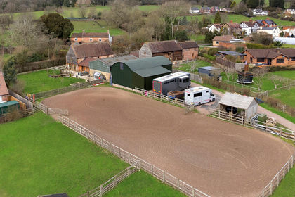
- Price
- Guide Price£1,250,000
- Size
- 10 acres
Blaisdon, Equestrian Property Sought After Village, Blaisdon, Gloucestershire GL17 England
Added on 25/05/2026Barn Conversion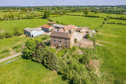
- Price
- Guide Price£1,250,000
- Size
- 37.39 acres
Added on 11/09/2026Agricultural Land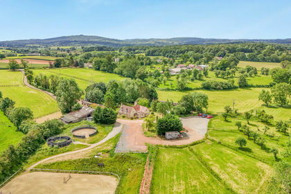
- Price
- Guide Price£1,200,000
- Size
- 17.5 acres
Hillend Green, Newent, Equestrian, Dymock, Gloucestershire GL18 England
Added on 22/06/2026Equestrian property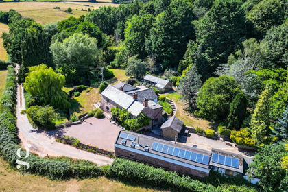
- Price
- Guide Price£1,190,000
- Size
- 2.5 acres
Whitchurch, Whitchurch, Herefordshire, County of HR9 England
Added on 13/02/2026Mill Conversion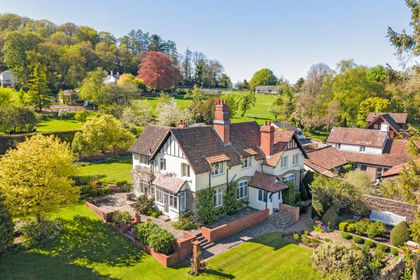
- Price
- Guide Price£1,625,000
- Size
- 2.98 acres
The Hermitage, Staunton, GL16, Staunton Coleford, Gloucestershire GL16 England
Added on 25/05/2026House with Land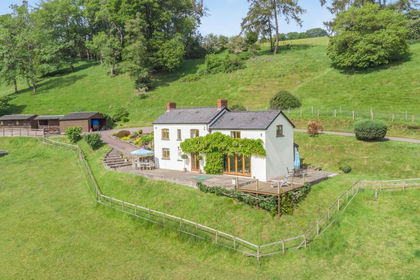
- Price
- Guide Price£1,300,000
- Size
- 10.4 acres
Ganarew, Monmouth, Ganarew, Herefordshire, County of NP25 England
Added on 10/06/2026Equestrian property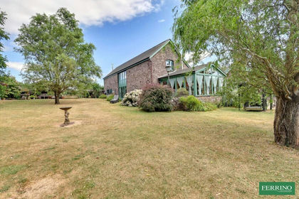
- Price
- £1,700,000
- Size
- 20 acres
Added on 17/09/2026Barn Conversion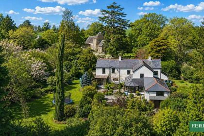
- Price
- £1,250,000
- Size
- 2 acres
Added on 25/05/2026Country Home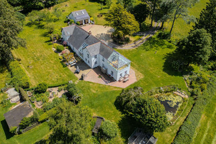
- Price
- Guide Price£1,250,000
- Size
- 5 acres
Monmouth Road, Monmouth, NP25, Trellech United, Monmouthshire NP25 Wales
Added on 17/07/2026Country Home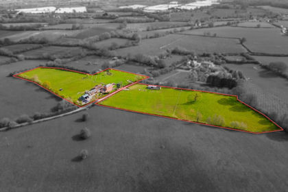
- Price
- £1,500,000
- Size
- 8 acres
Aylton, Ledbury, Herefordshire, Aylton, Herefordshire, County of HR8 England
Added on 31/08/2026House with Land