Closing date for offers: Friday 27 November 2026
Robins Lane, Poulton-le-Fylde, FY6
- Land size
- 2.49 acres
- Bedrooms
- 4
Key Features
- For Sale by Informal Tender Closing date Friday 27th November 2026
- 2.49 acres of land
- 4 bedroom detached Bungalow
- Detached Garage
- Paddock area
Description
For Sale by Informal Tender closing date Friday 27th November 2026.
The property which extends to 2.49 acres in total, offers itself as an excellent opportunity for someone seeking either a private detached residence with a range of useful outbuildings and land for private use or alternatively, subject to necessary planning consent being obtained, for potential redevelopment. The site is currently designated “Green Belt” and sits sandwiched amid an urban and agricultural environment with prime vehicular access directly off the busy “Faraday Way” Carleton which serves a multitude of nearby both residential and commercial business properties: the property also benefits from a second vehicular access onto the quieter “Robins Lane” which is also a designated Public Footpath and Bridleway.
DESCRIPTION
For Sale by Informal Tender closing date of Friday 27th November 2026.
The property which extends to 2.49 acres in total, offers itself as an excellent opportunity for someone seeking either a private detached residence with a range of useful outbuildings and land for private use or alternatively, subject to necessary planning consent being obtained, for potential redevelopment. The site is currently designated “Green Belt” and sits sandwiched amid an urban and agricultural environment with prime vehicular access directly off the busy “Faraday Way” Carleton which serves a multitude of nearby both residential and commercial business properties: the property also benefits from a second vehicular access onto the quieter “Robins Lane” which is also a designated Public Footpath and Bridleway.
BUNGALOW ACCOMMODATION COMPRISING:
Ground Floor
Entrance Conservatory
7'2 x 6'11 (2.18m x 2.11m) Double glazed, quarry tiled floor, wall light, radiator.
Utility Room
8'11 x 6'4 (2.72m x 1.93m) Stainless steel sink unit, wall mounted “Alpha” gas boiler providing central heating and hot water, tiled flooring, electric consumer unit, centre light.
Kitchen
Range of fitted cupboards and units incorporating stainless steel sink unit, built in double oven, ceramic hob with extractor hood, appliance recesses and worksurfaces with tiled splashbacks. Walk-in pantry cupboard, tiled flooring, 2 x centre lights.
Inner Hall
Open dog leg staircase, quarry tiled floor, centre light, radiator.
L - Shaped Lounge Diner
Lounge Area
15'1 x 10'9 (4.60m x 3.28m) Feature brick-built fireplace housing multi-fuel stove, quarry tiled floor, 2 x centre lights.
Dining Area
7'10 x 7'9 (2.39m x 2.36m) Serving hatch from Kitchen, quarry tiled floor, centre light, radiator.
Open Front Porch
5'1 x 4'9 (1.55m x 1.45m)
Bedroom 1
12'2 x 11'11 (3.71m x 3.63m) Dual aspect windows, centre light, wall lights, radiator.
Bedroom 2
12'2 x 12' (3.71m x 3.66m) Range of fitted bedroom units, centre light, radiator.
Bedroom 3
11'9 x 7'11 max (3.58m x 2.41m) Built in wardrobes, centre light, wall light, radiator.
Bathroom
9'8 x 6' (2.95m x 1.83m) 3 piece corner bath suite and shower cubicle. Fully tiled walls, vanity mirror recess with light, electric shaver point, tiled flooring, centre light, radiator.
Landing
8'2 x 3'9 max (2.49m x 1.14m) Built in storage cupboard, centre light, radiator.
Dormer Bedroom 4
16’ x 8’14 max (4.88 x 2.72) Under eaves storage area, centre light, radiator.
OUTSIDE
The property enjoys a gated wide vehicular access off Faraday Way on the Westerly side and a second gated vehicular access off Robins Lane (which is also a Public Footpath and Bridleway) on the Easterly side.
The property grounds extend to Circa 2.49 Acres in total incorporating garden grounds, principally 3 paddock areas and sundry buildings:
Viz
Block built/felt roof Detached Garage 18'4 x 18'3 external measurements (5.59m x 5.56m) with roller shutter door and light and power installed.
Mainly brick built/corrugated roof range of Poultry Buildings/Old Stables/Loose Boxes and Garaging 16'6m x 10'3m overall external measurements (5.03m x 3.12m) with light, power and water connected.
Open fronted Timber Framed Implement Shed 30'3 x 18'8 (9.22m x 5.69m).
Part brick/part corrugated old Detached Garage 19' x 11' (5.79m x 3.35m) external measurements.
The paddock area in the centre of the site previously had Poultry Buildings but these were cleared and the site was operated for 30 years as a CCCL (Caravan Club Certified Location) site with electric hook-up points.
The paddock area to the South of the site is currently used for agricultural and equine purposes.
The paddock area to the North of the site has recently been cleared but was also historically the site of Poultry Buildings.
Services
Mains water, electricity and gas connected.
Drainage currently connected to a private septic tank however mains drainage is available subject to application by the purchaser.
Agents
Richard Turner & Son, Royal Oak Chambers, Main Street, High Bentham, Nr Lancaster, LA2 7HF. Tel: .
Through whom all offers and negotiations should be conducted.
N.B. Any electric or other appliances included have not been tested, neither have drains, heating, plumbing or electrical installations and all persons are recommended to carry out their own investigations before contract. All measurements quoted are approximate.
Please Note: In order for selling agents to comply with HM Revenue and Customs (HMRC) Anti-Money Laundering regulations we are now obliged to ask all purchasers to complete an Identification Verification Questionnaire form which will include provision of prescribed information (identity documentation etc.) and a search via Experian to verify information provided however please note the Experian search will NOT involve a credit search.
Map Location
Property details
- Tenure
- Freehold
- Council Tax Band
- D
- Date Posted
- 2026-10-20
Market Value Analysis
Compared with 732 Homes with Land listings in North West England (1+ acres).
Energy Performance Certificate
Energy Efficiency Rating
Based on UK Energy Performance Certificate standards (EU Directive 2002/91/EC)
Running costs are one side. Planning activity, flood history and ground risks for this location are in the full report.
Utilities & Restrictions
Utilities
- Electricity
- Mains
- Water
- Mains
- Heating
- Gas Central Heating
- Broadband
- Ask Agent
- Sewerage
- Septic Tank / Private
Rights & Restrictions
- Public Rights of Way
- Ask Agent
- Private Rights of Way
- Ask Agent
- Listed Property
- Ask Agent
- Restrictions
- Ask Agent
Listed status, conservation areas and planning constraints for this location are in the full report.
Property Features
- Accessibility
- Ask Agent
- Parking
- Parking Available
- Garden
- Garden
Beyond the particulars: planning activity, flood history, heritage and ground risks, checked for this exact spot.
Connectivity
Broadband
Fastest speed available at this postcode
10 Gbps
Gigabit full fibre · available to 94% of premises
Suitable for
- 4K streaming on every screen
- Full-time home working
- Online gaming & big downloads
Mobile signal
Predicted 4G and 5G signal; indoor signal depends on building materials.
Ofcom Connected Nations postcode-level predictions. Speeds and signal are modelled, not measured, and vary between addresses and providers.
Signal is the easy part. Planning activity, flood history and protected designations here are in the full report.
Nearest Schools
Primary
- Carleton St Hilda's Church of England Primary School859 metresNo Ofsted rating
- Ages
- 5 to 11
- Pupils
- 212
- Type
- Voluntary aided school
- Faith
- Church of England
- Moor Park Primary School915 metresNo Ofsted rating
- Ages
- 3 to 11
- Pupils
- 329
- Type
- Academy converter
- Kincraig Primary School0.6 milesNo Ofsted rating
- Ages
- 2 to 11
- Pupils
- 235
- Type
- Community school
- Carleton Green Community Primary School0.8 milesOfsted: Good
- Ages
- 2 to 11
- Pupils
- 333
- Type
- Community school
- Bispham Endowed Church of England Primary School0.9 milesOfsted report card · Jan 2026
- Ages
- 3 to 11
- Pupils
- 322
- Type
- Voluntary controlled school
- Faith
- Church of England
Secondary
- Blackpool Aspire Academy0.8 milesOfsted: Requires improvement
- Ages
- 11 to 16
- Pupils
- 799
- Type
- Academy sponsor led
- Montgomery Academy1 mileOfsted: Good
- Ages
- 11 to 16
- Pupils
- 1,192
- Type
- Academy converter
- Unity Academy Blackpool1.2 milesOfsted: Inadequate *
- Ages
- 2 to 16
- Pupils
- 877
- Type
- Academy sponsor led
- Baines School1.3 milesOfsted report card · Mar 2026
- Ages
- 11 to 16
- Pupils
- 726
- Type
- Voluntary aided school
- Millfield School1.4 milesOfsted: Good
- Ages
- 11 to 16
- Pupils
- 877
- Type
- Community school
* Latest graded judgement covers quality of education only; no overall grade was issued under the 2024-25 inspection framework.
Distances are straight-line from the advertised location. Source: the national school registers (DfE, Welsh Government, Scottish Government) and Ofsted.
Schools are just the start: sold prices nearby, planning activity and any flood history are in the full report.
Amenities
Supermarket
GP surgery
Pharmacy
Hospital
Green space
Straight-line distances from the advertised location. Sources: NHS records, Geolytix supermarket locations, OS Open Greenspace and the national trails registers.
The area stacks up? Now check the location itself: planning nearby, protected designations and past flooding.
Getting Around
Nearest station
Nearest bus stop
Typical drive times
Straight-line distances from the advertised location; drive times are typical free-flow times over OpenStreetMap road data, so allow more at peak. Public transport locations from DfT NaPTAN.
Easy to reach matters. So do planning activity, flood history and ground risks: all in the full report.
Flood Risk
Environment Agency open data, checked around the advertised map pin for the listed acreage. Long-term risk counts flood defences; the planning map's flood zones do not. Provided by LandSale, not the listing agent, and not part of the agent's particulars. Risk varies across a holding, so verify before committing.
Rivers and the sea
Planning map: Flood Zone 1.
Surface water
Not at the pin: mapped about 30 metres away.
These bandings are the summary. Where this location sits on the flood maps, plus planning activity, heritage and ground risks, is in the full report.
Important notice: Information, maps and tags on this page are drawn from the advertising agent's marketing materials or generated automatically. LandSale has not verified them. Relying on these details is at your own risk, always carry out independent checks before committing to a purchase.
LandSale full disclaimer
Marketing information only - not formal particulars. The details on this website are provided for general guidance and do not constitute an offer or contract. Neither LandSale nor the advertising estate/land agent accepts responsibility for any inaccuracy.
1. Source of information
- Listing content: Core description, asking price, tenure, measurements, photographs and planning history originate from the marketing materials of the advertising estate or land agent. LandSale does not author this content and cannot guarantee its accuracy.
- Automated tags & categorisation: Property type, land-use class, acreage bands and similar labels may be applied by machine-learning models. They are intended as a helpful guide only and may not reflect the property's legal status or permitted use.
- Third-party & enriched data layers: Maps, boundary outlines, planning designations, soil reports, broadband coverage and other environmental or location-based insights are licensed from external suppliers. Such data are supplied “as is", may be incomplete or out of date and are subject to change without notice.
2. Verification required
Prospective purchasers must verify critical matters, including but not limited to planning permission, title boundaries, public rights of way, environmental constraints, acreage, services, access and VAT status, through their own inspections, specialist surveys, legal advisers and the selling agent before relying on the information or entering into any contract.
3. No warranty or liability
LandSale gives no warranty, express or implied, as to the accuracy, completeness or fitness for any particular purpose of the information displayed. LandSale shall not be liable for any loss, damage, cost or expense arising directly or indirectly from any use of or reliance on such information, save where liability may not be excluded by law.
4. Updates & feedback
If you believe any detail on this listing is inaccurate, please let us know. We will investigate and, where appropriate, update the listing or notify the agent.
© LandSale | Version 1.3 - August 2026
Listing agent
Richard Turner & Son, Bentham (Nr Lancaster),Royal Oak Chambers, Main Street, Bentham (Nr Lancaster), LA2 7HF
Contact Richard Turner & Son, Bentham (Nr Lancaster),
Royal Oak Chambers, Main Street, Bentham (Nr Lancaster), LA2 7HF
View agent profileSimilar properties for sale
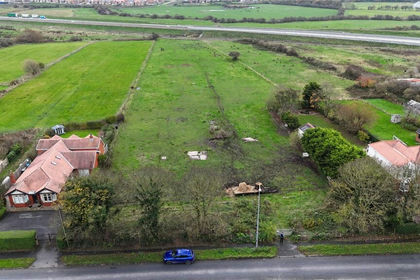
- Price
- Offers in Excess of£600,000
- Size
- 1.21 acres
Land Adjoining 179 Mains Lane, Poulton-Le-Fylde, Singleton, Lancashire FY6 England
Added on 11/03/2026Development Land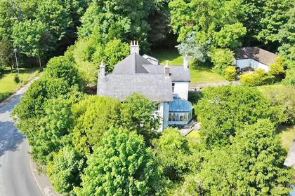
- Price
- Offers in Region of£900,000
- Size
- 1 acres
Lodge Lane, Singleton, Poulton-Le-Fylde, Singleton, Lancashire FY6 England
Added on 08/06/2026House with Land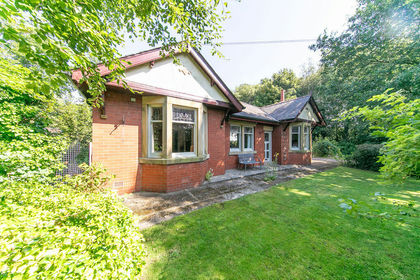
- Price
- £675,000
- Size
- 2.3 acres
'Daytona' Church Lane, Hambleton, Lancs FY6, Hambleton, Lancashire FY6 England
Added on 14/07/2026House with Land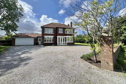
- Price
- £745,000
- Size
- 2 acres
Chapel Road, Blackpool, FY4, Westby-with-Plumptons, Lancashire FY4 England
Added on 24/10/2026House with Land
- Price
- Offers Over£600,000
- Size
- 1.2 acres
Jubilee Lane, Blackpool, FY4, Blackpool South, Blackpool FY4 England
Added on 28/08/2026House with Land
- Price
- £745,000
- Size
- 1 acres
Moss House Lane, Westby, PR4, Westby-with-Plumptons, Lancashire PR4 England
Added on 03/07/2026House with Land
- Price
- Offers Over£600,000
- Size
- 1.75 acres
Division Lane, Blackpool, FY4, Blackpool South, Blackpool FY4 England
Added on 28/06/2026House with Land
- Price
- £820,000
- Size
- 2 acres
"Appleton", Division Lane, Blackpool, FY4, Saint Anne's on the Sea, Lancashire FY4 England
Added on 12/02/2026House with LandLeasehold
- Price
- £735,000
- Size
- 1 acres
Dockinsall Lane, Out Rawcliffe, Preston, Out Rawcliffe, Lancashire PR3 England
Added on 03/09/2026Cottage
- Price
- Offers Over£850,000
- Size
- 2.95 acres
Little Tongues Lane, Preesall, FY6, Preesall, Lancashire FY6 England
Added on 11/09/2026House with Land