
Widecombe-In-The-Moor, Dartmoor National Park, Devon, UK
- Land size
- 41.58 acres
- Bedrooms
- 7
- Bathrooms
- 5
Key Features
- 19th-century granite country house within Dartmoor National Park
- Around 41.58 acres of gardens, woodland and deer park, with no public rights of way
- A further 12.64 acres available by separate negotiation
- Seven bedrooms across the main house and self-contained wing
- Four reception rooms and a kitchen and breakfast room with a triple AGA
- Two cottages each with two bedrooms
- East Webburn River and two large ponds within the grounds
- Woodland first planted in the 1860s and a deer park with fallow and red deer
- Oak-framed double garage and gym, agricultural barn, workshops and stores
- About a mile from Widecombe-in-the-Moor, with open moorland on the doorstep
Description
Introduction
Bagpark is a 19th-century country estate within Dartmoor National Park, set in the valley of the East Webburn River, about a mile from Widecombe-in-the-Moor. Once known as Widecombe Manor, the house has been restored and is built from local granite and slate, with leaded casement windows. A long private drive winds through mature parkland to reach the house.
The estate extends to around 41.58 acres of gardens, woodland and deer park, with no public rights of way across it. Alongside the main house, there is a self-contained wing, two separate cottages and a good range of outbuildings. A further 12.64 acres is available by separate negotiation, meaning Bagpark can be purchased as a whole or in two lots.
Location
Widecombe-in-the-Moor is about a mile away. The village has a shop, two pubs and a lovely café. Its church, St Pancras, is known as the Cathedral of the Moor. Open moorland is within easy walking distance, with Chinkwell Tor and Honeybag Tor close by.
Ashburton, with restaurants including Emilia’s Italian, and Bovey Tracey are both about seven miles away. The A38 provides quick access to Exeter and Plymouth. Mainline trains from Newton Abbot, Totnes and Exeter run direct to London Paddington, with journeys from around two hours.
Seller Story
“Bagpark has been such a big part of our lives for the past nineteen years. It’s where our children have grown up, where we’ve shared countless occasions with family and friends, and where we’ve enjoyed having the countryside right on our doorstep. Above all, we’ve valued the extraordinary peace and privacy. There are no public rights of way across the estate, and we can walk the dogs for half a mile without leaving our own land. From the house, we can also walk over three tors and down into Widecombe for lunch at one of the two pubs or the village café.
Bagpark has always been a house for family and friends. There’s room for four other couples to stay alongside our children and their partners, and we’ve hosted three of our children’s weddings in the grounds, with marquees, bands and fireworks to finish the evening. Our grandchildren play games in the orchard and climb the trees. In summer, we have lunch on the patio; in the panelled dining room, we’ve held candlelit dinners, once seating thirty around our table. In winter, the hall is the place to be, drink in hand, with the wood burner going.
The wildlife has been a constant pleasure. Buzzards circle overhead, mewing as they go, and land on their own table down by the pond. Every year, summer migrants arrive to breed here, including cuckoos, chiffchaffs, blackcaps, swallows and house martins. Otters and kingfishers visit, while geese with their goslings and ducks with their ducklings make use of the ponds. On dark nights, we can hear owls and foxes calling. We fish for sea trout, brown trout and the occasional salmon in the ponds and river. With no light pollution, the night sky from the courtyard is full of stars, and the Milky Way is clearly visible overhead.
Spring is particularly special. We walk through millions of bluebells and thousands of foxgloves, beneath dozens of magnificent trees, all well over a hundred years old and all of them ours. It’s a real privilege. The trees are stunning. We’ve had gardeners who have worked at Kew, and tree surgeons who simply stand and gawp at some of the specimens. One of the Western Hemlocks is 40 metres tall. We are, after all, in the middle of a temperate rainforest, so they should do well.
The land is productive, too. The soil is very fertile and, with the help of the greenhouse, we grow plenty of fruit, vegetables and flowers every summer. Our chickens live in a fox-proof pen and lay so many organic eggs that we give away dozens. We’ve bred deer and alpacas here, watching their young gambolling in the fields, and we produce our own venison steaks, sausages, burgers and mince.
There’s a practical side to Bagpark as well, with two double garages, two well-equipped tool rooms, a large barn for storage and a well-heated gym.
We will miss Bagpark dearly. Nineteen years is a long time, and over those years it has become so much more than a house to us. It has been the backdrop to our family life, a place where our children have grown up, our grandchildren have played and some of our happiest memories have been made. We have been incredibly lucky to call Bagpark home, and it will be very hard to leave somewhere that has given us so much. But homes like this are meant to be lived in and loved. We hope the next owners find the same happiness, freedom and sense of belonging here, and make memories of their own for many years to come.”
Accommodation
The Ground Floor
The reception hall leads to the drawing room and panelled dining room, both overlooking the gardens and ponds. The kitchen and breakfast room centres on a triple AGA and a large island, with doors opening onto the terrace. There is also a TV and cinema room with a raised wood burner, a library, a study, a utility room and stores.
The Wing
A glazed hall at the rear leads to a self-contained wing with a second kitchen, two bedrooms and two shower rooms. It works well for guests, family or staff.
The First Floor
A large landing, which also serves as a family room, leads to five double bedrooms. The principal suite has an en suite bathroom, a dressing room and views over the estate. There is also a guest suite with its own en suite bathroom, three further bedrooms and a family bathroom.
The Cottages
Two cottages sit close to the main drive. Each has an entrance hall, kitchen, sitting and dining room, two bedrooms and a shower room.
Outbuildings
The agricultural barn provides machinery and feed storage, a cold room, and garaging with workshop space. An oak-framed building houses a double garage and gym, with further stores also available.
Gardens & Grounds
The East Webburn River runs through the valley, bordered by wooded banks and accompanied by two large ponds. Sea trout, brown trout and the occasional salmon are found in the river and ponds. The estate is home to three species of wild deer, along with buzzards, owls, foxes, otters and kingfishers.
The woodland dates from the 1860s and contains more than a thousand mature trees, including a Western Hemlock around 40 metres tall, Western Red Cedars, Copper Beeches and Douglas Firs. Hundreds of thousands of bluebells appear each spring. Created in 1995, the deer park is home to herds of fallow and red deer. A stretch of woodland known as the Judge and Jury Plantation is believed to have been a medieval meeting place.
Closer to the house, there is an orchard of apple, plum and damson trees, a kitchen garden with raised beds, a greenhouse that came from the Hampton Court Flower Show, and a chicken run with water and electricity.
Lot 2 comprises a further 12.64 acres and is available by separate negotiation.
Useful Information
Tenure: Freehold
Local Authority: Dartmoor National Park Authority & Teignbridge District Council
Council Tax Band: Bagpark H, Cottages C
EPC Rating: F
Services: Mains electricity. Private drainage. Private water supply from a borehole. Fibre broadband (750 Mbps in the main house, 350 Mbps in the courtyard).
Land: Lot 1 approximately 41.58 acres. Lot 2 approximately 12.64 acres, available separately.
Distances: Widecombe-in-the-Moor 1 mile, Ashburton 7.2 miles, Bovey Tracey 7.3 miles, Newton Abbot 11.6 miles, Exeter 26 miles (all distances approximate).
Mobile Signal: Variable outside according to OFCOM mobile phone checker - EE 81%, Vodafone 79%, O2 69%, Three 65%
Internet: Ultrafast Broadband with speeds up to 1800MBPS according to OFCOM Broadband Checker.
Long Term Flood Risk: Very Low Risk according to the government long term flood risk check service.
Viewing: Via Joint agents, By Design and Knight Frank
Anti-Money Laundering Regulations: By Design is supervised by HMRC for compliance with the Anti-Money Laundering Regulations. All buyers will be required to complete digital identification checks at a cost of £25 including VAT per person. Proof of funds and source of funds checks will also be required once an offer has been received.
Disclaimer: These particulars are intended as a guide only and must not be relied upon as statements or representations of fact. Prospective buyers should satisfy themselves by inspection, survey, or otherwise regarding the accuracy of any statements or measurements contained herein. The agent has not tested any services, equipment, fixtures, fittings, or appliances, and therefore cannot verify their working order or condition. Any reference to alterations, land usage, planning permissions, or consents should be independently verified by the purchaser with the relevant authorities. Neither the vendor nor the agent accepts any responsibility for errors, omissions, or misstatements in these particulars. All measurements, acreage, and boundaries are approximate and should be independently confirmed by the purchaser's solicitor or surveyor. The photographs and descriptions provided are intended to offer a general impression of the property and may include features not specifically included in the sale.
Map Location
Property details
- Tenure
- Freehold
- Council Tax Band
- H
- Date Posted
- 2026-10-20
Market Value Analysis
Compared with 62 Homes with Land listings in South West England (25+ acres).
Energy Performance Certificate
Energy Efficiency Rating
Based on UK Energy Performance Certificate standards (EU Directive 2002/91/EC)
Running costs are one side. Planning activity, flood history and ground risks for this location are in the full report.
Utilities & Restrictions
Utilities
- Electricity
- Mains
- Water
- Private Borehole
- Heating
- Oil Heating
- Broadband
- Full Fibre (FTTP)
- Sewerage
- Ask Agent
Rights & Restrictions
- Public Rights of Way
- Ask Agent
- Private Rights of Way
- Ask Agent
- Listed Property
- Ask Agent
- Restrictions
- Ask Agent
Listed status, conservation areas and planning constraints for this location are in the full report.
Property Features
- Accessibility
- Ask Agent
- Parking
- Garage
- Garden
- Private Garden
Beyond the particulars: planning activity, flood history, heritage and ground risks, checked for this exact spot.
Connectivity
Broadband
Fastest speed available at this postcode
1.8 Gbps
Gigabit full fibre · available to 81% of premises
Suitable for
- 4K streaming on every screen
- Full-time home working
- Online gaming & big downloads
Fixed wireless access may also be an option here.
Mobile signal
Predicted 4G and 5G signal; indoor signal depends on building materials.
Ofcom Connected Nations postcode-level predictions. Speeds and signal are modelled, not measured, and vary between addresses and providers.
Signal is the easy part. Planning activity, flood history and protected designations here are in the full report.
Nearest Schools
Primary
- Widecombe-in-the-Moor Primary1 mileNo Ofsted rating
- Ages
- 4 to 11
- Pupils
- 93
- Type
- Academy converter
- Ilsington Church of England Primary School4.2 milesNo Ofsted rating
- Ages
- 2 to 11
- Pupils
- 95
- Type
- Academy converter
- Faith
- Church of England
- Moretonhampstead Primary School5.3 milesNo Ofsted rating
- Ages
- 2 to 11
- Pupils
- 116
- Type
- Academy converter
- Ashburton Primary School5.8 milesOfsted: Good
- Ages
- 4 to 11
- Pupils
- 161
- Type
- Academy converter
- Bovey Tracey Academy5.8 milesOfsted: Requires improvement
- Ages
- 4 to 11
- Pupils
- 245
- Type
- Academy sponsor led
Secondary
- South Dartmoor Community College5.3 milesOfsted: Good *
- Ages
- 11 to 18
- Pupils
- 801
- Type
- Academy converter
- Coombeshead Academy9.1 milesOfsted: Good
- Ages
- 11 to 18
- Pupils
- 870
- Type
- Academy converter
- Newton Abbot College9.4 milesOfsted: Good *
- Ages
- 11 to 18
- Pupils
- 1,108
- Type
- Academy converter
- Teign School9.4 milesOfsted: Good
- Ages
- 11 to 18
- Pupils
- 1,111
- Type
- Academy converter
- South Devon UTC9.7 milesOfsted report card · Feb 2026
- Ages
- 14 to 19
- Pupils
- 184
- Type
- University technical college
* Latest graded judgement covers quality of education only; no overall grade was issued under the 2024-25 inspection framework.
Distances are straight-line from the advertised location. Source: the national school registers (DfE, Welsh Government, Scottish Government) and Ofsted.
Schools are just the start: sold prices nearby, planning activity and any flood history are in the full report.
Amenities
Supermarket
GP surgery
Pharmacy
Hospital
Straight-line distances from the advertised location. Sources: NHS records, Geolytix supermarket locations, OS Open Greenspace and the national trails registers.
The area stacks up? Now check the location itself: planning nearby, protected designations and past flooding.
Getting Around
Nearest station
Nearest bus stop
Typical drive times
Straight-line distances from the advertised location; drive times are typical free-flow times over OpenStreetMap road data, so allow more at peak. Public transport locations from DfT NaPTAN.
Easy to reach matters. So do planning activity, flood history and ground risks: all in the full report.
Flood Risk
Environment Agency open data, checked around the advertised map pin for the listed acreage. Long-term risk counts flood defences; the planning map's flood zones do not. Provided by LandSale, not the listing agent, and not part of the agent's particulars. Risk varies across a holding, so verify before committing.
Rivers and the sea
Not at the pin: mapped about 20 metres away.
Planning map: Flood Zone 3, about 30 metres away.
Surface water
Not at the pin: mapped about 110 metres away.
These bandings are the summary. Where this location sits on the flood maps, plus planning activity, heritage and ground risks, is in the full report.
Important notice: Information, maps and tags on this page are drawn from the advertising agent's marketing materials or generated automatically. LandSale has not verified them. Relying on these details is at your own risk, always carry out independent checks before committing to a purchase.
LandSale full disclaimer
Marketing information only - not formal particulars. The details on this website are provided for general guidance and do not constitute an offer or contract. Neither LandSale nor the advertising estate/land agent accepts responsibility for any inaccuracy.
1. Source of information
- Listing content: Core description, asking price, tenure, measurements, photographs and planning history originate from the marketing materials of the advertising estate or land agent. LandSale does not author this content and cannot guarantee its accuracy.
- Automated tags & categorisation: Property type, land-use class, acreage bands and similar labels may be applied by machine-learning models. They are intended as a helpful guide only and may not reflect the property's legal status or permitted use.
- Third-party & enriched data layers: Maps, boundary outlines, planning designations, soil reports, broadband coverage and other environmental or location-based insights are licensed from external suppliers. Such data are supplied “as is", may be incomplete or out of date and are subject to change without notice.
2. Verification required
Prospective purchasers must verify critical matters, including but not limited to planning permission, title boundaries, public rights of way, environmental constraints, acreage, services, access and VAT status, through their own inspections, specialist surveys, legal advisers and the selling agent before relying on the information or entering into any contract.
3. No warranty or liability
LandSale gives no warranty, express or implied, as to the accuracy, completeness or fitness for any particular purpose of the information displayed. LandSale shall not be liable for any loss, damage, cost or expense arising directly or indirectly from any use of or reliance on such information, save where liability may not be excluded by law.
4. Updates & feedback
If you believe any detail on this listing is inaccurate, please let us know. We will investigate and, where appropriate, update the listing or notify the agent.
© LandSale | Version 1.3 - August 2026
Contact By Design, covering Nationwide
12 Old Bond Street, Mayfair, London, W1S 4PW
View agent profileSimilar properties for sale
- Price
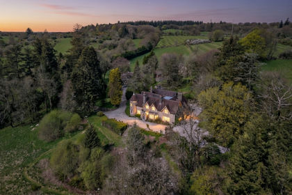
- Guide Price£4,500,000
- Size
- 9 acres
Dartmeet, Yelverton, Dartmoor National Park, Devon, , Devon PL20 England
Added on 24/07/2026Country Estate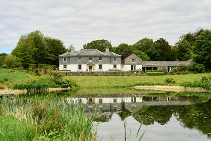
- Price
- £3,500,000
- Size
- 140 acres
Milton Abbot, Tavistock, Devon, Milton Abbot, Devon PL19 England
Added on 21/05/2026Farmhouse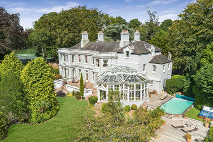
- Price
- Guide Price£3,250,000
- Size
- 5 acres
LOT 1 - Brixton House, The Paddock & Land at Venn Farm Phase 2B, Brixton, Devon PL8 England
Added on 25/09/2026Country Home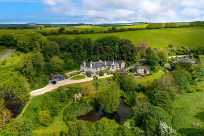
- Price
- Offers in Excess of£3,000,000
- Size
- 9 acres
Added on 04/06/2026Country Estate
- Price
- Offers in Excess of£3,000,000
- Size
- 9 acres
Added on 29/01/2026Country Home
- Price
- £3,500,000
- Size
- 30 acres
Toadpit Lane, West Hill, EX11, West Hill, Devon EX11 England
Added on 01/07/2026House with Land
- Price
- Guide Price£5,165,000
- Size
- 90.04 acres
Added on 10/09/2026Country Estate
- Price
- £2,950,000
- Size
- 22.1 acres
East Stoke, Somerset, Stoke sub Hamdon, Somerset TA14 England
Added on 04/07/2026Country Estate
- Price
- Guide Price£5,000,000
- Size
- 1.09 acres
A Cornish Icon in St Just in Roseland., St. Just-in-Roseland, Cornwall TR2 England
Added on 28/03/2026Historic House
- Price
- Guide Price£3,300,000
- Size
- 8 acres
Higher Waterston, Dorchester, Dorset, DT2, Athelhampton and Puddletown, Dorset DT2 England
Added on 16/04/2026House with Land