Tile Sheds, Gallowhill, Northumberland
- Land size
- 42.84 acres
Key Features
- Imposing three bedroom stone built farmhouse with pleasant surrounding gardens
- Traditional buildings and former workshop offering scope for residential conversation (subject to planning)
- Extensive steading with modern livestock and general purpose buildings
- Approximately 42 acres of permanent grassland surrounding the farm steading
Description
GENERAL INFORMATION
Tile Sheds Farm is an excellent example of a productive Northumbrian livestock holding and is situated in a desirable area of mid Northumberland close to the popular villages of Whalton and Belsay. The farm has historically supported a substantial sheep and beef finishing enterprise for the vendors making the most of the productive grassland and extensive buildings the holding has to offer.
Tile Sheds was purchased by the Vendors with the family having historically rented the farm. Following purchase, the vendors embarked on a programme of improvement on the holding with the construction of an extensive range of buildings . As a result the holding boasts substantial appeal in a most sought-after rural location.
Tile Sheds is located in a quiet rural location but is also readily accessible with the popular market town of Morpeth only 9 miles away and Newcastle upon Tyne only 17 miles away.
Description
The holding lies to the North side of the minor Meldon to Belsay road with the the holding extending to approximately 42 acres including Tile Sheds Farmhouse and an extensive range of modern and traditional buildings. The land lies at around 120 metres above sea level with good sized productive grassland fields.
Tile Sheds Farmhouse is the principal dwelling and lies in a pleasant situation just adjacent the steading with it’s own access and separate parking surrounded by lawned gardens.
The holding presents an opportunity to acquire a small livestock farm in a desirable location with a pleasant traditional stone built farmhouse and an extensive range of agricultural buildings which would lend themselves to a wide range of other diversified uses subject to planning.
Tile Sheds Farmhouse
The principal dwelling for the holding, Tile Sheds Farmhouse has more recently been operated as a successful holiday let. The stone under tile built farmhouse is surrounded by a private and enclosed garden. The property extends to kitchen / dining room with AGA cooker with functional utility at the rear entrance; large reception room with woodburning stove; 3 bedrooms and a family bathroom. Oil fired heating and partial double glazing.
Adjacent to the farmhouse is a traditional stone building that could offer potential for development for conversion to holiday let or residential use subject to planning. EPC Rating: E. Council Tax Band: D.
Land
The land at Tile Sheds Farm is productive grassland split into five principal parcels surrounding the farm steading with a small parcel of woodland to the Eastern boundary. In all the farm extends to 17.34 hectares (42.84 acres) or thereabouts, currently consisting of permanent pasture grazing land capable of producing silage and/ or hay crops. Some of the land has been ploughed and entered into arable rotations historically.
The land lies facing north gently sloping to a tributary stream of the River Wansbeck. The fields are good sized, regularly shaped parcels, well suited for modern farming operations. The
steading sits conveniently an the heart of the farm at 120m above sea level. Boundaries are well maintained and stock proof being a mixture of hedgerows and post and sheep net fencing.
The farm is classified by the Rural Payments Agency as Non Severely Disadvantaged. Agricultural Land Classification map Northeast Region (ALC001) shows the land being predominantly
classified as Grade 3. Formal land classifications aside, it is clear on inspection that both the grassland and farm in general is in good heart having been farmed to a high standard by the vendor.
Farm Buildings
The farm is serviced by an extensive range of modern and traditional farm buildings. Adjacent to Tile Sheds Farmhouse there is a useful traditional stone under slate building that could lend itself to potential conversion subject to obtaining the necessary planning consents.
The modern farm steading that lies to the north of the main road currently supports the sheep and beef finishing enterprises; it would lend itself to a wide range of other farming and alternative uses. The buildings extend to workshop, 50t corn bin, five principal livestock buildings with lean to structures, hay shed and newly constructed open fronted general purpose building and muck store. The covered area extends to approximately 2,800 square meters (33,150 square feet).
GENERAL REMARKS
Environmental Schemes
Tile Sheds Farm is not currently entered into a Countryside Stewardship agreement but the holding is ideally placed to do so. The vendor has entered the land into the current Sustainable Farming Incentive (SFI) Scheme options and also has an agreement for a programme of fencing and hedgerow planting in place. Further details of scheme options are available from the agents on request.
Timber and Sporting Rights (including Fishing Rights)
All standing and fallen timber will be included within the sale and the sporting rights are in
hand.
Plans, Areas and Schedules
These are based on the areas provided by the Rural Land Registry and Ordnance Survey and are for reference only. Although they have been carefully checked, the purchaser shall be deemed to have satisfied themselves as to the description of the property and any errors shall not annul the sale nor entitle either party to compensation in respect thereof.
Wayleaves, Easements and Rights of Way
The property is sold subject to and with the benefits of all rights of way whether public or private, water, light, drain, sewage, support and easements and other restrictive covenants and existing and proposed wayleaves for masts, pylons, cables, drains, water, gas and other pipes whether mentioned in these particulars or not. Note: There are no public rights of way on the property.
Method of Sale
The land is being offered for sale as a whole and by private treaty. The selling agent reserves the right to conclude the sale by any means.
Services
Tile Sheds farmhouse is serviced by mains water supply and septic tank. The farm buildings and land are serviced by a private spring water supply. Mains electricity to the farmhouse and the farm buildings.
General Binding Regulations (GBR) 2020
It is understood the outflow from the farmhouses septic tanksdischarge to soakaways. However, the Vendor does not give any undertaking that the property fully satisfies the GBR 2020 and any expressions of interest or offers made should take this into consideration.
Viewings
Strictly by prior appointment with the sole selling agents;
Richard Brown & Partners
The Office
South Bellshill
Belford
NE70 7HP
Tel:
Anti Money Laundering Regulations (AML)
Please note that under the 2017 AML regulations the selling agents are legally required to carry out money laundering checks against purchasers.
Health & Safety
Please be aware of the potential hazards of a working farm (especially livestock) and be as vigilant and careful as possible when making an inspection of the property.
What3Words
///bookings.diner.winded
Map Location
Property details
- Tenure
- Ask Agent
- Council Tax Band
- Ask Agent
- Date Posted
- 2026-10-14
Market Value Analysis
Compared with 16 Farms & Smallholdings listings in North East England (25+ acres).
Utilities & Restrictions
Utilities
- Electricity
- Ask Agent
- Water
- Ask Agent
- Heating
- Ask Agent
- Broadband
- Ask Agent
- Sewerage
- Ask Agent
Rights & Restrictions
- Public Rights of Way
- Ask Agent
- Private Rights of Way
- Ask Agent
- Listed Property
- Ask Agent
- Restrictions
- Ask Agent
Listed status, conservation areas and planning constraints for this location are in the full report.
Property Features
- Accessibility
- Ask Agent
- Parking
- Ask Agent
- Garden
- Ask Agent
Beyond the particulars: planning activity, flood history, heritage and ground risks, checked for this exact spot.
Connectivity
Broadband
Fastest speed available at this postcode
1.8 Gbps
Gigabit full fibre · available to 50% of premises
Suitable for
- 4K streaming on every screen
- Full-time home working
- Online gaming & big downloads
Mobile signal
Predicted 4G and 5G signal; indoor signal depends on building materials.
Ofcom Connected Nations postcode-level predictions. Speeds and signal are modelled, not measured, and vary between addresses and providers.
Signal is the easy part. Planning activity, flood history and protected designations here are in the full report.
Nearest Schools
Primary
- Whalton Church of England Aided Primary School1.9 milesOfsted: Good
- Ages
- 4 to 11
- Pupils
- 23
- Type
- Voluntary aided school
- Faith
- Church of England
- Belsay Primary School2.4 milesOfsted: Good
- Ages
- 4 to 11
- Pupils
- 84
- Type
- Academy converter
- Cambo First School5.3 milesOfsted: Good
- Ages
- 4 to 9
- Pupils
- 39
- Type
- Community school
- Morpeth All Saints Church of England First School5.8 milesOfsted report card · May 2026
- Ages
- 3 to 9
- Pupils
- 231
- Type
- Academy converter
- Faith
- Church of England
- Abbeyfields First School5.8 milesOfsted: Good *
- Ages
- 3 to 9
- Pupils
- 324
- Type
- Academy converter
Secondary
- Morpeth Newminster Middle School5.9 milesOfsted report card · Jan 2026
- Ages
- 9 to 13
- Pupils
- 521
- Type
- Academy converter
- Morpeth Chantry Middle School6 milesOfsted report card · Mar 2026
- Ages
- 9 to 13
- Pupils
- 525
- Type
- Academy converter
- The King Edward VI School6.3 milesOfsted: Good *
- Ages
- 13 to 18
- Pupils
- 1,426
- Type
- Academy converter
- Ponteland High School7.6 milesOfsted: Good
- Ages
- 11 to 18
- Pupils
- 1,536
- Type
- Academy converter
- St Benet Biscop Catholic Academy9.3 milesOfsted: Good
- Ages
- 11 to 18
- Pupils
- 994
- Type
- Academy converter
- Faith
- Roman Catholic
* Latest graded judgement covers quality of education only; no overall grade was issued under the 2024-25 inspection framework.
Distances are straight-line from the advertised location. Source: the national school registers (DfE, Welsh Government, Scottish Government) and Ofsted.
Schools are just the start: sold prices nearby, planning activity and any flood history are in the full report.
Amenities
Supermarket
GP surgery
Pharmacy
Hospital
Straight-line distances from the advertised location. Sources: NHS records, Geolytix supermarket locations, OS Open Greenspace and the national trails registers.
The area stacks up? Now check the location itself: planning nearby, protected designations and past flooding.
Getting Around
Nearest station
Nearest bus stop
Typical drive times
Straight-line distances from the advertised location; drive times are typical free-flow times over OpenStreetMap road data, so allow more at peak. Public transport locations from DfT NaPTAN.
Easy to reach matters. So do planning activity, flood history and ground risks: all in the full report.
Flood Risk
Environment Agency open data, checked around the advertised map pin for the listed acreage. Long-term risk counts flood defences; the planning map's flood zones do not. Provided by LandSale, not the listing agent, and not part of the agent's particulars. Risk varies across a holding, so verify before committing.
Rivers and the sea
Planning map: Flood Zone 1.
Surface water
Not at the pin: mapped about 130 metres away.
These bandings are the summary. Where this location sits on the flood maps, plus planning activity, heritage and ground risks, is in the full report.
Important notice: Information, maps and tags on this page are drawn from the advertising agent's marketing materials or generated automatically. LandSale has not verified them. Relying on these details is at your own risk, always carry out independent checks before committing to a purchase.
LandSale full disclaimer
Marketing information only - not formal particulars. The details on this website are provided for general guidance and do not constitute an offer or contract. Neither LandSale nor the advertising estate/land agent accepts responsibility for any inaccuracy.
1. Source of information
- Listing content: Core description, asking price, tenure, measurements, photographs and planning history originate from the marketing materials of the advertising estate or land agent. LandSale does not author this content and cannot guarantee its accuracy.
- Automated tags & categorisation: Property type, land-use class, acreage bands and similar labels may be applied by machine-learning models. They are intended as a helpful guide only and may not reflect the property's legal status or permitted use.
- Third-party & enriched data layers: Maps, boundary outlines, planning designations, soil reports, broadband coverage and other environmental or location-based insights are licensed from external suppliers. Such data are supplied “as is", may be incomplete or out of date and are subject to change without notice.
2. Verification required
Prospective purchasers must verify critical matters, including but not limited to planning permission, title boundaries, public rights of way, environmental constraints, acreage, services, access and VAT status, through their own inspections, specialist surveys, legal advisers and the selling agent before relying on the information or entering into any contract.
3. No warranty or liability
LandSale gives no warranty, express or implied, as to the accuracy, completeness or fitness for any particular purpose of the information displayed. LandSale shall not be liable for any loss, damage, cost or expense arising directly or indirectly from any use of or reliance on such information, save where liability may not be excluded by law.
4. Updates & feedback
If you believe any detail on this listing is inaccurate, please let us know. We will investigate and, where appropriate, update the listing or notify the agent.
© LandSale | Version 1.3 - August 2026
Listing agent
Richard Brown & Partners, Belford
The Office, South Bellshill, Bellshill, Belford, NE70 7HP
Contact Richard Brown & Partners, Belford
The Office, South Bellshill, Bellshill, Belford, NE70 7HP
View agent profileSimilar properties for sale
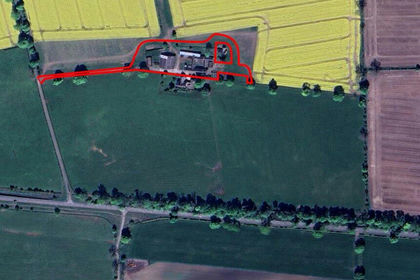
- Price
- From£900,000
South Clarewood Barns, Corbridge, Northumberland, NE45, Whittington, Northumberland NE45 England
Added on 11/03/2026Development Land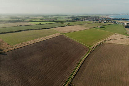
- Price
- Guide Price£995,000
- Size
- 104.36 acres
Land At Hartley East Farm, Whitley Bay, Tyne and Wear, NE26, Tynemouth, North Tyneside NE26 England
Added on 29/01/2026Arable Land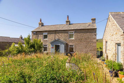
- Price
- Guide Price£725,000
- Size
- 10.5 acres
Sparty Lea, Hexham, NE47, Allendale, Northumberland NE47 England
Added on 01/10/2026Smallholding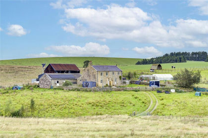
- Price
- £625,000
- Size
- 26.07 acres
High Tipalt Farm, Greenhead, Brampton, Northumberland, CA8, Greenhead, Northumberland CA8 England
Added on 22/09/2026Smallholding
- Price
- Offers Over£625,000
- Size
- 10 acres
Added on 18/09/2026Smallholding
- Price
- Offers in Excess of£950,000
- Size
- 18.35 acres
Hunwick, Crook, Durham, DL15, City of Durham, County Durham DL15 England
Added on 28/04/2026Smallholding
- Price
- £1,250,000
- Size
- 13.3 acres
Alston, Cumbria, Alston Moor, Westmorland and Furness CA9 England
Added on 21/03/2026Country Home
- Price
- Offers Over£795,000
- Size
- 1.58 acres
Old Wingate Farm, Trimdon Station, TS29, Wheatley Hill, County Durham TS29 England
Added on 02/07/2026Barn Conversion
- Price
- Guide Price£650,000
- Size
- 14.26 acres
Added on 29/01/2026Farm
- Price
- Guide Price£995,000
- Size
- 112.69 acres
Low Sorbies, Roadhead, Carlisle, Cumbria, Bewcastle, Cumberland CA6 England
Added on 20/07/2026Farm