High Tipalt Farm, Greenhead, Brampton, Northumberland, CA8
- Land size
- 26.07 acres
- Bedrooms
- 3
Key Features
- Three bedroom farmhouse
- Ideal Small Holding
- Off Grid and Sustainable
- Traditional agricultural buildings and/or Stables
- Diversification/Development Potential
- Existing environmental income, with scope to capitalize further
- Extending in all to circa 26.07 acres (10.55 hectares).
Description
High Tipalt represents a rare opportunity to acquire a characterful farmhouse with extensive land (approximately 26 acres), useful outbuildings and a sustainable off-grid energy system, all set within an exceptional National Park location. Combining privacy, practicality and breathtaking scenery, it offers the very best of rural Northumberland living.
DESCRIPTION
High Tipalt Farm is an idyllic Northumbrian small holding, which includes charming traditional Northumbrian farmhouse, nestled within approximately 26 acres of land and complimented by a range of useful agricultural buildings.
High Tipalt benefits from an outstanding elevated position within Northumberland National Park, ensuring that the surrounding, breathtaking open countryside is fully captured, and consequently there are uninterrupted panoramic views across one of the most spectacular landscapes in the North East. This unique smallholding presents a rare opportunity to enjoy a peaceful and self-sufficient rural lifestyle close to Hadrian's Wall.
Constructed of traditional stone and rich in character, the property combines period features with practical accommodation and benefits from a wind and solar powered off-grid energy system, making it particularly appealing to those seeking a more sustainable way of life.
The farmhouse is entered via a welcoming sitting room, a characterful space featuring flagstone flooring, exposed stone walls, substantial timber beams and an impressive inglenook fireplace with multi-fuel stove. Dual-aspect windows frame exceptional views across the surrounding countryside, while a dining area at one end creates an inviting space for everyday living and entertaining. From here, access is provided to both the dining room and kitchen, with stairs rising to the first floor.
The dining room offers a versatile second reception space, continuing the property's traditional character with exposed stonework and access to the front elevation. To the rear, the galley kitchen is fitted with a traditional Belfast sink and flagstone flooring, with space for a range cooker, fridge, freezer, washing machine and additional storage.
The first floor provides three attractive double bedrooms, each enjoying vaulted ceilings and far-reaching countryside views. Character features continue throughout, including exposed beams, stonework and traditional flooring. The principal bedroom benefits from an attractive period fireplace with a stone surround and timber mantel. A family bathroom serves the accommodation and comprises a bath with shower attachment, wash hand basin and WC.
Externally
Approached via a winding track through open countryside, High Tipalt enjoys an exceptional sense of privacy and tranquility. Double five-bar gates open onto a generous, graveled courtyard providing ample parking for numerous vehicles.
The property is well equipped for smallholding and agricultural use, with a range of useful outbuildings including animal shelters, storage sheds and a traditional stone stable building. Currently this building houses equipment associated with the wind turbine and backup generator, while also providing valuable storage space and informal animal housing. The nature of the building does, however, present opportunities for development, being a conversion into a holiday Let and/or an annex. Any such conversions would require the necessary consent.
In addition to the stables, there is a pole framed barn, with tin sheet sides and roof, which offers further opportunities for livestock housing, and/or general storage.
The surrounding land extends to approximately 26 acres and comprises productive grazing pasture and hay meadow, making the property ideally suited to smallholding, equestrian pursuits, livestock keeping or those seeking an idyllic country lifestyle.
The Tipalt burn, meanders its way along the northern boundary of the property, offering a sense of serene calm, with Hadrian’s Wall and open fell land providing a contrasting and dramatic backdrop; all of which add significantly to the abundance of amenity and wellbeing benefits this unique property benefits from.
Location
High Tipalt Farm lies in Northumberland National Park; it is within a mile of Hadrian’s Wall and located in an area famed for its unspoiled beauty and dark skies.
The property is ideally situated to enjoy many attractions and activities as well as the wonderful surrounding countryside of Cumbria and Northumberland. The village of Greenhead is circa 3.7 miles to the southwest of the property and offers a primary school, tearoom and hotel.
Haltwhistle (circa 4.3 miles to the southeast), is a popular and thriving town and offers an excellent range of amenities with supermarkets, a good selection of shops, primary schooling, professional services and a hospital. The beautiful surrounding area is Hadrian’s Wall country and the town itself is believed to be the center of Great Britain. More comprehensive services, including larger supermarkets, schooling, a larger hospital, a further range of shops and eateries are available in nearby Hexham (approx. 20 miles to the northeast).
The property, benefits from excellent transport links to regional centers. The Military Road (B6318) is close by and connects to the A69 at Greenhead. It also provides excellent access to the east of the county. The A69 is also accessible at Haltwhistle and provides good access to Newcastle Airport and City Centre, Carlisle and onward access to the M6 and A1.
Haltwhistle also has a railway station which provides regular links to both Newcastle and Carlisle, which in turn link to other main line services to major UK cities north and south.
What3Words: ///important.debater.cove
DIRECTIONS
Turn off the B6318 signposted Roman Army Museum and/or Wall Town Crags B6305. Follow this road for approximately 2 miles. The farm is located up a short private drive and is a left turn off the public road.
GENERAL REMARKS & STIPULATIONS
Services
The property benefits from private water and private electric. The electric is supplied via a wind turbine and solar panels, which is assisted by new battery storage system. In addition, there is a generator but rarely used and only ever in emergencies.
Council Tax
High Tipalt Farmhouse is Band D, payable to Northumberland County Council.
Energy Performance Certificate
High Tipalt Farmhouse has an E rating.
Sporting Rights and Mineral Rights
Included in the sale in so far as they are owned.
Tenure
Freehold with Vacant Possession on Completion.
Environmental Schemes
Part of the land is in a woodland creation grant, which essentially provides funding for capital works such as tree planting and fencing. The works have not begun, and as such are available for a buyer to take on, on the basis of the scheme being transferred. Alternatively, the agreement could be terminated.
The nature of the land at High Tipalt and the possibilities currently available via government and/or third-party funding suggest that further revenue can be generated from the land.
Method of Sale
The property is to be offered for sale as a whole by Private Treaty.
The Seller reserves the right to amalgamate, withdraw, or exclude any of the property shown at any time or to generally amend the particulars or order of sale.
Local Authority
Northumberland County Council. Any enquiries regarding planning or statutory matters should be directed to the Local Authority.
Designations
The Tipalt Burn is a Site of Special Scientific Interest (SSSI).
The property is located within Northumberland National Park.
Burdens
The property is sold subject to all rights including rights of way, whether public or private, rights of light, support, drainage, water and electricity supplies and other rights, obligations and easements, quasi easements and restrictive covenants and all existing and proposed wayleaves for masts, pylons, stays, cables, drains and water, gas and other pipes, whether or not constituted in the title deeds or referred to in these particulars.
The Purchasers will be held to have satisfied themselves as to the nature of such burdens.
Anti Money Laundering Regulations
Prospective Buyers should be aware that in the event that they are successful, they will be required to provide us with documents in relation to Money Laundering Regulations, one being photographic ID, i.e. driving license or passport and the other being a utility bill showing their address.
Viewings
Viewings should not be unaccompanied and are by prior appointment only. Arrangements can be made by contacting YoungsRPS, Hexham on or harry.
Particulars Prepared: September 2026
Map Location
Property details
- Tenure
- Freehold
- Council Tax Band
- TBC
- Date Posted
- 2026-09-22
Market Value Analysis
Compared with 17 Farms & Smallholdings listings in North East England (25+ acres).
Utilities & Restrictions
Utilities
- Electricity
- Ask Agent
- Water
- Ask Agent
- Heating
- Ask Agent
- Broadband
- Ask Agent
- Sewerage
- Ask Agent
Rights & Restrictions
- Public Rights of Way
- Ask Agent
- Private Rights of Way
- Ask Agent
- Listed Property
- Ask Agent
- Restrictions
- Ask Agent
Listed status, conservation areas and planning constraints for this location are in the full report.
Property Features
- Accessibility
- Ask Agent
- Parking
- Parking Available
- Garden
- Ask Agent
Beyond the particulars: planning activity, flood history, heritage and ground risks, checked for this exact spot.
Connectivity
Broadband
Fastest speed available at this postcode
23 Mbps
Standard (10-30 Mbps)
Suitable for
- Web & social
- Music streaming
- Standard video calls
Mobile signal
Predicted 4G and 5G signal; indoor signal depends on building materials.
Ofcom Connected Nations postcode-level predictions. Speeds and signal are modelled, not measured, and vary between addresses and providers.
Signal is the easy part. Planning activity, flood history and protected designations here are in the full report.
Nearest Schools
Primary
- Greenhead Church of England Nursery and Primary School1.4 milesNo Ofsted rating
- Ages
- 4 to 11
- Pupils
- 50
- Type
- Academy converter
- Faith
- Church of England
- Gilsland CofE Primary School2.6 milesOfsted: Good
- Ages
- 3 to 11
- Pupils
- 18
- Type
- Academy converter
- Faith
- Church of England
- Haltwhistle Primary Academy2.7 milesOfsted: Outstanding
- Ages
- 3 to 11
- Pupils
- 213
- Type
- Academy sponsor led
- Henshaw Church of England Primary School6 milesOfsted: Good
- Ages
- 4 to 11
- Pupils
- 86
- Type
- Academy converter
- Faith
- Church of England
- Lanercost CofE Primary School7.3 milesOfsted: Outstanding
- Ages
- 3 to 11
- Pupils
- 84
- Type
- Voluntary controlled school
- Faith
- Church of England
Secondary
- William Howard School9.8 milesNo Ofsted rating
- Ages
- 11 to 18
- Pupils
- 1,312
- Type
- Academy converter
- Haydon Bridge High School11 milesOfsted report card · Jan 2026
- Ages
- 11 to 18
- Pupils
- 392
- Type
- Foundation school
- Samuel King's School13 milesNo Ofsted rating
- Ages
- 11 to 16
- Pupils
- 113
- Type
- Foundation school
- Bellingham Middle School and Sports College15 milesOfsted: Good
- Ages
- 9 to 13
- Pupils
- 46
- Type
- Foundation school
- Queen Elizabeth High School16 milesOfsted: Good
- Ages
- 13 to 18
- Pupils
- 1,299
- Type
- Academy converter
Distances are straight-line from the advertised location. Source: the national school registers (DfE, Welsh Government, Scottish Government) and Ofsted.
Schools are just the start: sold prices nearby, planning activity and any flood history are in the full report.
Amenities
Supermarket
GP surgery
Pharmacy
Hospital
Green space
Walking trail
Straight-line distances from the advertised location. Sources: NHS records, Geolytix supermarket locations, OS Open Greenspace and the national trails registers.
The area stacks up? Now check the location itself: planning nearby, protected designations and past flooding.
Getting Around
Nearest station
Nearest bus stop
Typical drive times
Straight-line distances from the advertised location; drive times are typical free-flow times over OpenStreetMap road data, so allow more at peak. Public transport locations from DfT NaPTAN.
Easy to reach matters. So do planning activity, flood history and ground risks: all in the full report.
Flood Risk
From Environment Agency flood map open data, checked around the advertised map pin and allowing for the listed acreage where known. This summary comes from LandSale, the advertising platform, not from the listing agent, and is not part of the agent's particulars. Risk can vary across a single holding, so verify anything critical through your own searches before committing.
Rivers and the sea
Surface water
Also mapped within the area searched, about 180 metres around the pin: a 1 in 30 or greater chance each year from about 110 metres and a 1 in 100 to 1 in 1000 chance each year from about 100 metres.
Higher risk nearbyThese bandings are the summary. Where this location sits on the flood maps, plus planning activity, heritage and ground risks, is in the full report.
Important notice: Information, maps and tags on this page are drawn from the advertising agent's marketing materials or generated automatically. LandSale has not verified them. Relying on these details is at your own risk, always carry out independent checks before committing to a purchase.
LandSale full disclaimer
Marketing information only - not formal particulars. The details on this website are provided for general guidance and do not constitute an offer or contract. Neither LandSale nor the advertising estate/land agent accepts responsibility for any inaccuracy.
1. Source of information
- Listing content: Core description, asking price, tenure, measurements, photographs and planning history originate from the marketing materials of the advertising estate or land agent. LandSale does not author this content and cannot guarantee its accuracy.
- Automated tags & categorisation: Property type, land-use class, acreage bands and similar labels may be applied by machine-learning models. They are intended as a helpful guide only and may not reflect the property's legal status or permitted use.
- Third-party & enriched data layers: Maps, boundary outlines, planning designations, soil reports, broadband coverage and other environmental or location-based insights are licensed from external suppliers. Such data are supplied “as is", may be incomplete or out of date and are subject to change without notice.
2. Verification required
Prospective purchasers must verify critical matters, including but not limited to planning permission, title boundaries, public rights of way, environmental constraints, acreage, services, access and VAT status, through their own inspections, specialist surveys, legal advisers and the selling agent before relying on the information or entering into any contract.
3. No warranty or liability
LandSale gives no warranty, express or implied, as to the accuracy, completeness or fitness for any particular purpose of the information displayed. LandSale shall not be liable for any loss, damage, cost or expense arising directly or indirectly from any use of or reliance on such information, save where liability may not be excluded by law.
4. Updates & feedback
If you believe any detail on this listing is inaccurate, please let us know. We will investigate and, where appropriate, update the listing or notify the agent.
© LandSale | Version 1.3 - August 2026
Listing agent
youngsRPS, Hexham
Priestpopple Hexham NE46 1PS
Similar properties for sale
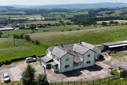
- Price
- Guide Price£650,000
- Size
- 4.11 acres
Comb Hill, Haltwhistle, Northumberland, NE49, Haltwhistle, Northumberland NE49 England
Added on 26/08/2026House with Land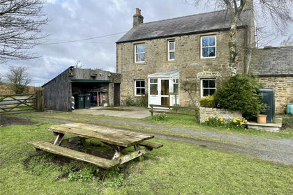
- Price
- Offers in Region of£595,000
- Size
- 2 acres
Bardon Mill, Northumberland, NE47, Henshaw, Northumberland NE47 England
Added on 10/05/2026Farmhouse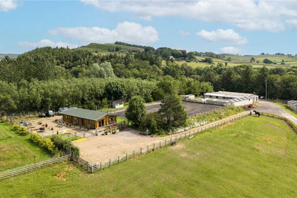
- Price
- Offers Over£700,000
- Size
- 28.51 acres
Bardon Mill, Hexham, Northumberland, NE47, Henshaw, Northumberland NE47 England
Added on 23/07/2026Equestrian property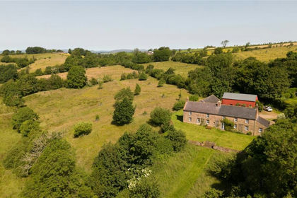
- Price
- £795,000
- Size
- 43.45 acres
Lot 1 Hopes House, Penton, Carlisle, CA6, Solport, Cumberland CA6 England
Added on 07/07/2026Smallholding
- Price
- Guide Price£625,000
- Size
- 5.29 acres
Cleugh Head, Longtown, Carlisle, Cumbria, Arthuret, Cumberland CA6 England
Added on 12/08/2026House with Land
- Price
- Offers in Excess of£825,000
- Size
- 7.05 acres
Long Park Farm, Long Park, Carlisle, Cumbria, CA6, Scaleby, Cumberland CA6 England
Added on 08/08/2026Small Farm
- Price
- £750,000
- Size
- 0.5 acres
Orchard Cottage, Wetheral Shields, Wetheral, Carlisle, CA4, Wetheral, Cumberland CA4 England
Added on 04/07/2026Development Land
- Price
- Guide Price£565,000
- Size
- 5 acres
West Woodburn, Hexham, Northumberland, NE48, Corsenside, Northumberland NE48 England
Added on 20/08/2026Barn Conversion
- Price
- £795,000
- Size
- 7.5 acres
Added on 07/07/2026Smallholding
- Price
- £750,000
- Size
- 1 acres
Carr House Great Bavington, Newcastle Upon Tyne NE19, Bavington, Northumberland NE19 England
Added on 28/04/2026Country Home