Scalm Lane, Wistow Common, Selby
- Land size
- 14.66 acres
- Bedrooms
- 4
- Bathrooms
- 1
Key Features
- 14.66 acres of Land
- Four Bedroom Detached House
- Detached Agricultural Building
- Rural Setting
- Detached Garage & Car Port
- Rare Opportunity
- EPC Rating: 63 (D)
- L-shaped Lounge
- Separate Family Room
- Downstairs WC
Description
A four bedroom detached dwelling, complemented by a detached double garage with attached car port, substantial detached agricultural-style storage building and approximately 14.66 acres of land.
Summary - Spinney House occupies an enviable position within an exceptional 360-degree rural setting, situated on the outskirts of the village of Wistow and approximately 3 miles north-west of Selby town centre. The property is understood to have been constructed by the present owners in 1969 and, remarkably, has remained in the same ownership ever since. Having never previously been offered for sale on the open market, Spinney House represents a particularly rare opportunity to acquire a property with such a long and established history of ownership.
The overall holding extends to approximately 14.66 acres, incorporating the dwelling, its immediate private gardens and grounds, a detached double garage with attached car port, together with a detached agricultural-style storage building.
The property enjoys an unusually private and far-reaching rural aspect, with the surrounding land providing an exceptional degree of separation from neighbouring properties and uninterrupted views across the adjoining countryside. The aerial photograph really demonstrates that this is one of the property's defining features, with Spinney House sitting within its own substantial holding and the surrounding agricultural landscape extending in all directions.
House - The property provides a good-sized footprint, extending to over 1,800 sq.ft of internal accommodation. It has been well maintained by the present owners, although the accommodation would now benefit from a degree of modernisation and updating. The existing layout provides a useful amount of living space across both floors, with scope for a purchaser to consider how the accommodation could be adapted to suit their own requirements.
The ground floor currently comprises two reception rooms, a conservatory to the rear and a kitchen, with the principal living areas positioned to take advantage of the surrounding rural outlook.
The family room, as identified within the sales particulars and floorplan, was originally the integral garage before being converted by the present owners to provide additional living accommodation. At over 340 sq.ft, this is one of the largest rooms within the property and benefits from good levels of natural light through a large double glazed window to the front elevation, together with a further window to the side.
The formal sitting room is generously proportioned and arranged in an L-shaped configuration. Three separate double glazed windows provide views across the surrounding land, whilst the overall space allows for a defined living area together with room for dining. The room provides a good basis for a purchaser to consider future modernisation and reconfiguration, if required.
The kitchen is fitted with a range of wall and base mounted cabinetry, together with recesses for freestanding appliances. There is a stainless steel sink and drainer, whilst a side door provides access through to the porch and beyond.
The conservatory adjoins the rear elevation and arguably provides the best position from which to appreciate the property's rural outlook. Constructed with uPVC framed windows, the room benefits from a pair of sliding doors opening directly onto the rear garden. Given the position and views beyond, there may be scope for a future purchaser to consider replacing or extending the existing conservatory and potentially creating a larger, more open-plan living space spanning the rear of the property. Any such proposals would, of course, be subject to the necessary planning permission and building regulations approvals.
Ascending to the first floor, a central landing provides access to four well-proportioned bedrooms. Each bedroom benefits from double glazing and a central heating radiator. The principal bedroom is positioned to the right-hand side and is the largest of the four bedrooms, further benefiting from a range of fitted wardrobes.
The internal accommodation is completed by the house bathroom, currently fitted with a wash hand basin and inset bath with shower attachment over. There is a double glazed window to the rear elevation, with a separate WC positioned adjacent to the bathroom.
Land - The land forms an important component of Spinney House, with the overall holding extending to approximately 14.66 acres, incorporating the dwelling, private gardens, buildings and agricultural land.
The majority of the land comprises open fields, formerly in arable use, extending predominantly to the south of the property and providing an attractive rural setting with far-reaching views across the surrounding countryside. Established hedgerows, mature trees and natural field boundaries provide definition to the land, whilst the position of the house within the holding provides a good degree of privacy and separation.
A further area of the holding incorporates a mature belt of trees and established vegetation towards the northern/eastern boundary. This provides an attractive natural feature within the holding and adds to the overall character of the property.
Please note that the adjoining woodland to the western boundary, visible within the aerial photography, does not form part of the sale.
Immediately surrounding the property are generous private gardens, predominantly laid to lawn and enclosed by established hedgerows. The southern boundary is defined by a mature hedgerow, separating the private gardens from the adjoining land. The gardens also incorporate a variety of established shrubs, trees and planting, together with a natural rock-bed pond.
Access to Spinney House is provided off Scalm Lane, with an extensive sweeping driveway leading through the grounds to the property and opening out to provide a designated parking area. The property benefits from a detached double garage with an attached car port, positioned immediately adjacent to the driveway and providing useful covered parking and additional storage. The garage is set within its own area of hardstanding, providing straightforward access and manoeuvring between the house and the larger agricultural building beyond.
There is also a secondary access from Scalm Lane, positioned adjacent to the principal entrance. This provides access to the northern field and the agricultural building, allowing the agricultural and storage elements of the property to be accessed separately from the main residential accommodation.
To the western side of the garage is a detached agricultural-style building, providing a significant amount of additional storage and working space. The building is of traditional agricultural construction, comprising a steel-framed structure with lower blockwork walls and profiled metal-clad elevations beneath a pitched corrugated roof. A large full-height sliding door provides access to the main building, with concrete hardstanding immediately outside.
The building has historically provided agricultural and general storage accommodation in connection with the property and offers a practical facility for the storage of machinery, vehicles, equipment or similar uses. Its size and position, separate from the main house, provide useful additional space for a purchaser requiring workshop, storage or agricultural accommodation, subject to any necessary consents for the intended use.
It is understood that the property and land are not affected by any public rights of way. In respect of the two overhead electricity cables and associated transformers crossing the property, the present owners have confirmed that a wayleave agreement is in place with Northern PowerGrid. The present owners have also confirmed that a lump-sum payment was received from Northern PowerGrid in connection with the wayleave. A copy of the wayleave agreement and any associated documentation can be made available for inspection privately upon request. Prospective purchasers are advised to make their own enquiries with their legal representative and the relevant utility provider to establish any other associated rights or obligations affecting the property. As with all matters relating to title, rights, easements and other legal restrictions, prospective purchasers should satisfy themselves through their own legal enquiries prior to proceeding with the purchase.
The property benefits from mains electricity and mains water, with oil-fired central heating and drainage provided via a private septic tank system.
A plan is enclosed within these sales particulars, confirming the extent of the land included within the sale and the relevant boundaries. The plan is understood to be the title plan associated with the property’s registered title, Title Number YWE59171. Prospective purchasers are advised to satisfy themselves as to the precise extent of the property and land included within the sale through their own legal enquiries.
The land is predominantly classified as Grade 2 on the Agricultural Land Classification and is within the Foggathorpe 2 Soil Series described as slowly permeable, seasonally waterlogged stoneless and fine loamy over clayey soils, being suited to grassland and cereal cropping.
Tenure: Freehold
Services/Utilities: The property benefits from Oil Central Heating, Mains Electricity, Mains Water and a Septic Tank for Sewage.
Broadband Coverage: Up to 76* Mbps download speed
EPC Rating: 63 (D)
Council Tax: North Yorkshire Council Band E
Current Planning Permission:
Imagery Disclaimer: Some photographs and videos within these sales particulars may have been digitally enhanced or edited for marketing purposes. They are intended to provide a general representation of the property and should not be relied upon as an exact depiction.
Viewings: Strictly via the selling agent – Stephensons Estate Agents –
*Download speeds vary by broadband providers so please check with them before purchasing.
Map Location
Property details
- Tenure
- Freehold
- Council Tax Band
- E
- Date Posted
- 2026-10-12
Market Value Analysis
Compared with 70 Homes with Land listings in Yorkshire and The Humber (10+ acres).
Energy Performance Certificate
Energy Efficiency Rating
Based on UK Energy Performance Certificate standards (EU Directive 2002/91/EC)
Running costs are one side. Planning activity, flood history and ground risks for this location are in the full report.
Utilities & Restrictions
Utilities
- Electricity
- Mains
- Water
- Mains
- Heating
- Oil Heating
- Broadband
- Full Fibre (FTTP)
- Sewerage
- Septic Tank / Private
Rights & Restrictions
- Public Rights of Way
- Ask Agent
- Private Rights of Way
- Ask Agent
- Listed Property
- Ask Agent
- Restrictions
- Ask Agent
Listed status, conservation areas and planning constraints for this location are in the full report.
Property Features
- Accessibility
- Ask Agent
- Parking
- Parking Available
- Garden
- Garden
Beyond the particulars: planning activity, flood history, heritage and ground risks, checked for this exact spot.
Connectivity
Broadband
Fastest speed available at this postcode
1 Gbps
Gigabit full fibre
Suitable for
- 4K streaming on every screen
- Full-time home working
- Online gaming & big downloads
Fixed wireless access may also be an option here.
Mobile signal
Predicted 4G and 5G signal; indoor signal depends on building materials.
Ofcom Connected Nations postcode-level predictions. Speeds and signal are modelled, not measured, and vary between addresses and providers.
Signal is the easy part. Planning activity, flood history and protected designations here are in the full report.
Nearest Schools
Primary
- Thorpe Willoughby Community Primary School1.6 milesOfsted: Good
- Ages
- 3 to 11
- Pupils
- 246
- Type
- Community school
- Wistow Parochial Church of England Voluntary Controlled Primary School1.9 milesOfsted: Good
- Ages
- 4 to 11
- Pupils
- 126
- Type
- Voluntary controlled school
- Faith
- Church of England
- Hambleton Church of England Voluntary Controlled Primary School2.2 milesOfsted report card · May 2026
- Ages
- 4 to 11
- Pupils
- 188
- Type
- Voluntary controlled school
- Faith
- Church of England
- Cawood Church of England Voluntary Aided Primary School2.4 milesNo Ofsted rating
- Ages
- 3 to 11
- Pupils
- 130
- Type
- Voluntary aided school
- Faith
- Church of England
- Selby Community Primary School2.4 milesNo Ofsted rating
- Ages
- 2 to 11
- Pupils
- 303
- Type
- Academy converter
Secondary
- Selby High School Specialist School for the Arts and Science2.5 milesNo Ofsted rating
- Ages
- 11 to 16
- Pupils
- 1,176
- Type
- Community school
- Brayton Academy2.5 milesNo Ofsted rating
- Ages
- 11 to 16
- Pupils
- 988
- Type
- Academy sponsor led
- Barlby High School3.9 milesOfsted report card · Nov 2025
- Ages
- 11 to 16
- Pupils
- 482
- Type
- Academy converter
- Sherburn High School5.1 milesNo Ofsted rating
- Ages
- 11 to 18
- Pupils
- 951
- Type
- Academy converter
- De Lacy Academy7.7 milesOfsted: Outstanding
- Ages
- 11 to 16
- Pupils
- 853
- Type
- Academy converter
Distances are straight-line from the advertised location. Source: the national school registers (DfE, Welsh Government, Scottish Government) and Ofsted.
Schools are just the start: sold prices nearby, planning activity and any flood history are in the full report.
Amenities
Supermarket
GP surgery
Pharmacy
Hospital
Straight-line distances from the advertised location. Sources: NHS records, Geolytix supermarket locations, OS Open Greenspace and the national trails registers.
The area stacks up? Now check the location itself: planning nearby, protected designations and past flooding.
Getting Around
Nearest station
Nearest bus stop
Typical drive times
Straight-line distances from the advertised location; drive times are typical free-flow times over OpenStreetMap road data, so allow more at peak. Public transport locations from DfT NaPTAN.
Easy to reach matters. So do planning activity, flood history and ground risks: all in the full report.
Flood Risk
Environment Agency open data, checked around the advertised map pin for the listed acreage. Long-term risk counts flood defences; the planning map's flood zones do not. Provided by LandSale, not the listing agent, and not part of the agent's particulars. Risk varies across a holding, so verify before committing.
Rivers and the sea
Not at the pin: mapped about 30 metres away.
Planning map: Flood Zone 2, about 30 metres away.
Surface water
Not at the pin: mapped about 10 metres away.
These bandings are the summary. Where this location sits on the flood maps, plus planning activity, heritage and ground risks, is in the full report.
Important notice: Information, maps and tags on this page are drawn from the advertising agent's marketing materials or generated automatically. LandSale has not verified them. Relying on these details is at your own risk, always carry out independent checks before committing to a purchase.
LandSale full disclaimer
Marketing information only - not formal particulars. The details on this website are provided for general guidance and do not constitute an offer or contract. Neither LandSale nor the advertising estate/land agent accepts responsibility for any inaccuracy.
1. Source of information
- Listing content: Core description, asking price, tenure, measurements, photographs and planning history originate from the marketing materials of the advertising estate or land agent. LandSale does not author this content and cannot guarantee its accuracy.
- Automated tags & categorisation: Property type, land-use class, acreage bands and similar labels may be applied by machine-learning models. They are intended as a helpful guide only and may not reflect the property's legal status or permitted use.
- Third-party & enriched data layers: Maps, boundary outlines, planning designations, soil reports, broadband coverage and other environmental or location-based insights are licensed from external suppliers. Such data are supplied “as is", may be incomplete or out of date and are subject to change without notice.
2. Verification required
Prospective purchasers must verify critical matters, including but not limited to planning permission, title boundaries, public rights of way, environmental constraints, acreage, services, access and VAT status, through their own inspections, specialist surveys, legal advisers and the selling agent before relying on the information or entering into any contract.
3. No warranty or liability
LandSale gives no warranty, express or implied, as to the accuracy, completeness or fitness for any particular purpose of the information displayed. LandSale shall not be liable for any loss, damage, cost or expense arising directly or indirectly from any use of or reliance on such information, save where liability may not be excluded by law.
4. Updates & feedback
If you believe any detail on this listing is inaccurate, please let us know. We will investigate and, where appropriate, update the listing or notify the agent.
© LandSale | Version 1.3 - August 2026
Listing agent
Stephensons, Selby
43 Gowthorpe, Selby, YO8 4HE
Similar properties for sale
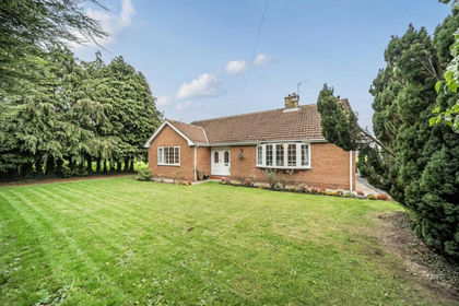
- Price
- Offers in Region of£550,000
- Size
- 7.1 acres
Bishopdyke Road, Cawood, Cawood, North Yorkshire YO8 England
Added on 21/07/2026House with Land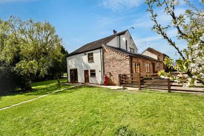
- Price
- £625,000
- Size
- 15 acres
Added on 28/04/2026Farmhouse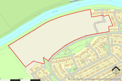
- Price
- Guide Price£750,000
- Size
- 12.48 acres
Added on 02/10/2026Development Land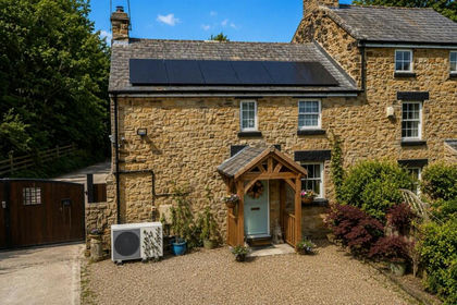
- Price
- Offers Over£500,000
- Size
- 9.34 acres
Tinglebridge, Hemingfield, Barnsley, S73, Barnsley South, Barnsley S73 England
Added on 18/09/2026Smallholding
- Price
- Guide Price£650,000
- Size
- 23.4 acres
Added on 29/01/2026Barn Conversion
- Price
- Offers Over£600,000
- Size
- 8.5 acres
Butternab Farm, Butternab Road, Beaumont Park, Huddersfield, Huddersfield, Kirklees HD4 England
Added on 29/01/2026House with Land
- Price
- Offers Over£695,000
- Size
- 9.2 acres
Added on 07/09/2026Smallholding
- Price
- Guide Price£550,000
- Size
- 34.74 acres
Moorlands Farm, Cold Edge Road, Wainstalls, Halifax, HX2, Calder Valley, Calderdale HX2 England
Added on 05/10/2026Agricultural Land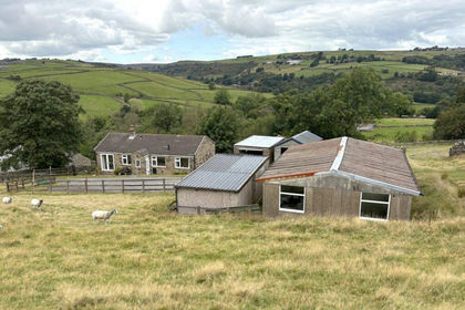
- Price
- Guide Price£545,000
- Size
- 8 acres
Added on 24/09/2026House with Land