Merstone, Isle of Wight
- Land size
- 16.25 acres
- Bedrooms
- 8
- Bathrooms
- 3
Key Features
- HISTORIC JACOBEAN MANOR HOUSE WITH ORGANIC GLASSHOUSE NURSERIES
- DELIGHTFUL GROUNDS OF 16.25 ACRES INCLUDING ANCIENT CARP PONDS
- TRADITIONAL OUTBUILDINGS INCLUDING TITHE BARN, COACH HOUSE & STABLES
- EXTENSIVE GLASSHOUSE SITE WITH SOIL ASSOCIATION ORGANIC STATUS
- PICTURESQUE RURAL SETTING
Description
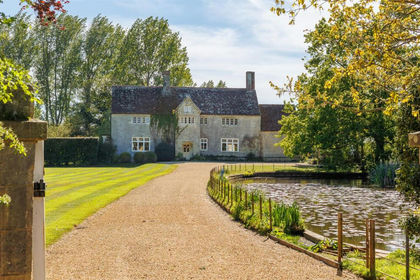
An exquisite historic Jacobean Manor House set in delightful grounds of around 16.25 acres with traditional outbuildings and organic glasshouse nurseries with a particularly attractive approach passing the ancient carp ponds
Located within a quiet rural area, mid-way between the county town of Newport and the island’s southeastern coast within the Arreton Valley, an area known for its sunny climate and horticulture. The property is approached via a no through lane so enjoys seclusion whilst being adjacent to a cycle path and the network of paths running through the surrounding countryside. The mature grounds are bordered by the Eastern Yar.
HISTORY
Great Budbridge Manor is an ancient manor house. Protected beside the Eastern Yar river, water meadows, and later a moat, the site has long been a place of settlement and security. Medieval records from Quarr Abbey refer to Budbridge’s meadows and fishponds, likely used by monks for breeding carp. In 1624, Great Budbridge was sold to Sir Robert Dillington who had the present house built in 1633. A classic example of Jacobean architecture, there were subsequent 18th and 19th century extensions, with the house being Listed, Grade II.
DESCRIPTION
The house retains a wide array of period features including many flagstone floors and a particularly impressive fireplace in the dining room. The majority of rooms enjoy the light with large windows taking in the views over the delightful gardens and grounds. The property benefits from a good range of traditional outbuildings including an impressive tithe barn, stables, adjacent coach house and extensive organic glasshouse site. A useful and substantial farm office building, historically serving the adjacent organic tomato growing site, is situated next to the secondary drive.
ACCOMMODATION
GROUND FLOOR
A carved stone arched entrance, dated 1668, leads into a PORCH with bench seating and front door opening to the ENTRANCE HALL with flagstone flooring and staircase rising to the first floor. A series of formal reception rooms to the front of the house overlook the gardens.
The DRAWING ROOM, a light dual aspect room with lovely views and access to the gardens has oak flooring whilst the impressively proportioned DINING ROOM with a high ceiling, exposed beams, an impressive large open fireplace along with flagstone flooring and large window seat overlooking the front gardens and ponds. The MUSIC ROOM has a bay window, timber flooring and sealed fireplace.
A spacious KITCHEN/BREAKFAST ROOM overlooks the gardens and is fitted with a good range of units with worksurfaces, an oil-fired Aga and separate electric hob. There is a shelved larder cupboard, flagstone flooring and a bread oven. Adjacent is the CONSERVATORY, a largely glazed structure overlooking the gardens.
A useful BOOT ROOM and LAUNDRY ROOM with stainless steel sink and space for washing machine have access to rear lobby with a door to COURTYARD on western elevation, whilst there is also a BATHROOM, STUDY and SECONDARY KITCHEN with an oil-fired Aga, with an adjacent GARDEN ROOM.
FIRST FLOOR
A PRINCIPAL BEDROOM with an ornate fireplace and fabulous views over the grounds and an adjacent DRESSING ROOM. In addition, there are SIX FURTHER BEDROOMS and TWO BATHROOMS all with varying characteristics and charm with diverse country views over the grounds along with a READING ROOM.
SECOND FLOOR
A series of characterful, versatile ATTIC ROOMS which include a BEDROOM, STUDIO and PLAY AREA.
GARDENS
A gated gravelled driveway flanked by ponds and lawned gardens leads to the front of the house where there is parking extending around to the western side of the property. Adjacent to the driveway is an ancient carp pond which feeds two further large ponds within the gardens which attract an array of wildlife. There is a delightful partially walled garden with borders including a selection of various roses and fig trees.
The gardens extend around the eastern and southern sides of the house providing a stunning, tranquil setting whilst to the western elevation there is a paved courtyard.
Adjacent to the kitchen is a paved terrace beyond which there is a vegetable garden and a wide array of trees including fruit trees. There is a stone timber garden store and an open fronted timber summer house.
A secondary drive leads to the outbuildings and western side of the house, (linking up to the principal drive).
TRADITIONAL OUTBUILDINGS
COACH HOUSE A two-storey period brick building (6.92 x 5.55m) currently used as a workshop with steps to storage above. Adjacent range of FOUR STABLES and STORES (14.4 x 4.65m).
TITHE BARN An impressive and substantial barn (22.5 x 6.15m) retaining original timbers with a concrete floor and additional chalk and stone barn to the western side (6.1 x 4.9m). There are two additional lean-to stores to the front of the barn (4 x 2.6m) and (4 x 6.38m). Former farmyard to south with POTTING SHED (11.4 x 3m) and FOUR FORMER STABLES (13.5 x 3.2m).
There is also a substantial FARM OFFICE BUILDING of approximately 1,425 sq. ft. situated adjacent to the secondary drive with ample parking.
LAND
To the eastern and southern sides of the gardens are meadows that border the Eastern Yar river. The field to the south of the manor is registered with the Soil Association as Organic and has been since the 1990s.
GENERAL INFORMATION
SERVICES Mains water and electricity, private drainage and oil-fired central heating with Aga.
TENURE Freehold
COUNCIL TAX Band H
EPC The property is Listed, Grade II
FIXTURES & FITTINGS To be agreed between the parties and confirmed by written inventory. The written inventory will be the sole arbiter of what is included in the sale whether or not items are referred to or photographed within these particulars.
ORGANIC GLASSHOUSE NURSERIES
The commercial glasshouse site, situated to the west of Great Budbridge Manor and set within an area of around 7.75 acres, has organic status accredited by The Soil Association. Two of the blocks of glasshouses ceased operating in 2012 but the structures have been maintained and are largely operational offering a rare opportunity for large scale horticultural production in an area with excellent growing conditions. The site also has its own water supply from a borehole and partially adjoins the River Yar.
The glasshouses extend to approximately 2.9 acres (11,833 sq m) and are complimented by ancillary buildings including a warehouse with cold store (452 sq m), office building (147 sq m) and boiler houses. The gated site has ample parking.
The glasshouses comprise:
- One 5-bay Q22 glasshouse constructed in 1973 and 1974 with 2.6m to the gutter (3,713.4 sq m)
- Two identical 2-bay Frampton Ferguson glasshouses constructed in 1970, (2,022.7 sq m each)
- An 18-bay Van de Hoeven glasshouse constructed in 1979 with 3.1 m to the gutter, (3,974.4 sq m)
GLASSHOUSE SITE SERVICES: The nursery is connected to mains electricity (three phase) and mains water in addition to a bore hole with current licenced quantity of 9500 cubic metres.
The glasshouses were previously heated by hot water from a 4.5 MW biomass boiler, a 3.5MW heavy fuel oil boiler and a separate kerosene boiler. The system had over £50,000 spent in around 2006 when new concrete pathways were also constructed. Systems will need surveying and renovating, where required. There is one large cesspit tank and a septic tank, a hot water storage tank of 100 cubic metres, and bunded oil tanks for 54,000 litres of heavy fuel oil and 15,000 litres of kerosene. There are three above ground tanks for irrigation water and the office building and nursery office both receive internet service.
TENURE NOTE: The nursery is operating commercially under a formal license which can be renewed for a further term. A public footpath runs through the site.
VAT If the sale of the property be deemed to be a chargeable supply for VAT purposes, such tax will be payable by the purchaser in addition to the sale price.
POSTCODE PO30 3DH
VIEWINGS All viewings will be strictly by prior arrangement with the joint sole selling agent, Spence Willard.
IMPORTANT NOTICE: Particulars: These particulars are not an offer or contract, nor part of one. You should not rely on statements by Spence Willard or Knight Frank in the particulars or by word of mouth or in writing ('information') as being factually accurate about the property, its condition or its value. Neither Spence Willard nor any joint agent has any authority to make any representations about the property, and accordingly any information given is entirely without responsibility on the part of the agents, seller(s) or lessor(s). 2. Photos etc: The photographs show only certain parts of the property as they appeared at the time they were taken. Areas, measurements and distances given are approximate only. 3. Regulations etc: Any reference to alterations to, or use of, any part of the property does not mean that any necessary planning, building regulations or other consent has been obtained. A buyer or lessee must find out by inspection or in other ways that these matters have been properly dealt with and that all information is correct. 4. VAT: The VAT position relating to the property may change without notice.
Map Location
Property details
- Tenure
- Freehold
- Council Tax Band
- H
- Date Posted
- 2026-10-09
Utilities & Restrictions
Utilities
- Electricity
- Ask Agent
- Water
- Ask Agent
- Heating
- Ask Agent
- Broadband
- Ask Agent
- Sewerage
- Ask Agent
Rights & Restrictions
- Public Rights of Way
- Ask Agent
- Private Rights of Way
- Ask Agent
- Listed Property
- Ask Agent
- Restrictions
- Ask Agent
Listed status, conservation areas and planning constraints for this location are in the full report.
Property Features
- Accessibility
- Ask Agent
- Parking
- Parking Available
- Garden
- Garden
Beyond the particulars: planning activity, flood history, heritage and ground risks, checked for this exact spot.
Connectivity
Broadband
Fastest speed available at this postcode
5 Mbps
Under 10 Mbps here
Suitable for
- Basic browsing & email
Mobile signal
Predicted 4G and 5G signal; indoor signal depends on building materials.
Ofcom Connected Nations postcode-level predictions. Speeds and signal are modelled, not measured, and vary between addresses and providers.
Signal is the easy part. Planning activity, flood history and protected designations here are in the full report.
Nearest Schools
Primary
- Godshill Primary School1.2 milesOfsted: Good
- Ages
- 4 to 11
- Pupils
- 172
- Type
- Community school
- Arreton St George's Church of England (Aided) Primary School1.7 milesOfsted: Requires improvement *
- Ages
- 4 to 11
- Pupils
- 56
- Type
- Voluntary aided school
- Faith
- Church of England
- Newchurch Primary School2.2 milesOfsted: Good
- Ages
- 5 to 11
- Pupils
- 209
- Type
- Community school
- Wroxall Primary School2.8 milesOfsted: Good *
- Ages
- 2 to 11
- Pupils
- 90
- Type
- Community school
- Broadlea Primary School3.3 milesOfsted: Good
- Ages
- 4 to 11
- Pupils
- 242
- Type
- Community school
Secondary
- The Island Free School3.9 milesNo Ofsted rating
- Ages
- 11 to 16
- Pupils
- 613
- Type
- Free schools
- Christ The King College3.9 milesOfsted: Requires improvement
- Ages
- 11 to 18
- Pupils
- 1,131
- Type
- Voluntary aided school
- Faith
- Church of England/Roman Catholic
- The Bay Church of England School4 milesOfsted: Good
- Ages
- 4 to 16
- Pupils
- 1,232
- Type
- Voluntary controlled school
- Faith
- Church of England
- Carisbrooke College4.2 milesOfsted: Requires improvement
- Ages
- 11 to 16
- Pupils
- 615
- Type
- Academy converter
- Medina College4.3 milesOfsted: Requires improvement
- Ages
- 11 to 19
- Pupils
- 1,094
- Type
- Academy converter
* Latest graded judgement covers quality of education only; no overall grade was issued under the 2024-25 inspection framework.
Distances are straight-line from the advertised location. Source: the national school registers (DfE, Welsh Government, Scottish Government) and Ofsted.
Schools are just the start: sold prices nearby, planning activity and any flood history are in the full report.
Amenities
Supermarket
GP surgery
Pharmacy
Hospital
Green space
Straight-line distances from the advertised location. Sources: NHS records, Geolytix supermarket locations, OS Open Greenspace and the national trails registers.
The area stacks up? Now check the location itself: planning nearby, protected designations and past flooding.
Getting Around
Nearest station
Nearest bus stop
Typical drive times
Straight-line distances from the advertised location; drive times are typical free-flow times over OpenStreetMap road data, so allow more at peak. Public transport locations from DfT NaPTAN.
Easy to reach matters. So do planning activity, flood history and ground risks: all in the full report.
Flood Risk
Environment Agency open data, checked around the advertised map pin for the listed acreage. Long-term risk counts flood defences; the planning map's flood zones do not. Provided by LandSale, not the listing agent, and not part of the agent's particulars. Risk varies across a holding, so verify before committing.
Rivers and the sea
Planning map: Flood Zone 1.
Surface water
Not at the pin: mapped about 140 metres away.
These bandings are the summary. Where this location sits on the flood maps, plus planning activity, heritage and ground risks, is in the full report.
Important notice: Information, maps and tags on this page are drawn from the advertising agent's marketing materials or generated automatically. LandSale has not verified them. Relying on these details is at your own risk, always carry out independent checks before committing to a purchase.
LandSale full disclaimer
Marketing information only - not formal particulars. The details on this website are provided for general guidance and do not constitute an offer or contract. Neither LandSale nor the advertising estate/land agent accepts responsibility for any inaccuracy.
1. Source of information
- Listing content: Core description, asking price, tenure, measurements, photographs and planning history originate from the marketing materials of the advertising estate or land agent. LandSale does not author this content and cannot guarantee its accuracy.
- Automated tags & categorisation: Property type, land-use class, acreage bands and similar labels may be applied by machine-learning models. They are intended as a helpful guide only and may not reflect the property's legal status or permitted use.
- Third-party & enriched data layers: Maps, boundary outlines, planning designations, soil reports, broadband coverage and other environmental or location-based insights are licensed from external suppliers. Such data are supplied “as is", may be incomplete or out of date and are subject to change without notice.
2. Verification required
Prospective purchasers must verify critical matters, including but not limited to planning permission, title boundaries, public rights of way, environmental constraints, acreage, services, access and VAT status, through their own inspections, specialist surveys, legal advisers and the selling agent before relying on the information or entering into any contract.
3. No warranty or liability
LandSale gives no warranty, express or implied, as to the accuracy, completeness or fitness for any particular purpose of the information displayed. LandSale shall not be liable for any loss, damage, cost or expense arising directly or indirectly from any use of or reliance on such information, save where liability may not be excluded by law.
4. Updates & feedback
If you believe any detail on this listing is inaccurate, please let us know. We will investigate and, where appropriate, update the listing or notify the agent.
© LandSale | Version 1.3 - August 2026
Listing agent
Spence Willard, Cowes
Waterside House, 72a High Street, Cowes, PO31 7RE
Similar properties for sale
- Price
- Guide Price£2,000,000
- Size
- 8.5 acres
Merstone, Isle of Wight, Arreton, Isle of Wight PO30 England
Added on 30/05/2026Stately Home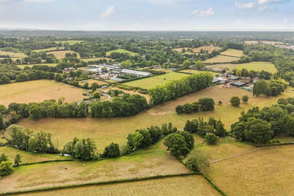
- Price
- Guide Price£2,000,000
- Size
- 12.28 acres
Long Acres Farm, Wangfield Lane, Curdridge, Southampton, Curdridge, Hampshire SO32 England
Added on 01/07/2026Farm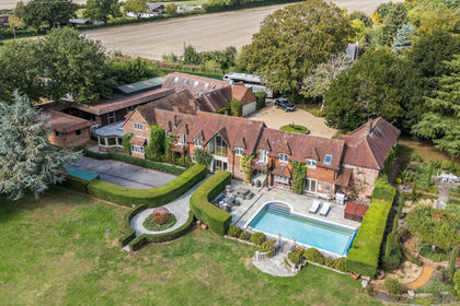
- Price
- Offers in Excess of£2,300,000
- Size
- 8 acres
Eastland Gate, Lovedean, Waterlooville, Hampshire, PO8, Horndean, Hampshire PO8 England
Added on 29/09/2026Equestrian property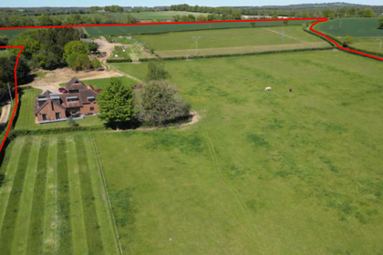
- Price
- Guide Price£3,050,000
- Size
- 67.17 acres
Added on 13/06/2026Farm
- Price
- Guide Price£2,750,000
- Size
- 21 acres
Oxenbourne Lane, East Meon, Petersfield, Hampshire, GU32, East Meon, Hampshire GU32 England
Added on 15/09/2026House with Land
- Price
- Guide Price£3,000,000
- Size
- 24 acres
Highwood, Ringwood, Ellingham, Harbridge and Ibsley, Hampshire BH24 England
Added on 04/06/2026Country Home
- Price
- Guide Price£2,200,000
- Size
- 24 acres
Added on 16/02/2026Equestrian property
- Price
- Guide Price£2,900,000
- Size
- 10 acres
Tunbridge Lane, Bramshott, Liphook, Hampshire, GU30, Bramshott and Liphook, Hampshire GU30 England
Added on 16/06/2026Mill Conversion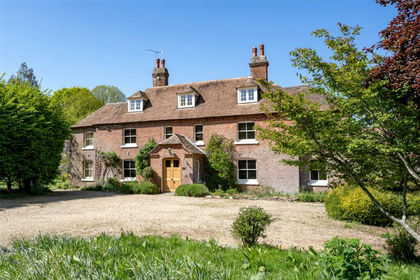
- Price
- Guide Price£2,250,000
- Size
- 11.7 acres
Dorchester Road, Sturminster Marshall, Wimborne, BH21, Sturminster Marshall, Dorset BH21 England
Added on 22/06/2026Country Home